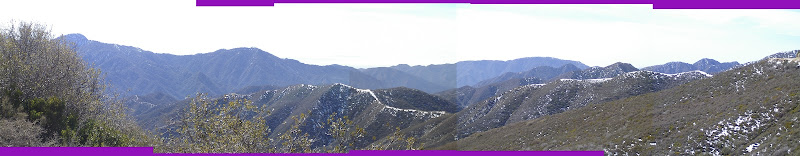
Posts

Showing posts from February, 2008

Vogel Flat area

Image
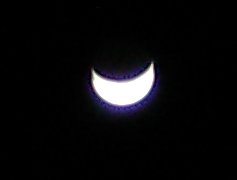
Angeles National Forest When I got back from the Condor Peak hike, it had gotten quite dark and the moon was overhead. I played with the camera a little bit. Just letting the camera choose its own speed, the moon is easy to see. I was holding the camera against the car to try to get this at first. Since the shutter isn't open so long, it almost worked. Result was generally fuzzier than this. After playing with night mode, I tried again with this normal picture setting but this time making it pause for a long time between the press of the shutter and the photo so I could take my hands away from the camera before the picture was taken leaving it just resting against something. Plants, in this case, which isn't ideal. In between I played with the "night mode" which seemed to open the shutter for about six seconds. This turned out to be too long to try to hold the camera, even braced against something. That's when I found the plant to hold th

Condor Peak (initially trying Mount Gleason)

Image
Mount Gleason Angeles National Forest Taking off for a nice drive and a little hike, I headed for Mount Gleason. Which hopefully wouldn't be too high for snow. The plan was to take the trail down from Deer Spring, which goes along the canyon I hiked last week. The road is off the old crest highway. Even though the local mountains aren't so high, a few were obviously a little splotched with snow especially on the north side of the mountains. As the road wound up, it quickly gathered its own splotches nearby. They seemed to get thicker and then as the road passed into a north side slope it became clear it had been plowed. So it's looking good for getting to the trail, but not so good on actually traveling down it. Luckily it is down and a southern slope, so it might be okay. On the other hand, a canyon will generally keep snow longer. Anyway, see when I get there. But I didn't get there. Turns out the road is only plowed to "County Camp No 16"

Trail Canyon Trail

Image
Angeles National Forest Locate the trailhead. Myself and a crew of one decided to head up to Trail Canyon to see the waterfall about two miles along. He offered to drive up there, but I knew he wouldn't like to have his car on the last bit of road so I insisted on driving. When we got out he confirmed that he wouldn't have wanted to drive down that road and I probably shouldn't either. Unfortunately for my car, my philosophy is that it exists to get me where I want to go, and if that means a rough but passable road, then that is what it will go down. There is some parking at the start of the road for those who do not wish to beat up their cars, but I have rarely seen it used. The public road stops just before the first crossing of the creek. I could only recall crossing the creek a couple times on the first trip up this canyon, this first crossing being one of those times. It was the hardest crossing, and the current water level made it especially difficult. The

follow by email