Angeles National Forest
Locate the trailhead.
Mount Baden-Powell is not the highest peak in the local range. That is Mount San Antonio (Baldy) SSE of it. After that, a few of the peaks around Baldy also top out higher than Baden-Powell, but rising over 9000 feet is sufficient to dwarf the nearby peaks and be generally higher than a lot of people ever get to while being able to freely look around and feel the wind in their hair. The Pacific Crest Trail passes near it and a spur trail finishes the journey to the very top. I took the quickest route, catching the northbound PCT as it travels southward through Vincent Gap. The trail switch backs for nearly 4 miles up the north side of the mountain before continuing on the generally western traverse of the San Gabriels. Over the elevation gain, the trees dwindle from a lush forest full of ponderosa and its usual neighbors to a few limber pine populating the nearly bald top.
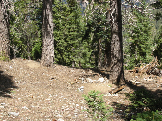
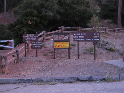
Vincent Gap is obvious if you know what to look for, but it didn't seem to have a sign for eastbound traffic. The road drops down to a wide and low pass through the mountains. A huge lot is on the south and some dirt roads head off to the north. The lot had quite a number of cars in it, but it also has quite a number of choices for hiking, with the gulch, a mine, the mountain, and whatever is north along the roads or the southbound PCT, although those are likely considered routes between interesting things like the Devils Punchbowl below (one road goes there) or the Blue Ridge (where the PCT goes). The trail up the mountain starts next to the biffy on the west end.
 |
| There's a big sign and a lot of information at the parking lot. After passing that, there's this more traditional trail sign. It says 3.7 miles to the mountain, 9.4 to Windy Gap, 9.7 to Little Jimmy Trail Camp, and 11.8 to Islip Saddle where the trail hits road again. |
The switchbacks start immediately. After the first mile, there is a bench. It is a nice bench with a nice view, but it felt like a rather short mile to me. After the second mile, there is a spring. I saved the spring for later and continued on. There were a few camping sites after it. After the third mile I realized that, in general, switchbacks aren't still going after the third mile. I was getting a bit tired. Throughout, I was swapping places with a couple who were hiking faster, but resting for long periods while I simply kept going but at a slower pace. I was getting a lot slower as the last mile up wore on and their rests were getting more frequent. At one point I mentioned to them that it was less than half a mile to go (and it was) and it seemed to help them along although I was still feeling quite slow.
 |
| The trail very quickly offers views of the surrounding country which are better with each turn on the switchbacks. So that's something to look forward to. |
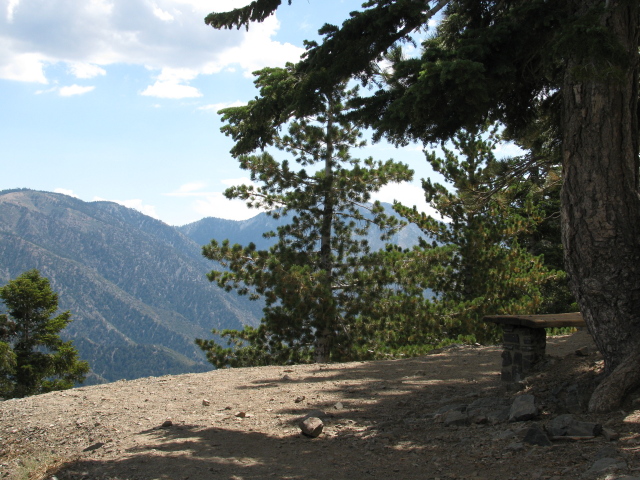 |
| Here is a nice place to sit, but we've only started the climb. |
At some point along the way, I passed a particularly fragrant ponderosa. It was so strong that the sweet scent was wafting over the trail. If you've never smelled one of them, stick your nose in a crack among their puzzle piece bark. They come in a wide variety.
 |
| Getting up higher and there is even more flat desert out there. |
 |
| Lamel spring is a little way past the switch back. |
 |
| A little campsite down the side of the trail that could fit one small tent and was probably within a quarter mile of the spring. |
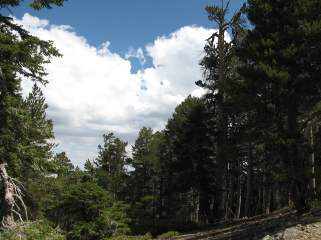 |
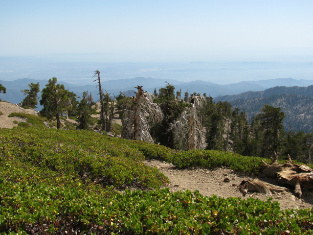
| Stands of nice, healthy, big trees cover most of the north slope. |
 |
| Some limber pines. They're like big bristlecone pines. |
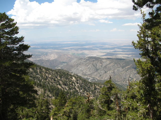 |
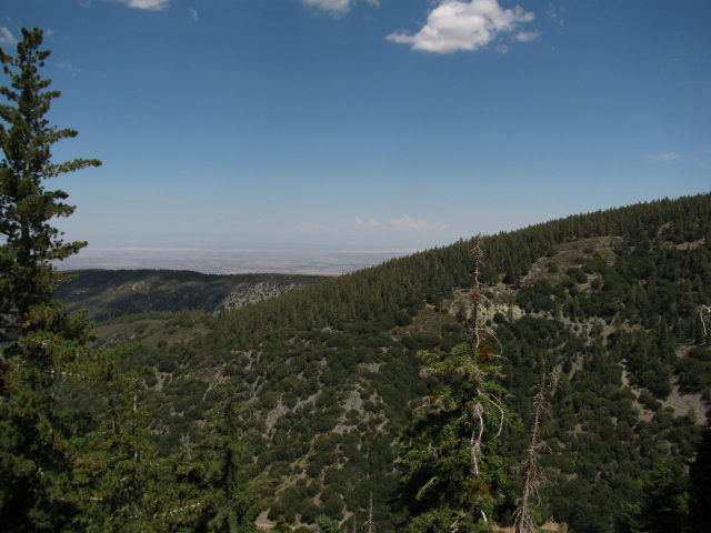
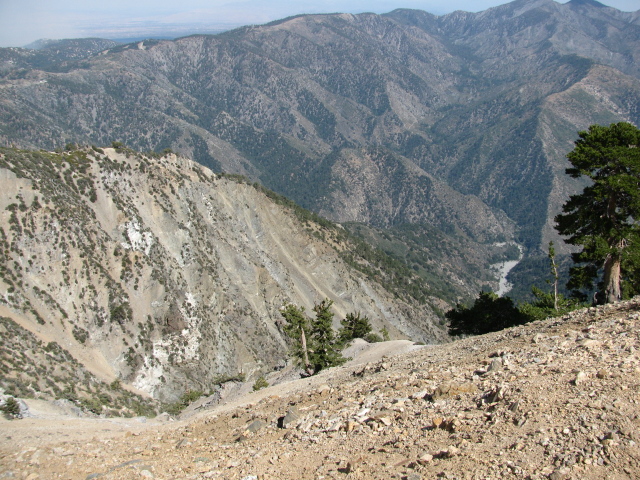
| The San Andreas Fault splits the tall mountains from the flat desert and makes some funky features between. The Devil's Punchbowl, the odd looking feature to the upper left of the valley, is one of these. |
At long last, the peak comes into view. One last crossing of a steeply sloped ridge leads to the junction with the trail to the peak. From there, it is a quick jaunt up to the peak itself. It was beautiful and clear except for a few puffy clouds and one spot where it was raining. There were amazing lightning bolts streaking down from the clouds high above the mountain to the desert plane far below. They started a few spot fires, but about the time I got to the peak, one was setting off a proper blaze.
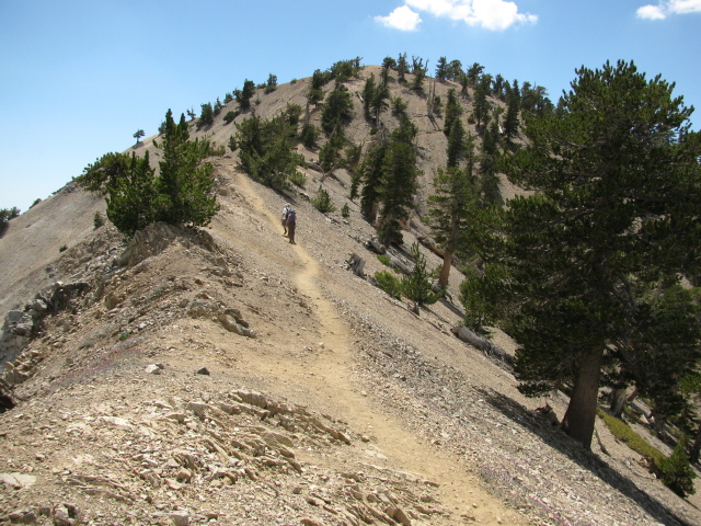 |
| One last bit of ridge and a little climb left to get to the peak. |
 |
| The junction with the trail to the top seems to have moved a little bit. The sign behind the tree notes that it is 2.5 miles to Dawson Saddle, 3.8 back to Vincent Gap, 5.2 on to Windy Gap, and 7.2 to Islip Saddle. It also says that at 9300 feet, this is the highest point on the PCT's 100 mile run along the Angeles Crest. |
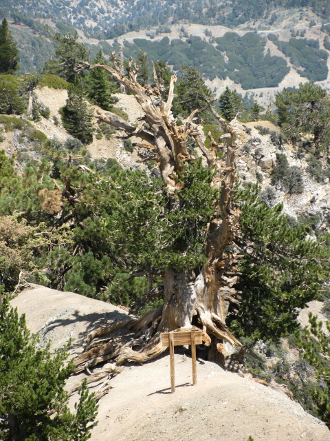 |
| Estimated to be 1500 years old, this tree may be the oldest on the mountain. The Boy Scouts have dedicated it to one Michael H. "Wally" Waldron. One older fellow on the top of the mountain said he remembered it from coming up here as a boy. The ground was a lot closer to the roots then. |
 |
| Rain over the desert and a little puff of smoke a little closer from a freshly started lightning strike fire. |
 |
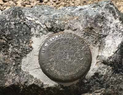 |
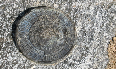
| I found two of the markers at the top. The first from 1954 has both "Mt. Baden-Powell" and "N. Baldy Aux" on it. The second from 1930 is just marked "North Baldy". |
|
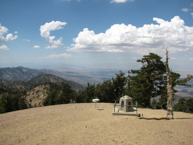
| The monument and the peak register and the mountains and desert beyond. The mountain was named for the founder of the Boy Scouts in 1931. |
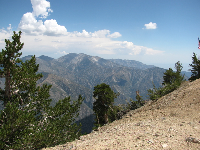 |
| The actual bald one and its surrounding mountains. These are the only things locally that stand taller than Baden-Powell. |
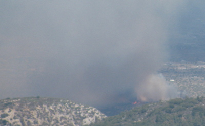 |
| Told you there was fire. |
With fire burning in the distance, I wondered who you call and how you tell them where to go fight it. While taking photos, I was buzzed by a red glider. This was the second glider I saw as there was a silver one flying around when I first got to the top. They were generally pretty quiet, but the wind around them can get noisy, especially when they are buzzing you. I watched the glider and the smoke and finally the little silver specs that came to put out the fire. They seemed to get it out before too long. Well fought! The rain moved on westward taking its lightning with it, but there were no more fires. I sketched the fire and the trees, both fun to do.
 |
| Showoff. |
 |
| On down the very steep eastern slope looking into Mine Gulch and Vincent Gulch. |
 |
| A gentle slope to the south provides a few camping spaces. |
 |
| The fire is still raging but now being fought. The rain has moved on. |
 |
| We found out who eats the pine nuts of the high limber pines. |
 |
| There were two pairs of the birds hanging out. |
I packed up and headed back down. The smoke had spread to the mountain and was a little thicker than I'd like. Bits of ash were coming down. I stopped by the spring on the way down, as planned. I ran out of water (5 liters!) on the last mile, not as planned.
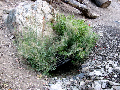 |
| Lamel Spring seems to be gated. Sort of. |
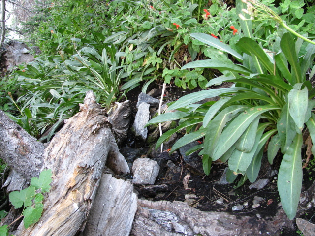 |
| More water oozing out of the ground where no one has tried to claim it. |
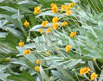 |
| Some big yellow flowers down by the spring. |
 |
| Back down to the trailhead. Mine Gulch is 4.5 miles down Vincent Gulch and Lamel Spring is listed as 1.5 miles up while the peak is 4 miles up. |
|
And with that, it was time to drive the long, winding road back home.
*photo album* (includes photos sent by the glider pilot)
©2011 Valerie Norton
Posted 19 December 2011


Comments