Los Padres National Forest
Map link.
Looking around for hike suggestions, I clicked on
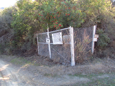
this hike, thinking, "Alder Creek is in LA!" I miss the now somewhat recently burned and still closed Alder Creek trail and decided to try out this one. The directions on that site tend to be sketchy at best, but Franklin Trail is easy to find on the Carpinteria and White Ledge Peak quadrangles. It comes down to Juncal Road along the Jameson Reservoir on the back side, and that goes west to something that may be driven by the public (when the road is open), namely Romero Camuesa, which is the continuation of Camino Cielo after an intersection with no other open choices. Just find a place to park that isn't blocking the gate nor on the road a few feet after the ford of the Santa Ynez River, then start hiking up the closed road.
The road behind the gate is currently a lot better than the road in front of the gate. It probably helps to have very little travel. The regular gate is quickly followed by another gate with long fencing on either side and posted "no motor vehicles". I had to crawl through the fence as there was no slot to walk through. Then there was a wide, dry ford for a tributary to the river. From there, the road just continued on, smooth and easy, up the side of the river. The screech of a hawk over the riverbed is common. It climbed a little from time to time, once where it was clear the road had washed out lower. Then after a couple miles, there is a ford for the Santa Ynez and it starts to climb. Above this ford is a narrow canyon and the dam for the reservoir. It was bone dry even though there was water over the ford just before parking. A deep pool a little way up had a little mud in the bottom, but that was all the water.
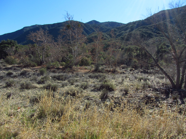 |
| Trees growing in the flood plane of the river. The river itself is on the far side of the valley and doesn't have all that much water in it. |
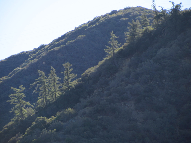 |
| A line of pines growing on a ridge line high up the mountains and appearing to glow in the sunlight. |
The road continues to be very nice as it starts to climb up the ridge between the Santa Ynez River and Alder Creek. It wiggles a few times and goes at a fairly easy pace upward. It passes over the pipeline that brings water to Montecito a few times and the power lines that were following the road seem to be going to this. There is a remnant of an old gate. The dam comes into view and better and better views down the canyon just traveled are offered as the road climbs. I heard voices and saw a truck parked down below the dam. It looked like they were out to inspect it. The dam has at least two sections and they had a boat to take them from one to the other. I came to the spur road they must have taken down to the dam and signs demanding that I should not trespass in any form nor loiter started up on the reservoir side of the road.
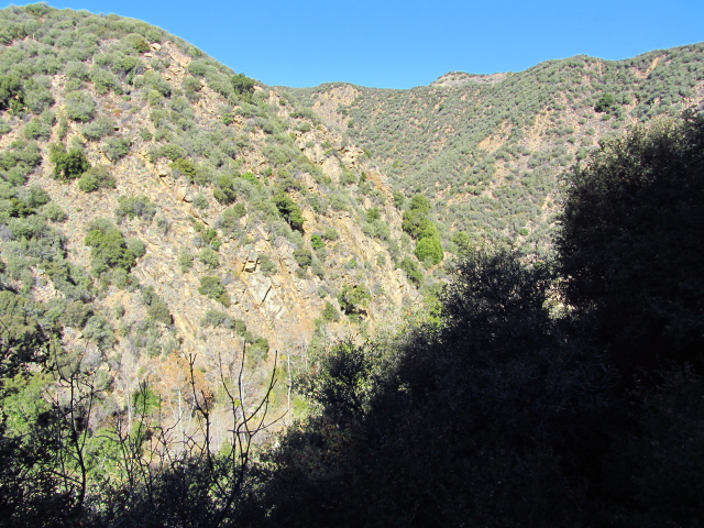 |
| The Santa Ynez River suddenly has steep canyon walls as Juncal Road starts to climb the ridge between the river and Alder Creek. |
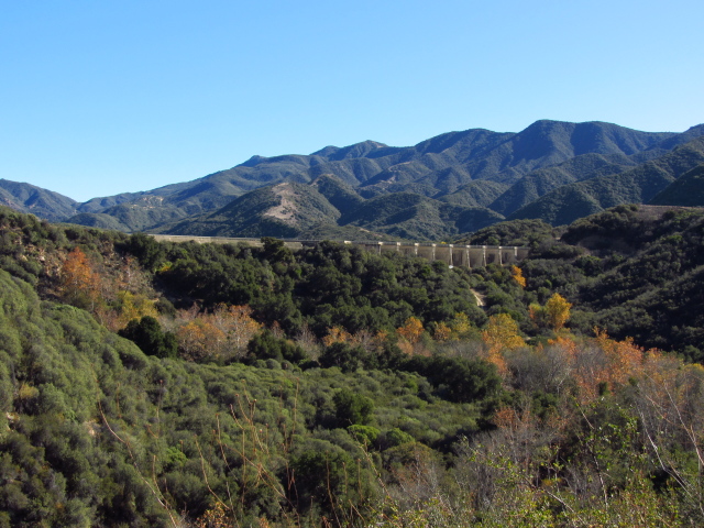 |
| Suddenly there's a great big man made structure along this man made road. |
 |
| There's an old no trespassing behind the fence and a new one on the fence, plus a smaller one, plus the solid "keep out" on the right, but the gate has been wedged open so it's not stopping anyone determined. |
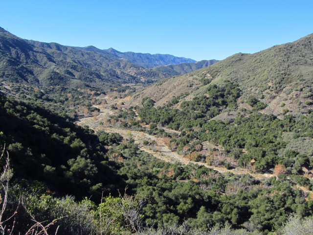 |
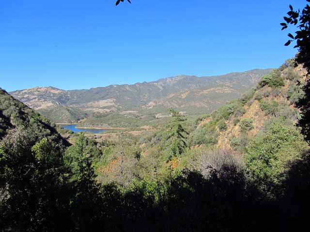
| The Santa Ynez River stretching dryly to the west. The uniform strip to the right is the smooth dirt road I came in on. |
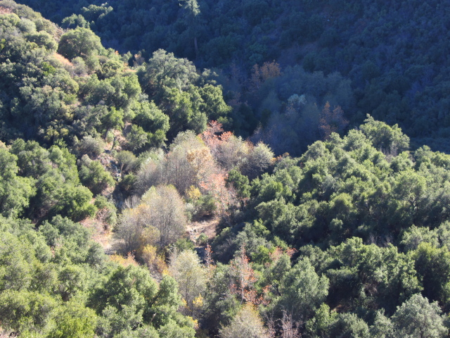 |
| Once up on the ridge between, Alder Creek comes into view far below. There's water in that one. |
 |
| A red tailed hawk riding the thermals over the road. This one only made whooshing noises. |
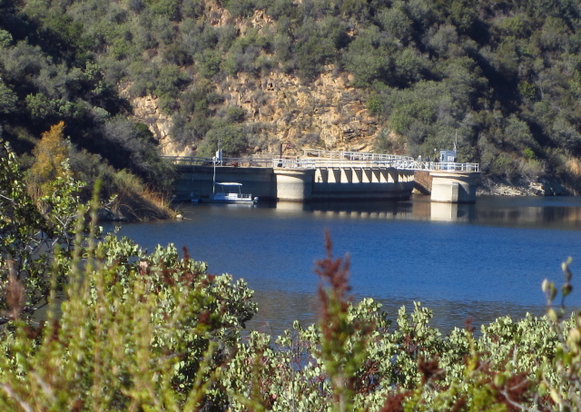 |
| Three men and a boat... out working on the dam. |
It was about 2.5 miles to get to where the road started climbing. After another mile and multiple little spurs along the left side of the road, a road went off to the right with a big sign. This is the north end of Franklin Trail. Following the road, it drops down into Alder canyon below. A big sluice takes water from the creek to the reservoir, unless it leaks all away before it gets there. The road splits, going up and to the left to the sluice and to the right to a turn around and the old trail heading off on the far side of the loop. I poked around a little then continued down the trail. There were no signs to keep off the sluice, maybe they're coming later.
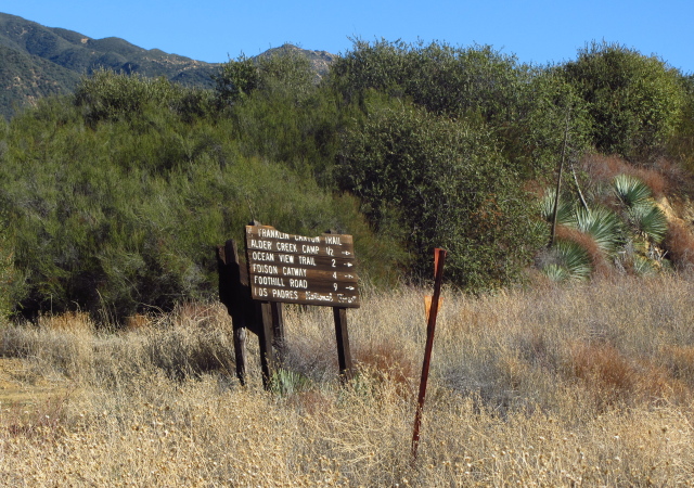 |
| Reaching Franklin Trail, there's a sign for "Franklin Canyon trail". (The canyon is on the other side where the trail also goes.) It is 1.5 miles to Alder Creek Camp, although someone has scratched out the 1 it is more than halfway to the top. Ocean View Trail is in 2 miles, Edison Catway in 4, and Foothill Road in 9. On the other sign are Juncal Road destinations. East 2.5 miles gets to Upper Santa Ynez Camp and 4 miles to Murietta Divide. West 1.5 miles to Juncal Station (didn't see it) and 3.5 miles to Juncal Camp (ditto). |
 |
| Guess it wasn't such a good road at some point. |
 |
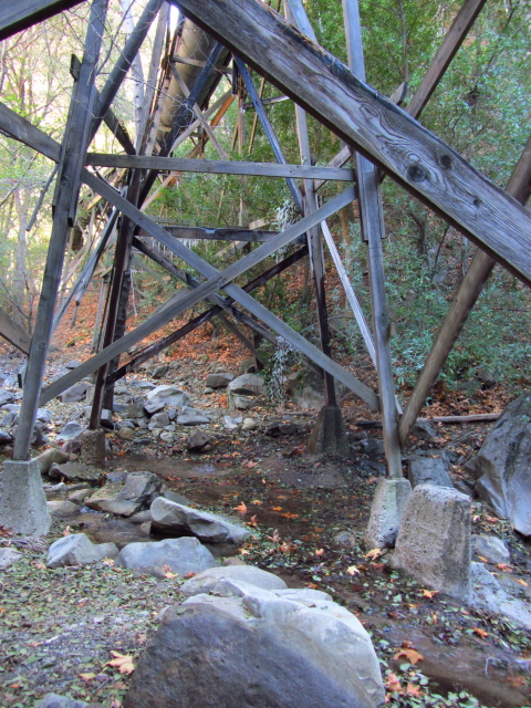
| Alder Creek and a trestle for the sluice that drops some of the water in this reservoir instead of one of the next two. |
 |
| Coming to the end of the road through some nice big oaks and the road is still good. |
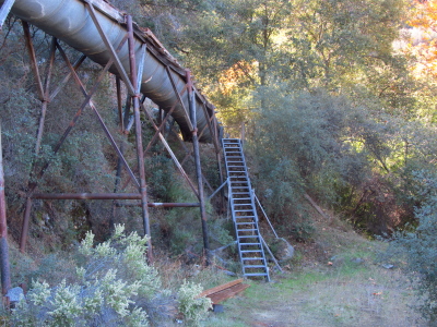 |
| The bit of the sluice at the end of the road going upward. |
 |
| The start of the trail. It's actually fairly wide, like it was also road for a bit, but it quickly loses that character. It's also got a lot more trees on it than the maintained road. |
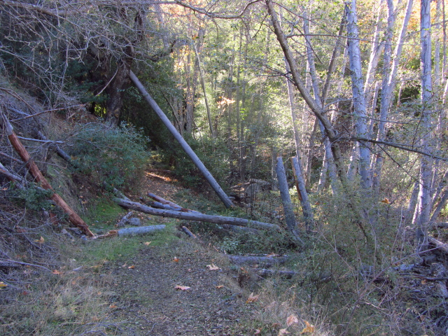
Heading up the trail, I found it initially to have many logs on it, but that was half the total logs for the trail. The route was marked by stamped down raspberry bushes, the old tread below hard visible if looking for it. It joined with and followed directly under the sluice, or more likely the other way around since the trail is older. Mostly this wasn't a problem, but there were occasional leaks. There was a significant leak over a stream crossing where cliffs below and above on either side limited the crossing opportunities severely and the best crossing had water pouring down on it. Icicles hung from the trestle above, although I knew it was cold based on already spotting a little ice on someone's hole on the upper road. I managed to cross to the side of the leak, using a pointed rock I'd rather not have and balancing holding onto the ice covered wood.
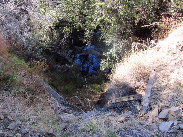
Soon the sluice came to an end at a dammed up pool. It looked like this was another crossing for the original trail, but now people were making use of a lower crossing and walking up the other side a bit to avoid the pool. The trail on that side didn't quite connect, but there was an easy way through. Above the pool, it smelled a bit like sulfur. The trail crossed two more times quickly and had a couple more breaks along the sides, then started climbing up the side with a couple switchbacks. Once it was climbing, the tread was pretty well established throughout, at least until above the campsite.
 |
| Lots of green down by the stream. Since it is fall, some of them are even dropping their leaves. |
 |
| A dribbly curtain of water makes crossing a little more difficult than it should be and seems to turn into ice at night. There's an ice encrusted tree limb too. |
 |
| There's quite a variety of trees in and around the canyon, some of the ones in the bottom being quite tall. |
The trail would take a couple switchbacks up the side of the canyon, the upstream legs being longer than the downstream ones as I headed up, then it would meet up with the creek and eventually start climbing again. It got out of Alder Creek, going up a dry canyon for a short way, then climbed back over to the creek and water. There were a couple spots that could use improvement of the tread and one spot required being extra careful while crossing, but it is generally intact and solid. It finally crossed the water again and started up another dry bed shortly before getting to Alder Creek Camp.
 |
| A section of trail needing work. This isn't the section that required careful crossing. That's next to it where the tread supports are holding well, but rocks have filled it in. |
 |
| Of course, getting higher in the mountains offers a few views back the way I came. |
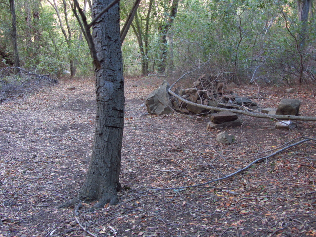 |
| Presumably this this is Alder Creek Camp. It doesn't have any actual improvements that couldn't simply be done by people using the site. There's just flat areas and a large stone fire circle. |
Above the camp, the trail has a few spots that are hard to follow. It also had cut branches on and around it showing it has been maintained not too many years ago. These seemed odd together. The trail below had seemed a little more steep than is typical for modern trails, but above it got a bit steeper. Switchbacks seemed to have smoothed out a bit. Many of them had animal trails at the turn that twice were stronger trails than the correct continuation. Still, it wasn't too difficult to follow. It climbs to directly under one power pole for the high tension lines, then climbs one last little bit to the top. I started to see frozen ground along the route. So it was frozen at the bottom and top, but in the middle, quite warm enough.
 |
| Toward the top, the landscape is more like hills with easier slopes instead of the tight canyon with steep slopes. |
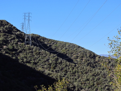 |
| Eventually the trail meets the wires. They probably used the existing trail for access to clear the area and construct one tower as it goes directly under one. A few miles down, the wires to the pipeline branch off. |
Reaching the top, there was suddenly an ocean to behold. There was no sign where Franklin met Ocean View (aka Camino Cielo) and the trail was not distinct as seen from the road. I wouldn't envy anyone trying to find it from the road. The foothills roll down to Carpinteria. Out in the distance, Santa Cruz Island dominates the horizon. Anacapa on the left was pretty clear, showing itself to really be three islands and some rocks. Santa Rosa Island was nicely distinct from Santa Cruz, especially from that altitude. I ate and sketched and enjoyed the view.
 |
| Rolling hills, city, islands, oil rigs, and boat trails all visible from high on the ridge line. |
 |
| Up on Camino Cielo after it is closed to general traffic. |
 |
| The unsigned trail actually parallels the road for about 20 feet as it gets up to the same elevation, but it is hard to see as people tend to climb instead and the bushes are encroaching. The trail headed out is also hard to notice. |
I headed back down the way I came up. Coming to the tower, it wasn't easy to see where the trail continued, so had to rely on memory. It really proceeds from one corner to the opposite one, but another corner looks more like it has trail when coming down. I almost did manage to take one of those animal trails instead of the switchback while coming down, but realized it in time. The brush connecting over the top is usually a pretty good hint. For some reason, I noticed the mushrooms a lot on the way down.
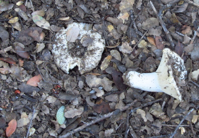 |
| A mushroom that I probably kicked up on the way up. |
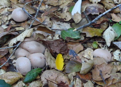 |
| Some mushrooms down in the camp. They have a classic mushroom shape and a fleshy look to their caps. I like the little texture on the caps. |
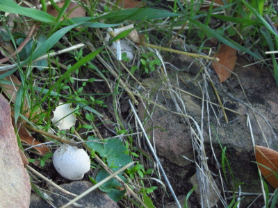 |
| A little white powder puff of a mushroom. |
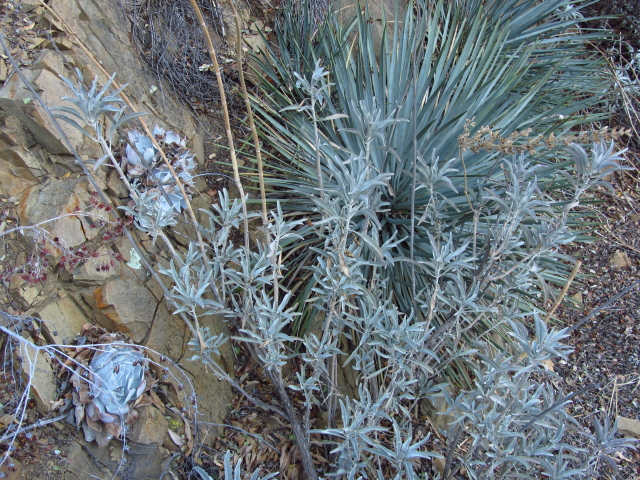 |
| Yucca, white sage, and some other things that all come in similar grey-green colors. They were common as the trail got high on cliff faces. |
 |
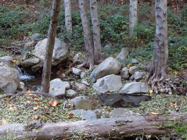
| Back to the creek at a particularly tight portion of the canyon. |
The moon nearing full had already risen by the time I got back to the sluice and reservoir. Everything was in shadows and the sun thinking of actually going down. Between the twilight and the big moon, there was enough light to pick my way along the easy road. I saw no other people along the way besides the dam inspectors. It was long, being a little over 11 miles, but most of those miles were quick ones on the road. Still, my feet were getting a little sore on the return.
©2011 Valerie Norton
Posted 10 December 2011


Comments
See you out there! :-)