Angeles National Forest
 Map link.
Warm Springs Mountain once had a fairly short trail up to the top. It was once a well maintained trail, according to my Afoot and Afield, and although the mountain was burned, it would surely be repaired soon and continue to be a simple hike to the top. Unfortunately, there seems to be a general policy of neglect for the area which once contained a condor sanctuary and some of the last wild condors, at least that is what my reading would seem to indicate. I once
tried for this peak in the past, but didn't know about the neglect, only the enthusiastic expectations. I didn't get far through the then 23 years of free growing brush then, but I returned now with a different plan. The old lookout was serviced by fire roads which provide a second route to the top, albeit more than twice as far as the hiking trail. These roads are easily visible in satellite photos but the only report of them is
a nearly three year old track taking the first part and a mountain bike trail for a loop and gives very little indication of the state of things, but does seem to maintain a reasonable speed.
I print out the most useful bit of the Warm Springs Mountain quad from USGS, which contains all the trails and roads, and arrive there with a plan. I will start at the gate across the road and head up to the lookout. If I spot the mountain bike trail forking off, I will take it. I hope that the trail will be slightly shorter than the road and hopefully more interesting. Taking a left at the top of the trail or a fire road intersection, and then a left at a fork, I should find myself at the top of a peak that may or may not have any indication that it once had a lookout at the top. From there, I might try to take the trail down or I might take the road. I expect to want to try the trail.
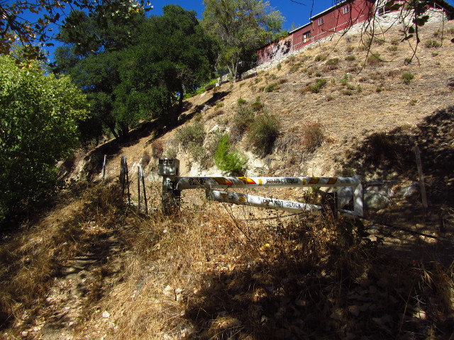
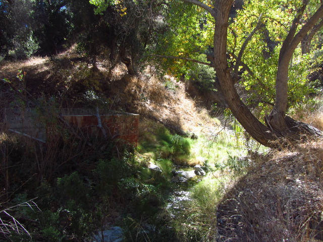
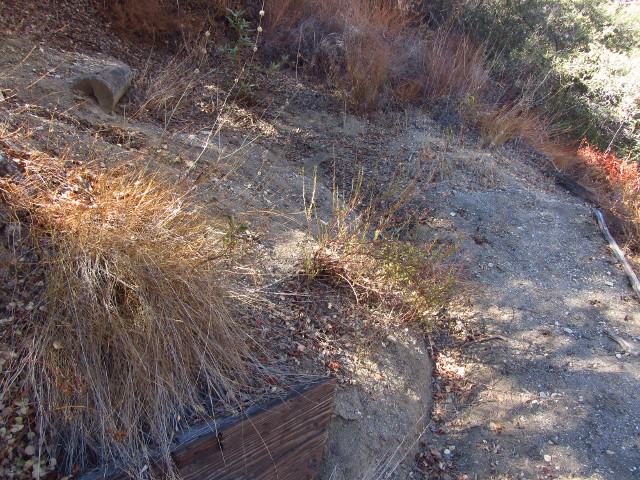
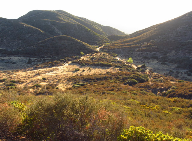
I drive a little way past the spots made familiar by my failed attempt at this mountain to find the expected fire road just as a touch of civilization pops up, noticing on the way that the gate on Ruby Clearwater Road is open. I turn into Warm Springs Road (Warm Springs Fish Canyon on the map) to see a road that looks good enough to drive, but has a solid gate closed across it. I find a place to park to the side of Lake Hughes Road and make my way up the fire road. A bit of water flows in the creek bed to the left and a few buildings are high on a flat to the right. Footprints in the dirt show I am not the only one to pass this way. The canyon is cool and shady. I pass the remains of a structure on the far side of the creek and soon leave behind both water and buildings as the creek dries out.
 |
|---|
| The start of the road based route up to the top of Warm Springs Mountain. |
 |
|---|
| The bit of water in the creek flows past some sort of utilitarian structure that is now just a canvas for art. |
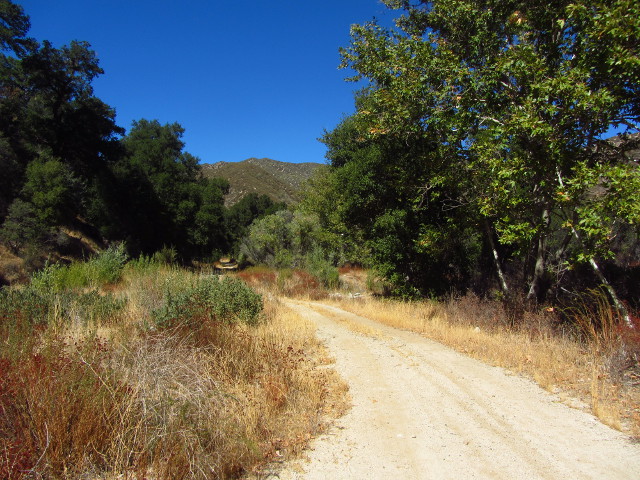
As the road progresses, it passes over the creek many times. Metal pipes and dirt serve as bridges, so the going is easy. Some look as though the road bed isn't sufficiently protected from the water flow and will wash out soon, but for now it would take any car. The canyon opens up a bit, and then I spot a trail off to the left. It is a little earlier than expected, but I turn down the mountain bike trail.
 |
|---|
| The canyon walls seem to slide back as I turn a corner and there is much more open space. |
The trail swings out wide and then almost reconnects with the road before wiggling back to keep to the creek bed. At first it seems well maintained, although a closer look leads one to believe that must of the small, brittle brush has broken rather than cut. There are a few foot prints, a fat tire, and a four inch wide tire that probably belongs to something that shouldn't be on a road marked "no motor vehicles", much less the mountain bike trail beside it. The trail continues to cross the creek bed frequently, except now each crossing would be a ford if there was any water. Now it is just a drop and a climb, sometimes quite steeply over a few feet.
 |
|---|
| The trail wiggles along the creek while the road, visible to the right, travels high above it. |
 |
|---|
| Spots of sycamore can be found, including these at the mouth of this side canyon. |
The trail seems to wiggle more than required, taking long loops around little flats that could be easily crossed. In some areas, the vegetation closes in, sometimes nearly achieving tunnel, but there is always a way to stay standing. The tread is distinct, even if overgrown, except for one spot where a tree has fallen with its medium sized branches across it. It looks to me like people sometimes go to either side of the tree and rarely over, but since it looks just fine, I go over. The old, dry branches hold me up better than expected. On the far side, an extra wide skid indicates the bike was coming downhill. Eventually, after I can easily spot the road the trail will eventually climb to, it grows tired of the creek bed and takes a switch back to head up the side. This first switchback has the only improvements I see along the trail to prove that this is something built instead of generated by use.
 |
|---|
| A couple large pieces of wood hold the trail in and make a step along the otherwise simple tread work trail. |
The trail loops back out the small canyon it had entered and around the side of the main one. Two more switchbacks bring it to the road at the top. The road is wide at the trail, giving ample parking for those who can't actually come up it at the moment. The widening also provides an easy turnaround for those who find the gate just after it closed. Today it stands wide open although it wouldn't be much of an obstacle for a hiker. I turn to go through it along still very good road, but no longer accompanied by many foot prints. Now that I am out of the very bottom of the canyon, I have quite a bit of wind. There are wind advisories for canyons and passes today. As I hike, the wind is often blocked, but it is a little chilly.
 |
|---|
| A look back down the canyon from the road. Warm Springs Road can be seen to the left and the trail on a hill in front of it. |
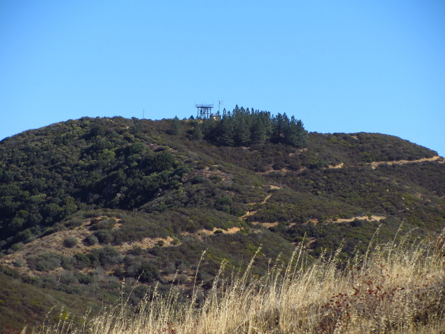
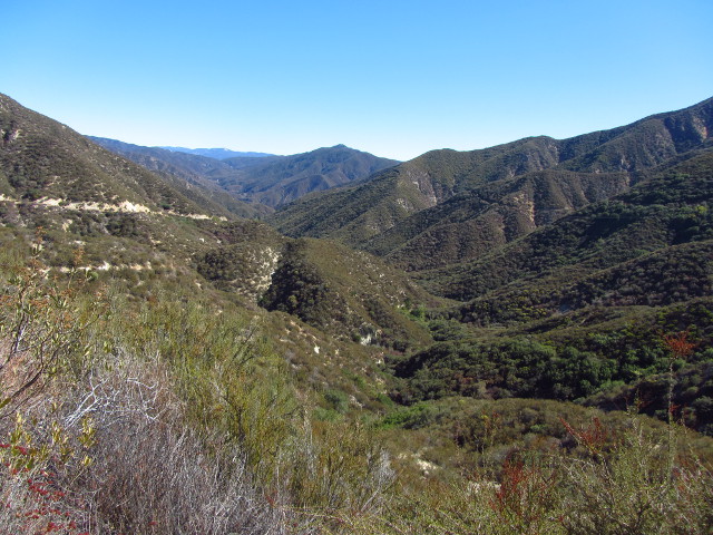
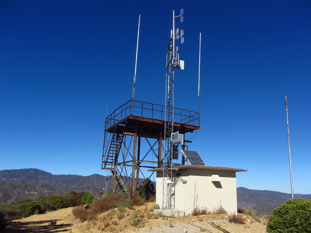
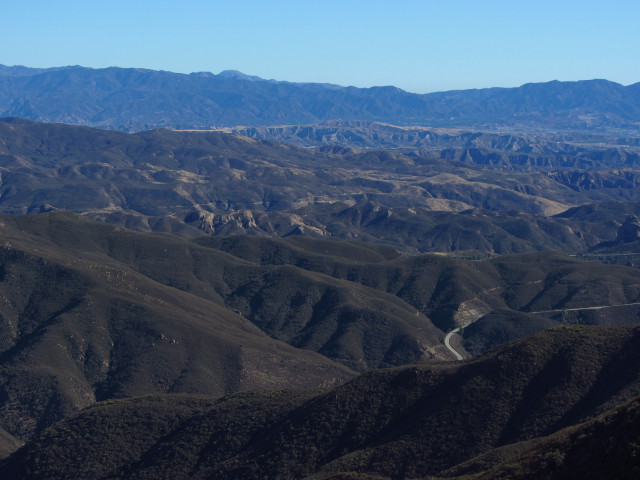
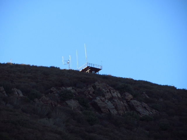
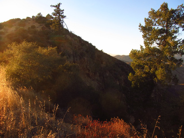
I stop under the high tension wires for a snack. The wind running past them makes a sound like water, but not the disordered noises of a stream. Instead, it is the sound of water being pushed through a straight pipe. A near constant crackle that rises and falls adds another dimension to the sound of the wires. The routes that were plowed for the workers to set up these towers still look usable to me. The junction with the road is obscured by grading and perhaps purposeful dirt moving, but it would be easy to drop down onto them a few feet along and they are so distinct in the mountain side that it is easy to locate where the junctions should be. I see three round, white buildings topping a peak to the northeast. Coming over a ridge, I spot the old tower of a fire lookout to the south.
 |
|---|
| A little bit of the view of mountains rolling off to the north. |
|
|---|
| The old fire lookout tower at the top of Warm Springs Mountain, which seems to have a few instruments adorning it. |
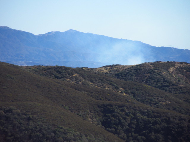
I pass a post marked "Warm Springs 024", but don't know what to make of it. A number of people have climbed up the slope beside it to a small peak that might have a bench mark at the top. I leave it for the slightly higher peak further on. I spot smoke over the hill and the glint of a low flying plane wing. Go to a fire lookout, spot a fire, except this one is already being fought. It is too far away for me to worry about on this hike.
 |
|---|
| Head for a fire lookout, spot a fire. |
As I get closer to the peak, I can see Castaic below and the city beyond it. The road forks next to a fallen, broken, faded to nearly nothing sign that once pointed left for Warm Springs Mountain and right for Necktie Basin. Taking the left, I circle around the mountain. I should be able to see the old hiker trail heading out from the south end of the road as it turns. Exactly where marked on the map, there is a metal post next to the remnant of trail that follows the fuel break down the mountain side to a saddle. I turn and go up to the tower.
 |
|---|
| A remnant of trail along the fuel break. |
 |
|---|
| The old fire lookout with some new instruments. |
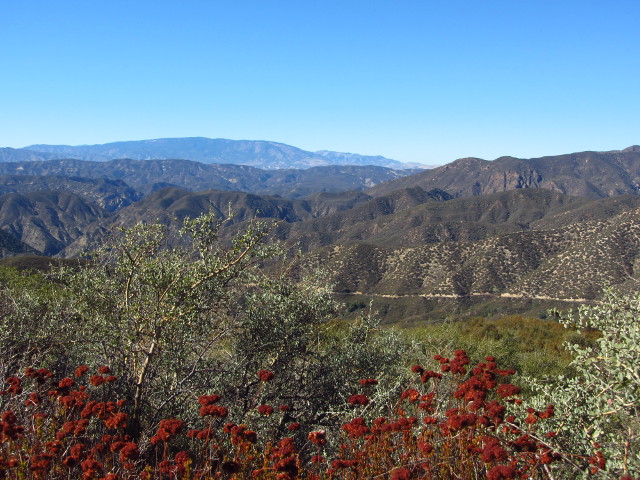
The tower seems to be in pretty good shape, where it still exists. It is missing the landing halfway up, half the trap door, and a few boards up at the top. I brave the missing landing for the view at the top, which is quite extensive. A stand of trees that look like they could be about 25 years old are growing up to obscure Necktie Basin, but otherwise, the view is clear and wide.
 |
|---|
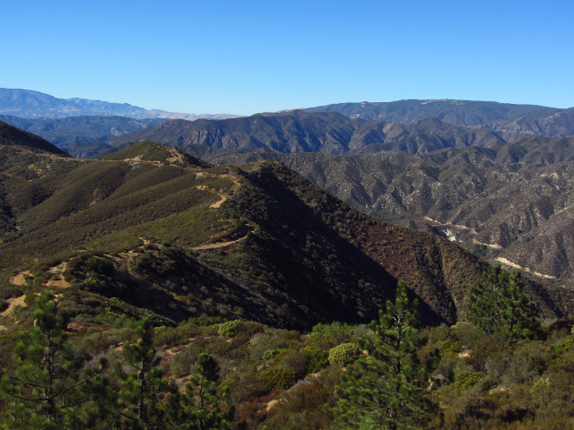
| A northerly look out over the mountains. The road comes to the peak along the ridge, and the canyon road can also be seen. |
 |
|---|
| A view of Necktie Basin that may be hard to see in another 10 years. |
 |
|---|
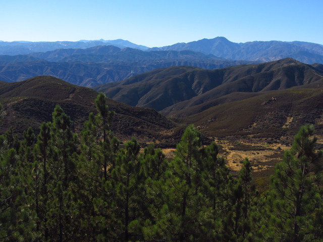
| A bunch of little bumps that are off to the southeast, with a stripe of Lake Hughes Road and Elizabeth Lake Road. |
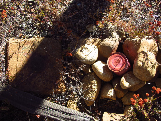
I carefully climb down again and check out a possible route down from the north side of the peak. The old fuel break heading northeast looks particularly old and it turns out I'm not feeling that adventurous today. I stop under the center of the lookout where a bench mark was placed in 1941. Next to it is a small coffee can and soup can register. It was placed in 2006 and although it is very skimpy, there is still plenty of room to sign it. By a former sign, I find a geocache which was placed the same day and has a few of the same signers, although the messages are quite different. The register signers usually came up on a motor bike, some of them noting it was a hard ride so I hope they aren't talking about my route. The geocache signers were concerned about a jeep someone lost down the side of the road, hopefully not losing themselves too.
 |
|---|
| The Warm Springs bench mark placed in 1941 and the register placed in 2006. |
Continuing down, I'm not feeling any ill feelings toward the road route, possibly because it promises to be a little different from the route I took up, at least over a few miles. Still, when I get to the top of the trail, the desire to know eventually wins and I start down the old fuel break. It looks like some have passed this way. A specific route through the small bushes is visible. At the saddle, I don't see the continuation of the trail at first, but when I check out the area it should be if the topo had it placed correctly, I find some more distinctive track heading east. Grasses are trampled down showing recent use and as I hit the bushes, I can see that they were recently cut back. A few old cuts also show, so this isn't the first time someone has come through and brushed the trail, either. I wonder if it actually goes all the way down or is just a start to reclaiming the route. The first few yucca along the side are cut away even though they would be easily avoidable, but after that avoidable yucca are left. The application of knife to bush continued so I keep going. The tread is bad in some places, but the cuts faithfully follow it. Around a corner, the tread continues, but the bushes over it stand unmolested. I can see where the old tread goes. It is interesting that although the bushes over the trail seem indistinguishable in height and growth from those off the trail, I can still pick out the route along the mountain. I hadn't seen the faint trail at the bottom as I drove past and I'm not in the mood to battle the brush, so I turn back to climb back up to the road.
 |
|---|
| Looking up at the mountain top from the last of the brushed part of the trail. |
Climbing back up the trail without too much stabbing from yucca, I make it to the dirt road. Another metal post marks the trail where it meets the road which seems to get closer into the saddle than indicated on my map. I take the road, with its long loop around the outside of Necktie Basin, back up to the fallen sign. This road seems to have been neglected for a while. At one point, it narrows down to a single track. I pass a flimsy old yellow gate held open by woody brush next to a sign that states the road dead ends in 2.5 miles. My map has it going through to the lake after meeting another road that goes out to Templin Highway, but the sign looks like it could predate the map information or the fire 25 years ago could have taken out part of the road but the map wasn't updated. I continue along the road around the basin and back up to the road I came in on.
 |
|---|
| Poplar trees grow very close to where the map marks a spring. |
 |
|---|
| Necktie Basin with the road traveling through it on the far side. |
I turn left to retrace my steps, largely.
 |
|---|
| A few ponderosa stand on a steep slope next to a number of old matchsticks that weren't so lucky in the fire. |
 |
|---|
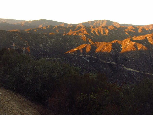
| The ridges in the mountains are picked up beautifully with the lengthening of the shadows. |
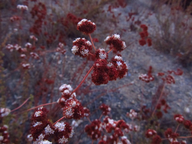
I reach a switchback that looks like it has a little bit more past it around sunset, so poke my way through. More than half covered and somewhat blocked by grading, an old road does go here. The map actually shows a short spur. I find very nice hills and a good sitting rock, so stop for a snack and a sketch. The sunset is mediocre, as they generally are over mountains, but the good hills are inspirational. Starting off again, I apparently decide that after sunset is a good time to photograph the few flowers along the way.
 |
|---|
| A little buckwheat in the dying light. |
 |
|---|
| Some composite flowers along the road side. |
Passing the gate again, I saw the trail going down to my right, but skipped it. Then the continuation of the road I came up on goes down to the left with a modern sign noting it is not maintained for low clearance vehicles. A little further, a dirt pile blocks the road headed north and wheel marks show how effective that is. Looking down the road, it looked like people liked the challenge of going over this dirt, but weren't so brave about actually taking the road. Taking the right, I find another modern "not maintained for low clearance vehicles" sign. I have good moonlight from high overhead as I proceed downward, but it is hard to really take in the surroundings by it. The canyon does look a bit different from this vantage. I spot a pipe along the wall on my left near where another spring is marked on the map. Further down, as the road gets down into the canyon, there are a set of roads off to my left which go to some structure, but I can't tell what. Quickly enough, the bit of road I am on looks familiar after the trail rejoins. Then there are a few lights from the buildings above and to the side and I'm back to the pavement. The road turned out to be a little shorter than the trail. The route is just over twice as far as the old trail, but the 6.5 miles are rather easy ones.
*photo album*
©2012 Valerie Norton
Posted 27 Oct 2012


Comments