Gaviota Peak
Gaviota State Park
Los Padres National Forest
Map link.
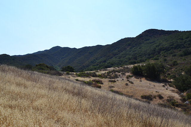
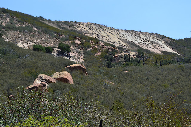
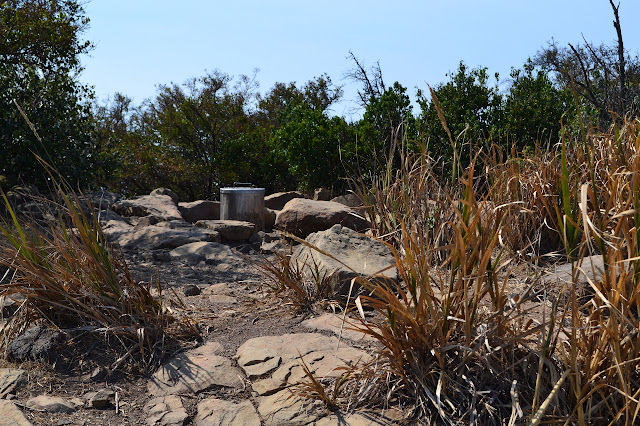
When I first hiked the loop to Gaviota Peak, I looked across to the ridge between it and the ocean and saw something that looked like it might be ruins at the top. I was informed by a frequent hiker of the area that they were not and better visibility and better zoom made it seem unlikely, although there is clearly an old road cut. The tinge of curiosity never quite went away and there is a very serviceable use trail along the road cut, so I decided to set out to explore it. I headed up and around the point and into the little lot for the hot spring and peak.

Starting up the hill, I am warned of mountain lions as I pass giant fallen oaks that are none the worse for it. The road soon splits offering the hot spring and peak to the left and Trespass to the right. I hang right for a short climb and there is a second split as a trail leaves. This one is marked by a short, small sign that once said "trail" along the vertical. Trespass trail continues to the left and Tunnel View takes off to the right. I want to try to make my way up the trail, so I take the right again.
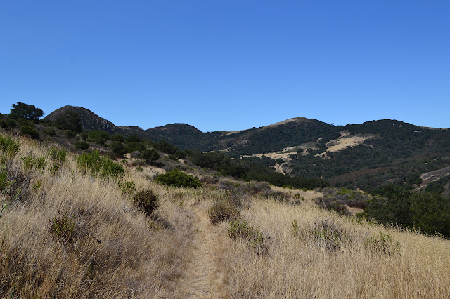
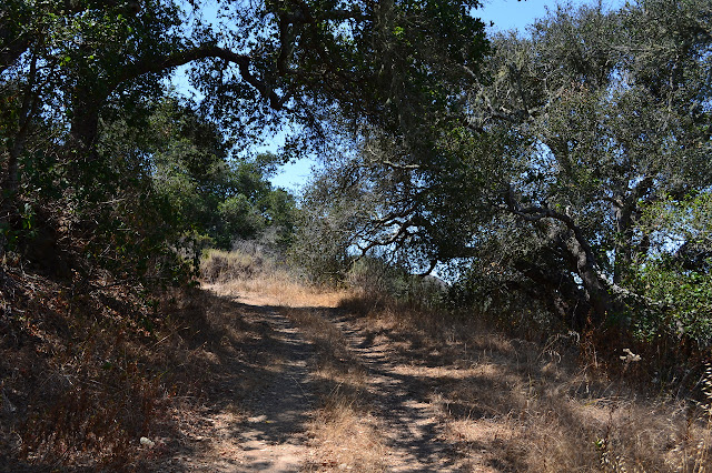
The trail is a clear path of hardened dirt at first. Other trails head off in the dried grass, some quite well established. Hitting the first of the two small wood bridges assures one that the current trail is the right one. I come to the marker for the Beach to Backcountry Trail, but it is just as devoid of trail as before. Trails spurt off down the hill as I go. A couple green and soggy patches hint of small springs in the area. I should be generally contouring, but I am generally dropping as I go. I pass where I know there's a bit of pipe, but to the downhills side of the bushes that hide it, and continue to follow the trail downward along the edge of a stand of oaks. I keep testing it for a trail through, but keep coming to walls of poison oak. I continue along the edge until I can clearly make out the tunnel under the northbound lanes that the Beach to Backcountry Trail uses and which I don't wish to check on this trip.

Coming back up along a somewhat more direct route, I passed along the pipe and followed another trail that does cross into the trees and past the poison oak, but only for a little way. I came to wide expanse of poison oak with three faint options going in completely different directions. If it was the only way forward, I might go through it. It wasn't that tall and I do wear long trousers hiking, so it should be alright. It isn't the only option, so I turn back the way I came to travel by way of the wide open fire road instead.
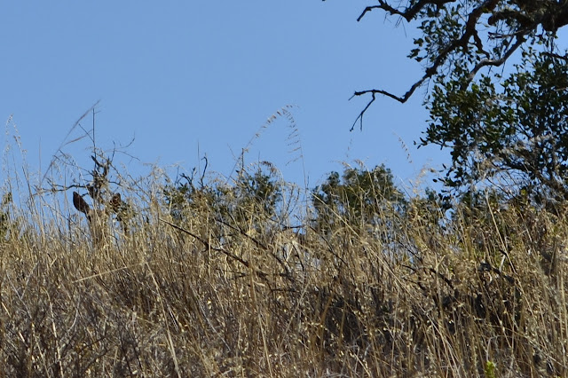
Hiking up the road is the same as usual. It looks like they might not have mowed around it this year, but it is still very much a wide road that doesn't go anywhere. A rustling to my left isn't much different from so many other rustlings, but it eventually gets my attention. At hearing my footsteps stop, the maker put a head up, then bounded off over the grass and sage. It was a young deer. Further on, I come to the second little brown sign that once said "trail" vertically. A track through the grasses heads down from there and one day I will have to take the loop in the opposite direction so that trying it from this side is more attractive. Maybe it actually just goes down to the witness corner marker indicated on the map at the acute angle of the forest boundary. Today, I keep on to the end of the road, as usual.

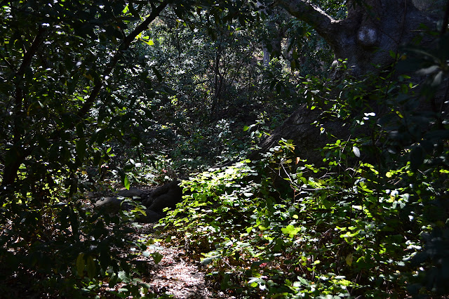
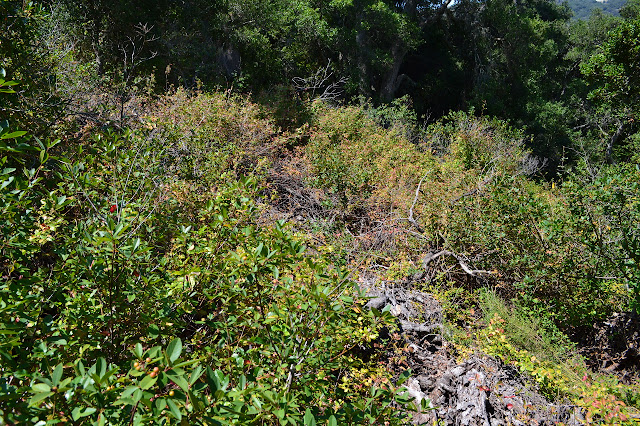
The end of the road comes at the first gate, which now sits in a giant arch a fair way off to the side. This is the end of the state park and the start of the national forest. The wide dirt and grasses quickly becomes a narrow canyon through chaparral just above head height. Old road bed is still beneath my feet, but now I find the bushes reaching at me from both sides. Someone has been cutting it back recently and it isn't so bad. The maintenance through here is probably entirely by regular hikers and not anything official. The chaparral gives way again to grasses, but comes back from time to time.
There is a second gate hanging open with some fencing still intact. This gate probably signals the section the trail is named for as it passes out of the national forest. As I work my way up the canyon, I come to one last smaller gate that stands half open. Past it, at a gully, the trail splits into two. The map indicates there is actually trail along the road for most of the way and which remains is a bit of a guess. Here, the left should be road and the right should be trail. It seems to be the only spot where there seems to be both, but a rock line warns me away from the route on the left even though both look well used. I have always gone right, today I cross the line and go left. I find myself ducking through the chaparral as I go. It is a bit taller than a bear tunnel, but still a tunnel. It quickly falls apart and I can either go through a shortening tunnel with poison oak starting up, or down a rock with no handholds and the only foothold a bit too far to reach. I scramble down the side of the rock near the bushes where I won't need a foothold, but it was a tight squeeze. Wading through some very short poison oak for a couple yards puts me back on the recommended route and climbing up to the saddle.
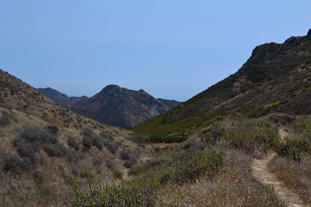
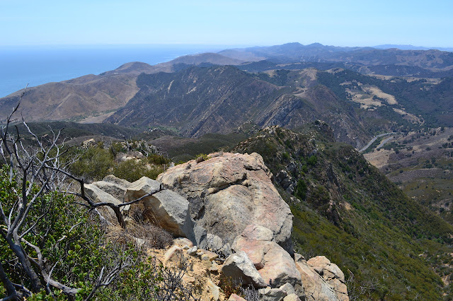
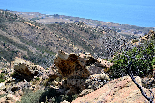
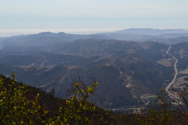
At the saddle, I take the trail off to the right toward the last ridge before the ocean. The brush beside it is short and stabby but the trail is well established and there is plenty of room between the branches. The old road contours around the hill and into a drainage where it is hard to tell where the road bed used to be. The trail travels up the drainage until it finds road bed again to start climbing out on. At a corner, a short spur offers a new angle on the view down the valley I just came up. A little more climb, and I'm out on a wide flat area near the top of the ridge. The rocks are sandstone with its soft insides scooped out. I walk along the ridge to the east and start to hear the freeway below. The trail continues east, but not very far.

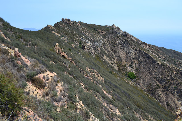

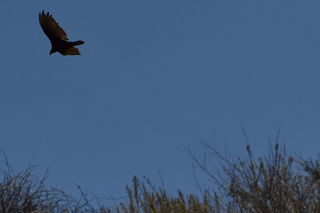
Turning back, I notice that there is still more road cut climbing the bump to the west. I make my way along the trail and up some steep and loose dirt to it and follow more trail off to the west. Over the hill is more wide and flat area. I spot another turkey vulture followed by quite a few more all riding the thermals on the ocean side. I check out a notch in the north wall before continuing along the trail as it follows the ridge further west.

The trail continues down the ridge and I follow it for a short while. It seems determined to make it all the way back down to the road or a house or another spring as it is probably a deer trail. I turn back and follow another trail around the front of the ridge instead. I pick up a "klean kanteen" someone dropped and dump out the half liter of water it contains. Mostly a deer trail. It becomes mostly a gully as the flat ends and I turn back to retrace my route back to the saddle below.
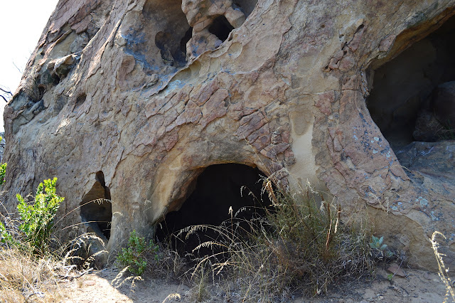
I continue to insist that the trail goes up from the saddle, not down to the vernal pool below then up, just because that is where it is shown on the map and I can see the cut in the side of the hill, so I wade through a sea of dried thistles to the little ledge of dirt. It looks like two people have stomped down the dried grass on it this year. The remains of the old forest service gate seem to be getting buried in the dirt below the trail. Climbing in full sun in the heat of the day starts to feel a bit hot and I grab some cooling time inside a nearby large, hollow rock. It shows black from a fire and modern day cave paintings.
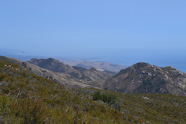
Cooled off, I continue up the trail to the peak. The murk in the air seems to have lifted a little and I can almost see an island. The windward side seems to gathered a bit of the murk into a fog bank. As I climb further, I can see more fog piling up on the coast past the point. The trail finishes most the climb and bobs along for a short way past old fallen barbed wire. I wish coming to the peak wasn't signaled by stashes of toilet paper by fools who don't realize this is a proper trail with people coming along it at odd times and who believe it's okay to tuck TP under a bush. Then I am to the brush covered peak. The brush does tend to obscure the view.
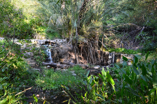
I start down the wide fire break to the fire road below. Someone seems to have been especially enthusiastic clearing it this year and it appears to have gotten wider. I pass more gates as I make my way. Coming to the shortcut to the hot spring, I turn off the road only to be blocked by a large oak that has fallen along the trail. I wonder if I can just walk along the trunk, but oak trees aren't a form that makes that easy. I go back to the road and continue down it instead. At the creek, I feel the water and it is cold. I walk up to the pools and find them to be lukewarm, at best. The pools are a lovely blue and bubbles come up here and there keeping everything nice and sulfurous. One small puddle that drains by a pipe into the pool is releasing huge bubbles, but the water in it is very cold.
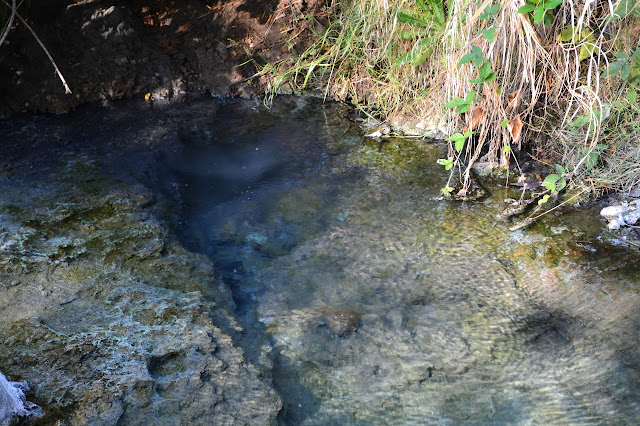
I poke around the little structure behind the spring and find that the pipe that leads from it has no water coming from it, but there is plenty of mud below it. I head down toward the trail head and parking lot. There were plenty of cars in the lot when I started, but there are nearly none now. I pack up and complete the emptying.
*photo album*
©2013 Valerie Norton
Posted 22 July 2013
Liked this? Interesting? Click the three bars at the top left for the menu to read more or subscribe!


Comments
I always love the clarity and brilliance of your pictures of familiar scenes and note most have high contrast with the sun behind you. However, there's more to it than that and I wonder if you have any post-processing secrets tweaking contrast, saturation, dynamic range etc? I shoot RAW files to allow this flexibility.
As for the Gaviota Peak hike, check out another Beach to Backcountry linkup from the eastern end of Gaviota State Park (below.) It is spectacular and joins the ridge you hiked on here.
And my answer is:
For post-processing, I honestly do as little as possible. Most of the pictures above were resized, some were cropped, and one had the contrast increased and the brightness decreased. I went a little too far with that last one, and you can probably figure out which now that you know.
I am shooting on superfine jpg. I tried RAW+jpg for one hike, but got worried about how much space it was taking (I should just get a bigger chip) and when I got home, I couldn't edit the RAW format (NEC) in GIMP anyway. There is a little processing from the camera with this. I think that's just white balance, which is usually set to auto, and the inescapable smoothing of the lossy jpg. I have tried shooting in "vibrant colors" mode, which I prefer on my Canon point and shoot cameras, but I did not like it on this Nikon dSLR.
Most likely, my secret is exposure compensation. I almost always have it set at -1/3. Sometimes I reduce it even more. Rarely, I'll actually increase it. Some metering modes seem more consistent than others allowing fewer adjustments of the exposure compensation, but they all seem determined to overexpose the photo just a little bit to my eye.
The picasa album for this hike is here. The extended information has usually been preserved, so you can see which camera took any photo and what settings it had by clicking the "full details page" link on the right. Unfortunately, that won't say if I've adjusted the photo but I really only sometimes adjust contrast and brightness.