Santa Barbara front country
Map link.
Down below the main ridge of the Santa Ynez Mountains that make a backdrop for the city of Santa Barbara, there are a few shorter peaks that jut out. They stand obviously shorter than the short mountains that don't even break 4000 feet in the part behind the city. I tend to think of these peaks in front as, well, not real peaks. I don't think any of them have proper trails to the top. Most of them don't even have use trails. Still a few are named and a few are quite striking when viewed from the city. Cathedral Peak is both, which might be why there is a well advertised use trail that climbs its flank. Being "striking" can translate into "difficult" when actually climbing and this trail and this one is said to be class 2 and sometimes easy class 3 climbing. The difference may depend as much on lucky path choices as on the skill of the traveler. I decided to head up to it and, once there, maybe continue on to La Cumbre above and back down Tunnel Trail, depending on my water situation.
Grabbing a legal parking spot, I pound up the pavement to the trail head and then pound along some more pavement well past it. At the south portal for the actual tunnel, the paving ends. Mission Creek is like a desert wash above the road, so I skip the use trail along it and follow the easier catway route instead. Making the turns to head up Jesusita brings me back to the creek which still looks as though water is only a distant memory. Two trails head up from a dry pool just above the trail. The further one provides an alternative for those going to Seven Falls who do not want to rock hop up the stream. I head up the steeper first trail which provides a bypass of the falls to get to Three Pools as well as the route to Cathedral Peak. It is a quick and steep climb out to a bit of ridge and then generally along it and up.
 |
|---|
| Jesusita Trail stretches out to the right and a spur of the Edison Catway winds up on the left in the initial stages of climbing up to Cathedral Peak. |
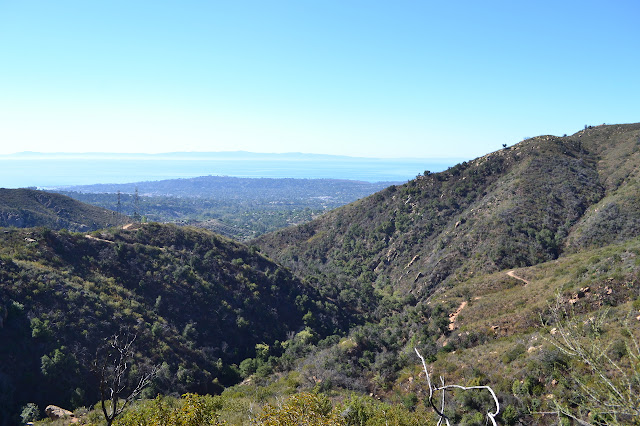
Steep climbs alternate with fairly flat segments. The bypass trail splits off on a fairly flat route to the right. Slowly, the various destinations available from the start of Tunnel Trail begin to fall away and the view widens. Often there are a couple of routes to choose from. I seem to tend to the left side routes as I go, sometimes deciding it wasn't the best after all but always managing the route. Sometimes, someone has stuck a load of sticks across the more attractive of two clearly visible routes, including forcing climbs where a walk will do. Turning a corner along the ridge, things start to get rockier and the upper section of Mission Canyon is spread out below. Far in the bottom, there turns out to be water after all.
 |
|---|
| A somewhat obscured view of Mission Falls. Tunnel Trail curls around the far side of the canyon. |
 |
|---|
| This spring fed canyon may have some water in it yet, up closer to the spring. |
 |
|---|
| Some of the better trail along the top of the ridge. |
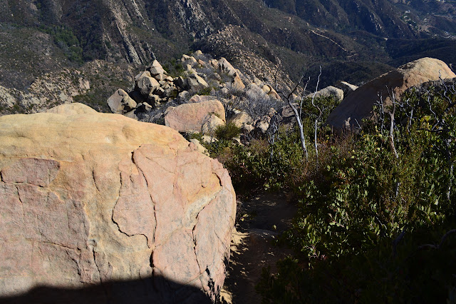
Picking my way along the top of the ridge, I generally find the trails to the northeast side to be better. Getting down on the south side leads to a couple tough, but short, climbs. There are more and more blockades on the trail, and after coming to one and finding that removing the yard high pile of sticks will be less work than following the path it tries to direct me along, I start taking them as endorsements for the trail behind. This works quite well for the rest of the climb up, but there are plenty of unmarked splits to go wrong on.
 |
|---|
| Tunnel Trail on the far side of the canyon and the Edison Catway behind it. |
 |
|---|
| A couple of pine trees make their home along the northeast edge of this ridge. |
 |
|---|
| Nearing the top, the sandstone has a lot of darker sandstone inclusions. |
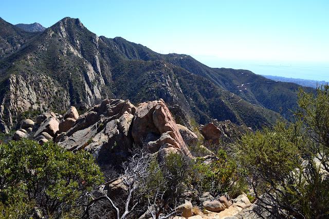
Shortly before coming out to Arlington Peak, the slightly shorter southern prominence of Cathedral Peak, the first of my water runs dry. I have somehow managed to drink 2.4L in about 2.5 miles, twice as much as I allocate for hiking in 90°F weather, and it's only been lost as sweat so far. A couple guys also hit the peak just before me, one carrying nothing proclaiming he was a bit dizzy, but who cares? It just goes to show you don't always realize when you're being suicidal. After posing manly and taking in the view, they head back down again telling me I'd made it as they went. I poke around a bit and ponder if for today, this will be it.
 |
|---|
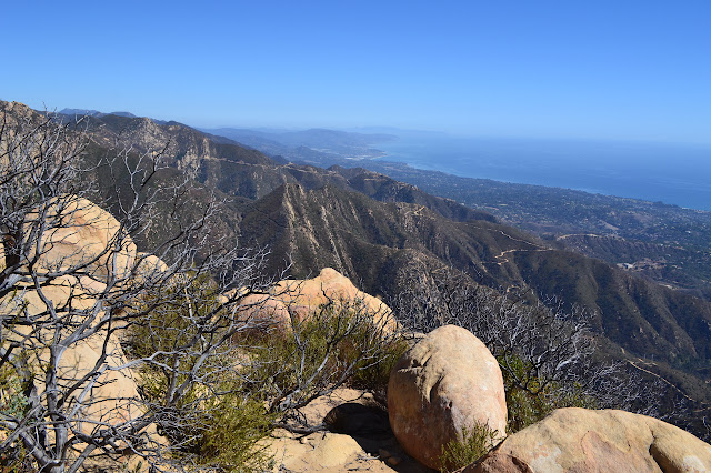
| Up on Arlington Peak, looking to La Cumbre, the peak with the fire lookout and antennas toward the left. |
 |
|---|
| The prominence of Cathedral Peak, looking decidedly shorter than the mountains behind. It seems to have a number of caves in the south face. |
I can pick out the trail across to Cathedral and the one that continues up to La Cumbre Peak, but not the one that leads down to Inspiration Point. That one is visible from lower down. I have about a liter of water left in a second Platypus bag and at the current rate, it looks like about enough to get to the peak, but not back, much less off this one. Not feeling suicidal, or at least no more than usual, I decide that it is, indeed, it. You win this round, fake peak.
 |
|---|
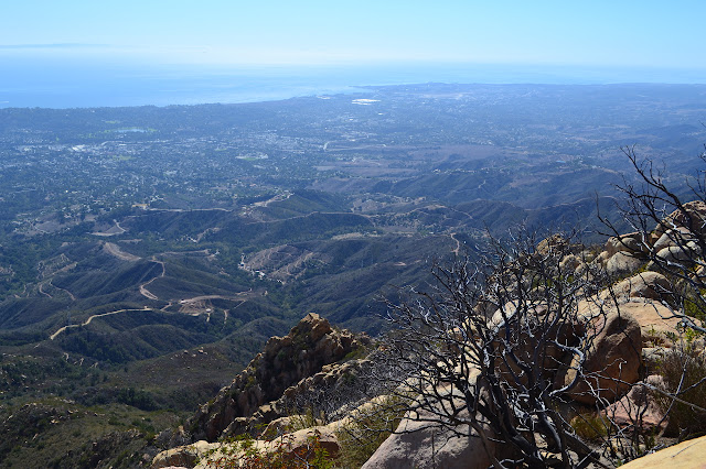
| Tunnel Trail, the Edison Catway, and Gibraltar Road all stand out in this look down the coast toward Carpinteria. |
 |
|---|
| Looking to Goleta, there's a bit of marine layer rolling back in. |
 |
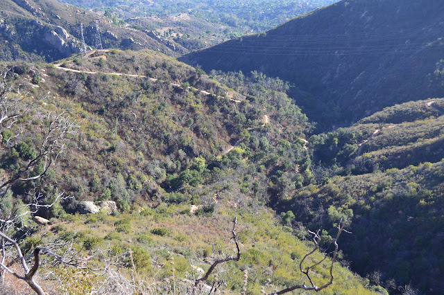
|---|
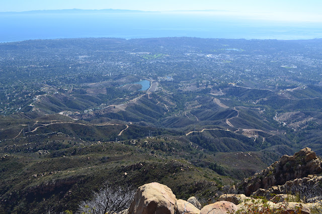
| Below, a number of trails and roads seem to explore every curve of the land behind Santa Barbara. |
I head down, often along a somewhat different route than I came up. The way down is easier, mostly because I don't hit anything too high to jump down from or with a bad landing area.
 |
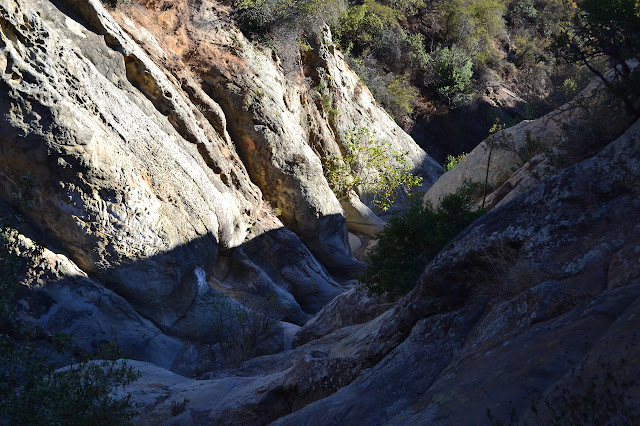
|---|
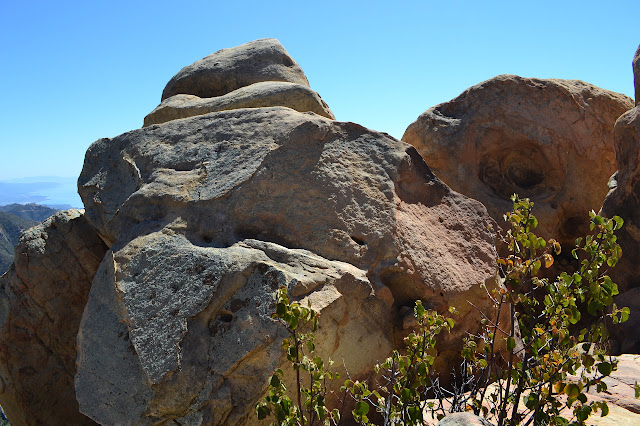
| The sandstone rocks embedded in the sandstone make odd erosion patterns. |
 |
|---|
| Still careful work to get down this thing without injury. |
 |
|---|
| Of course, there are plenty of lizards hanging around on the rocks. |
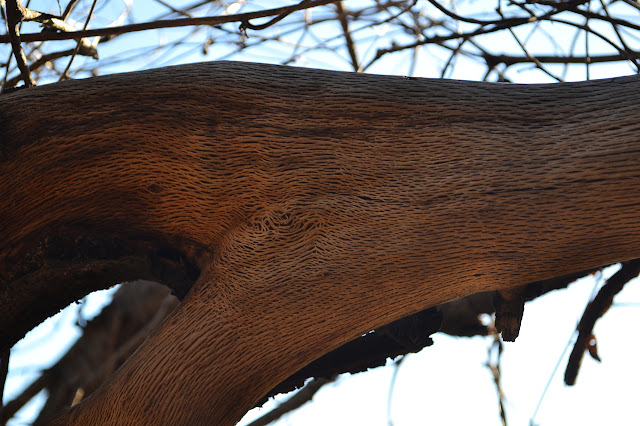 |
|---|
| The top layer of wood on a dead branch is making interesting patterns as it dries out. |
 |
|---|
| Jesusita Trail dropping down into the canyon, and this one dropping along the ridge to meet it, are now close at hand. |
Getting comfortable that I was almost down and feeling you can't go wrong choosing the northeastern path, I manage to go wrong doing so. There was a familiar bit and then an unfamiliar bit and I find myself headed down a steep dirt path in a small ravine. Up on the rocks on either side are two of the remaining little power poles that used to serve the fire lookout. There are even three wires hanging very loosely between the two. The trail isn't bad at first, so I go with it. It gets very bad quickly, but by then a lot of feet had been lost. Somewhere down there is the Seven Falls bypass, so I know there's a way to get back by going down and work carefully down to it. It takes a lot longer than expected.
 |
|---|
| The pole to the right and a bit of the wire. It has a match to the left. |
Finally, once down under the cliff, the trail improves a little and shortly does hit the bypass, just as it drops down to the creek again at the top of Seven Falls. Plenty of footprints assure me the trail is not washed out, so I can take it back down. First a glance at the top of the falls.
 |
|---|
| The top of Seven Falls is looking pretty dry. |
It is an easy walk along the bypass, then a bit more downhill to the real trail. I drink the last of my water as I hit it. The last mile or so is dry, but after the short climb out of the creek bed, it is all downhill and easy.
©2013 Valerie Norton
Posted 26 September 2013


Comments
I am enjoying your take on the Los Padres NF.