San Gorgonio: Forsee Creek to Limber Pine Bench
San Bernardino National Forest
San Gorgonio Wilderness
Map link.
DAY 1 | DAY 2 | DAY 3
Wanting to hit the initial points near one end of the San Bernardino Peak Divide Trail and San Gorgonio Mountain at the other, I decided on a loop starting at Forsee Creek and finishing at South Fork. With the last bit of walking to connect the ends, it looks like about 35 miles of travel. I didn't like the way the second day was working out when insisting on camping by water, so settled on an easier four day plan giving much more time for wandering up all the peaks and searching for all of the initial points. Most of the hiking is in the San Gorgonio Wilderness, so I stop by the Mill Creek Ranger Station on the way up to get a permit. They have quotas to limit the number of people in the wilderness, implemented mostly by campsite for backpackers to keep the sites from overflowing. My desired sites are all available, so getting the permit is painless. Stoves are currently allowed, unlike in the local forest. Excellent, because it's cold out and I want some warm dinner and breakfast. The road up to the trailhead from Jenks Lake Road is signed and a touch on the rough side.
 |
|---|
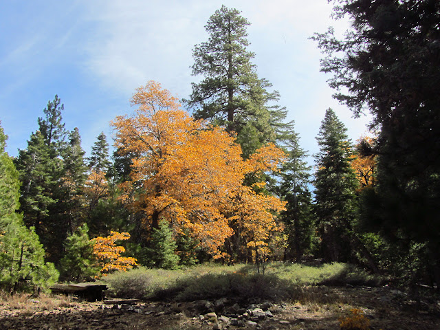
| The black oaks are showing off their fall color. |
 |
|---|
| The wilderness boundary at 7000 feet. |
The mountain has a dusting of snow remaining from the first storm through. The black oaks stand out sporting yellow foliage among the evergreen pines and cedar. The trail starts at 6920 and climbs quickly to the San Gorgonio Wilderness Boundary, then splits to climb to the ridge on the left or contour and climb to Johns Meadow on the right. Heading right on the smaller trail gives a rolling walk through the thick trees. A few more yellows join the black oak leaves.
 |
|---|
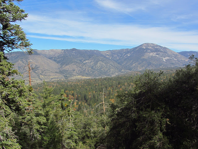
| Fall colors in the Santa Ana River valley. |
 |
|---|
| Yellow willows occupy Forsee Creek, which has a nice flow. Johns Meadow seems to be the green space near the creek that opens up a bit a little higher up. |
Crossing Forsee Creek, there are a few nice camping spots under "no camping here" signs. Johns Meadow Camp has been closed due to the danger posed by standing dead trees. The area around the trail doesn't look more dangerous than other places to me, but the correct camping area is probably off the trail and these are from people who found reading difficult. The trail dips again to cross a second creek, past which it is no longer maintained. There are day hikers coming down who were looking for the meadow, and I can see how they might miss the little bit of grass as what they were looking for. The climb out of the creek is getting a bit sketchy. The trail beyond isn't much worse than the maintained trail although a couple spots could use some love. The trail works its way steadily to the ridge trail above.
 |
|---|
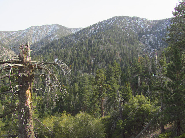
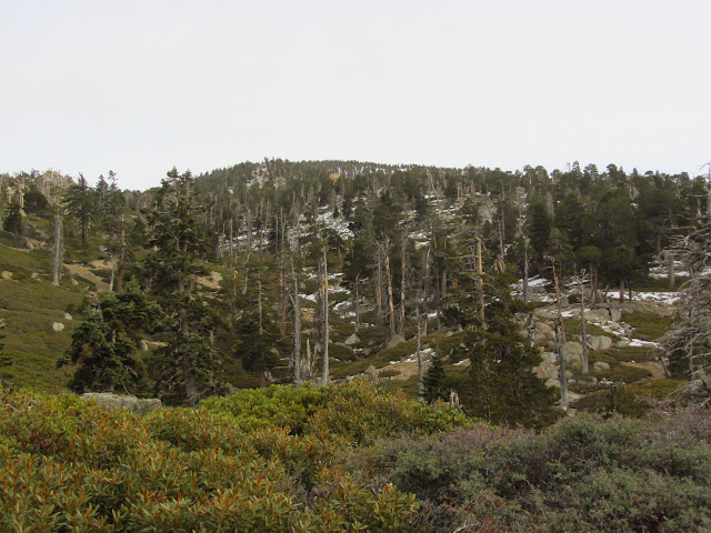
| Patchy snow has stuck to the north side of the mountains, sometimes extending over the trail. |
 |
|---|
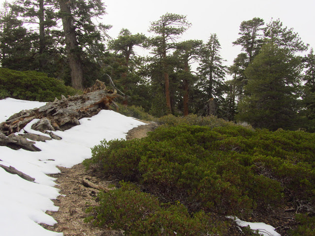
| Manzanita and icy snow as the trail passes through Manzanita Flats. |
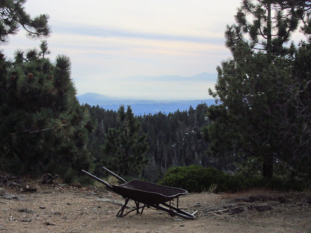
Thickets of manzanita over ground that is relatively flat compared to the steep mountainsides that have preceded signal nearly arriving at the San Bernardino Peak Divide Trail. The trail to Columbine Spring heads down the other side of the ridge past the relic of a wheelbarrow. It's a good place to stop for a moment, but there are still a couple miles to go before camp. The ridge is a beautiful hike. The black oaks were left far behind, but the rest of the Jeffery pine and incense cedar and ponderosa pine have also vanished by the ridge line. The lodgepole pines that replace them have a starkly different look.
 |
|---|
| Climbing to the ridge line brings the Inland Empire into view, except that it is a bit cloudy currently. |
 |
|---|
| There's a pine that looks particularly limber. |
 |
|---|
| Rocky and a little snowy on the slopes above. |
 |
|---|
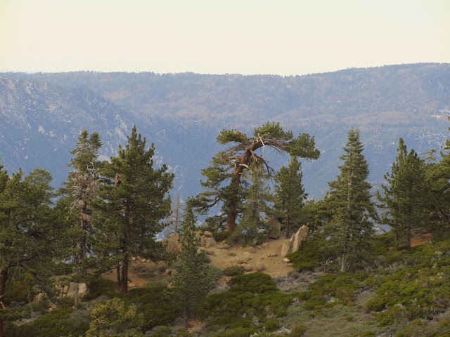
| A look down the ridge line that the San Bernardino Peak Divide Trail follows. |
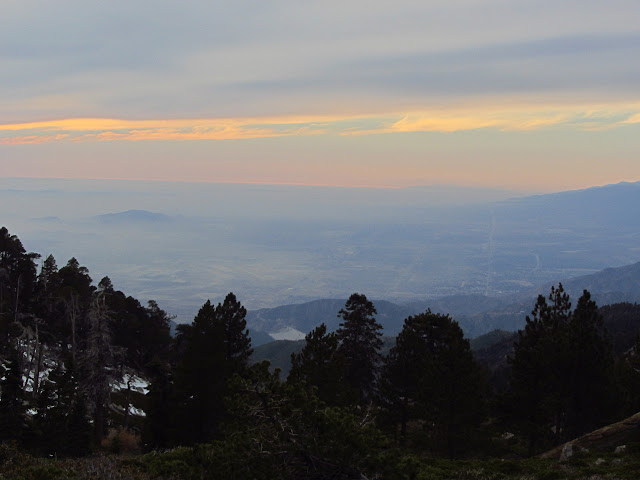
The clouds to the west manage to turn the sky sunset colors an hour before the sunset is supposed to happen. A bright smudge in the sky shows the sun is still high. After a little more climbing, there are a couple tents up ahead, part of a large group that didn't manage to notice the "no camping here" signs by the main trail and the spur off to the appropriate camping area. The spring is another quarter mile up the trial, so I check my water level and head up to it to have plenty for both dinner and breakfast before heading down to the camping area. There is a small group down there, too, and plenty of room for more. The spots are all set up with wind breaks built by those who found the wind too much on other nights. There isn't anything tonight, but I take a site with a good block by a short, living tree which proves nice later on.
 |
|---|
| Sunset colors in the sky even while the sun is still higher in the sky than the colors. |
Setting up camp means a new Nemo Hunker 2p which can keep my upper body dry in the little bivy and which I can't quite set up in a way I like, even after retying all the silly knots. I have the Whisperlite along again, with a new pump, as white gas should be better for cold weather. It was the easiest thing to light so far with my fire starter at ~75°F, but takes a match in the cooling night after the sun has set. This is unfortunate as my matches seem to have gotten some moisture and two of them fizzle a little before a third lights properly. It is trouble free after that, so I get a hot dinner with lots of lights twinkling below. With a little clearing, there are a few lights twinkling above as well.
 |
|---|
| The Inland Empire twinkles below Limber Pine Bench. |
The nightlight glow from the cities below is enough to wander around in, although my fellow campers seemed to stick to having a headlamp on while they were up. It is fine behind my tree, and really not even half as bright as when the less than quarter moon finally gets up later in the night after the sky has cleared of cloud.
Continue reading: day 2
*photo album*
©2013 Valerie Norton
Posted 30 October 2013
Liked this? Interesting? Click the three bars at the top left for the menu to read more or subscribe!


Comments