Montecito Peak
Los Padres National Forest
Locate the trailhead.
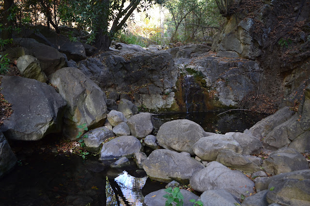
It's a beautiful day for an afternoon wander up to a local little peak. Clouds dot the sky delightfully, but the islands are just a bit murky as I head to the Cold Spring trailhead. There's a group of backpackers creatively slinging average sized loads in and around small packs in the parking lot, somehow looking more capable than the average person jury-rigging a load. There's a little bit of water crossing the ford as I turn up the trailhead nearest the creek, but the bench at the junction with the trails up the other two forks seems to be looking over dry creek bed. In a section where the trail climbs up past a hard rock layer, water can be heard falling a fair distance far below, but can't be spotted. There is water again at the pool above the creek crossing.
 |
|---|
| A little bit of water is coming down Cold Spring Canyon. |
It is getting easier to miss the trail just after the second crossing where it heads a little downstream and starts to climb but plenty of feet have started upstream. The backpackers have briefly caught up and half the group starts up it before one in the other half calls them back. I notice one hip belt has been turned into lashing straps and cringe a little. They stop to make adjustments as I climb the trail up out of the canyon. A guerrilla trail along the way is marked "route closed" with a slapstick. The cute scattered clouds have brought friends and the sky has a nice texture, but nearly covered. Below the sun, the light is bending just so to bring out sunset colors even though it is still some time until then. It makes the climb up to the Edison Catway rather nice.
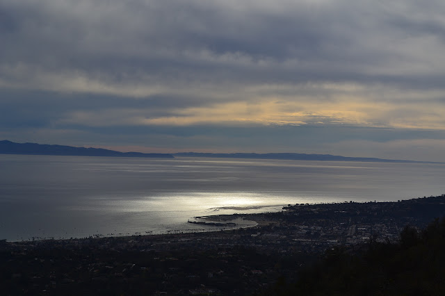 |
|---|
| Looking out to the harbor, there's a little bit of red ringing the edge of the world. It has an evening look even though the sun is still quite high. |
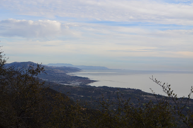 |
|---|
| The view down the coast toward Carpineria. |
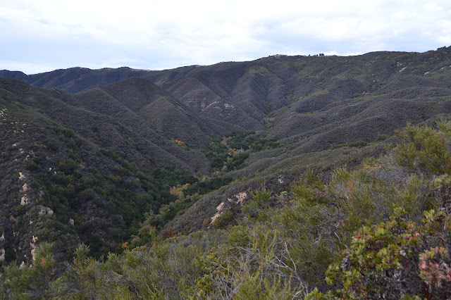
The trail quickly leaves the catway again and here the guerrilla trail builders have been hard at work. A small trail to the left twists easily up the hill and a wide track on the right blazes up the line of the ridge. The trails rejoin only to split again with a route to the left climbing up the ridge while the old trail circles around to the right. After that rejoins for a saddle, there is one last guerrilla trail to the right. Basically, the low route is the correct one through here. At the eastern extreme of the circling, the old trail heads down to the hot springs and which I plan to take on the way back. For now, there's just a bit of climbing to do. Across the canyon, the west fork trail is starting to look grown in.
 |
|---|
| The now even more inaccurate sign at the top of the trail down to the old Monticito Hot Springs Club, and the ruins of the club below. |
 |
|---|
| Looking down over the north fork. It is hard to pick out the trail that climbs it again. Maybe it is well on its way to being lost again. |
 |
|---|
| Taking a moment under the eucalyptus trees planted long ago for shade and checking out that sky still tinged with red. |
After hiking around the peak, a gentle trail starts up from the main trail toward a saddle and then crosses back for the steep climb up to the peak. There are two choices for this use trail, directly up a wide slide or along a somewhat narrower and slightly less steep trail. The top is a hard climb, but quick. The view is much better than last time.
 |
|---|
| Still an hour to sunset on Montecito Peak as I look out past the pine planted as a memorial. |
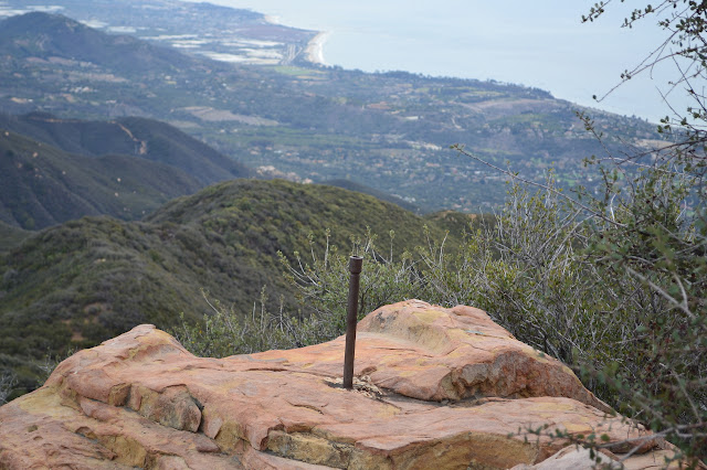 |
|---|
| Reference mark 2 is in a rock on the far side of the peak from the trail and marked by a pipe. |
Crossing the peak, I quickly find the second reference mark set in 1927. Follow its arrow, and there's a loose bit of sandstone with half of a short drill hole and recess caked with old epoxy for the destroyed station. The colors in the sky are inspiring and there are bits of blue in the west to hint that there will be some light show, so I end up staying for the actual sunset. Out past the eastern island of Anacapa, I notice the grey suggestion of Santa Barbara Island.
 |
|---|
| A little bit of bright in the clouds at sunset on Montecito Peak. |
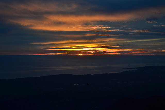
 |
|---|
| The afterglow is spectacular as the ocean starts to reflect all the red above it. |
 |
|---|
| Of course, as dusk settles in, the city lights fill in the landscape. |
It is a careful scramble down the use trail in the last of the dusk light and it is comforting to reach the bottom. The route down from the saddle requires a light to find again. It doesn't take long for the trail to need a light as well and when the moon rises, it is no help as it is just a brighter bit of cloud. I notice different things on the way down. There is a thick trail of ants who don't seem to be slowing down for the dark. As it is dark, I skip the hot spring and head down the high route. I catch it from further along the catway than I came up, but the route is decidedly not an official one. I meet the proper trail and keep going, finding a long and fat millipede crossing the trail. As I watch its legs undulating ever forward in six ripples, I notice the other trails it has left earlier in the dust of the trail. A few quick switchbacks and I'm back to the road.
*photo album*
©2013 Valerie Norton
Posted 18 December 2013
Liked this? Interesting? Click the three bars at the top left for the menu to read more or subscribe!


Comments