Posts

Showing posts from August, 2013

sketches

Image
For this month, I've got: The three peaks on the tallest of the Tri-peaks of Boney Mountain . The excellent, if perhaps not complete, view from a bit past the the east end of Buena Vista . A study of the branches of the oak at the junction of Saddle Rock and McMenemy .

Hot Springs Canyon

Image
Santa Barbara front country Locate the trail head. I decided to go on a loop hitting the Hot Springs Club ruins and giving me an excuse to look for another benchmark that has no reporting since 1964, or maybe that's the other way around. The day is hot but the trail parking is full and I have to park on a side street. The trail passes between a fenced garden and the creek as it climbs shallowly toward another road. A trail sign points at a dirt path along the side of this trail that ends at an intersection. Continuing in the same direction, the route crosses a ford and then passes again between fence and creek, but now swapped. Past this, it drops onto the fire road and continues up. Generally shaded by non-native trees, it climbs some more to a junction. Trail signs point to a creek crossing to the right while a second trail along water pipes and a road continue past private property signs. I think the road goes to a house, but the trail may now be taken. The tra

Buena Vista and Old Pueblo Trails

Image
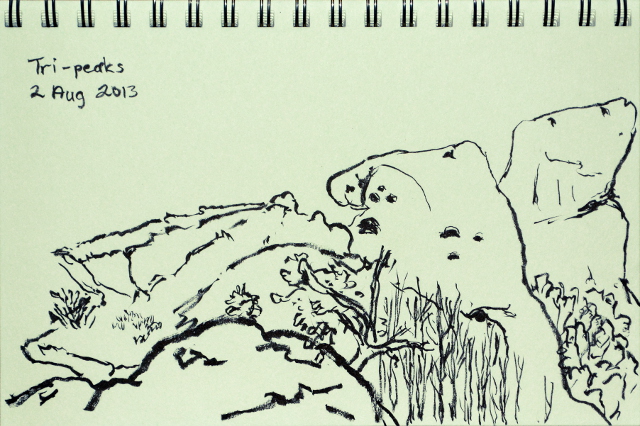
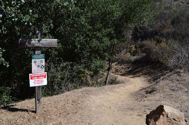
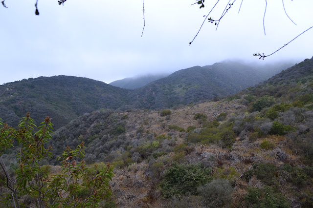
Santa Barbara front country Map link. Buena Vista is a three pronged trail extending east and west to the Edison Catway on either side and south to a bit of road between Romero Canyon and San Ysidro Creek. I spotted it while checking satellite around a benchmark. I don't hear people talk about it and only the catway connecting segments are on the 1995 Carpinteria topo, but it seems well covered in a couple of area trail guides. It is particularly well described by Ray Ford , who notes, "Not too far beyond the end of the trail and the beginning of the catway a small trail leads to a knoll which is marked on the Carpinteria topo with a small triangle and the elevation-1543'." That triangle is the benchmark. He also suggests a loop with Old Pueblo Trail, which I thought was excellent since I have so far ignored it as I went other places. The three trail heads to the west (San Ysidro, Hot Springs, and Cold Spring) are all fairly crowded, even on a weekday, but

Arroyo Hondo Preserve

Image
Land Trust for Santa Barbara County Map link. Over a month ago, I asked my mom if she wanted to go to Arroyo Hondo and she said she'd been wanting to. It then took two months to get sorted because Arroyo Hondo is not as easy to visit as most of the Land Trust's holdings. Reservations are needed during open days on the first and third weekend of the month. (Click here for information on visiting.) When trying to make reservations for the upcoming weekend, we were told we were too late to get them and there was a function during next open weekend. Our own schedules conflicted after that, but we finally found a day. So I find myself traveling "north" on the 101 until just the right moment when I take a hard right off the highway at one of the smaller roads along the side, one that doesn't even have a right turn lane or a crossing point to head back the other way. A little sign says "Arroyo Hondo Preserve" and another by the gate informs of the

Los Liones

Image
Topanga State Park Locate the trail head. After neglecting the trail for about a year, the LA section of Hike the Geek decided to hike Los Liones Canyon up to Parker Mesa. The marine layer over the ocean continues, so the start isn't too bad as we make the wiggles up through the canyon on the narrow trail. The chaparral is looking pretty brown and grey under the cover of low clouds.

Boney Mountain

Image
Rancho Sierra Vista/Satwiwa, Santa Monica Mountains NRA Boney Mountain State Wilderness, Point Mugu SP Locate the trail head. The predicted temperatures inland range right up to 100°F, but on the coast there are still areas expecting a nice 70°F. Being somewhat suspicious of the predictions, I pack enough water for hiking in over 80°F temperatures and decided to climb Boney Mountain from the Thousand Oaks side. The area has been recently burned and the weatherman isn't predicting for the mountain top, so I wasn't going to take any chances with the precious liquid. Normally, a recent burn would put an area off limits, but the relevant agencies have decided that all may continue to use the land as long as they stay on established trails and keep to the hours of sunrise to sunset. There is danger from fire smoldering inside trees, but this can be carefully checked for along the trails and there are a few reasons to invite the public back onto the land. Setting off

follow by email