Sespe: Fishbowls
Los Padres National Forest
Map link.DAY 1 | DAY 2 | DAY 3 | DAY 4
The night was a bit on the cold side, which is to say I was quite comfortable under my too warm quilt. The vapor on the exposed side of the Platypus on the ground even tried to freeze, although the one on top of it showed no signs of frost. We are slow to get started as the hardest days have already past and this one should be the easiest. With the flow in Piru looking so low, we will keep a sharp eye on it. After two years of very low rainfall, you have to keep close tabs on the water and always know where the last was. There are interesting water features planned for the end of the day, but first we have to do a lot of road walking.

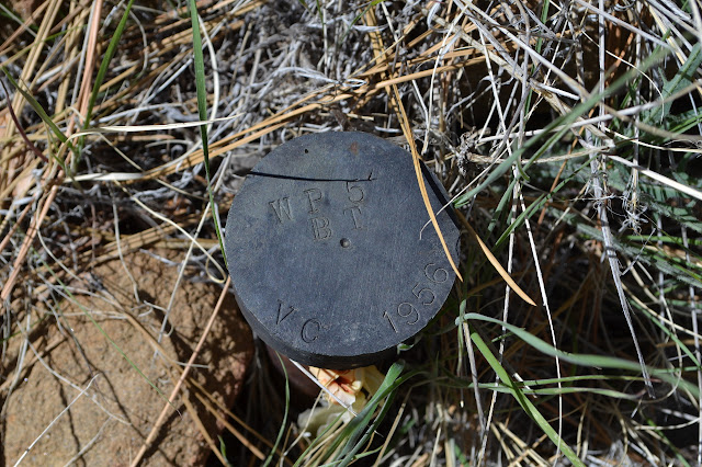
The yellow of a location poster on a lone tree in a field presents a sudden orienteering challenge I cannot pass up. I have a scrap of map that shows six PLSS markers that my be obtainable, but I have not put any approximate coordinates in the GPS to make finding them more likely. This is better than coordinates. The poster is dated March 2007, so is probably a replacement since the Day Fire. It is a 1/4 section corner, of which I have one on my map, and 310 feet distant. Taking the bearing without compensating for magnetic north sends me a bit further up a steep hill than strictly needed, but I manage to drop right down onto the post anyway. It is actually a pair of posts with entirely identical markings except a few of the letters are double struck on one. They were set by the county in 1956 and they are decidedly boring.
After my little escapade, we walk right past the old Fishbowls Trail, which started from the road not very far north of this particular monument, probably just before the decaying corral, and quickly find ourselves at the new trailhead instead. This means we have to go up and over a small ridge, and on a day with 500 feet to climb, that can be tough. Well, noticeable, anyway.
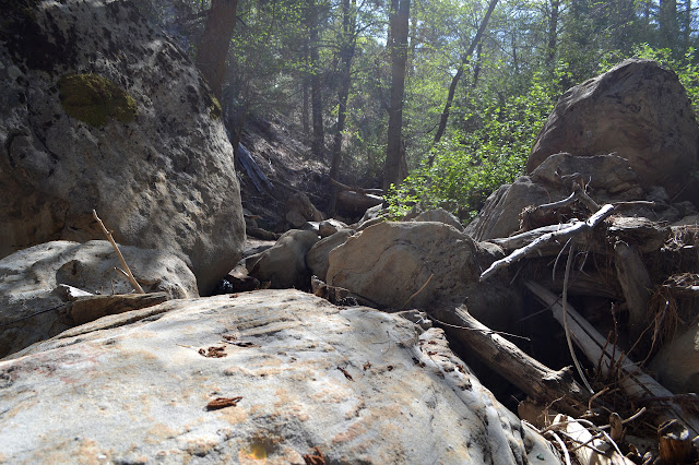
This trail also has quite a few trees down, but it is easier to navigate than the Johnston Ridge Trail. The old trail is easy to see joining the new one and it looks like it might be just as much extra work from all the extra trees that hinder forward progression. Parts of this trail look like old road too. We seem to be back on easy street for travel, except for the occasional downed tree. Unlike the road and previous bit of trail, there are a few footprints to be found on it. Many plants are starting up in the tread. Eventually there is a sign and we reenter the Sespe Wilderness.
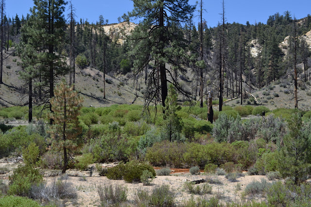
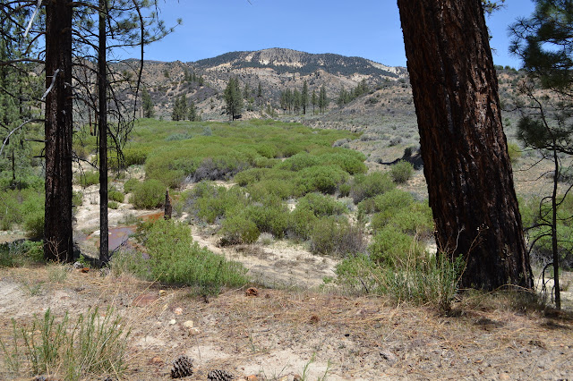
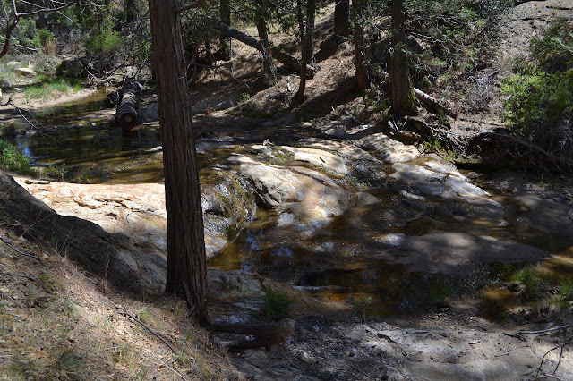
The trail does not change much for entering the wilderness. The creek does not seem to be growing or shrinking as we go. I manage to lose the otherwise obvious trail twice as I go. The first time, there is a trail ahead that does not cross the creek when the trail does. Following it, the choices become numerous. There is a higher flat ahead and upstream, so I just make for that and a quick look around shows a cut log, usually a good indication of maintained trail passage. Joining the line emerging from it gets us going correctly again. Later on, someone has felled a massive tree across the trail. It looks like a six foot saw would only have a couple inches of play between handles. The inner rings are all huge for 150 years worth, then all the outer rings seem to be practically on top of each other. The change is so stark and consistent that the tree must have had the creek flowing next to it for a while, then the creek moved far enough away that it got very little of the water from there. Around the tree, there appears to be no more trail. Making our way along it and upstream, we somehow find ourselves on trail again. There is a devastated sign post with few scraps of wood around it to indicate what was here. The few clues seem to indicate anther wilderness sign. The valley narrows as the trail climbs and there are a series of crossings each followed by a quick climb and drop before arriving at Fishbowls Camp.
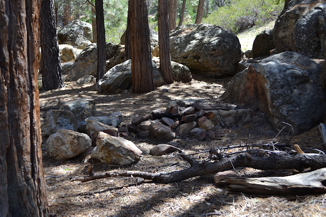
There is a sign to indicate Fishbowls Camp and a large developed site behind it. Making our way past it, we do not see a way up the canyon to the fabled Fishbowls. Crossing the creek and starting up a tributary, which is also flowing with water, there is a second sign for the camp. Behind this are three more developed sites and a trail up the canyon.
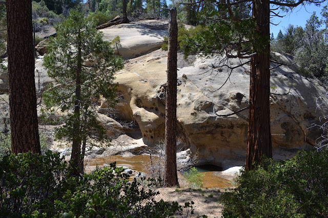
We drop our packs in a site and head up Piru just a little further to find the Fishbowls. They are not quite as expected.
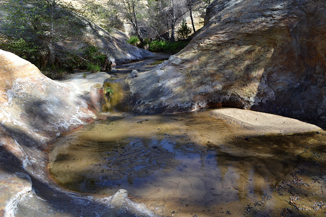
It seems the Fishbowls have silted in during the winter. We pull off our boots to make our way upward still. It is concerning that these are supposed to be quite deep pools, so this sand could be dangerous to walk on. It only take three steps to confirm this, somewhat, as I sink in quickly to just below my knee. It is easy to escape again as my leg comes up covered in green mosses. We make our way upward through more filled in pools, finding that after solid rock, it seems safest to walk in the current. I still sink a few more times and Bhagwan drops in once. A boulder at the top seems to be the upper reaches of the feature as it is back to a dirt sided valley above.
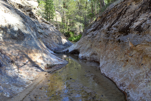

We return as we came. It is nice, but not up to expectations. Still, never underestimate the excitement of not being sure if the next step will produce sinking up to the neck in inescapable sand. We head back to set up camp and enjoy the rest of the day, the sound of gentle water, and the few birds singing under the cedars that have been prevalent since the trail turned south.
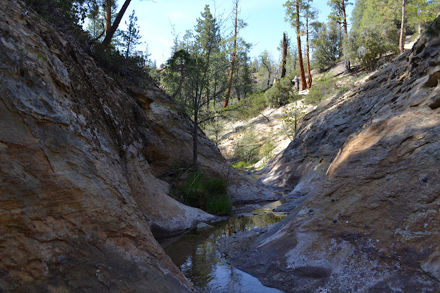
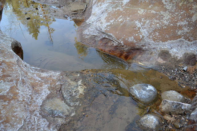
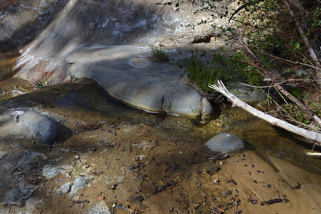
*photo album*
Continue reading: day 4
©2014 Valerie Norton
Posted 21 May 2014
Liked this? Interesting? Click the three bars at the top left for the menu to read more or subscribe!


Comments