Sespe: Sespe Hot Springs
Los Padres National Forest
Map link.
DAY 1 | DAY 2 | DAY 3 | DAY 4
Grabbing a little water to warm up my unfinished supper (it was so late my appetite had vanished), I cannot help but notice that while it is not warm, it is warmer than I expect. The leftovers go quickly now and we pack up to have breakfast at Sespe Camp where there is a table and even a toilet with walls. It is close enough to the trail that we may have found it in the moonlight, but it is hard to be sure and the Harrison map incorrectly places it is after the stream crossing. The water seems just a little warmer here as I get enough for cooking and the morning hiking. Just after camp, the trail does cross the stream and become elusive. There is lots of clear space to walk heading upstream, but little indication of anyone doing so. There is a small path through some vegetation, but it is a bit low for such a well used trail. From the perspective of the other side of the stream, there is another break in the vegetation a little downstream where the trail does go. With the map saying the camp is further on and the trail briefly hard to find, this could have been intensely stressful in the moonlight. In the sun, it is a brief head scratcher before clambering up the bank on the other side past an old metal sign with no apparent purpose. In no time, we are at a junction and a rather well used camp.

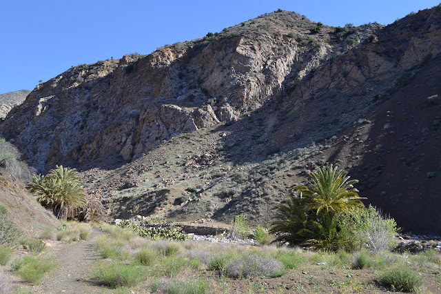
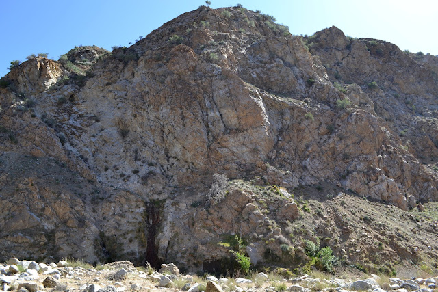
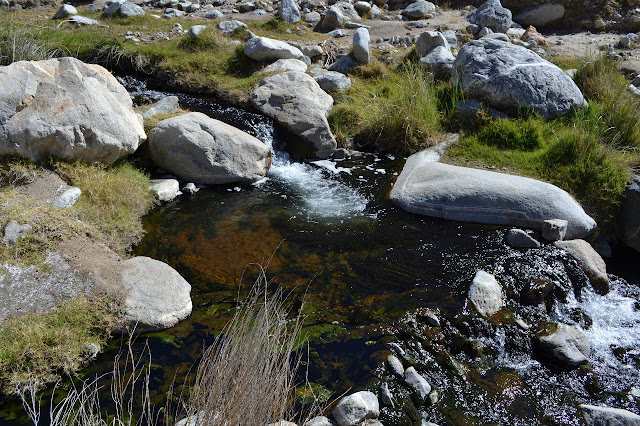
The junction is sooner than I expect, but consulting the map shows that is just a memory problem. The trail up to Sespe Hot Springs is wide and flat. The canyon walls rise steeply on either side. There are a number of camps along the way and a few clumps of palm trees. Some of the trees are doing very poorly. Water is pouring out of the canyon wall to the east. I had been told once that Sespe Hot Springs is a mud hole, which I think was an attempt to illustrate that it has no amenities (specifically, a tub) like Willett. I have also been told by someone that he experimentally determined they are hot enough to cook dinner. What I see around me is most decidedly not a mud hole. As the trail crosses the creek, I stick a finger in it but retreat quickly. It is red, but not burned. I can believe you do not need to bring a stove to cook dinner here. The direction of the path on the far side is no longer apparent, so we start to wander.
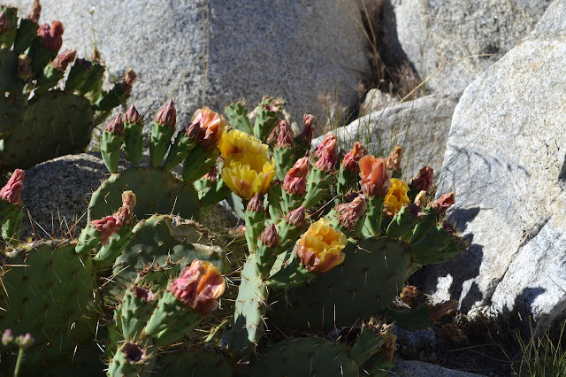
One bit of flow in the canyon above where the trail crossed actually feels somewhat cool. Out on the flat, someone has done a bit of rock art. One spot by the canyon wall appears to have a pool built, but it turns out to be full of rocks and is steaming intensely. I have to know and give the water a quick tap. I would have burned the finger if I had stuck it in and waited for nerves to react.


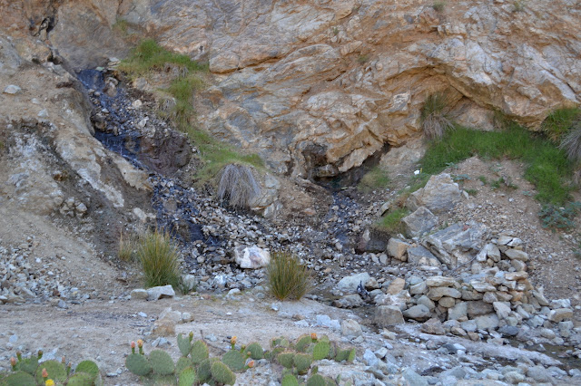
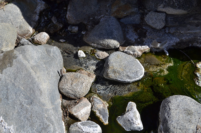
We cannot find a suitable place to soak in the upper waters, but the algae patterns are fascinating. There are pools, and in them the algae sends up long spires that widen at the top into a funny copy of a lily pad. In the current, long tough strings of algae wave making contrasting lines. Different temperature water sports bright green or dull yellow brown types. Sometimes, there is a spot where the water comes out too hot and it is barren and white until it can cool enough.
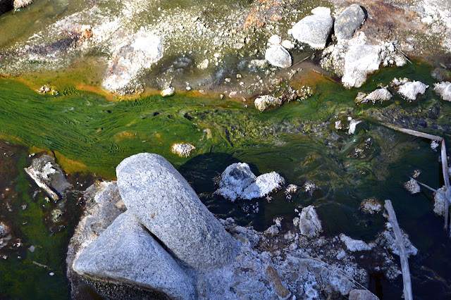


We start down the road again, but quickly drift back to the stream to see more pools as the water cools. The big pools are marked by cairns. Small springs add their own hot seeps to the stream all along the route.
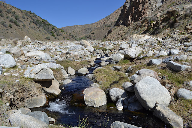

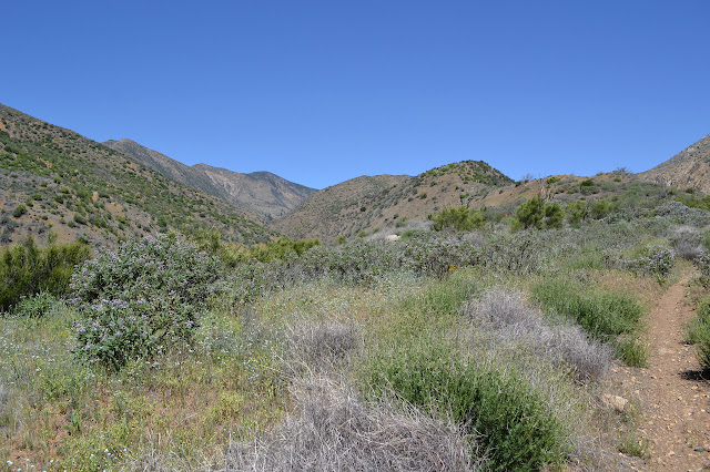
We head out the rest of the way and then collect water for the upcoming six mile climb. There is possible cold water at the far end of the camp where another canyon joins. I almost do not check it, but it does have a beautiful trickle of clear, cold water coming down it suitable for filtering. As we start to climb toward Mutau Flat, it is hard not to notice that the only tracks on the trail are now those of a motorcycle with occasional interruptions by wildlife. From above, it is easy to pick out the rest of the road after it crosses over the creek. It makes a few angled climbs up the side of San Rafael Peak, then stops. Perhaps a mine? The older maps do not seem to offer any clues. There is very little shade along the way, none of it usable.
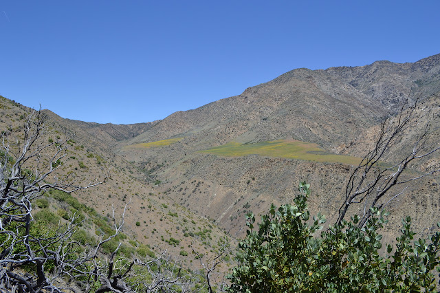
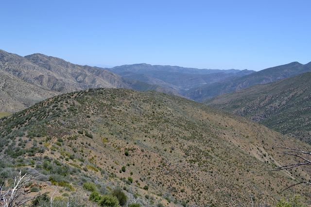
Not quite four miles into the climb, the trail is starting to level off for a moment and a usable bit of shade offers itself. We drop down into it for a nice long lunch before moving on. After, the trail seems to start drifting downward rather than climbing. It keeps drifting downward for the next two miles and then we are in Mutau Flat. Most of the motorcycle tracks head out onto the private property, presumably along the old trail. The temperature in the bowl of the flat seems about 5 degrees hotter than out on the sun baked, but windy, ridge. We turn to climb again and end up battling dozens of small fallen trees. The trail comes to a fire break which has wooden railings to help keep us on the trail, except that some of them are missing now. The trail makes a long loop around a short and fat drainage, then pops over the side and down to Little Mutau. We take a left to get to Mutau, where there is some water even if it does not look all that nice.

We exit the wilderness by a sign that someone has been doing donuts around. This just causes eye rolling. We climb up past a couple driveways and wind a little higher on an old road. Most the way along it, there is a mysterious path to the north. We continue on the road because, well, it is bigger. A series of dirt piles make the last part of it difficult, but there is a high route along them and down to the maintained road below. It is currently closed due to storm damage, but there are plenty of tire marks on it showing someone is quite capable of getting through. Around the corner, a spur road goes up to the current Johnston Ridge Trailhead, which probably connected with the mysterious trail. Even the map at the trailhead only shows the old road and places an erroneous "you are here" arrow pointing at it.

From the trailhead, it is a generally flat and easy walk over to Halfmoon Camp. As we come to overlook Piru, we see a wide flow of water below and can stop worrying. The water at the ford to the camp is, however, quite gross and shows that they flow is actually quite small. Being a car camp behind a closed road, we have our pick of a half dozen tables and a couple biffies. Annoyingly, it is about a quarter mile over four old beds to get to the water from camp, so we gather up all our bottles so we can keep it to one trip to get all the water for camping and tomorrow's hike. The GPS is at an even 30 miles when I shut it off.

*photo album*
Continue reading: day 3
©2014 Valerie Norton
Posted 19 May 2014
Liked this? Interesting? Click the three bars at the top left for the menu to read more or subscribe!


Comments