Golden Trout Wilderness tour: Casa Vieja Meadows
Inyo National Forest
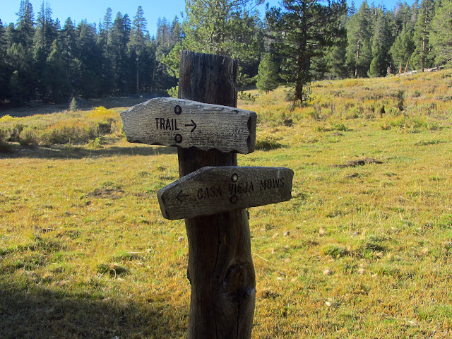
Locate the trailhead.DAY 1 | DAY 2 | DAY 3 | DAY 4 | DAY 5 | DAY 6 | DAY 7 | DAY 8
A good study of the map while having supper for breakfast suggests I am hanging out by Movie Stringer. One of the guys with the stock had suggested I should try to get down into it for water. Looks like he had a good idea there, although he also thought I would be traveling through Ramshaw Meadows for a bit but I only got close enough to see it through the trees briefly, and thought Ramshaw Meadows would be my last chance for water before the peak so did not know about all the water in the Kern Peak Stringer. The trail up to the peak shows much less evidence of stock travel than the other trails, he probably has never actually gone up it. He said there was a corner in Ramshaw, too, so at least one of the three I have found marked on the map is really there. I want to poke around Templeton Cow Camp where there should be a weak corner, so pop over the hill to the southwest to find my way back to the network of trails. It takes longer than expected, but soon enough, just after almost tripping over another telephone wire, there is a bit of trail. I expect I want to turn right to get to the cow camp, but make sure with the map and GPS. As they say, "measure twice, cut once." The map confirms, and it is only a few hundred feet before an intersection and another few hundred feet to the cow camp.

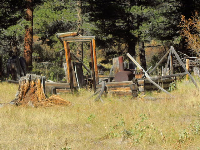
The cow camp is not what I expected. Rather than the elaborate network of branches strung up in the trees to support large tarps and the odd bit of furniture, there are a number of buildings in various states of decay. I found the old telephone line because the least leaning building once had a telephone. Now, there is a large antenna bolted to the side of it, so the building continues to serve as a remote ranger station. A couple sheds are also bolted closed while the rest of the buildings are leaning heavily or remain as an outline after the walls and ceiling have come down. Through some high weeds, there is an outhouse. A little further along, there is a corral. There is not the slightest suggestion of water anywhere. There also does not seem to be a corner, but maybe I should have spent a little more time looking along the fence line and even examining the fence posts for township and range markings.
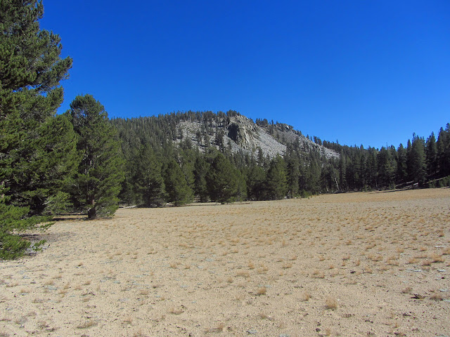
Templeton Mountain rises about 1300 feet from the meadows, but being a cinder cone it probably has a "real feel" of about 2000 feet. My estimate is that it will take 3-4 miles to climb and return. Normally, it would not look very challenging, but based on my performance yesterday, it will have to wait for another time. I simply work my way through the edge of Templeton Meadows and around Strawberry Meadows. The mountain seems to tease me, sitting there with all its big trees and almost no undergrowth to hinder travel. The meadow grasses are shaggy and the trail has no competition from cow paths. The cows have been gone from here for a long time, presumably because there is no water for them.


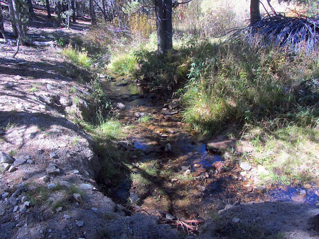
Keeping right at the junctions, I leave the meadows and begin to climb again. Just after leaving the dry Strawberry Creek at a junction pointing to Brown Meadow, there is proof that this area is no so dry after all. An unnamed blue line on the map is a good flow coming down some 40 feet of the trail today. It is the last water before the top of Toowa Ridge.
I should have taken advantage of the water on the trail, but instead arrive at the top of the ridge having run dry. Worry about water on the other side is quickly put to rest because there happens to be two guys lounging at the top to ask about water availability. They are headed to Templeton Cow Camp and expecting to see no water on that side of the ridge, so are quite happy to find out that they will stumble across water in a little over two miles and there is more in Movie Stringer. They are not so happy to hear that 1.5L was insufficient to get from Movie Stringer to the ridge. I am happy to find that there is good water in about a mile and delighted to help reduce their pack weight by a liter of the stuff. Most of it seems to vanish quite quickly.

The far side of the ridge does not look promising for water. There is a massive flat of sparse, brown grass. It has some nice rock outcrops. Once past it and through the trees, things start to look up. Long Canyon is full of meadow. It is also full of fighter jet noise for some moments. I must have missed a glance when I said that I had seen the jets every day but at least they were not running the canyon. This one is definitely running the canyon. Its retreating rear takes up a surprisingly large arc in the sky just before it turns at the ridge and vanishes from sight behind the next ridge upside down. Running the canyon is not the only trick the pilot knows. The cows have been here more recently and the tough grass is cropped short by their food needs. The trail splits and splits and splits leaving me to wonder which way is correct. I find I am no longer following fresh footprints and end up hitting the reliable water, a spring fed tributary from the north, a bit higher up than I should. After collecting some, I work my way back to the trail across the grasses. Occasional signs point out the route as I go down, but for people going the other direction.

There is a house at the bottom of the canyon which must go with another inholding. Signs at the bottom of the meadow are about the only indication of trail in the area. One tells me to cross the creek to get to my destination. The trail splits and there is a small camp along route that is the most obvious but seems to go to the house. The map suggests I should be going along the creek and closer investigation shows a path doing this through the trees.
The trail continues through the trees and is easier to follow. I meet a fellow and his mules as they come down from dropping someone off at Cold Meadows. He says they have really cleaned up that trail and offers to take my pack to the trailhead, if that is where I am going. The trail leaves the creek to travel along rocks and flats and over one rather putrid looking creek in a long and rolling route. Eventually, I can see the upper section of one arm of Casa Vieja Meadows. Many trails come into these in different spots, too, so there are a number of signs at the bottom of the meadow. There is a house on one side and a barn and ranger station on the other. There is an established camp as I get to Ninemile Creek and settle in there for the night, which is coming on quickly.


Continue reading: day 6
*photo album*
©2014 Valerie Norton
Posted 4 October 2014
Liked this? Interesting? Click the three bars at the top left for the menu to read more or subscribe!


Comments
kil50