Golden Trout Wilderness tour: Volcano Falls
Sequoia National Forest
Inyo National Forest
Locate the trailhead.DAY 1 | DAY 2 | DAY 3 | DAY 4 | DAY 5 | DAY 6 | DAY 7 | DAY 8
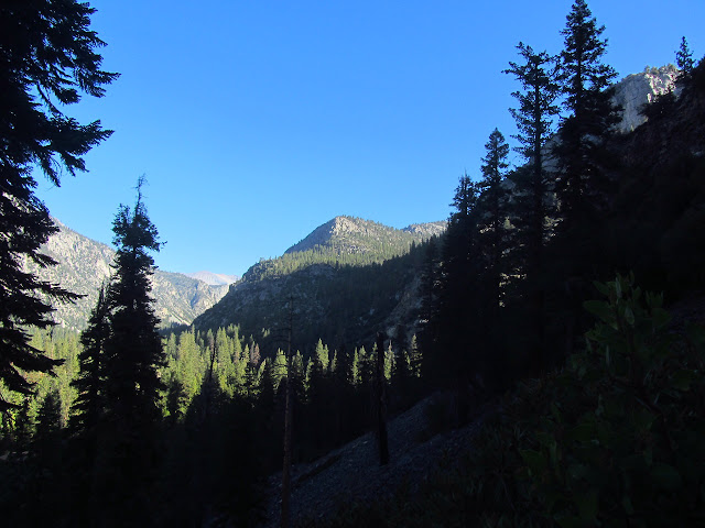
The deep canyon of the Kern River stays in shadow a long time. While eating breakfast, I realize that one of the trees beside me with bark like a redwood actually has pine needles as well. The other trees are more cedars, but I have finally found a redwood among them. It is a little one that would only require a couple people to give it a hug. Hiking out, it continues to be a gentle slope up the river, but the river returns to an obviously churning and roaring thing as things get rocky again. I can see a large break in the canyon ahead on the east side which will be my leaving point. There is a bypass trail for "visitors with pets and weapons" or just no need to go to the national park, so I take that.

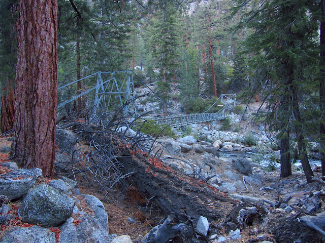
It is with apprehension that I approach the river crossing in the still cold morning air. No one mentioned a bridge up ahead. Crossing one last creek and coming around the corner, my fears are laid to rest. There is a bridge looking much like the one over the Little Kern, only appropriately larger to traverse the larger river.
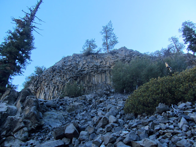
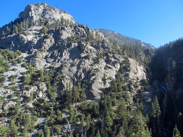
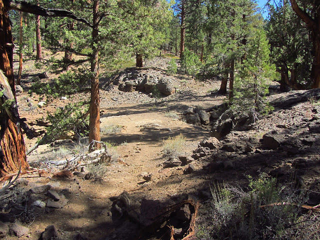
The trail climbs shortly, then progresses along a sandy flat. The sand slows movement, but is left behind as it starts to climb again. Big switchbacks narrow down as it works its way up between a granite cliff and lava of the same sort that makes up Devil's Postpile to the north.

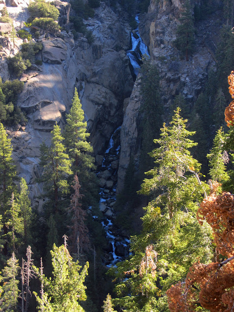
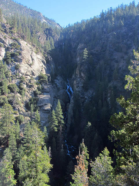
Above the postpile, I can hear a new roar almost entirely muted by the rocks around it. Moving off trail toward the cliffs, I am greeted with a view of a huge waterfall. At first, my attention is grabbed by a huge cascade of white water halfway down the steeply dropping canyon. Gradually, I start to see more and more of this expanse of water including a vertical drop high up the canyon. The trail soon comes to its own viewpoint of the falls, but rocks on this side of the canyon obscure more and more of it as one travels east. I decide I want to spend a little more time with the waterfall and get out the art supplies.

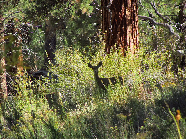
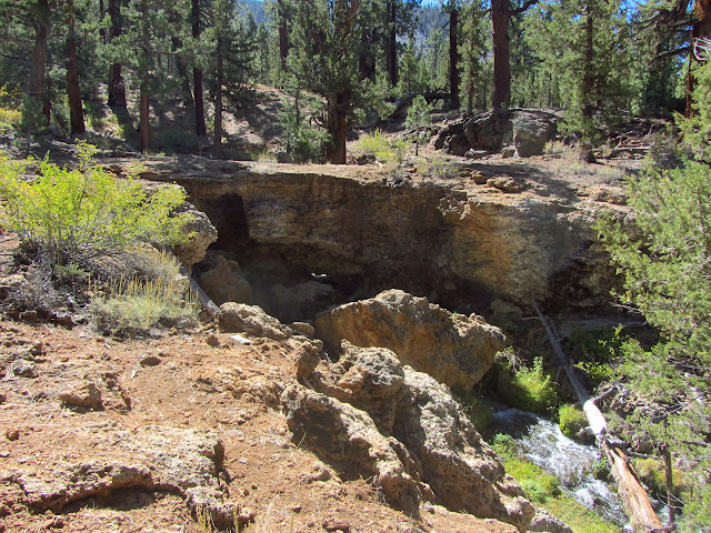
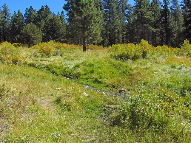
Once near the waterfall, the trail does not climb so steeply. I find myself wandering through forest over lava rocks or through meadows with deer. Although Golden Trout Creek is still inaccessible, there are three streams along the way with plenty of water to supply the needy traveler. Eventually, I get to the second natural feature of the area so striking that it even appears on the old 30' quad: the natural bridge.

I am never sure what to expect of a natural bridge. The one above Arcadia is rather disappointing. This one is a consequence of the lava flow which probably left some holes as it covered the land. There are actually two natural bridges in the area, but no more are apparent further along the creek well fed by springs.

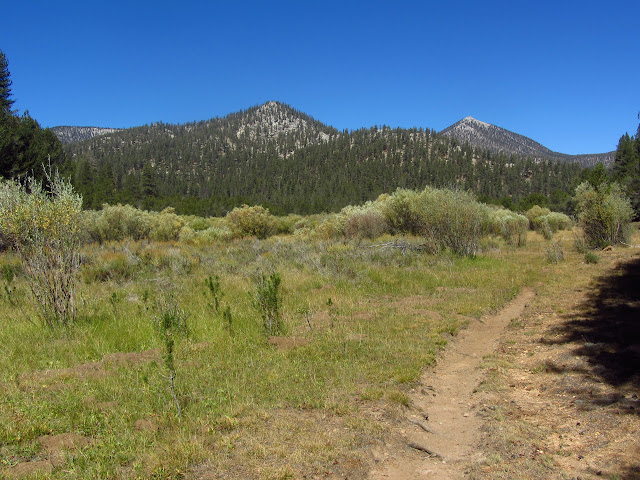
More gentle climbing through lava and meadows eventually gets me to a signed junction to Volcano Meadow and to Little Whitney Meadow. I can see the gentle southwest slope of Mt. Langley again in the distance. There is another sign as the trail passes along the south side of the meadow for destinations to the north, but no trail apparent to go with the new sign. More signs out in the meadow likely lead the way to where the trail is visible. A large house sits on the other side of the meadow as well, probably another inholding.
There is a cow camp just before leaving the meadow again. The trail crosses Golden Trout Creek and climbs up into more sandy stuff. Granite outcrops are on my left and a dark lava flow is on my right. When views open up, little cinder cones are visible in all directions.


There is another junction with another trail leading to Volcano Meadow, then another meadow. The trail seems to multiply as it gets closer to the various junctions at the south end of Tunnel Meadow. I cross back over Golden Trout Creek and find myself a camping spot for the night. I have now made up all the miles I needed to make up. Just over a small rise, there is another group with support also settling down for the night.

I still have an hour at least of time to explore and there is another of those benchmarks marked on the 1905 Olancha quad in the area. This one is also not one I planned on looking for because it is simply along a ridge, not at a peak. It does have an elevation and is probably on some minor peak along the way, so I go for it. First I want to head north toward the old guard station and "The Tunnel", whatever that might be, then start up the ridge trying to miss the many false peaks before the one I want. I have to cross the South Fork of the Kern River to get to the ridge and find that is is much smaller here than the creek it shares a canyon with briefly. The views are good from up on the ridge east of the guard station, but I do not seem to be missing the false peaks for the most part, but am missing them just enough that if they turn out to be the right one, I will miss the monument, if it exists. Realizing I also left anything warm for my arms at my campsite, I decide this is a foolish climb and head back down into Tunnel Meadow.
It is easy to cross Tunnel Meadow to the area of the trail, especially since the fences have been dropped for the winter. The south fork is just a hop when I come to it. I end up on a secondary trail that follows the inside of the fence rather than the official trail, but eventually climb up to it just before the area of the Tunnel Guard Station. Besides the old mule barn now being used as the station after it burned, there is the remnant of a water tower and a remote weather station. The door contains the obligatory "turn off the gas!" note, but no one is home today.

While I did not find the benchmark, I did determine exactly which trail I need to head out on tomorrow, which I did not know for certain in the maze of trails and extra trails. Chatting with my neighbors turns out to be quite helpful in finding out what exactly is "The Tunnel" marked on my old map. It seems it is all about water. Two creeks pass by and, as I observed, one is much smaller than the other. It seems the people with the rights to the south fork dug a tunnel to even things out a little. This was not looked upon kindly by those with rights to Golden Trout, who blew up the tunnel. It was dug and destroyed at least once more. It really is very curious how these two waterways come so close and do not join although the separation is soft and easy to dig through.
Continue reading: day 4
*photo album*
©2014 Valerie Norton
Posted 2 October 2014
Liked this? Interesting? Click the three bars at the top left for the menu to read more or subscribe!


Comments
The Freeman Grove contains the George Bush Sr. Tree approximately a mile up Freeman Creek from the paved Lloyd Meadows Road. Strange that he would have a tree named for himself and take the trouble to attend the ceremony to do it and yet fail to do any sort of executive action to protect the grove his tree is within. But that is politics which is controversial and therefore to be avoided.
kilo50