McGee Creek: Scheelore Mine
Inyo National Forest
Locate the trailhead.
DAY 1 | DAY 2
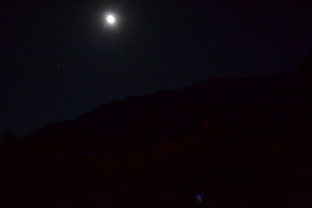
I have been hearing a vicious rumor that this time of year, one should be heading out to look for fall color, perhaps around Bishop and a few other areas. Then I noticed Red Slate Mountain. Who could resist that? Quite a few people by the summitpost entry which claims many prefer to go for the one peak higher in the Mammoth area, Mt. Ritter. We get a late start thanks to planning around jury duty and hike in a little way under the bright moon for a little dispersed camping before the John Muir Wilderness boundary. There is no sign, so we may not have managed to stop before the boundary, but as it is after midnight, we definitely enter the wilderness on the permit designated day. We can see just enough under the great streetlamp in the sky to be excited about what the morning sun will show.
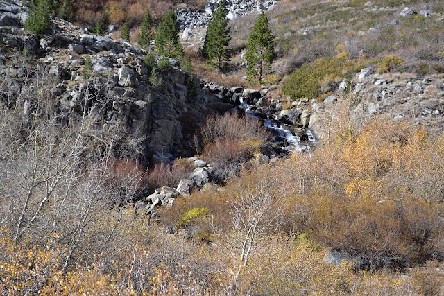
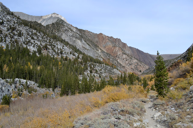
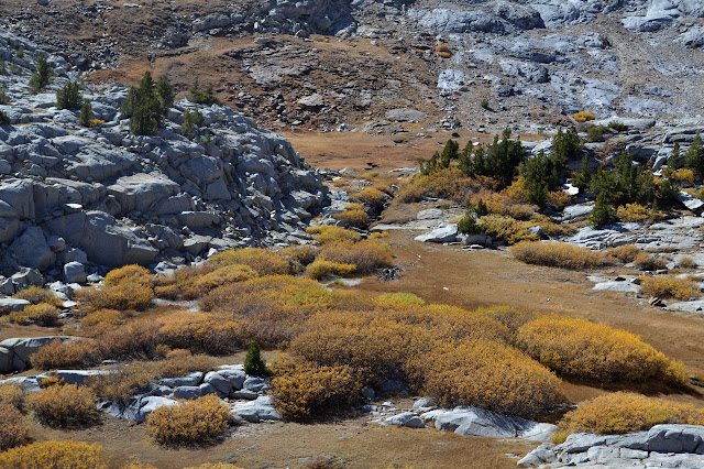
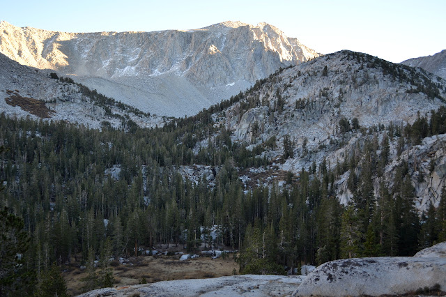
The morning does not disappoint. Bright yellows trace out the places that have some water flow, either from the creek or springs, in seasonal color. Above, the rocks are striped in whites and reds and greys and even blues in permanent color. A little packing and a little breakfast and we are ready to be off. Two groups, three people altogether, have passed by before we even start. We should probably be a little quicker to begin, but it is not all that late as we step out to climb the almost unnoticeable slope of the old road. The springs marked Horsetail Falls provide good flow for grabbing water.
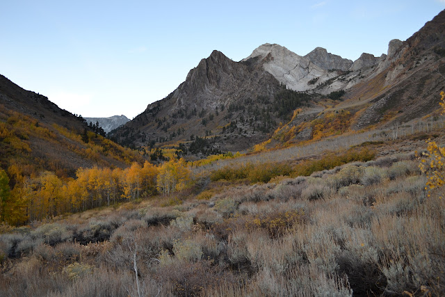

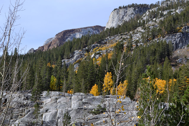
Behind the trees, the flows through a narrow and shallow canyon it has carved in the currently red rock bottom of the wide valley. We are striding through sages, although they seem to be quickly losing their hold. Around the corner, we can see the pines start and, a little higher, thin out again. The trail jogs backwards slightly to cross at a bridge with some build quality issues. Rocks along the side of the trail hint that some of the reds are rusted blues.

Other than the bridge, the trail is very well constructed. Many trails along old roads simply rely on the wide track to provide a route, but this has the various constructions to deal with water required to keep a trail from eroding too quickly. We pass a few springs and a beaver dam before crossing back over the creek.
We start to climb marginally faster after the crossing. It is not long until we are at an intersection and dropping off our overnight gear for the spur up to the mine.
The intersection is only marked with a sign pointing out the direction to McGee Pass. We head the other way. Now the trail improvements have vanished and there is only the old road bed to follow. Cut branches block our progress next to a trail heading off to the south. We go for it, assuming it is a reroute, only to cross a creek and find ourselves at another trail with another sign, this one pointing the way to Big McGee Lake and nothing else. It is just a cutoff between the two trails. We turn back and wish we had been more attentive to the map (USGS Convict Lake 1994 7.5'), which does show this trail, and left our heavy items near here instead.

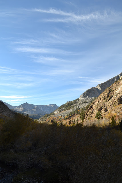
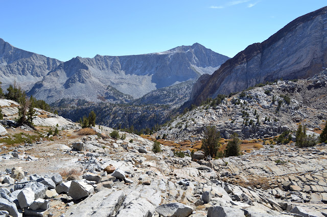
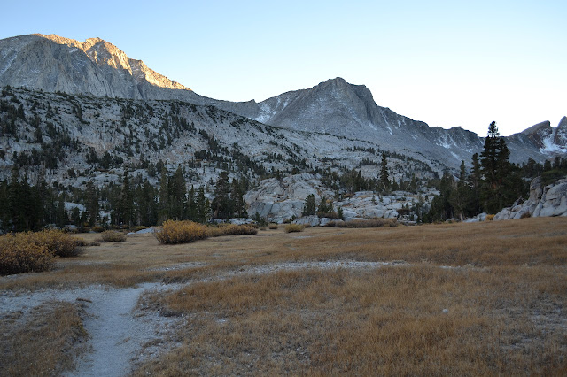
The road is generally clear and distinct. There are many camping sites in the lower areas, especially around the first of the three lakes shown on the map. The slope seems far too easy, but somehow we get out of the trees. In moist spots, willows encroach leaving just a very narrow band to walk through. In rocky areas, a turn may be easily missed.
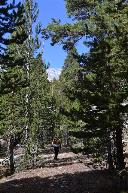
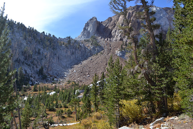
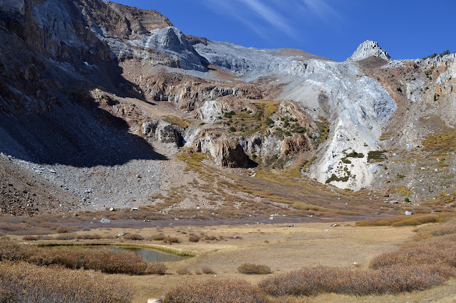
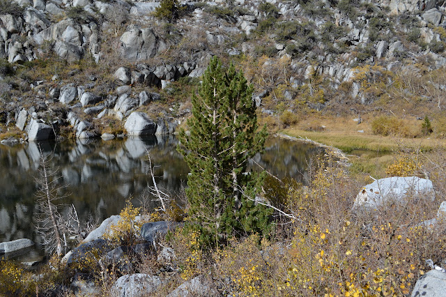
Past the grassy pond, the road takes switchbacks although a trail would have no problem just climbing. We follow it, missing the second cut back and decide to just go with it. Eventually we bump into the road again and follow it some more. At least here the road continuously climbs, even if quite slowly. As things get rocky, it climbs slowly and then loses elevation randomly. You would be forgiven for just leaving it to its wanderings and clambering up the rocks. Bernard does just this while I take the slow way. We find what is likely to be the bulk of the mine leavings beside the third lake shown on the map. Today, the large blue dot is a large grey sand lot although there is at least a trickle of water most the way here.
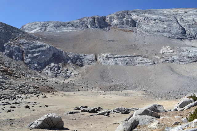
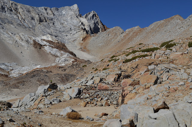
There is a little bit of information online about Scheelore Mine. It indicates that three locations were mined with pits and trenches for tungsten. Looking around the area, it appears one of these locations is just behind the location of the buildings. A second location is high above where a wooden structure can be seen at the end of the road. A third location is likely where pipes can be seen running up from the dry lake which sits between the other two locations. It looks like some level of tunnel was actually made, but everything has long since collapsed leaving only a buried frame.


Deciding we do not need to go all the way to the end of the road, we head down through the dry lake and down the rocks more directly for a bit, then follow the road for a bit. I try to follow it where we went wrong on the way up and just end up cutting down the hill in a different spot. So much for that. The last bit to our camping gear seems like a long way of extra. Once collected, we follow the sign up through the trees. Day hikers are coming down as we climb. Just before the cutoff trail is the one spur trail with a sign that points up it saying what is there: Steelhead Lake.

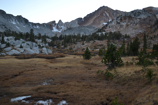
After the cutoff, the trail starts climbing at a more reasonable pace. There is another sign directing us away from a spur that may go out to a meadow that looks to have nice spots at the far side for camping.

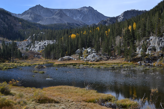
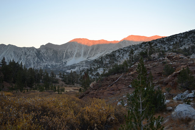
Eventually, there are meadows to cross, or rather edge around, instead of slopes to climb. Little climbs between each wide meadow keep us going upward until we get a glimpse of Big McGee Lake. We head along a use trail to a flat spot only to find that there is a tent there already, then go a little further and drop below a hill to settle in while the last of the sunlight turns a deep red on some of the lighter colored ridges above us.
Collecting water and cooking supper and setting out the bedding takes us to dark and a little beyond. The stars come out in impressive numbers to enjoy, at least until that giant moon rises again.
Continue reading: day 2
*photo album*
©2014 Valerie Norton
Posted 15 October 2014
Liked this? Interesting? Click the three bars at the top left for the menu to read more or subscribe!


Comments