Posts

Showing posts from March, 2014

sketches

Image
Frazier Mountain from an unnamed ridge . Hungry Valley and mostly beyond from Bear Mountain . A few rocks at a creek crossing coming down from Manzana Narrows .

Mill Creek

Image
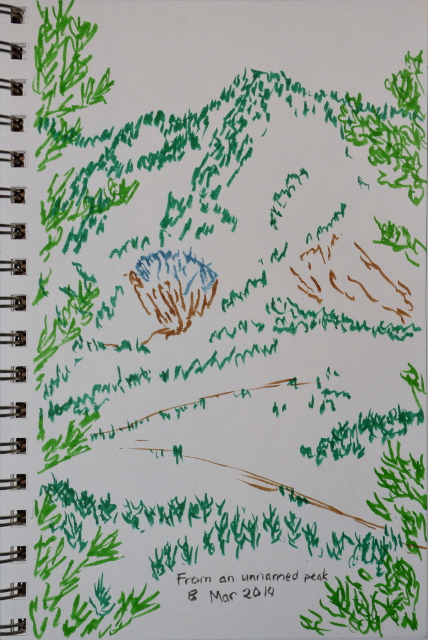
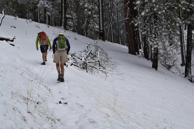
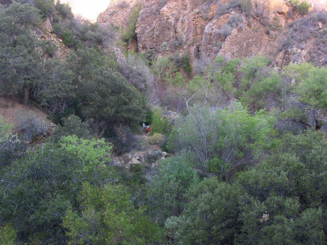
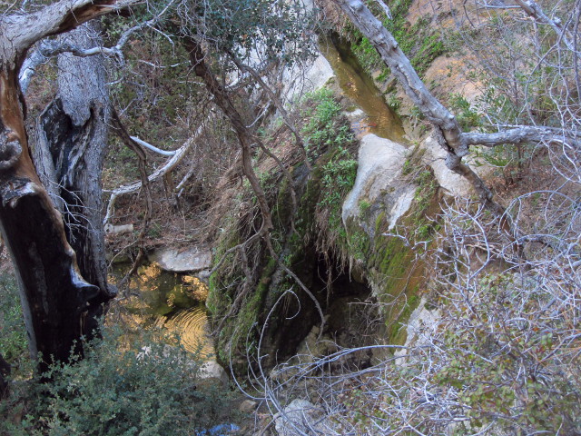
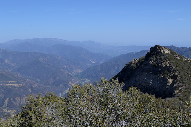
Sequoia National Forest Locate the trailhead. We hit the road not quite as early as planned for the Mill Creek Trailhead off the Old Kern Road with the goal of Breckenridge Mountain, about 11.5 miles and 5000 feet up. The weather was predicted to be rain overnight, with particularly high probability in the very early morning hours, but "30% before 11AM" for our purposes. There is a descent drenching over the Grapevine, but by the time we are at the trailhead, skies are showing brief patches of blue. Just under the slowly lifting clouds to the north, the mountains have been topped with a layer of white. At our feet, small wildflowers are blooming dotting the area with purples, whites, and yellows. The trail initially undulates along, crossing the creek from time to time. As we hit the creek, reds are added to the wildflowers and we spot our first salamander of the day. The start of Mill Creek Trail at 2400 feet. The correct trail winds upward at a better grade

Manzana: NIRA again

Image
Los Padres National Forest Map link. DAY 1  |  DAY 2  |  DAY 3 Camp is much more full this morning and it is just volunteers now. Our only task is to carry the tools back down and get ourselves back safely. We are all a little slow after our big dinner. I guess I did not mention the big dinner. There was fire roasted bits of bread dipped in melted butter and given a bit of garlic salt and it dissolved into deliciousness in the mouth (and left plenty of residue on the hands). The meat eaters had a bit of mammal flesh, too. Beans and salad and beer rounded it all out. None of us lasted past 9PM, just like the night before, so perhaps we are not all that rowdy after all. We are not all that much slower and Mike is wanting to get an early start with the goats since Gunter started to get very slow the day before. Coming up, Nitro took his pack the last 2 miles. They are both about the same age. The rest drift one by one from camp, grabbing tools as they go. Folks seem

Manzana: White Ledge

Image
Los Padres National Forest Map link. DAY 1  |  DAY 2  |  DAY 3 Manzana Narrows is shadowed but light in the morning. The goats are feeling more comfortable and decided to spread out around the campground foraging for breakfast. One takes a few sniffs at my pack and then my drink tube, but then leaves it alone opting for a bit of bay laurel instead. We split into two groups, one to head up Big Cone Spruce and one to start toward White Ledge and divvy up the tools. The goats are taking the low side where they will hopefully eat up the poison oak and I am headed up the hill. Another crew from those in Happy Hunting Ground will be getting a large tree at the top of the trail, but we will go after everything we find after that. We are loud as we get going, but the couple we are sharing the site with do not stir until we are headed out. It is already getting toward warm for hiking as we head up the hill. The water is flowing better at the top as well and some of the dry

Manzana: Manzana Narrows

Image
Los Padres National Forest Map link. DAY 1  |  DAY 2  |  DAY 3 It seems to be the season for trail work. The original plan for this one was to head up Lost Valley and cut out a few of the baker's dozen (plus whatever the rain brought down) trees and make the tread somewhat less scary at the top. Having just come down the trail, I figured the need was great and I was in. Unfortunately, rumor is the post-rain water situation is very much like the pre-rain water situation, and the only water near the unofficial "Twin Oaks" camp is a mile up at the spring or a mile down and stagnant. This can be fine for a bunch of hard working humans who will have one or two in their number who will be willing to bring down water, but this is a Mike Smith trip and is supported by a collection of pack goats which complicates the situation. The people would rather have water closer at hand, too. We have been diverted to the Manzana instead, where the water is now flowing all th

Old Man Mountain and Monte Arido

Image
Los Padres National Forest Map link. I have a list of potential hikes that seems to add items faster than they get done, and many hikes I do do not even come from this list, so when Bernard said, "We should have another 20 mile hike," I jumped at the chance to check the item "Old Man Mountain" off of it. Then I remembered him mentioning that he was not a fan of fire roads and tried to backtrack on this suggestion because this route is almost entirely on fire roads. It was too late, the suggestion was made, it was declared that a fire road might be alright once. The Matilija Trailhead has cars stacked in everywhere, but not so many as I expected and it is easy to find a spot. This area got almost 18 inches of rain by one gauge, so maybe people are worried the creek is still uncrossable. Online USGS stream gauges include one below the dam which indicates water flow is already below normal for this time of year. It is an illustration of the need for a long

Gold Hill and Bear Mountain

Image
Los Padres National Forest (map link) After Gold Hill Guard Station, Gold Hill Camp, and Gold Hill OHV Trail, maybe I should actually hike Gold Hill. The peak is near to Snowy Creek OHV Trail and even nearer to an old track used by prospectors, part of which makes up a portion of the trail. To judge by the map, Gold Hill was ultimately a bust, but people tried really hard to make it work and put a lot of holes in it. There is another high gate to climb over to get onto Snowy Creek OHV Trail, which is not so hard to find after all . Just hang a right just before the biffy in Kings Camp and it is at the end of this spur of the camp on the far right. There are lots of footprints on the trail for the first half mile, but then most of them seem to turn back at a dry creek crossing before any substantial climbing. It does not take much climbing to get some views, which is good since there is not much to climb. A few low hills off to the north. The old guard station is behind

Gold Hill area monument search

Image
Los Padres National Forest Locate the trailhead. I signed up for another round of cleaning up microtrash at the former Gold Hill Guard Station with Los Padres ForestWatch, so head out to the site, but this time with a plan to fill in a few of the extra hours in the day since the cleaning is only from 9AM to 3PM. There is getting to be more hours of daylight, so there are plenty before and after. There's no real plan for before, but the plan is to find monuments and it is piecemeal. Waking up an hour early makes it make sense to do part before. The first piece is a boundary monument where the boundary makes a corner, so I pull over to the side beside the forest gate. This is actually already in the forest as the post is to the north and I passed the line when passing south of it. I head north along a road marked green and I could probably drive, but there is little point since it is only a quarter of a mile. A bit short of a creek, it is time to start looking for the mo

follow by email