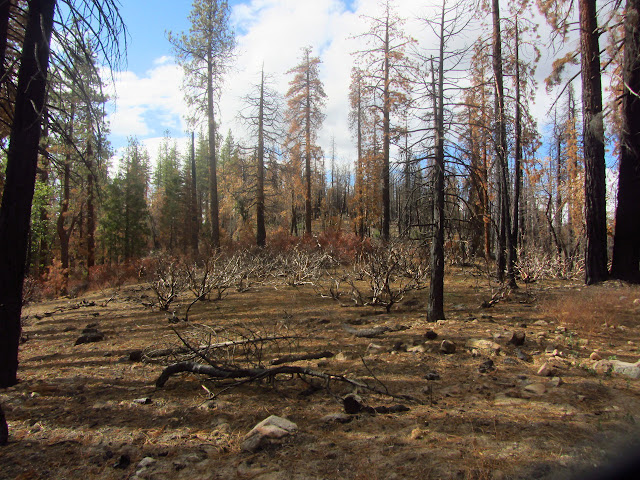
Posts

Showing posts from September, 2014

sketches

Image
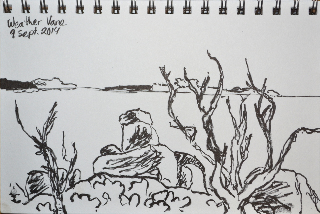
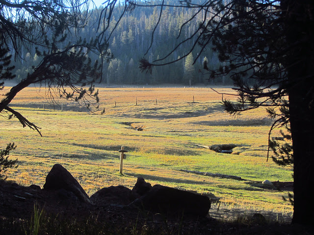
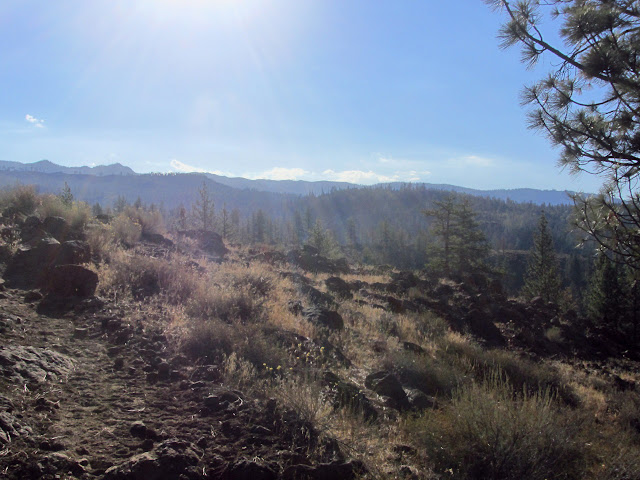
I managed a few sketches this month, unlike last month. The rocky peak that was the goal while having lunch after being thwarted by the vegetation. One in the dying light of the evening while claiming a monument . Circumstances made the first day backpacking short, so I painted the bridge . I had to take a bit of time to take in Volcano Falls , so got out the paints. In the evening after soaking in the upper pool at Jordan Hot Spring, I sketched the one with a little waterfall of hot water into it.

Golden Trout Wilderness tour: Lewis Camp

Image
Sequoia National Forest Locate the trailhead. DAY 1  |  DAY 2  |  DAY 3  |  DAY 4  |  DAY 5  |  DAY 6  |  DAY 7  |  DAY 8 A little poking around find the remains of a dead horse left just up the hill from the trail and the trail that cuts across to the Little Kern River from Willow Meadows. Away from the camp, the trail is quite obvious as it climbs steadily, once needing a little switchback. The area is burned at the top. Coming into the burn area and finding the manzanita almost completely gone. More burned trees and manzanita. The last peaks as the Great Western Divide comes to its southern end. A sign tells me where I am going and where I am coming from as I cross a trail that comes up from the Trout Meadows Ranger Station and drops down to Burnt Corral Meadows. It might make a nice alternate route back adding on about 4.5 easy miles to get there and then cross the Little Kern River to climb up via Grey Meadow. The threatening clouds, the promis

Golden Trout Wilderness tour: Kern Flat

Image
Inyo National Forest Sequoia National Forest Locate the trailhead. DAY 1  |  DAY 2  |  DAY 3  |  DAY 4  |  DAY 5  |  DAY 6  |  DAY 7  |  DAY 8 My attempt at getting some sun in the morning has failed as my camp is still deep in shadow as the buildings and trees across the creek gain the sun. The original plan has three days to hike out, but that was really to give an extra day "just in case". Under normal circumstances, I would hike most of the next two days in a single go and the mention of the first weekend of hunting season provides a little extra motivation to get out earlier. With a reasonably early start, I should be able to get down to Kern Flat and loaded with water by 1PM. If I start the "six mile climb" back out of Kern Canyon, really only 1500 feet up, I should be able to stumble into a camp I know has water by sunset. The GPS shows sunset is somehow half an hour earlier than it was when I started this trip. The days really are gro

Golden Trout Wilderness tour: Jordan Hot Springs

Image
Inyo National Forest Locate the trailhead. DAY 1  |  DAY 2  |  DAY 3  |  DAY 4  |  DAY 5  |  DAY 6  |  DAY 7  |  DAY 8 Today is a very easy day. The morning is to be looking for monuments around Casa Vieja Meadows and wandering three miles or so down the trail. The afternoon is to be sitting in the hot springs and exploring old cabins from when it was a commercial concern. The morning sun on the meadow is stunning, and after some battling with the camera in need of a new battery, I can capture a slightly lesser moment of the light. Then, with breakfast put away, I turn my attention to climbing the small peak just north of my campsite. Manzanita makes a feeble attempt to block my way sometimes and I am quickly into a cold wind, but soon find myself on Doc Peak, as it is labeled in the OpenStreetMap. It is another labeled with a benchmark on the 1905 Olancha 30' map and on the more recent 1987 Casa Vieja Meadows 7.5' quad. The benchmark is there, but has me

Golden Trout Wilderness tour: Casa Vieja Meadows

Image
Inyo National Forest Locate the trailhead. DAY 1  |  DAY 2  |  DAY 3  |  DAY 4  |  DAY 5  |  DAY 6  |  DAY 7  |  DAY 8 A good study of the map while having supper for breakfast suggests I am hanging out by Movie Stringer. One of the guys with the stock had suggested I should try to get down into it for water. Looks like he had a good idea there, although he also thought I would be traveling through Ramshaw Meadows for a bit but I only got close enough to see it through the trees briefly, and thought Ramshaw Meadows would be my last chance for water before the peak so did not know about all the water in the Kern Peak Stringer. The trail up to the peak shows much less evidence of stock travel than the other trails, he probably has never actually gone up it. He said there was a corner in Ramshaw, too, so at least one of the three I have found marked on the map is really there. I want to poke around Templeton Cow Camp where there should be a weak corner, so pop over th

Golden Trout Wilderness tour: Kern Peak

Image
Inyo National Forest Locate the trailhead. DAY 1  |  DAY 2  |  DAY 3  |  DAY 4  |  DAY 5  |  DAY 6  |  DAY 7  |  DAY 8 The early morning comes with burning eyes and a stuffed nose and allergy medicine only partly helps it. It is a very poor sleep after not particularly good sleeps. My start is late, but I am not in much of a hurry. I have a 5.6 mile climb along trail to get to the top of Kern Peak and an even shorter way down, hopefully partly on trail, to get down again. Once packed up and supplied with a bit over 2L of water, it is time to climb slightly and find the faint, but clear trail along the top of the slight hill I was sleeping on. It seems to take random turns as it wanders through the trees past yellow painted tin can tops nailed to the trees. Sometimes another, even fainter, old route can be seen beside the current route. The trail drifts up to a saddle this way, then splits. A "Kern Peak" sign nailed to a short stump points downhill stee

Golden Trout Wilderness tour: Volcano Falls

Image
Sequoia National Forest Inyo National Forest Locate the trailhead. DAY 1  |  DAY 2  |  DAY 3  |  DAY 4  |  DAY 5  |  DAY 6  |  DAY 7  |  DAY 8 The deep canyon of the Kern River stays in shadow a long time. While eating breakfast, I realize that one of the trees beside me with bark like a redwood actually has pine needles as well. The other trees are more cedars, but I have finally found a redwood among them. It is a little one that would only require a couple people to give it a hug. Hiking out, it continues to be a gentle slope up the river, but the river returns to an obviously churning and roaring thing as things get rocky again. I can see a large break in the canyon ahead on the east side which will be my leaving point. There is a bypass trail for "visitors with pets and weapons" or just no need to go to the national park, so I take that. Sun coming through the break in the canyon for Golden Trout Creek to come down into the Kern River. It i

Golden Trout Wilderness tour: Kern Lake

Image
Sequoia National Forest Locate the trailhead. DAY 1  |  DAY 2  |  DAY 3  |  DAY 4  |  DAY 5  |  DAY 6  |  DAY 7  |  DAY 8 It is neither early nor late as I get started on the day's hiking. I need to make up four miles. Two trails are supposed to leave from near the bridge and go to Willow Meadows, according to Tom Harrison. As I follow the one trail I can find, I can faintly see a track leading steeply up the other side of the little canyon it has just traversed, but nothing that looks like trail. A little further is an unsigned, but real, junction for the shorter route that I hike right on past. This keeps me on a fairly level and easy route around the edge of old lava into Trout Meadows. The nearby roar of a chain saw adds to the wilderness noises, going for a short time and finishing again. Looking out over the old lava flow in the morning sunlight. Looking down the Little Kern River valley. There is another junction, this time signed, then I am

Golden Trout Wilderness tour: Little Kern River

Image
Sequoia National Forest Locate the trailhead. DAY 1  |  DAY 2  |  DAY 3  |  DAY 4  |  DAY 5  |  DAY 6  |  DAY 7  |  DAY 8 I got it into my head to do a good look around of the Golden Trout Wilderness. I have made my way through a corner of if and looked down on its expanse from there, but never come down into its expansive meadows and plateaus. A basic loop for such a journey can be found here. Adding on things like the Coyote Peaks is tempting, but the report that Deep Creek, the major water source on the way, is dry somehow dampens that idea. A climb up Kern Peak seems necessary. Blackrock Trailhead on the Inyo side actually makes a bit more sense, but is a fair bit longer drive. Jerky Meadow is another popular trailhead with similar access to Lewis Camp. Signs could be better for getting to Lewis Camp. I turn at the big advertisement sign for the Golden Trout Packtrain at the end of highway 190 because that is in the same direction, and found confirmation t

Arroyo Sequit I6

Image
Leo Carrillo State Park Map link. I decided to finish off the day with a drive down the Mulholland Highway and a short benchmark search in Leo Carrillo. The trails make a loop around a small peak by the ocean and a spur climbs it from the north. The benchmark is on the top of this same peak, so it should not be hard to find. Leo Carrillo also requires a $12 day use fee to park in the lot, but a single payment covers all the state parks for the same day. Free parking can be had on the far side of the Pacific Coast Highway. I decided to start along the Willow Creek Trail, since I have not hiked that one before. It follows along above the highway which has quite a bit more traffic than Mulholland before turning up a canyon and starting to lose the traffic noise. It is still quite warm even by the ocean and with the wind blowing nicely. Both windsurfers and kite boarders are out today and even windsurfers are kicking up big wakes. Windsurfing seems to have been replaced

M*A*S*H filming site

Image
Malibu Creek State Park (map link) For a $12 day use fee (or free parking along Mulholland Highway and a bit further to walk in with more hills), Malibu Creek State Park offers quite a lot of easy hiking past popular swimming holes to the extremely un-Korea-like part of an old Paramount movie ranch where MASH was filmed. (A number of other movies and shows were also filmed there and in an old 20th Century Fox movie ranch on the way.) It seems like an excellent hike for an extremely hot day. A sign points to the "backcountry trail", which seems a bit of a stretch for the set of stairs leading down to an initially paved road leading to a large visitor center past a detailed information sign. The road crosses over the first swimming hole, a deep spot just below it in Las Virgenes Creek, then launches into the dry and hot park past the first of many signs pointing the way. It tells me that if I go a little further, I can visit something called "Reagan Ranch"

Gaviota Peak

Image
Gaviota State Park Los Padres National Forest Locate the trailhead. In looking at the benchmarks in Gaviota in the NGS database, I noticed quite a few of them are referenced to "weather vane". Curiously, this point is up high on the ridge south of Gaviota Peak. There is no information on this point except the name, location, and identification number. It seems likely that this was not a monument, but an actual weather vane, an item that usually sits on top of something else. What might it have been sitting on, if it was? Is there anything left of it? One way to find out would be to go and look. It also gives me an excuse to explore east along the ridge a bit further. It might be tempting to do it via a much lesser known route just on the ridge, but I go for Trespass Trail. There is some construction in the lot and along the road, but there is still parking for state park users. The trek up to the saddle is the usual hot and exposed route with a single repriev

Forks of the Kern

Image
Camp Tecuya may have been "my" camp and I knew every inch of the grounds after all the winter weekends, summer weeks, and staff working weekends, but Camp Mountain Meadows was my favorite. They offered multiple camp units for backpacking. One for beginners did a 3-4 day trip, another did a 5-6 day trip, and a third did at least 2 weeks on the John Muir Trail. (My recollection is that they through hiked it in 3 weeks, but it seems unlikely that memory is accurate.) It is the only camp that had a camp song, and yes, I do remember it. I have since heard it sung with another camp's name inserted and suspect it is just a standard one. For some reason, the songs we sang there seemed a little more sophisticated. "On the Loose" and "Moon on the Meadow" were absolute favorites and one counselor would get out her guitar and sing "Big Yellow Taxi", so when a cover later got lots of radio play it lead to happy memories of camp for me. I am going to

follow by email