Hines Peak
Los Padres National Forest
Arriving at Middle Lion before 7 AM on a Sunday makes it hard to find a parking spot near the trailhead. The campground is full and active and cold. I forget how cold the microclimate of this canyon can get. There is a fair amount of jumping while waiting for Mark who underestimated his travel time by about 10 minutes. I go to grab my hiking sticks, which turn out to be... on Baldy? Actually, they probably found a new owner by this time the next day, knowing that trailhead. (I asked Pavel if he might have seen some about. He said no, and that he once let someone use a single pole on the way down. It was left by the gate and already procured a half hour later.) I really like to have my sticks if hitting the 10 mile mark, and today should be 20 miles. Mark lightens his own pack by one pair of sticks, which he carries but rarely uses, and we are off, around the campers beside the trail, across the creek, and climbing gently.

Water is flowing well in the creek when we cross it, but further up the creek is dry, then flowing again. It makes it hard to know if we want to check out the waterfalls or not. We decide not.


We find ourselves climbing up the side of the west fork canyon. The trail to the campsite is only a few tens of feet off and a bit further down. I cannot pick out the waterfall in the canyon below although it seems like I should be able to. We climb higher and obtain the ridge between the forks. Finally, the canyon seems to be coming up to our level for a last few twists. We travel up a wash and come to the road at the top.


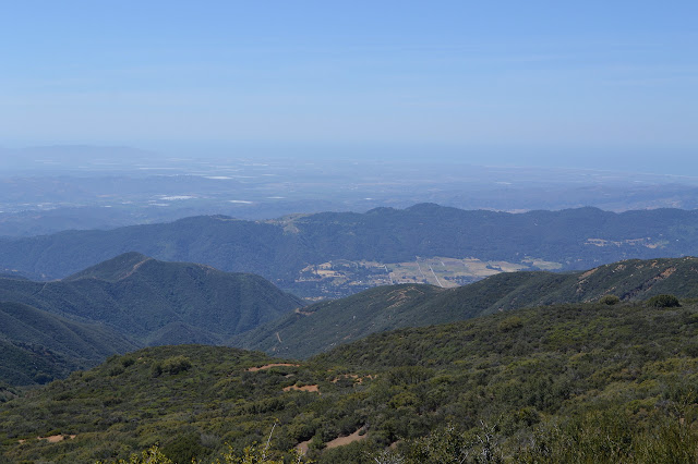
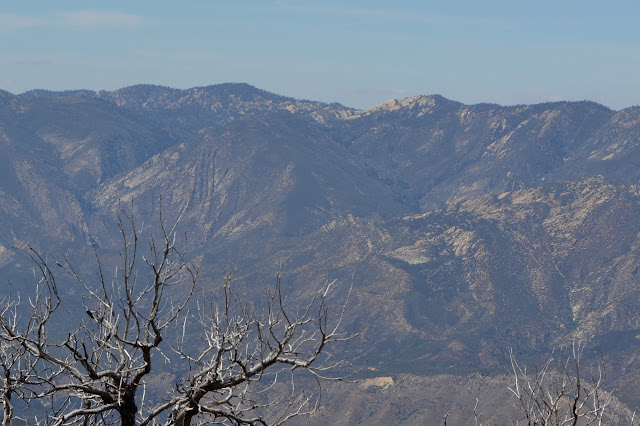
Topatopa Bluff is a lot easier to see today, as is the upper Ojai Valley. The fields are all browning. Oxnard is still a bit hazy and the ocean is as much imagined as seen. We turn and quickly pass the top of Red Reef's front country section bringing me to very familiar trail. We twist across and upward, past the trail I took up Topatopa Bluff, the bent over wilderness sign, and the junction for the old road along the back.


The trail seems fairly level for a while after this, but looking back it is actually a gentle climb. We start to drop again and pass the trail to Last Chance without even seeing it although there is obvious trail below. This part of old road ends at a sign that points us to Ladybug Camp and the Sespe River.
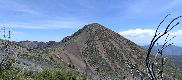

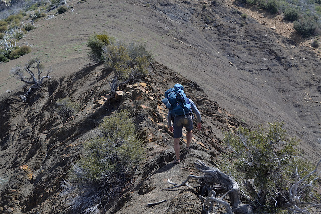
We are not going any of the places on the sign. The saddle is wide and flat and has been a camp many times. It narrows down to a knife edge rocky crest as we reach the flank of the steep mountain. The shale slope is less loose when following older paths. Above it, things are rocky and steeper, but it just takes a little clambering. Getting to the top shows it is a false summit, but we have done all the hard work. It is an easy walk to the true summit, stamped with the height by USGS.


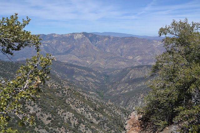
The register is not signed nearly as much as the one on Topatopa Bluff. Two notebooks go back a couple decades. The Sespe flows around us, but most of the massive cut is hidden. The lesser west fork flows from here somewhere, but is hard to see. Out at the end of the ridge that starts at Hines is Topatopa Mountain. Other peaks rise out of the Condor Sanctuary. Whiteacre is not so striking from this side. To the west, the Topatopa Bluff is also not quite so impressive. The cuts by the creeks are the stars of the view from here.


Eventually, we return the way we came. Slowly and carefully on the downhill, it can be more treacherous than the uphill. Climbing Topatopa Bluff from here is practically an afterthought, but we leave it for another time.
*photo album*
©2015 Valerie Norton
Posted 5 May 2015
Liked this? Interesting? Click the three bars at the top left for the menu to read more or subscribe!


Comments