Uncompahgre: Uncompahgre Peak
Uncompahgre National Forest
DAY 1 | DAY 2 | DAY 3 | DAY 4 | DAY 5 | DAY 6
Things are wet in the morning from a few brief rains overnight. Today is an short day starting with a day hike attempting Uncompahgre Peak and I can leave the camping gear to dry while I do that. A couple posts can be seen climbing the hills, marking where the trail passes. The trail climbs very steeply to the first one along a couple tracks. A couple elk on it last night took the less steep one, and I agree with them. The snow is fairly solid when I hit it, sometimes a little too solid.

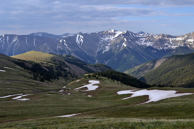
Getting to the trail to the peak, I can see that I have company today. Uncompahgre Peak can be done as a day hike in just over 4 miles, and it clearly had some traffic over the weekend. The snow is marked with many footprints and there is a group of three ahead of me. I feel like I am moving at a miserable speed, maybe as little as 1 mph, but they are fairly fresh from 500 feet up in San Luis Obispo and I catch up to them quickly. Oddly, it is the teenager climbing his first 14er who seems to be having the most trouble. Passing them seems to nearly halve the number of footprints in the snow.


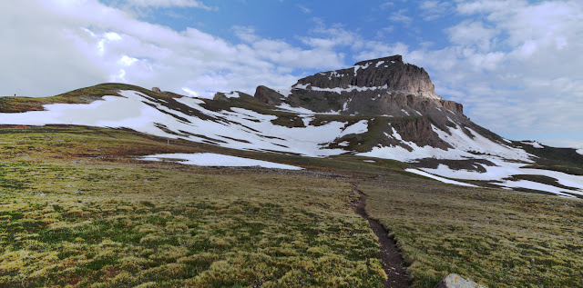
I post hole more in the higher patches of snow. The highest even feels like it has a crust on it from freezing the night before, but little solid footing before the dirt. The trail remains largely snow free as it climbs around to the cliff areas. Here, it becomes a scramble with some class 2 climbing, but finishes quickly. It is another long, easy slope up to the top after that.


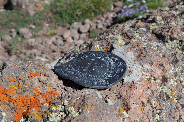
I have the peak to myself. There is a register at the high point. A few feet further, the ground drops off a very tall cliff. The top is so wide and flat that seeing all the best views requires some wandering around. I wander about looking at the views, but also looking for benchmarks. Eventually, there is a reference, so I start off in the direction it points for a station. There does not seem to be one, but then I find a second so I can triangulate. They point at a post in a low rock, so that game ends in a little disappointment. Trying to figure out what the trail holds just makes me worry about all the snow that seems to increase in that direction.


The first day hikers arrive as I am ready to head down again. There are at least a dozen more day hikers behind them. Some of them even have climbing helmets on. I spotted one person striding confidently along the trail I came along and wonder where they came from. Everything is quite dry as I arrive back at camp and pack up. The pack sure feels heavy with all the camping gear as I start retracing my steps heading toward the spur trail up Wetterhorn Peak.


At the second junction, I keep to the "driveway". This higher trail looked snowy from below and that was no illusion, although it is not all that deep. The hiker I had seen was one of two that are day hiking from the Matterhorn Trailhead, which is easily determined when they catch up to me. They are avoiding the snow much more enthusiastically than I am. I had seen their steps climbing to cross narrower sections of snow even if the climb was a bit high. They also slush through water a few inches deep rather than a half a foot of snow. I got ahead and try it. It is certainly faster, but a fair bit colder, too.


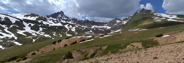
There is a surprise benchmark at the pass marking 12,463 feet. It is all downhill from here, today. I head for the junction around 12,000 feet, still having to avoid snow on the trail. Up the hill from the junction, there is a fire ring. I set up camp although I will not be using the ring.

Talking with day hikers, I have found that the climb up Wetterhorn is "definitely class 3" although Summitpost listed it as "2+". That and the larger amount of snow makes me think I will not make it up, but I cannot get this close and not try. If I had gone with my expectations, I would not have even packed enough food to be this far. I gambled on being able and I won. I have been feeling pretty good and The 59th Bridge Song has been the main song on the internal soundtrack for the trip. "Life, I love you, all is groovy!" Time to settle down and have some supper.
Continue reading: day 4
*photo album*
©2015 Valerie Norton
Posted 12 Aug 2015
Liked this? Interesting? Click the three bars at the top left for the menu to read more or subscribe!


Comments
- Bryan