Nineteen Oaks lunar eclipse
Los Padres National Forest
Locate the trailhead.The eclipse is coming and I have a plan to get my mom out backpacking for the first time in quite a few years. Yes, I do have to choose short and flat day hikes for her, but I will get her out backpacking! The hike up to 19 Oaks would qualify for one of those day hikes. I also like it because Upper Oso has some very nice dark skies, so just 2 miles further along should not be too bad either. It seems like a better chance to see the moon in a sea of stars if I go for a place with dark skies. I have also invited folks from the Wednesday night hikes, the Friday night hikes, and a local backpacking Facebook group, but everyone seems to be already off to Santa Rosa Island or barbecues at the top of the ridge for the evening.
I dug out my first internal backpack, a cavernous thing that I have never been able to fill up, to be able to carry whatever was needed between the two of us. Mom only asked me to carry her sleeping bag and mat. Even though the bag is in a stuff sack sized to fit nicely on the bottom of an external frame pack, stuffing it into the top still cannot fill this thing up. We head up in the late afternoon and happily do not have to deal with the troll guarding the ford on the way in. The heat is not so bad and it is getting cooler as we start off along the closed road.
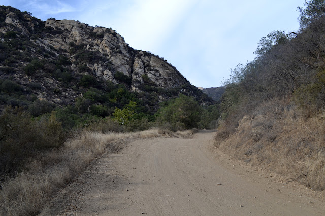
There is a little bit of water in the creek below and the road is looks like it has had some work since the last time I was on it. This is probably a good thing for the trail work volunteers who passed us on their way out. The usual puddle of wet marks the spot of a spring near the road and below it the water in the creek is quite obvious. Not too far up, the water vanishes except for one last little seep. After that, everything is baked dry.

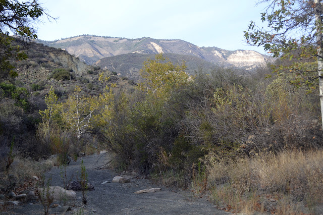
We are passed by three ATVs just before getting off the road to the trail. It is amazing how much more each one of them smells in excess of the entire mass of trucks that passed in front of them. It makes us quite happy to hit the trail. In another mile, we are at the camp, lovely but dry.

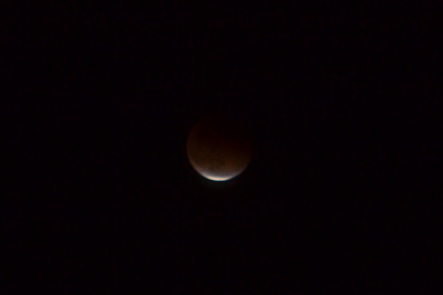
The clouds that have come up today are worrying since they do seem to be thick to the east from time to time. It takes a bit longer than I had hoped for the moon to come up. We have a lovely Milky Way above as we wait. After an hour or so, there is a blaze like a couple of red search lights in the east where the moon is coming up in the thin clouds. Gradually, it turns from the sharp V of light to a round, red moon in full eclipse. The Milky Way still hangs visibly above us, but the thin clouds are blocking my vision of a moon surrounded by visible stars.
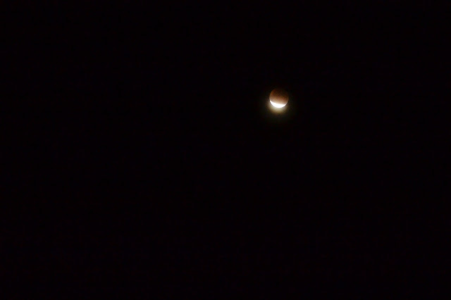
We watch the moon come back again, showing shapes a little different from the usual thin edge of light that grows. As soon as the edge brightens, the Milky Way vanishes in the minor flood of light.
It is more enjoyable than one might expect to watch the moon come back, and nice that it is still a reasonable time to be up by the time it is finished. We tuck in after, of course, and then head back in the morning after checking around the camp and finally finding the spring. It is so dry it looks like it has forgotten about water and a disturbing number of people are leaving toilet paper under the bushes just twenty feet away.
©2015 Valerie Norton
Posted 8 Oct 2015
Liked this? Interesting? Click the three bars at the top left for the menu to read more or subscribe!


Comments