Alder Creek (Juncal Road and Franklin Trail)
Los Padres National Forest
I was wondering what the state of the part of Franklin Trail that was never closed was and thinking that since I hiked the newly reopened part, I should finish the job. Dreading the step at the end of the pavement, I kept putting it off. I was informed that it has been improved, though, so there were no excuses. I heard rain drops on the roof last night, so was worried the gate might be closed. I checked it online, but found no problems. Still, I made a contingency plan and started the long drive over the top of the mountains and down to the river on the other side. The step was not large, the gate was not closed, and the parking is even more clear than it was before. Today is the day for the rest of the trail, then, so on with the shoes and off onto the easy stretch up to the reservoir.


Finally, after nearly two miles, there is a significant climb as the road gets near the dam in big, lazy loops. It looks like some shortcut the gentler road by taking the route next to the water pipe. That route is full of poison oak, so I do not go for it. At the upper end, it becomes very steep and a rope has been left to help with the climb. The dam comes into view after another lazy turn over the top of a hill. The road already seems higher than it, but keeps on climbing gently.


Signs around the lake forbid any "hunting, fishing, hiking, picnicking, and other forms of trespass". I have heard that the lake was once the best fishing in the county and wonder how one would get to find out. The lake is still very low, but the brief rains have not brought much to most places yet. The route is nearly flat again as it makes its way to the lake and a little past.


The junction is marked by new signs. A few of these have been popping up, produced to look very similar to the previous ones at each spot, but with some edits like changing "Depression Drive" to Gibraltar Road and fixing mileages. I miss the weathered sign that was here and still easy to read except for a 1 in the 1.5 to Alder Creek Camp. This sign did not reproduce the 1 and there is a piece of tape correcting it. There seems to be one less entry, too, and I realize "Ocean View Trail" has been dropped. I could see changing it to Divide Peak OHV, but to leave off the destination at the top seems like an egregious mistake. Its companion sign has everything that was there before including Juncal Station, which I can find on no map, and Juncal Camp, which is long removed and should have been replaced by Romero Camuesa Road that marks basically the same location.

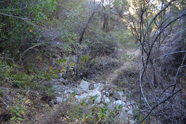
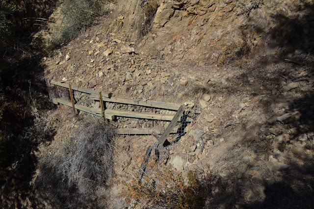
Turning south, the Franklin Trail stretches out still as a bit of road. It drops down past the sluice to a turn around point. Trail is very clear heading out the far end of the loop at the end of the road and continues to be down under the sluice. Today, it is not dribbling on me from huge icicles. Part of the reason appears to be that it is being left dry while repairs are being made.


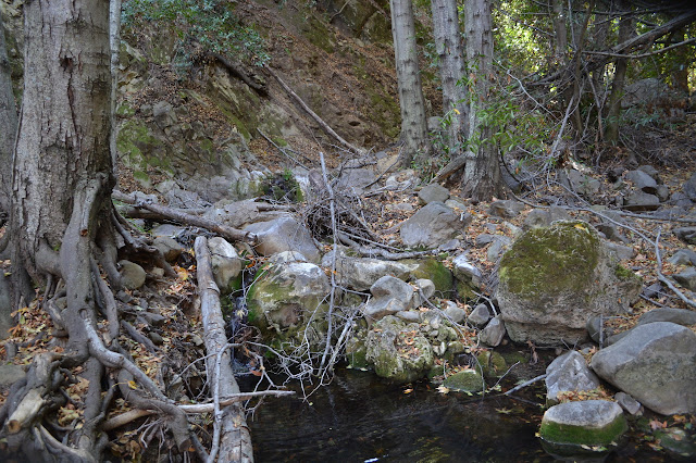
The trail crosses the creek a little before the diversion dam that supplies the sluice with water. Just past the dam, things get confusing. There are trees across the lower part of the canyon and some attempts at going upward have left some rough trails. As I look for better hints of trails, I realize that the correct route is right across a small spring and over the trees. I follow some rocks and clamber over the trees and there is dim, but well packed, trail behind it. It crosses the creek, gets slightly confused, then crosses again and starts climbing in short switchbacks. Here, it is solid and clear and all question of being on the trail are dispelled.

Now it is in the first real climb of the hike, over halfway along. There is a spot early on that I am worried about where some of the trail structures have failed and rocks have piled high. It looks the same now as it did four years ago, mildly worrisome, but passable. Up and up I go, leaving the water which dries out quickly anyway. There is one pool below. There are steep sections and more tight switchbacks up to little ridges and views of the mountains and lake being left behind.


The trail climbs up and over another little ridge and drops down steeply enough. People have made part even more steep by cutting a switchback which seems to be lost. There is water in the creek again. A fallen bay blocks the path while it continues to grow. I scramble below its green bulk. Crossing the creek, it starts up a different canyon very shortly to a clearing with a fire ring and a loose toilet. Alder Camp seems like a better place for a summer trip when the enclosed cool would be appreciated. There seem to be a couple spots built up to be flat, but otherwise the area is somewhat sloped.


There is still more to climb after the camp. The brush is thicker on this side. I have to duck through a couple of tunnels that are not quite so low as bear tunnels. I break off the twigs that reach out the furthest. It eventually ducks under a power tower and follows the old trail from the building, or perhaps that old trail followed this one anyway. It seems wide like a road in a few spots, but is still sagging in a couple others. A large bush has collapsed across it in one spot and is a bit more work to pass than it should be.

And then there I am at the top. The ocean glistens below with the dark shapes of the islands rising from it. The oil rigs continue their steady attempt to rid our beaches of oil for future generations while doubling it for the current ones, but otherwise the surface is nearly deserted. Chaparral still holds the hills, but city holds the flats below. It would take eight more miles to reach those roads. Oh, and the OHV route looks very much like something that ought to be listed on a nearby sign that is not more than a year old.


After lunch perched on a rock overlooking that ocean, it is already time to return. Again, I would not want to be trying to find this trail without having been on it before. Someone has helpfully placed a ribbon at the top. There are a few more, too, although they really are not needed.


Below the reservoir as the road flattens out, there is a cable across the memory of a short road. Perhaps this is where Juncal Station was? Now, it is a trail that runs into the track of the water pipe from the reservoir. Other spurs lead off on the same side, but they head off to places where the water pipe can be checked on. Investigating them yields no clues and I continue the easy walk out.
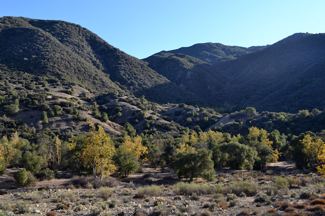
*photo album*
©2015 Valerie Norton
Posted 25 Nov 2015
Liked this? Interesting? Click the three bars at the top left for the menu to read more or subscribe!


Comments
I could only get maps back to 1952 from USGS and they don't show Juncal Station. Can't find it on the 1938 or 1976 forest maps either. Where was this mythical place?