San Emigdio and Brush Mountains
Los Padres National Forest
On one side of the San Andres Rift, Mount Pinos rises more than 8800 feet to be the highest point in Los Padres. On the other side of the rift, there seems to be a little less crumpling where the mountains only rise nearly 7500 feet. The seed of desire to go up San Emigdio Mountain was probably planted while I recorded my newly climbed Hundred Peaks Section listed peaks after I traversed from Mount Pinos to Cerro Noroeste (AKA Abel) then dropped down to the San Emigdio Mesa. Next to my new mountains was another with the same name of the mesa and I rather liked the mesa. Then I found out the mountain was not there, but on the other side of Mount Pinos and much of the desire fell away. Somewhere, a little bit of the seed remained.
More recently, I was looking at some geocaches set in the area and thinking about the mountain again. There are two listed peaks in the area and San Emigdio is practically a drive up at just 0.2 miles round trip from the parking area accessible by most cars. Where is the challenge in that? The other one is at least a two mile round trip from the end of the two wheel drive accessible road, but still little challenge. At this time of year, both roads are closed and will remain so until early May. The snow level is currently 6500 feet, 1000 feet below the taller peak and 500 feet below the shorter. However, the last storm through was warm enough to be rain at these elevations and even the nights seem to be above freezing if the National Weather Service can be trusted. I picked the second of two expected gorgeous days in a row and went for it. Since it was hard to even pull off 10 miles in some days going through too much snow back in spring, it is nice to know that the moon will be rising nice and big as the sun goes down. In a nice, new pair of waterproof boots to keep my feet dry, I am off.

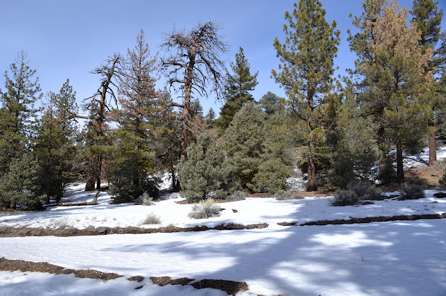
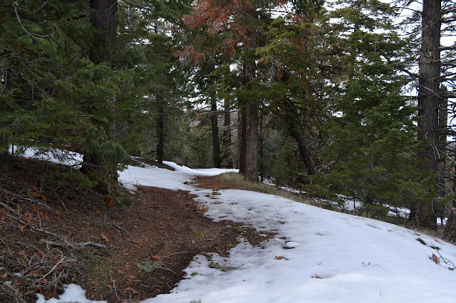
The gate is locked, as expected, and the road in front of the gate is a mess of deep tire tracks. Behind it, it is just smooth road. As I climb, I can hear radio chatter from the speakers at the fire house at the saddle. Patches of snow pop up quickly in sheltered areas and many foot prints cross them. The footing is less stable where the snow is already compacted, so I add another set. The climb is easy, but it does feel like it is getting somewhere.


Continuing on the wide road, the snow patches are growing, but still not thick or constant. The footprints also go this way, but not for long. There is a sudden eruption of footprints going every which way and then empty snow beyond. It starts to be tempting to walk along the side of the road since there is less snow there, but the vegetation looks very delicate and the ground quite soft. I keep on through the snow, which is already tiring as I give each step an extra stomp to make sure the footing is as good as possible. A bit of ice looks like the convenient place to step until actually trying it. I manage to keep upright, but it feels more like luck than skill.


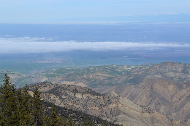
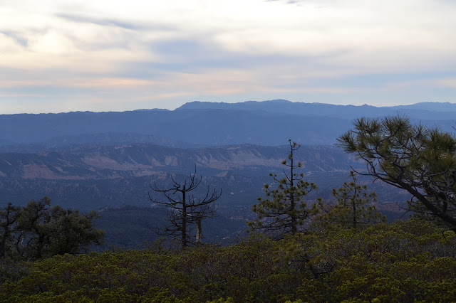
The geocaches I am going after are not actually at the peak, but continue on past it. I figure I will go out to the furthest one and then just wander upward to the peak since I do not know where HPS likes to start. It is soon clear why the geocaches are where they are. The wide road ends in a large parking area with a massive view. It is quite a drop down into the foothills and out to miles and miles of flat. Southern Sierra Nevada peaks look crisp in their white snow coats in the distance out past the squares of farmland.


Past the lot, jeep trail continues down the ridge. Here, the snow is deep enough to need my gaiters to keep it out. It is time to turn and find the peak.

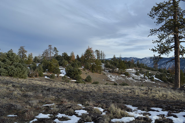
I head back up the road until there seems to be something to climb above it. There does seem to be the described parking area at this point. Some deer prints show a route without too much ducking through the trees until I am in a large, flat area that seems to be the top. A small cairn marks a seemingly random spot on it. Searching the snow covered rocks around it does not reveal any register. It was good to overshoot the peak, there is no view for me here.

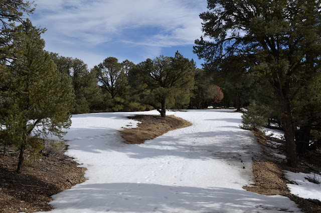
I head a little way down a mysterious road for a brief look before returning much of the way I came. Since there are such big trees remaining, it must not be a logging road. Maybe mining. The map confirms. Yellow rocks remind me quite a lot of the ones on the other side of the rift. Maybe this is really still transition zone between the plates and really the other side. Continuing back, some of my footprints left in the snow already look old.

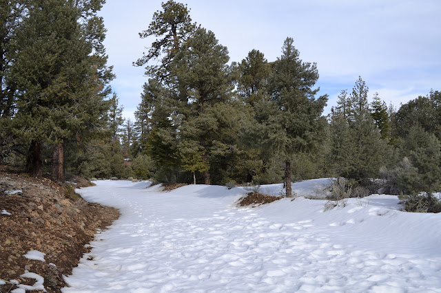
Starting down the jeep trail, the snow is clear again. Being more sheltered, this road has a lot more snow on it. I am quickly joined by a set of bear prints. They look fresh. With the weather the way it is, they would have had to have been made in the last day or so. A brief excursion south off the road to try to find a monument yields nothing although the general area is clear of snow. Maybe it is a little further up the hill than I looked?


The road is mostly downhill and the snow gets quite deep as the hill increases. I am happy to be going this direction on it. The bear tracks lead off one way or another and then shortly after are back. I keep following the bear almost to the campground. At a fallen log with a drive around, I even follow it over the break in the log.


As I come down, I can see a bare road climbing steeply ahead. This is directly across the campground. After the initial steep climb, things level off a bit. Again, the geocaches I am going for overshoot the peak a bit, but this time I stop by the peak on the way. There are no bear prints up here.


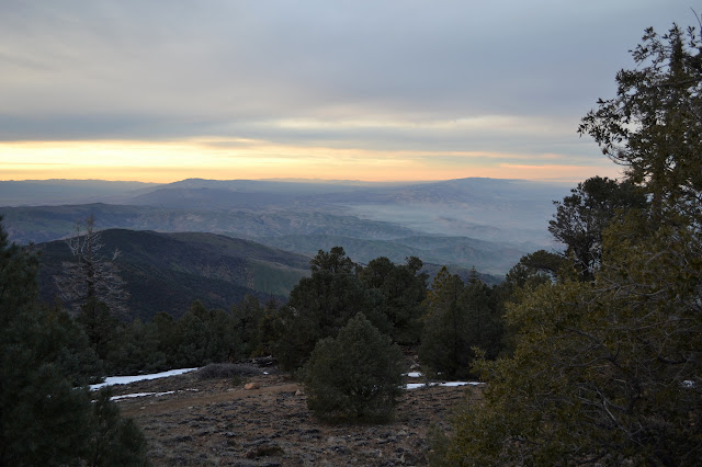
As before, it becomes clear that the caches lead on to increasing views. Getting a bit north gets around a ridge to grab a wonderful view out over San Luis Obispo. I feel like I can see almost to the ocean, but it is foggy at the moment.

Turning back again, I just have to make my way back to the campground and then follow the wide road down to the pavement below. As the sun gets low in the sky, it drops below the cloud level for one last celebration in red light before slipping behind the mountains. I keep trying my luck on patches of ice and after four attempts that all result in slips, but no falls, I finally stop trying. Fool me four times, lots of shame on me.

It is starting to get dark as I get back to the campground, but still plenty to find the road back down the mountain. Again, I am on a wide and smooth road. As it darkens, I wonder where my moon is. There was supposed to be a big, beautiful natural streetlamp in the sky tonight. Searching the sky, there is a bright spot in the clouds. So much for my moon. Still, the clouds seem to thin as I go and it is enough for this smooth road. There are many footprints on the road and across the few patches of snow below the campground, so this too is getting some traffic for a little way. I wonder who comes up here, but not very far. The road is perfectly angled for watching the last of the twilight fade over the mountains. Caballo Campground seems to be a bigger place as I pass through. It actually has toilets and a sign. From it, it is not far to the pavement and then it is just a little more than a mile along the otherwise utterly abandoned road back to the saddle and my car. The moon has come out by the end. My first indication of other living humans in the evening is the same as the last in the morning, noises from the firehouse.
*photo album*
©2016 Valerie Norton
Posted 23 Jan 2016
Liked this? Interesting? Click the three bars at the top left for the menu to read more or subscribe!


Comments