Fishbowls
Los Padres National Forest
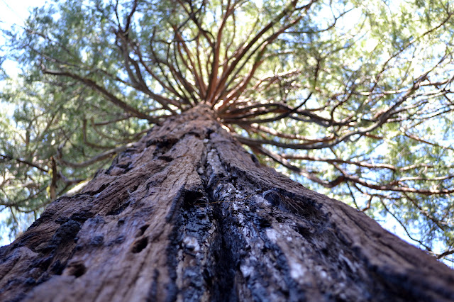
The Fishbowls were not very impressive two years ago after I climbed all the way from the Sespe River to see them. This year, with the road open and some better reports from last year, I decided to head out on a slightly shorter loop to see them again. Passage along the road is not a given for a little car with 6" ground clearance, but a short wheel base and not too much nose help. There are a couple stones on the steep hill down that require driving around rather than over and one ditch that takes a little careful maneuvering, but without too much effort or anything important scraping, I am at the trailhead parking. There is one other car already there. Will I have to share them? I do not spend long thinking about it. The day is forecast to be on the hot side and the sun has already been working on the land for 3 hours. I find the thin line through the grass behind the kiosk and follow it as it becomes more definite and starts to climb.


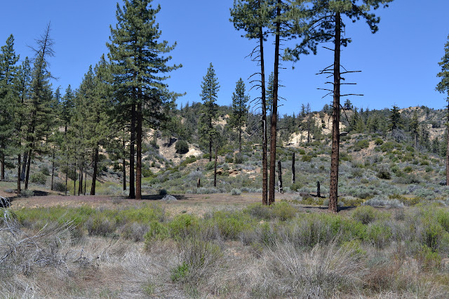
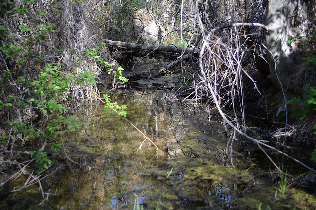
Up and over the hill and everything seems wild except the trail running along it. It does not take long to discover if the creek has water down here or not. It does. At first, I see a muddy pool. Then, there are the thick red streaks along the small rocks of the creek bed. Piru is flowing.


The area is so very level, it is hard to believe that the water can flow through here. The sun beats down, but breezes bring cool and the walk is so easy that the heat is not a bother. It is also not quite so hot as I feared it would be. I pass a backpacker under the shade where I sat for lunch almost two years ago. He is also hanging out at the spot. Maybe I will have the Fishbowls all to myself after all.


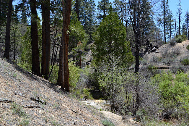
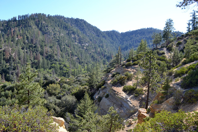
The trail turns south and the vegetation changes as cedar trees appear. The land also changes as more and more actual rocks show up. It is not longer level as the trail climbs and drops and crosses the creek and climbs and drops again. One creek crossing carries some of the largest bear prints I have seen. Catch sight of the one lonely bathtub that can be found about a mile before the camp, I give it a look over before continuing up. It looks pretty clear, but it is not a good indication of what will be above.


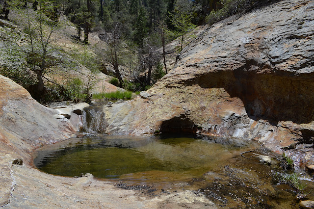
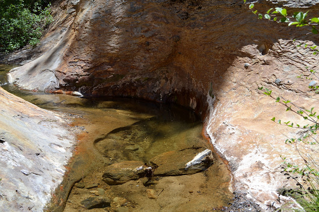
The camp is just the same and quite empty. A couple of sites behind one sign and a few more across the creek on the other side. Heading up from the south side, the canyon gets particularly narrow. Another corner and there is the big Fishbowl. Mark S might have trouble sitting in some of it because it is a bit too deep for that now. Other parts still have plenty of sand. It is much harder to go exploring above the big pool without the sand to walk across. I can, just barely, climb out the pool to the upstream side, but it is easier to climb the steep rock beside it.


It takes a while of lounging with my feet hanging in the water, but eventually I put my shoes back on and tuck everything back into my backpack. There is still climb to go and the hottest part of the day is almost upon me. A good dip of my shirt should help hold off the heat for a little while longer although the initial chill is a bit much. Every step has been familiar so far and I am eager to finally make it to some new trail.


There is a sign, now in the ground like it should be, and I turn to climb down toward Cedar Creek. The trail follows the ridge, but some are trying to make it do so more exactly. At one point of particularly bad trail, I look over the side to see the real trail below. Making my way down to it, I find it is completely unmarked by footprints although there have been at least four sets of fairly fresh ones on the rest of the trail. Another spot is flagged to help people take the trail rather than the erosion hazard that some would like to make the trail. Once it gets away from the ridge, it is easier to follow. Meanwhile, I seem to be smelling more and more ceanothus and it is getting my attention. It looks like regular white thorn, but through here the flowers are various shades of lavender, often all on the same bush.

The trail bottoms out and crosses the creek. It is small, but flowing steadily. Of course, there are cedars. There is a camp just a little downstream. The first site does not look well used, but the second certainly gets some.

From here on out, it is again quite level. Tiny tributaries trickle in more water to the steadily flowing creek. The springs must be flowing along here, even if just a little.


And then there is a sign and a road. The road is not quite so level as the trail was as it climbs to be a little higher above the water. Finding a way around the ford takes a little effort, but it is possible to cross without getting my feet wet. Looking down at the ford on the other fork to Halfmoon, it looks as though that will not be my camping spot tonight. The ford is over a foot deep. That would be fine compared to the first ford, which is more than knee high. Somehow, people do make it through. It takes quite a long excursion, but I do find a way across without wet feet to get back to the car. There are no fords on the way out.
*photo album*
©2016 Valerie Norton
Posted 17 May 2016
Liked this? Interesting? Click the three bars at the top left for the menu to read more or subscribe!


Comments