Cone Peaks: Jordan Hot Springs
Inyo National Forest
Sequoia National Forest
DAY 1 | DAY 2 | DAY 3 | DAY 4
(The night was too warm even for my light quilt until a breeze came up to mix the night air a little bit. Soaking in the hot spring under the bright Milky Way was great, but now it is morning and time to hike out on an often hot trail. The moon rose a thin crescent in the dawn light, but the sun is very slow to get up after it. Since I had no photos of the spring after getting in at sunset, some in shadow would just have to do.

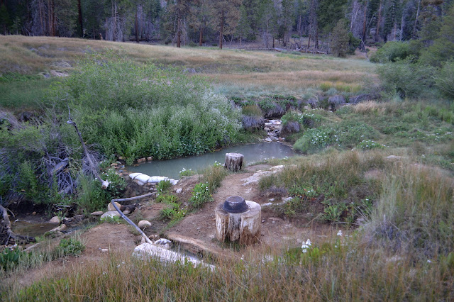
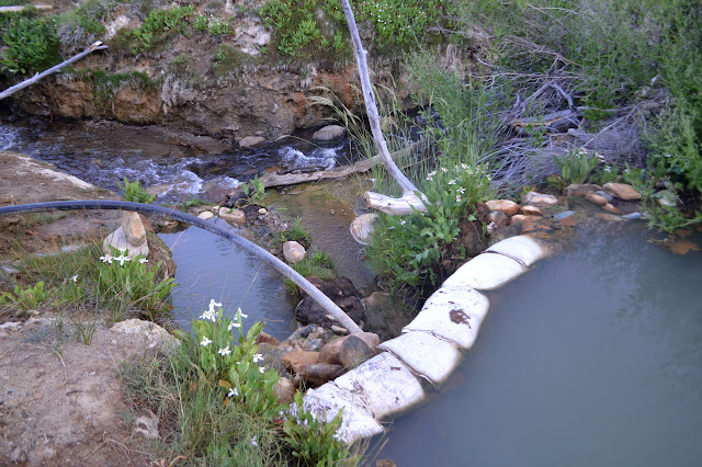
The main pool is bubbling everywhere. I do not remember it having that many "air jets" a couple years ago, but it is probably not something that changes much. Little hot creeks flow in in a couple places. As much as the tub was too hot to soak in for more than 15 minutes or so, the nearer trough is even hotter. The reeds on the other side where there were once some tubs are knocked down a bit, so it would be easier to explore those today, but the bridge is looking a little worrisome with one of the handrails knocked down. Is that how it was when I used it before? There are two single sized tubs, one just below the end of the main tub and one below the bridge. I did not try them. Maybe I should have.
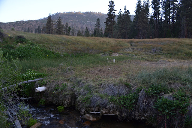

Above, the camp looks much the same as before. Today, I leave the buildings largely unexplored.


It really is not that long a hike out from here, but the drive is long, so I feel like getting moving up and out. It will be best to get the first bit done before the sun is too warm, too.


The burn area is broken up by very little, but it is nice to see where a large creek feeds in from Long Canyon. The cluster of trees around it and the cool water flowing by make a very nice spot to rest from the sun. Coming around the corner to the campsite above the confluence, it is surprising to find the area occupied by people still in warm hats and long johns in the bright sun while I have been cooling down by the water.


Even in the burn, there is a lot of green, at least to knee high. There are a lot of people on this part of the trail, all going down to the hot spring. Well, almost all. The volunteers who take the cabin in Casa Vieja for the summer are trying to remove a large tree from the trail, instead. The tree is laying across the trail, but since it is on such an extreme slope that the whole thing must be removed or it will just slide down to the trail and block everyone again. It was a very old tree with good wood, so is quite a lot of work to remove.


Like along Redrock Creek, the burn did not go all the way up. It is nice to get out of it although it seems shorter than when I went through it before. Maybe it is all the burned area below that is making my memory incorrect.


There are three horses in the pasture when I get to Casa Vieja Meadows. These belong to the volunteers below, too. There is one fellow staying at the meadows, so another person who is not going to the hot spring. A fellow with a couple mules and a couple dogs passes by and does seem to be.


I turn to climb the bit of trail I have never been on but is the first most people see as they come to the hot spring. I had grabbed a bit more water from Ninemile Creek, but it is soon clear that was an unnecessary precaution as the meadows have streams running through them. This area of Golden Trout is known to be wetter than around Templeton Meadows. More people are going the other way, including another group on horses.


One more pair of hikers passes going the other way sporting bear bells and mace as I make the last few steps from the edge of the wilderness to the parking lot. There were two vehicles in the trailer lot when I got here, now both lots are half full of the respective vehicles. The weekend crowd must be huge. I take off and give them one more space.

The associated album is here.
©2016 Valerie Norton
Posted 6 July 2016
Liked this? Interesting? Click the three bars at the top left for the menu to read more or subscribe!


Comments