Posts

Showing posts from June, 2016

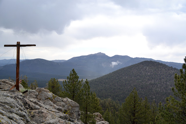
Cone Peaks: Templeton Mountain

Image
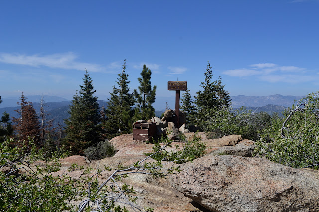
Inyo National Forest DAY 1  |  DAY 2  |  DAY 3  |  DAY 4 Templeton, the original impetus for this trip plan, sits serenely across a short meadow and a random little hill. Should I get to a "better" position to start up it, or just clamber right up it and that little hill for good measure? Packed up, I go searching for that elusive trail, but there really is no certain sign of it. There is a funny looking post on the far side of the meadow that looks to have trail beside it. Maybe. And maybe that is a line there. As I hit the creek, there are a couple rocks set out to help hop it without getting my feet too wet, although the meadow plants are doing a good job of wetting my shoes already. The post turns out to be another location poster with an unfamiliar format, but this one is only about 7 years old. It is at the edge of dry land and points to something right by the creek only 51.6 meters away. I look, but nothing is obvious. Location poster at the edg

Cone Peaks: Brown Mountain

Image
Inyo National Forest DAY 1  |  DAY 2  |  DAY 3  |  DAY 4 With the wet ground and falling temperatures in the night, there was a fair bit of dew. As the sky brightens, a moo drifts across the grass. Ah, wildlife. The mist hangs over the meadows, especially around the river, but it increases and moves as the sun rises and warms the wet ground. I thought I was well situated to get some morning rays, but it just takes forever to get over the mountains. Mist on the meadows in the morning. Eventually, I realize the sun actually is glowing up there in the sky, however what was a sky full of stars has somehow turned into a sky full of clouds. There is no telling how long it will take the sun to come out, so everything will just have to be put away wet. Since I ignored the road to find water and then camp last night, I have to go find it again in the morning. This is easy, it is right where I left it. Then I have to try to navigate the many junctions to the trail thro

Cone Peaks: Monache Mountain

Image
Sequoia National Forest Inyo National Forest DAY 1  |  DAY 2  |  DAY 3  |  DAY 4 I left Templeton Mountain unclimbed almost two years ago and decided to try for it again. The impetus to climb this silly looking nearly perfect cone of a peak was to look for a benchmark that is on the 1905 Olancha 30' map. There are others, so I decided to add a few more to the trip to make a big loop with a return that may as well visit Jordan Hot Springs again. I stopped by the Blackrock Ranger Station to self issue a wilderness permit then got up to the parking lot just after hitting the breaks to avoid hitting a bear. Seeing the bear makes me really want to get rid of food trash and maybe food before leaving the car, but there are no trash cans or bear boxes available. So it goes. There is a beautiful hazard tree central to the lot. So it goes. To avoid walking the same trails as much as possible, I decide to head over to Monache Meadows via motorcycle trail and jeep road.

Yucca Trail

Image
Gaviota State Park Gaviota State Park seems to be out to get all its trails back. There was a while when there were about twice as many on the map as on the ground. Exploring one of these reworked trails is most easily done starting at the park entry by Las Cruces. I picked up a couple sisters from by the old adobe stage coach stop and after having a look at that, proceeded to the gated end of the road and the start of the hike. It is a little warm although I can just see the fog hanging above the break in the rocks made by the pass. We start off down the fire road and quickly come to a trail junction. Before, this junction was easily missed and only one trail showed at all. Now it has an information kiosk and trail signs marking the Ortega Trail that follows near the creek and the Yucca Trail that climbs along the ridge. Both easily found and followed. After a brief discussion, we head up the Yucca Trail, the one that was previously invisible. It climbs quickly. Lo

Burnt Peak

Image
Angeles National Forest It was starting to get hot as we finished climbing back up from Atmore Meadows, so it is nice to grab another thousand feet or so and start up Burnt Peak. Again, we are on bicycles. This one starts off downhill and has some steep uphills before more downhill. The objective: Burnt Peak. Getting low and looking back at Sawmill Mountain. Looking west, I can just make out the road down to Atmore Meadows. The final climb starts off steep, but then levels off to a typical road slope. We slowly twist our way to the top.

Atmore Meadows

Image
Angeles National Forest The line on the map has intrigued me, so now is an opportunity to check it out. The road from the saddle is easy enough for high clearance, but the road down to the meadow is marked as closed and unsafe to travel. Without a gate to close, there are plenty of tracks past the sign anyway. The end of truck travel. Take the left fork for the meadows and the right for a closed gate in a few feet. It is clearer today. Looking to the Tehachapi Mountains to the north before heading south. We take the bikes although the road looks fine from here. Although mostly downhill, we have to ride generally uphill to get over a shoulder before getting to the business of dropping to the meadows below.

Maxwell Trail

Image
Angeles National Forest The Powerhouse Fire closure may be expired, but there are still a few closed roads in the area. We decided to take advantage of one for a ride. It will be interesting to see what the fire has done, but most of this one did not actually burn. Finding the bottom to set up a shuttle is difficult as it looks like it is just some driveway in the middle of the town at the north end of Lake Hughes Road. There is some truth to this impression. The road does go to a home, then becomes a washed out mess on the way to the locked gate. There is plenty of room to leave a car there for a shuttle before heading up to the saddle by Burnt Peak to start. The air is a bit hazy today, reducing the views just a bit. We start off with a bit of climbing. A break to the northeast allows a view in that direction. The solar panels look like lakes out in the desert today. The road is getting some travel by those with keys. Even more ridges to the south. Somewhere

Sunday Peak

Image
Sequoia National Forest We climbed Sunday Peak with our backpacks weighed down with #10 cans of peaches and things out of the kitchen to get the feel of a weighted pack before going out for a three day trip. It was probably meant to shake out whoever might have signed up for a backpacking unit even though they should not have. I remember it being a sunset hike and we all had a grand time, so there was no actual shaking. I probably hiked it again in a similar way before going out on a five day trip another year. The camp is gone, but the driving directions still say to park near the sign for Camp Mountain Meadows GSA. I am rightly suspicious the sign is gone, but it has simply been replaced with one for the trail so that it is still easy to find. The area could be confusing with a motorcycle trail running past and the old camp road heading down to the meadows the camp was named for, but there is a second sign a little deeper in that makes the correct route clear. This wa

Bohna Peak

Image
Sequoia National Forest We stayed the night at Cedar Creek Campground, which is also a good starting point for climbing Bohna Peak. The road up the creek through the campground continues past the last site to what could almost be called a parking area and a trail continues after that. The creek quickly becomes a stunning thing of ledges and cascades. It is quite surprising after seeing it as the overtrampled flow of water over jumbled rocks and dirt that it has inevitably become within the campground. Cedars and cottonwoods along Cedar Creek. A thin canyon with tall cottonwoods. Many flowers are blooming along the creek. The trail crosses the creek often and sometimes gets very nearly into the creek. As I edge along a rock wall trying to keep my feet dry, there is suddenly an odd hole in the side. Very square and very deep and very consistant, it must be an old mine.

Black Mountain and Split Mountain

Image
Sequoia National Forest I signed up for another Hundred Peaks Section outing, this time bringing along another geocacher who is not at all worried that there are no geocaches to get along the way. The planned early morning start got earlier when the weather for the weekend became known. The high for Kernville, somewhere down the hill a bit, is expected to be 104°F. Up here, 3000+ feet higher, that translates into something that is on the correct side of body temperature but still very hot. Twenty minutes after sun up, it is not yet hot, but it is certainly not cool either. I have dropped in three bags of water at 2.5 liters each to try to make it through the 12 mile or so day without drying out. I find a half liter a mile is a minimum on days that hit 90°F when on trail and these will be off trail miles. The water is heavy, but the pack is riding better than usual with the extra weight as we start up a thin track in the grass, climbing steeply up the hill. Without a t

follow by email