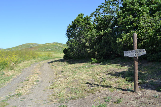
Bill Wallace Trail
El Capitan State Beach
Link to map.
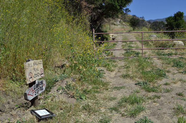
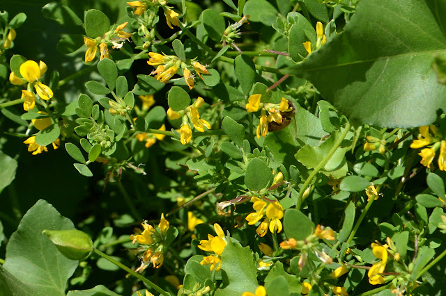
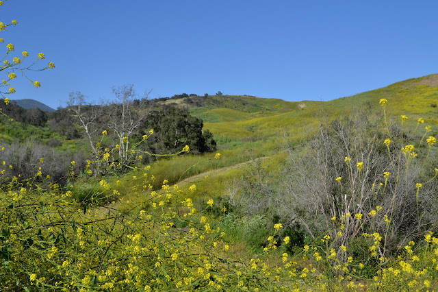
The Sherpa Fire burned through much of the foothills around El Capitan almost a year ago, but the area is open to hike the Bill Wallace. I park on the dirt lot at the entrance to Ocean Mesa Campground. There is a sign that points around the corner along a bit of campground road out to the hills. From the road, a slot has been mowed through the tall mustard to the old sign saying "easy" to the right and "hard" to the left. The fire did not quite get everything.

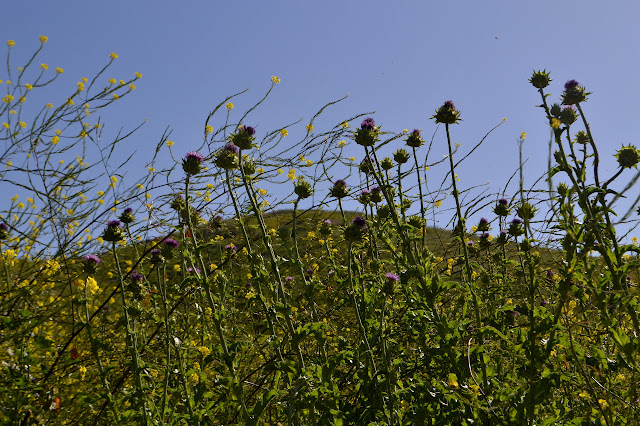
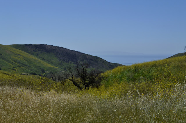
This time, I turn toward the "hard" side. We shall see just how hard that really is. It winds upward on the hill. The trail is narrower and the mustard is joined by thistle, but mostly just far enough that I can avoid getting stabbed. Both tower over my head. The trail gets narrower up higher and waist high star thistle joins in on the stabbing game. Tiny needles, but at least they only hurt when actually in contact. Rocky sections offer some relief as they are covered in grasses and morning glory. Near the top of the hill is the "1 mile" sign I missed on my first hike. This time, the GPS will mark off the same miles as the signs, if any of the rest still exist, rather than a half mile short after taking the "easy" way.
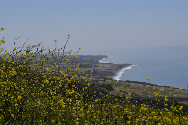
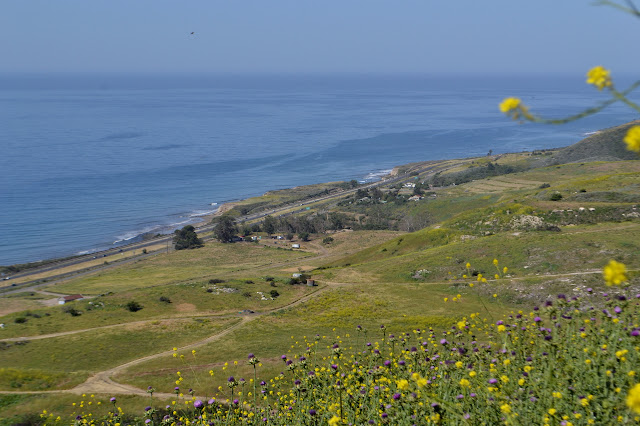
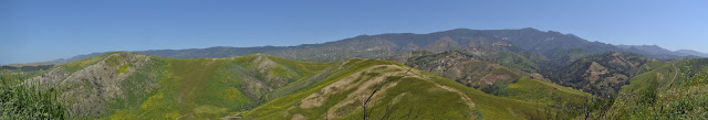
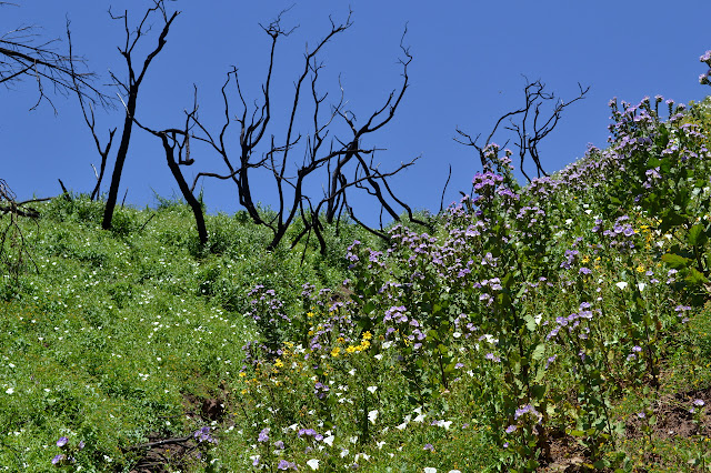
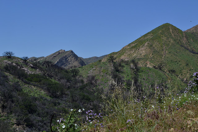
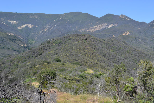
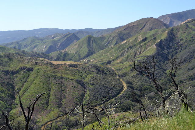
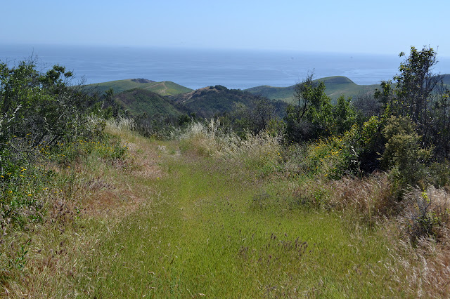
Coming over the top of the hill, the burn area is revealed. Beside me, there are the burned remnants of bushes. Except for a handful, the oaks out on the hillsides just look black. The mustard and thistles largely stop. The trail drops down the other side to rejoin the "easy" route and then continue up along the ridge line in the grass. There are lots of people out on it today. Some seem to be organized groups from the campground.
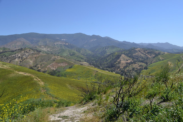
The other "easy" and "hard" sign is now gone. Closer up, the oaks do not look so bad. There is deep green growth popping out all over the blackened bark of most of them. The sign pointing down off the ridge is also gone and all of the trail continues north further before cutting back toward the cabins below. The old, shorter trail is now just a line without quite so many mustard flowers. No one has been using it this season. This must also have been the original route because I am nearing 3 miles on the GPS as I pass the now missing "3 miles" sign on the way down.
The signs closer to camp have been preserved along with the cabins. They were not so lucky with a later rain event, but so it goes. As I hit the paved road, I turn left to get back out of camp as quickly as possible. The creek is chattering below. The sign pointing up the dirt road beside a final parking lot also remains, as does the undated note about a "recent" sighting of a juvenile mountain lion. It probably is not a juvenile anymore.
The old road is largely in good shape, but there are some spots where the erosion has been harsh. It no longer works as a road, but there is always good trail. Someone has stuck little red flags around the edges of the drop offs that have formed.

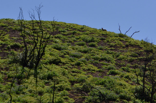
Something is barking at me from up on a hill. There is a coyote standing up there. It jumps back and out of sight, then back to bark a little more. It seems wary of me, but not quite wary enough.
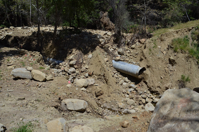
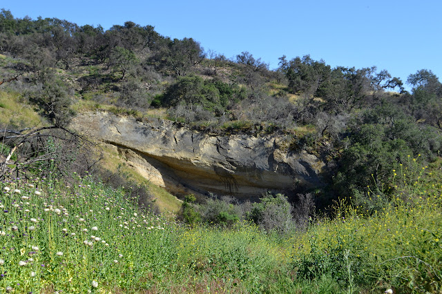
The trail comes to a major tributary and abruptly stops. The water rushed through cutting away the old road leaving the sides of massive pipes. A little water still runs through at the bottom. The little flags marking sudden drop offs line the edge from side to side. It is clear that most sensible people would find this to be the end of the line. There is a slide of shale without too much slope to it on one side that looks like a way down. The way up the larger cliff on the far side is more of a challenge. It looks like there might be a way up to where a smaller flow from the north side of the road came in. If I go up that creek, there might be a way up to the road itself. The way down looks easy enough to give it all a try.
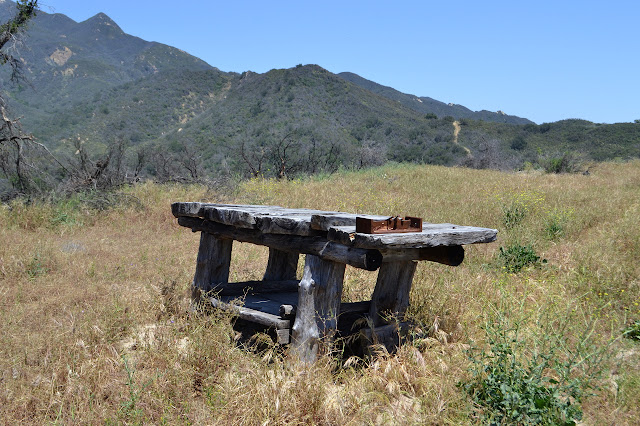
Down is easy, but up to the creek bed beside the road on the other side takes some stretching. A little way up the creek, a log provides an opportunity to get up to the road. It is in perfect shape as it climbs up again and a lot of spots along the way have even been left unburned. The rough table at the top remains as do some of the signs for the way down.
Not quite all the signs remain, though. Apparently the one I need is gone because I get onto the old and steep road that drops down to the creek below a bit faster than the current iteration. I do catch one turn, but the cuts along it quickly stop leaving no route further, so start back on the downhill route. It is clear enough as it drops, then turns into a creek bed and empties into the actual creek. Back a little way, I can see a ribbon on a tree. Climbing up the side, there does seem to be some old road bed covered over in poison oak. The ribbon is not marking it. It says "killer tree" on it over and over again, so seems to be marking a tree someone means to cut down for safety. From where I could see the other side of the trail coming down, I know it is upstream, so follow the old road bed that way. A quarter mile of poison oak wading alternating with rock hopping up the creek gets me to the crossing.
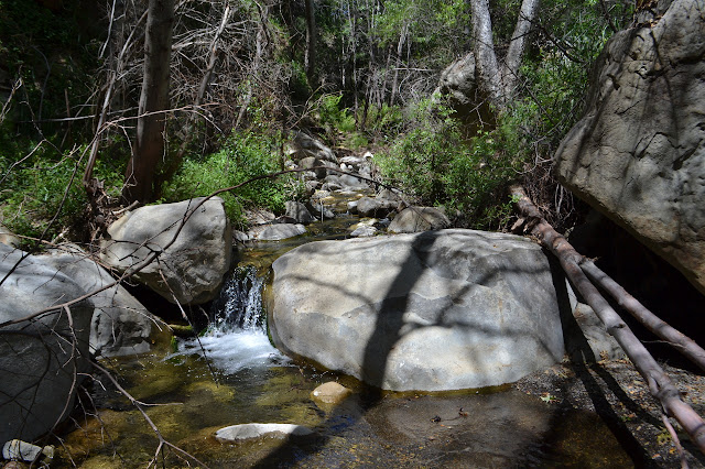
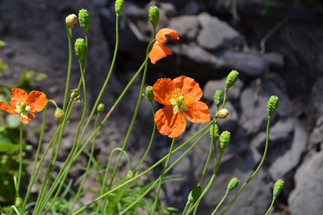
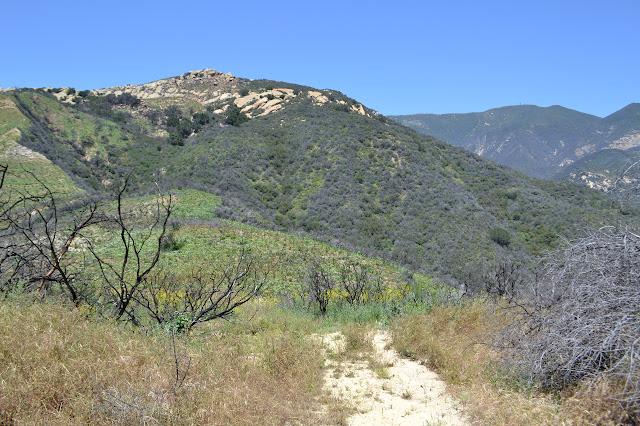
Nothing about this creek shows that there was a significant rain event in the area. It probably was running a few feet high as is typical of a good storm. The steep trail up even shows little problems from the big rain although it is not well constructed. I make my way up to the ridge in little steps. Across the way, the turn I missed looks clear enough. The road I followed looks like a much less attractive route. It is again not the day to poke my way up the pseudo Gato Trail that someone has cut, but it remains within the unburned chaparral. As I make my way back, the grasses along the top of the ridge seem to have been undisturbed for quite some time. It worries me as I wonder what difficult crossing might still remain.
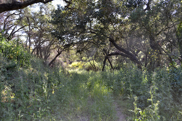
The fire touched this ridge and even crossed it in some places, but for the most part this is where it ended. After more than a mile, it does start to look like someone may have come this way in the last few weeks. Thistles appear again as I go, but this time they are not pushed away from a well used track. At least they are less dense. There are some unmarked junctions along the way, but it is generally a matter of keeping right and avoiding the gates, even if they are open, to continue on. I remember a stand of oaks for bringing me cool when I needed it and they seem to have been spared.
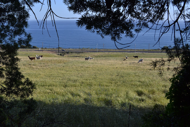
One very large oak has come down onto the trail. Another nearby is marked with the same "killer tree" tape and I give it a wide and quick pass. Then there is a confusing junction next to a well. A sign that spins points off where there does not seem to be a route. I follow road down as far as it goes in that direction. It is not far before there is nowhere to continue. I am tired and just feel like going down the road off the ridge. A truck passes along on the road out in the canyon which makes me think of that route so I just go following its route out. It is quickly clear that this is not the road I meant and in the wrong canyon. Still, the way out is obvious. Still keep right, for the most part, and avoid the gates. It means I get to stop by the llamas again.
As I make it back to the camp and a bench and knowing I would not be going through more long grasses, I stop to remove some of the things in my socks that are stabbing me. The area seems devoid of people, but there is still a guy with a clipboard willing to come around and chase me away for not being a paying guest. The inscription on the bench celebrates a woman who helped preserve the surrounding land for everyone. Since he is here, I decide to ask him the best way back to the parking area because I did not much like the route I used before. He directs me along the same trail that goes right next to the trailers in the campground that I would have liked to have avoided. No help at all. I finish pulling out the stabbing things at the parking lot.
©2017 Valerie Norton
Posted 3 May 2017
Liked this? Interesting? Click the three bars at the top left for the menu to read more or subscribe!


Comments