Madrone Trail, Las Trampas Ridge, and the Corduroy Hills
Las Trampas Regional Wilderness
Click for map.
I finally noticed that the East Bay Regional Parks have a trails challenge on. In fact, this is the 25th trails challenge that they have done. They have descriptions for 20 trails in the park system and challenge folks to hike 5 of them or a marathon worth of miles. My original plan for Round Top closely resembled one of their moderate hikes and my loop around Wildcat surrounds one of their challenging hikes. They also have one for those hills I was glancing over at from Redwood that just happens to pass closely by three more of the San Francisco Bay Area Nifty Ninety peaks so I decided to try one as described. Well, as described with the addition of the tenth of a mile or so needed to actually get to the top of each peak along the way.
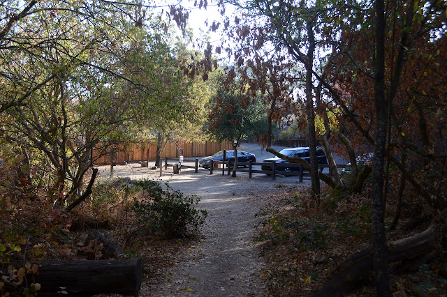
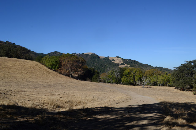
The trail is a little cool in the morning as it passes beside dry creek bed. I stop to ponder an old pump, then continue on. A junction offers a route to more parking or a shortcut for the loop, but my way is up. Up is a bit of work, but it comes with views, first through small windows past the trees, then bigger, and finally a few expanses. These really are the hills I was seeing in front of Diablo, so that Mount is part of the view rather clear view. A little mist is in the bottom of the valley, but it is burning off quickly.


This is another area where they have cows. I'm not certain what makes it a wilderness rather than park or preserve, but apparently cows can be a part of that. There are plenty of their fresh leavings to avoid on the fire roads and a few of them (actually, plenty of steers, too) to make their presence known.
Ringtail Cat ends at the Madrone Trail, and I turn right as prescribed. This crosses a field (with cows) and enters into the trees. Some oaks, black oaks perhaps, are yielding their leaves to fall while quite a few live oaks hold onto theirs. Further in are the madrones which also keep their leaves. The oaks are not small, but the madrones are just as big around and maybe a little taller. They are huge, especially compared to the little trees we get to the south.

The trail climbs again as it leaves the big trees (with cows down among them where there is water). I seem to be on that far field of grass I saw before as I climb. I was sure there were some wild turkeys moving about on it, but there is no indication now. As it tops out briefly, there is a bench with an ammo can underneath full of items to tell more about the individual it is dedicated to. The bench is faced for a Diablo view, which is almost obscured by trees. A bit odd, since there is quite a clear view to the north.

The trail continues around to another junction, and up it is again along Trampas Ridge. There is not so much up left, though. There is enough to feel, but after a few more little rolls of the trail, there is a short spur to the top of Las Trampas Peak, the first and highest of the set.


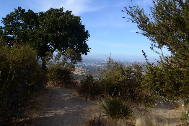
I spend a little time on the peak. I can't help but notice the peak south of me across a deep valley looks a bit taller than the one I am on. I was already wondering at the quality of this "nifty ninety" peak list with these clustered peaks all on it. Now I find that there is something taller right over there. In fact, it is a peak with quite large prominence of over 1000 feet. I'm sure these peaks have their points, but surely so does the one across the way that was missed.


I wander a little further to the next peak where there is a RAWS site just because and then back to the trail to continue the loop. It looked rather steep and deep to get across to the rest of the ridge. It is quite steep, but not so much down as it looked. Then the route I am on sheds the bicycles from the list of those allowed.
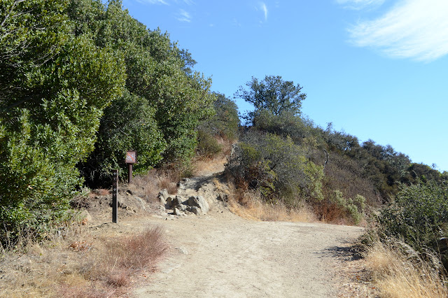

There is a bit more up and down, but it is not quite as steep as the road had been and never very long. Still, a bit of work. Vail Peak does not have an official trail up it, but does have a very obvious use trail just before the junction with Corduroy Hills. I enjoy the shady summit briefly before continuing on to the junction where the trail promptly sheds horses as allowed users.

From here, it does get steep. The first thing it does is drop down several tall steps. I elect to take the side trail around them. This area had not looked particularly rugged from around it, but it suddenly seems so when within it.

Eagle also does not have an official trail, at least not anymore. There is a sign pointing out how Corduroy Hills goes, leaving the third trail to be the peak. This trail actually goes quite a bit further than the peak. I try it out a little way, but it just keeps on going and has some nervy spots as it edges along very steep slopes. Back the way I came seems better.
The trail is still steep down, then comes to another gate this time in metal. After that, it is quite mellow down to a road. It goes two ways with no explanation, just a sign saying my trail goes to the left. Turns out, it is just a loop at the top, so it does not really matter which way I go. I head down the bit of trail that is steep road to return to Madrone Trail at the bottom. It has fewer madrones in this part although it does have trees. I pop out from under them just in time to enjoy a little sunset color.

The field up ahead looks familiar and then I spot Ringtail Cat Trail heading back down. It does not take long to take it down.
©2018 Valerie Norton
Posted 27 October 2018
Liked this? Interesting? Click the three bars at the top left for the menu to read more or subscribe!


Comments