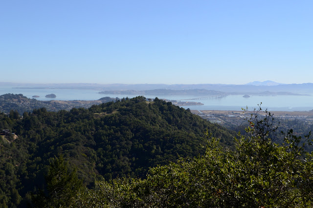
Mount Tamalpais from King Mountain, with a side of Knob Hill
King Mountain Open Space
Baltimore Canyon Open Space Preserve
Mount Tamalpais Watershed

Click for map.
Mount Tamalpais, which is actually just called "Mount Tam" by the people around it, is another one that one could be climbed by a long wiggling drive and a short stroll. However, I don't want to just be there, I want to have journeyed there. There are lots of ways to really hike up it, too. I chose one that looked like it would be an easy drive and let me loop around King Mountain before tackling the big stuff. Somewhere up a steep two-way road with driving down one side and parking, paved around redwood trees, or non-existence down the other, I found a gate and a turnaround. There are maybe five parking spots within a quarter mile of it, but the top one was free and I grabbed it. On a bit of a hill with no curb to turn into, so with the break as tight as I can get it and in gear and a bit of thought about maybe a rock under a tire. The trail is easy to find as the continuation of the road behind the gate and signed if I'm not sure.


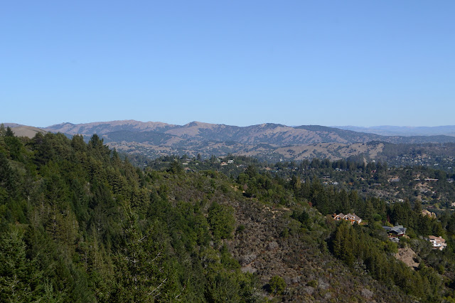
The Wilson Way Trail quickly connects up with the loop around King Mountain. Since I suspect it might be dark on the way back, I'm not really certain how many miles I have set before me to hike today, I will start off with the loop. I hand a right to better views of the bay through oaks and bay laurel on the south and east and through young, tall redwoods on the north side of the mountain. The loop has a few runners on it for the morning and, unless he has a twin, one guy is even doing laps.


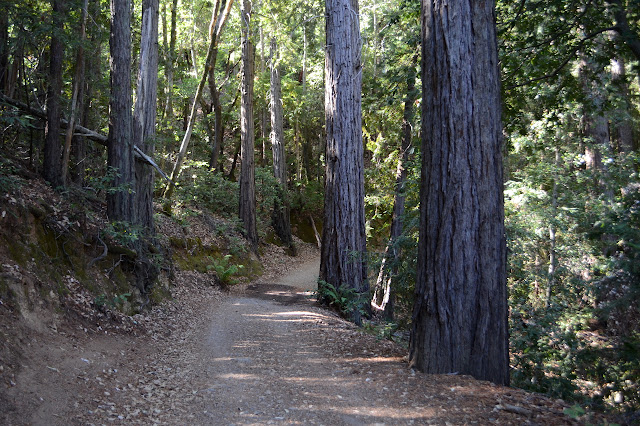
Nearly around the loop, there is an old road that went up to the top and a loosely locked gate across it. Folks go up from here to tag the peak, but I decided that with some taller peaks to come, I could be good and respect the private property. Most of the trail itself is on an easement. Just past the gate, there is trail down into Baltimore Canyon. I take it down. I need to cross the canyon to get up Mount Tam. The bottom of the canyon is full of larger second growth redwoods and cold as I make my way up the Dawn Falls Trail. There are a few huge stumps. The trail goes right through the middle of one that must have been at least 15 feet across. It takes starting to get up out of the canyon again to find out how the trail got its name.


The trail twists upwards in many short runs. I think I can hear voices above, but never see anyone, at least not until breaking out onto the fire road. The road gives a chance to go out exploring for a vantage point to see where I have gotten to before starting up the trail once more. I turn left as the trail ends in another one, then head right on a fire road as the trail crosses over. This goes over one bump, then around the side of Knob Hill until there is an old bulldozer track that goes out to the peak. The track is overgrown, but only a short section has anything painful on it. The manzanita and oaks and pines may all seem a little different, but the ceanothus in my way seems very much the same. The path of least resistance is not a path of no resistance and it stabs me a bit where it exists. The track opens up right at the top and there is a little bit of view.

After Knob Hill, it is a matter of picking fire roads to climb up Mount Tam. I keep turning upward, then working upward at what is generally a rather easy slope.


I miss the first opportunity to miss a long stretch of fire road for a steeper bit of trail at a sign for the north peak trail even though there is a helpful sign and everything, but catch it at the next loop even though there is not. The trail below is desperately in need of a trim, but there is a sign indicating the bicycles must be walked or carried along it. I see the sign as I walk out to a rocky lookout near the trail.


It is hard to pick out where the trail continues upward above the road. I start along the road a little further, but can find nothing better than a thin line that seems to vanish into thin bushes. Still, the lower trail is so obviously uncared for, this could be it. So I go up. I go very directly up. I find the trail twists a little to the side if it gets particularly steep, but more likely if the vegetation directly above gets particularly thick. It looks a lot like those trimmed tracks that peakbaggers make up peaks with no trail. If it got more traffic, it would have turned into a deep rut from being too direct in climbing the mountain. When it does come out at the paved ring trail at the top, there is a thin path going to the side of a rock wall that holds in the paving. The only sign is the number 8 for the interpretive portion of the trail. It seems likely it is not really a trail.

Searching for the trail I am expecting to take up from the paved ring to the top was almost as bad. I found it next to a bridge, but with no markings. Other trails have markings. It isn't that far up and I try it anyway. It is just a badly designed, if anyone ever actually did design it, but has had sufficient traffic to become a rut. In fact, it has become a few ruts and deciding which is the "correct" way is difficult. I fail as I shy away from more rut but still manage to come out near the fire lookout at the top.


There is a middle and west peak as well, so I am not yet done. According to the recorded heights, the west peak is actually the tallest one, although it seems likely that that was measured sometime around 1859 when it was first monumented, or 1882 when the geodetic position was determined and it was remarked, or maybe 1922 when it got a more standard couple of marks. This is before 1951 when it got flattened and all the marks destroyed, and it is only rumored to be 4 feet higher. Still, there seems to be a slight obsession with getting the west peak which was a military base and is now controlled by the FAA. Anyway, I want to get down off the mountain going west, but I manage to get that wrong too. My map shows trail looping around over the top, but following it down to the south just gets me to a chained off side of the trail up to the north. I get down to the lot without taking much official trail over the peak at all. Maybe the rest will go better. There are no trails shown in the direction of the road to the Middle Peak Fire Road, but as I plod the pavement, I am fairly certain there is one down there to the north of me. Even if it goes down instead of along, it can't get too far because there is a fire road coming up to meet the road below it. Trail would have been nicer, the road has a little traffic. Swinging onto the correct fire road and on up the middle peak is easy enough to get right. It has a rock outcrop between installations that seems to be the high point.


I head down, noticing the Earthscope set up not too far from the junction at the top. They are quite common along the San Andres Fault, after all. There were two trails down off the fire road and I want the one that is still signed, so that is easy to find, too. It flirts with the road before heading down on the north side. This I almost get wrong because I am expecting two trails and so do not at first suspect a higher use trail of being something funny until I see the sign for the junction below me. I head back and down and fix my mistake easily enough. Although... it probably was going to get up to the peak a lot faster and it is starting to get deeply into the afternoon already. Once I've found the official trail, I stick to it around to Rifle Camp. It seems to spend a surprising amount of time going downhill and I worry how steep the short climb back is going to be.

There are tables on every flat spot at Rifle Camp as though when they disallowed camping, they just brought out tables until there was no more place to put a tent. The biffys are still there, but tilting at scary angles and boarded up so that no one desperate for one needs to feel pressured to try it out anyway.

The trail going up is not steep at all. It seems relaxed in its wander upward to the old base at the top. The fence has been removed where the trail passes since the base is gone. It still has some buildings and a thin track goes down to the old swimming pool. I check it out (and look for a geocache) and find myself stepping into the deep end. It says 10 feet on the side, but the dirt is not even 10 inches down. Higher up, I am not sure if I want to stay inside or outside the old fence to head up to the peak. The old outside fence is removed in several places, so it doesn't really matter. I ultimately pass through where a utility pole was placed. There is trail all the way up from there.

I move around the FAA fence (which is basically signed don't mess with the equipment or we'll prosecute you for attempted murder or worse) looking for another way down, then decide to just stick with the way I know. My original plan was to wander even further west before making my way along the various trails along the south side of the mountain, but it is clearly too late for that. Instead, I take the road back to where I started around to the north side of the peak and grab a direct trail down to the trails along the mountain. The Miller Trail is surprisingly direct at getting down. There are built steps at first. As the crevasse it follows becomes a steep canyon with a growing stream, the steps can be quite steep. I follow it carefully to the second fire road it crosses, then turn east along this. The road makes a long and easy way back toward Knob Hill. The south side of the mountain seems to have a lot more water coming down its creases.

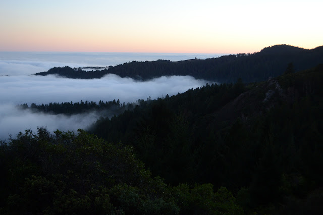
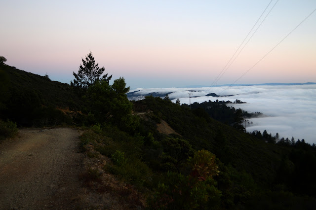
The fog comes in in the evening, but then thins again as it gets dark. The lighted city below is beautiful and seems to be wearing a flowing gossamer cape. It is quite nice walking the road back under the moon. Well, I spot three bicycles coming down one trail and then get startled 20 minutes later when they pass by me, but otherwise it is relaxing. I had more thoughts of taking various trails down which, now that I look at them, would require taking other trails up and over an extra ridge to get back to the car on King Mountain. I miss the cutoff trail to go around Knob Hill, but only because I neglect to notice it is the same as a trail down to all the extra stuff I had planned before for the first few feet.


Once back on the trail I came in on, it is easy to get back. The only difference is taking the short way back to Wilson Way Trail instead of the long way, and that is simple enough to do even in the dark. All the other spots seem to be taken as I let go of the one I took. The GPS says I just did 20.8 miles, so it's probably a good thing I cut out a few things I was thinking I would do.
©2018 Valerie Norton
Posted 21 October 2018
Liked this? Interesting? Click the three bars at the top left for the menu to read more or subscribe!


Comments