Redwood Peak and the Ridge Trails
Redwood Regional Park
Roberts Regional Recreation Area
Click for map.
My original thought for Round Top in Sibley Volcanic was a short hike and then take off for a longer hike at Redwood, but I went and gave it a little more time like it deserved and then there really wasn't the time for the longer hike after. So now I am back to put that previous plan into action. After accidentally going down Pinehurst (scariest road with a painted double yellow line I've ever seen as the outside is slumping downward and the inside doesn't have enough room to travel and there is traffic so you better stay on your side anyway) I was done driving and parked at the intersection where there are some dirt spaces. A proper parking lot is not too far along if you can stick to Skyline. The Ridge Route cuts through here for easy access to the park, so I can just start at the corner beside a park bench and get a little climbing going before dropping into the top of the valley.

The trail pops out at a road full of people and I turn right, taking me to the parking lot where most of them started. The lot is nearly full. There are maps available here and I grab one. I want to follow the West Ridge Trail until near the peak, then bag that thing and keep on going until I feel like it is time to return via the Stream Trail and East Ridge Trail, one way or another. As I continue along the road past the parking lot, there are fewer people. This side has more shade, but the day is not particularly hot in the sun. I seem to be hanging out with historic Juan Bautista de Anza again.

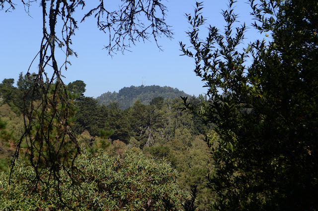
I get glimpses of view off toward the east as I go. Just over the near ridge, I can see some bumps that might be interesting to explore. I look them over while lounging on a bench with my snacks, then return to here. I still haven't even gotten to the peak.

Here has a sudden bought of civilization as I come to the edge of the Chabot Space and Science Center. The trail crosses a road and flirts with the complex. There are at least two domes for telescopes and a hint at exhibits as I walk down a steep hill from the buildings. Another road crossing, and it is back to trees and nature.

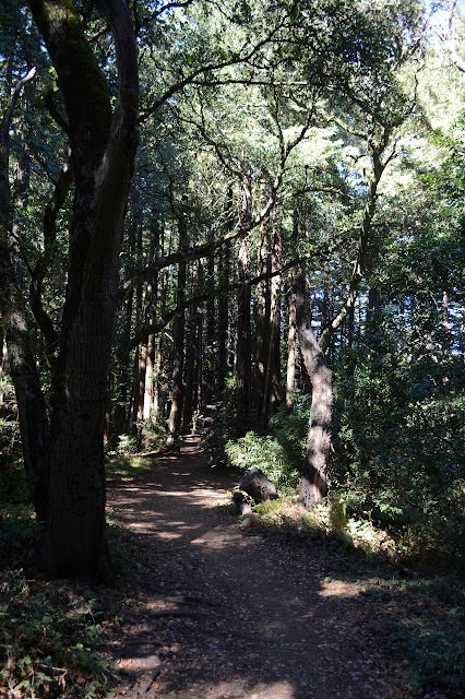
Well, there is a slightly developed natural area with picnicking and such, but then it is just trees. Young redwoods with eucalyptus mixed in compete for the light. Also, it is time to make the turn for the peak.

The trail slides past the edge of an archery range that is fenced for safety. It is part of the "and such" from before. There are no views from the peak, but it is still a fun little thing. The old benchmarks remain as do a few other marks.

I decide to take a bit of trail winding down into Roberts Regional Recreation Area to the southwest before coming back to the ridge and finding my way down to the creek. It takes slightly more backtracking than just to the ridge, but very little.


The road swings back toward the West Ridge Trail and passes by some of the tallest bay laurel I have ever seen. I have some thoughts of maybe transferring over to a different trail that the map shows. I can see the Golden Spike Trail distinctly, but it separated by a tall cliff. Never mind.

The road gets more open and sunny as it starts to climb. I only need to navigate one unmarked junction to get back to the West Ridge Trail, but having the map makes that easy. Then I manage to accidentally shortcut a bit of trail while poking around for a geocache I thought was well off trail. It is so far off trail it is on the next one. There was a very nice trail leading toward it, so it is probably a regularly used path even if it is not official. I take Chown Trail down the other side and it is particularly shady and thick with trees. It is also on particularly steep hillside.

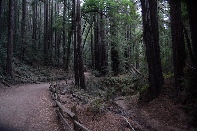
Once down to the creek, the Stream Trail is another old road. It even has old pull out areas with tables. The creek is dry, at first, but as I check it along the way, there are some small pools left. They don't look like they'll last much longer. The map shows drinking water up ahead and I am skeptical, but then there is a dry drinking fountain. Just to find out, I give it a crank. It is still dry. So not really.
The Stream Trail isn't really what I'm looking for, so I head up the next trail to the East Ridge. There are a lot of people out on it now, especially joggers. The sun soon vanishes behind some hills although the sky is not yet colored and the joggers thin out quickly.


I wander back in the few colors that do come and then the dying light. I suppose I am vanishing quickly from these trails, too.
©2018 Valerie Norton
Posted 25 October 2018
Posted 25 October 2018
Liked this? Interesting? Click the three bars at the top left for the menu to read more or subscribe!


Comments