San Pablo Ridge to Wildcat Peak
Wildcat Canyon Regional Park
Tilden Nature Area
Click for map.
There's been some shuffling going on and then other shuffling and driving a truck halfway across the north end of the country and then being more than done with that and I really need to get a hike going. What is near at the moment and big enough for an all day extravaganza is Wildcat Canyon Regional Park, one of the East Bay Regional Park District's parks. They have a site for each of their many parks and supply PDF maps, so it is easy to plan something. I planned to go up Wildcat Peak with plenty of ridge journey on the way and canyon journey on the way back starting from a handy end of a random street that has access and, as it turns out, pretty easy parking even around 10 AM, which is a little late for starting an all day extravaganza.

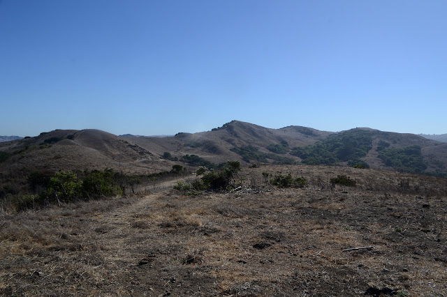
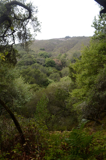
The road has a locked gate, of course, with a latching hiker gate to the side. The area is rolling hills of dried grass dotted with tufts of trees and stands of chaparral. The San Francisco Bay becomes part of the view quickly. Oh, and there are cows. They are supposed to be here. Just a part of the park.


While it is not yet particularly hot, it is nice as the trail wanders into a shady wooded area. The woods are a mixture of conifers and eucalyptus and stand quite tall. The trail rolls around to the edge of the trees then along that edge before climbing away, just a little bit more with each roll.

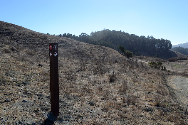
The trail splits and I fail to interpret the sign at the junction as meaning that the main trail goes off around the hill to the left while something of no note goes off to the right to an end. It does not matter, because I decide to take the thin, unmaintained rut of trail up and over the top instead. It feels like the lots-of-extra-climb route at first, but turns out to be the shortcut on the short way down to the main fire road. Once back on the road, there is no more need for such choices because it starts hitting near the tops of all the bumps on its own.
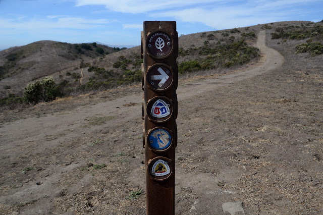
The sign posts along the way seem to be gaining trail crests. At first, it is the Juan Bautista de Anza crest that pops up all over the place along the coast. I have run into it in Thousand Oaks and San Diego and Simi Valley, I think. Always in near-urban locations. Then there is the East Bay Skyline Trail, which sounds like it could be interesting. Now there is the Bay Area Ridge Trail, which seems to illustrate a full hiking trail around the bay. That could be interesting , but the reality is a little different from the illustration.

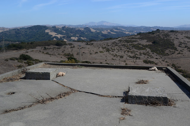
My path takes a turn to avoid a hill and becomes paved suddenly. I am not too keen on the paving, so follow a path up the hill again. There is more paving up there as well as massive cement blocks. It is an old Nike missile site, another sort of thing that one can bump into from time to time along the coast. This one seems to have been quite large.
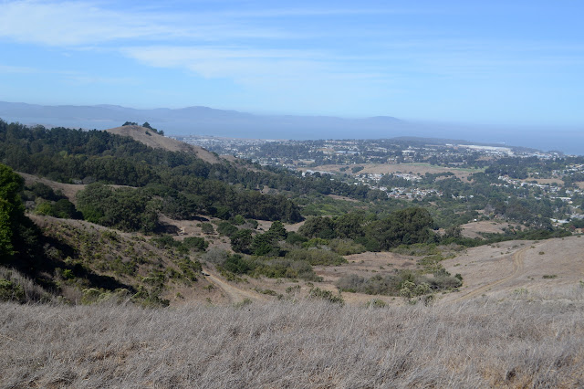
Trails go down the south side and the east side to reconnect with the paved road the fire road has become. I head down a track that shows its cow based origins as it finishes up under some low branches of trees near the road. I stay on the road a little while as it crosses cattle guards, then stay to a dirt path that slowly drifts away from the road. Halfway along, I can see the top of elaborate signage for an entry into the lands around the reservoir. The online map mentions required permits for hiking in that area, so that probably explains some of the elaboration. I have plenty for today just hiking the length of the park and then the mountain. The mountain is getting quite close as my path closes back on the pavement just short of another cattle guard and a junction.

Near the junction is a sign explaining the cows. They are part of a demonstration project. The sign asserts that while uncontrolled grazing was the cause of quite a lot of invasive species flourishing on these hills, controlled grazing at the right times will actually make it easier for native plants to compete. They are also meant to reduce fire danger. They certainly have given a lot of the hills a rough mowed look. The junction requires a little navigation. I turn to climb the mountain rather than traverse the north side of it. There seems to be some clouds moving in, so I better hurry.

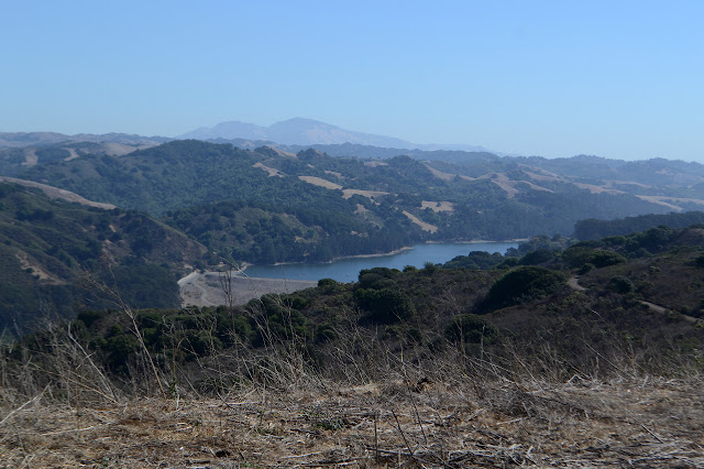
The route to the top of the mountain is easy enough to find by simply moving upward. The top has a platform built of rocks ostensibly for viewing the Peace Grove below. The clouds obscure that side a bit, but the rest of the view is murky but there. A fellow up shortly after me helps me out with identifying the distinctive bump across the bay as indeed being Mount Tamalpais (or rather "Mount Tam"), the high point of Marin County.


For heading back, I plan to make my way down the peak trail, maybe stop by the educational center, then head up the canyon back to the car. Excellent thought to put the canyon second as it would already close off my views and it doesn't matter what the clouds, which seem indecisive, actually do to also close off my views. I start down that more traditional route, pausing for a loop around the trees. They decided to honor Angela Merkel this year, although she is way at the back.


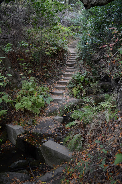
The route down is heavily forested. It is variously thick with eucalyptus or bay laurel. I eventually leave the Peak Trail for Laurel Canyon, which comes in road and trail form. The trail can be quite steep and leaf covered and seems to be going in quite the wrong direction according to my tree addled sense of direction.

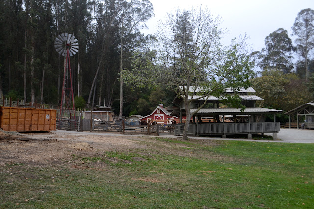
The trail is not going to wrong way. It puts me out right by the educational center for the area. They have a barnyard and all sorts of other educational things for the city kids who are probably subjected to at least a few field trips here over their elementary years.
No signs point me toward Wildcat Canyon, but it should be past Jewel Lake and there are signs for that, so I go to see the lake. It is a small reservoir built quite some time ago and has signs telling about it. Currently, it is utilized by a few birds.

No signs point the way to Wildcat from Jewel Lake either. It should be along the road, so along the road I go. It does not quite seem to be in the canyon, but is certainly not out of it. When I can investigate it, the bottom of the canyon is surprisingly close. It really is just a little way to my left. The road keeps noting that there is storm damage, but there is not much to see. Eventually there is a sign for entering Wildcat Canyon as I exit the Tilden Nature Area (which has the education center and a few other things).

Trails head upward often, each through a latched gate. The cows are not allowed down into the creek area of the canyon. Many of them are signed with the name. I am looking for Bonita, but end up just having to guess at it in the growing darkness. It comes after a picnic area and my guess is correct. The canyon is not all that deep and soon enough I am back at the car before the curfew on the sign.

©2018 Valerie Norton
Posted 19 October 2018
Liked this? Interesting? Click the three bars at the top left for the menu to read more or subscribe!


Comments