Clam Beach - Strawberry Creek to Little River
Clam Beach County Park
Little River State Beach
Moonstone County Park
Click for map.
Back in Arcata, the obvious hikes are up under big trees or out in the dunes. Little River is a pretty little spot when zooming past it on the freeway, so I decided to go for some beach and/or dunes hiking to finish up there from Clam Beach. Perhaps now that I have learned to stop fighting the gentle downhills so much, I might be able to get across the really flat stuff without much pain too. Anyway, it is just 2 miles or so and I have managed that much flat before. There are a few lots for Clam Beach. The first one is at the corner just short of the campground and has a sign that is easy to miss. The lot is unpaved and seems to have been the staging ground for an old road on the dunes once.

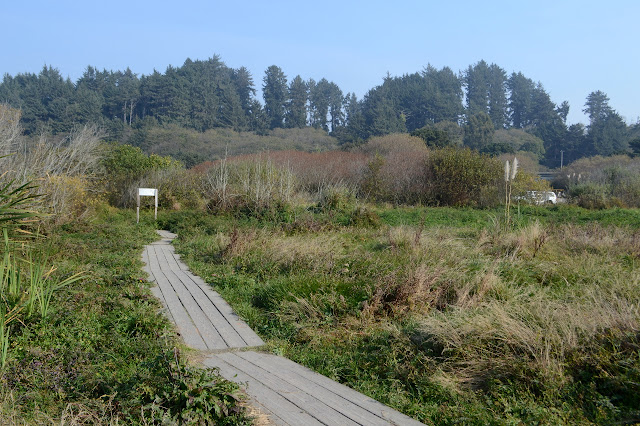
A very well established trail of gravel passes by another sign warning me to take my valuables with me. A bit of boardwalk crosses Strawberry Creek and from there the most obvious trail powers its way down to the beach. There should be something somewhere, but I miss it. It will be the beach then.


This is all tsunami zone and signs marked the entry into it to make sure everyone is aware. More signs warn of rouge waves claiming I should never turn my back on the ocean. Right now, it is a rather misty ocean. I can just make out the headlands at Trinidad. The beach feels so vast that it seems odd to think one of those waves might come up it, but then rouge waves are a lot bigger than the ones generally lapping at the sand and slowly coming higher with the rising tide.

A spot to my right by the dunes is distinctly more wet than the rest. Strawberry Creek, now joined by Patrick Creek, has sunk into the sand but the waters is briefly visible where the sand is low. Their progress into the ocean is invisible today. The freeway does not offer much noise here, at least not sufficient to hear it over the surf. Behind it, the hills are set with a few houses.

The distant headlands sharpen up as I get closer. Not just that headland, but the various stacks start to pop out of the mist. They have a sharpness down their sides while seeming more smooth and welcoming at the top.


There are a lot more people as I approach Little River. Moonstone must be a very popular beach. I had expected the river to be the end of the line for me, but it really is a little thing. It probably helps that the rains have not yet really started so it is now at the end of the summer drying. The water is not swift or deep or particularly wide. This is quite clearly demonstrated by a stand up paddleboarder taking advantage of the water to drag his board behind him back to the car.


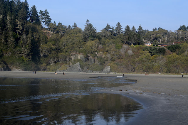
Getting past Little River doesn't mean more miles I can go. In less than a quarter mile, the beach stops abruptly. Here the rocky coast has decided to make a stand against the relentless ocean. I can get around the first rock easily with just a little timing, but there is more after it.


Tide pools exist in the rocks, but there seems to be nothing living in them. Maybe a little kelp. Once I stop looking for life, I notice that the rocks are quite interesting. Most of it has maintained a rough, pitted texture with sharp edges, but past a distinct line it becomes very smooth. I wander back, now along the cliffs, finding more interesting features as streams carve caves and glens on their way to the ocean.


Continuing along, I decide to head back along the edge of Little River and the dunes, if I can find a trail going that way. Got to wade across the river on the beach, though, it widens and deepens into a bit of a lake above the beach.

Many footprints already follow the edge of the river, so I suspect I will find a few trails to choose from. The mud along the edge looks a bit like a tidal flat and I wonder how high up the tide will come. It probably gets plenty of salt into it even if the usual tide doesn't reach.


The river comes down the hills more directly toward the beach before taking a big bend northwesterly prior to its exit. At the bend, it digs deeply into the dunes, so I have to retreat a bit to avoid more wading through water. Even so, the wet sand I cross is particularly soft and I sink up to 4 inches with each step. At least it does not grab and suck at my shoes. There are many trails through the dunes after the bend. There are even signs marking off the state beach area as closed to dogs and horses and other parts closed outright.


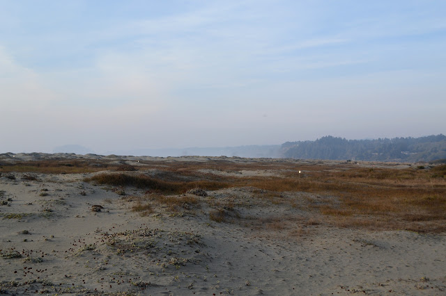
Walking through the dunes does take a bit more energy. The dry sand is loose and sucks up the energy I push into my feet. The hills are quite small, so any up is short. There are a few entry points and even a few signs to give trail directions. I am on the Nearshore Dunes Trail, finishing it at the South Beach Trail. The arrow only points back the way I came, anyway. There seems to be more trail continuing my way, so I take it.


Getting back to the start is made difficult by running into the edges of Strawberry Creek. I don't really feel like slogging through it, but I apparently already crossed it without noticing. I just follow a different trail closer to the beach and get around to the boardwalk to cross back over to the parking area. There is still a half hour until the gate on the lot gets locked, so I take a moment to check out this end of the Hammond Coastal Trail. This seems to be 5 miles of ADA compliant trail running from here to the Mad River Bridge. If you need that, it is certainly the longest piece I have ever come across. It also gives me a chance to see Strawberry Creek as a creek where the bridge crosses it.

©2018 Valerie Norton
Posted 24 November 2018
Liked this? Interesting? Click the three bars at the top left for the menu to read more or subscribe!


Comments