Hennessy Ridge and the world's largest tan oak
Six Rivers National Forest
Click for map.
After finding no trails coming up to the ridge and the "world's largest tan oak" from near the rest area below, I drove up to Hennessy Ridge. It feels silly to drive more than 10 miles to get 0.9 miles away, but there is some climbing as well. There are a couple roads up and the one signed for Hennessy Peak is not bad. It was once paved for the length from the paved South Fork Road up to the ridge, so has a few deep potholes to look out for. Once on the ridge, there is a spur road. This was paved once for a short way, but after that is often one lane and, since I overshot the tan oak, eventually has areas where the vegetation drags along both sides of the car. I parked at the edge of a longer two lane section just past a blocked road heading up to the ridge that I hoped was the higher ridge route shown on a map I looked at before but do not have.
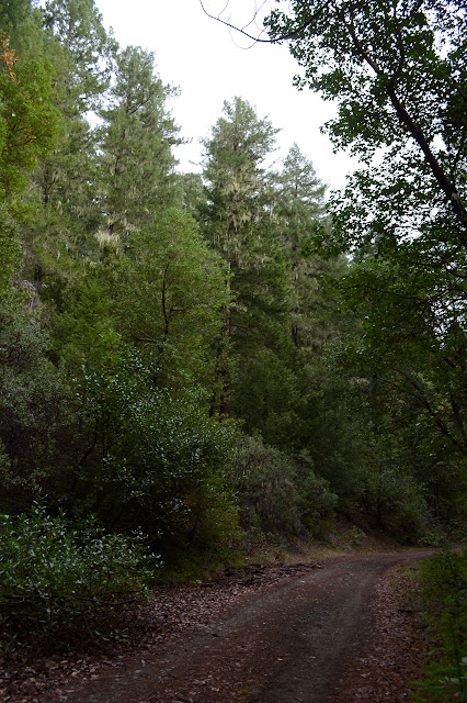
The clouds are still rising and just barely rose above the road as I got to the ridge. It means I can see the trees, at least. That is about all I can see anyway. The old road is blocked with a high pile of dirt that has a well worn path around the edge. The path makes me think it might be what I am looking for to meet this big tree.

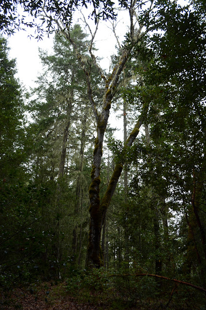
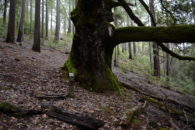
The old road goes quite a ways in the wrong direction before finally coming to the edge of the ridge and turning upward. A huge tan oak presides over the turn. I am rather surprised to see rubber water bars crossing the road as it climbs back the other way. Someone has put an effort into this route. It is definitely the one I was looking for.

The road splits with no indication of why. The right hand one leads to the tree, but after the start, it is hard to follow. The more direct route goes steeply down, but I go for something a little less steep. There are fallen trees and one has been cut to give a pass through for a trail, but there is very little of such. It might cut back the other way to meet with the steeper route, but not long after that everything is lost of a trail. It doesn't matter anyway, I can see a rather large tree to head toward.

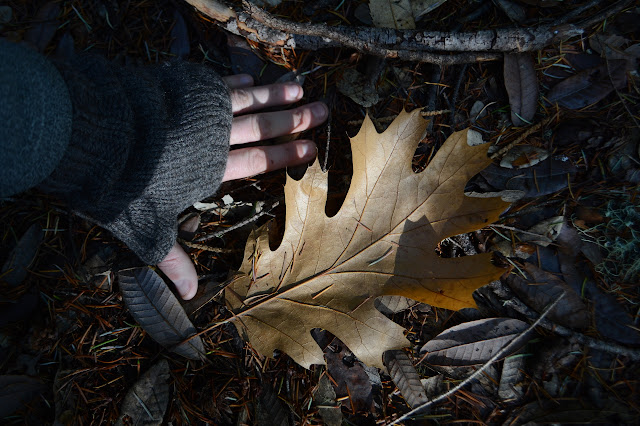
Getting down to the tree without trail is easy enough. There is plenty of clear forest area although there are also a lot of fallen trees in this particular area. There is a post for a plaque or something to the side of the tree, but whatever it held is gone now. The tree is more important anyway.

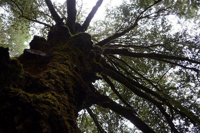
Squinting at the lowest of the high leaves, I can see the sharp points. This is the same as the oak-like trees that form much of the higher understory among the redwoods. This is certainly not the tallest. Some of those down on Grasshopper Mountain were taller.

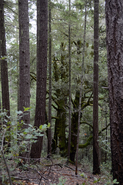
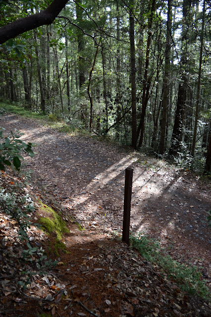
Looking around the tree, there are some interesting details. There are a lot of spots where other trees were, but have either rotted or burned away. There is not much evidence of fire. Further out, there is a ring of signs forbidding equipment behind them presumably part of a legal protection for the tree. These plastic signs are all warped and shrunken from heat, which is evidence of a quite low fire. Oh, and not too far away is the road with a perfectly good little trail climbing up from it next to another post that has also lost its sign. I remember seeing it on my drive past, but had forgotten it again by the time I turned around. The car is only a little further than around the corner from here.


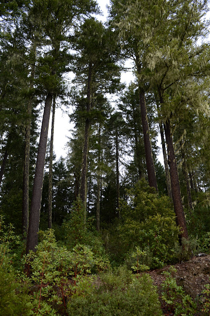
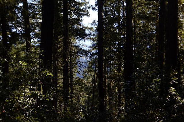
The sun finally comes out while I am exploring. Although it would be very easy to go back to the car, I think I will go along the rest of the ridge top route. I am just really enjoying the lichen hung fur trees and looking around to see if this tree isn't even the largest on the ridge.
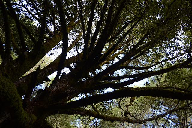
And so I make my way back up to the road above and start following it south gain. There are a few big trees, but when I look more closely, they are conifers instead.

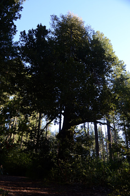
The ridge route comes out onto the main road with no blocks at all except for a full coverage puddle that could hold anything below its muddy surface. There are a couple dispersed campsites up at the top well away from the tree. I take the road back with one last quick visit to the tree. There is another big tree below the road along the way, but it is a madrone. And not quite so big, if I get to really comparing. That really is a big tan oak.
I took the other route back to South Fork Road and found it to be a little less comfortable. From the spur to the first junction, it gets a bit narrow and there is even a warning sign for people going the other way that the road ahead is one lane. Signs indicate that the peak is further along. Taking the rightmost road, it drops down slightly and has some sections that are really one lane wide with a steep hill to one side and a drop off on the other such that there is no way to pass. Someone would have to give way if they met. There are a few rocks on it, too. The next junction is not marked at all. The middle road should be marked Hennessy Peak, but none of the resources I had with me actually marked the peak so I wasn't sure enough to go for it to bag the peak. Instead I took the road down. This had more long sections of very definitely one lane road including some where the brush underneath has been cut by the previous cars going by. The Scion still got through it all, although I did go ahead and move one rock off the road and a wet spot beside a stump nearly cut to the road level and a fallen tree on the other side to leave little room for choice was worrisome. The bushes made me wonder if there was something like a total blockage below that was keeping people from taking that route. Happily, it goes through and I didn't meet anyone coming up, but the first road signed "Hennessy Peak" is definitely the more desirable route.

Disclaimer: Although this tree is quite big and the forest visitor map calls it the largest, there is apparently a rather larger specimen on private timber land in Oregon. So it goes. Assuming they haven't cut it down yet.
©2018 Valerie Norton
Posted 9 December 2018
Liked this? Interesting? Click the three bars at the top left for the menu to read more or subscribe!


Comments
I also found a nice FaceBook post by the Six Rivers National Forest with a picture of the tree and the USFS employees at its dedication ceremony: https://www.facebook.com/SixRiversNF/photos/a.863405333678033/2408304869188064/
Pretty cool to see then vs now!
If anyone needs that clickable, click here!