Aubrey Hills - the needle
Arizona State Trust Land
Click for map.
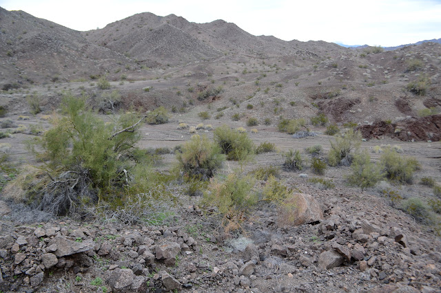
Today is a day for aimless wanderings, but I'm not very good at aimless, so I'll aim first for a rock some geocacher in 2005 thought folks should come out and visit (and indeed quite a few have since then) and then over to a selection of section corners that happen to be marked on my map. All this easily starts from wherever I happened to land the night before, which was south of Lake Havasu City. Something of the hills to the south has just been calling to me. I had tried for something on the Bill Williams River, but the road was muddy and marked not for camping, so I came back north a few miles. It's an expansive spot that looks like some developer got started but never finished. The rumors that come to me from other campers agree with this impression and add that one of a pair might be in jail now. It's a bit far from anything for houses, but if you build it, they will come.

The geocacher actually left sufficiently detailed instructions for getting to his rock including a parking spot in the wash just north of the one I'm in and then follow it around just so. I see an interesting line of ridge that leads to it, so that's my route. Road leads upward past narrow terracing and swings back to a flattened mountain top while another starts off toward the ridge only to stop suddenly. They won't get me far. Trail continues along the ridge after the road finishes, so I am not finished. Beyond it, nothing more seems cut and sliced, at least not by potential developers.
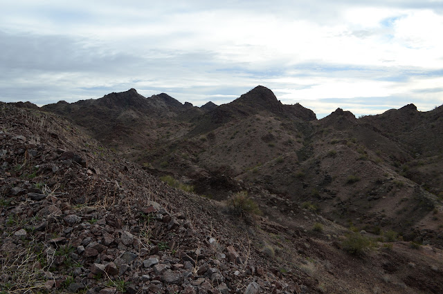
The trail fades quickly from a well used track to a game trail. It is a tough trail to follow in spots and I tend to lose it around rocky ribs of the mountain. The slopes take sudden turns to being difficult to walk along, so I make my way down to the wash below where people have been driving. The wash suddenly narrows at a hard layer that has left big rocks on either side and I figure it is the end of the line for the drivers, but some of them actually do manage it. They probably go up and over one side. There are more and smaller constrictions, but at least one set of tires has managed them all. I climb out as the wash is getting as rough as the ridges but the ridges are getting smooth again. There is a game trail waiting for me to follow along. It splits and braids, and sometimes seems harder to see when on it than off it, but there always seems to be something making about the same route choices I make.


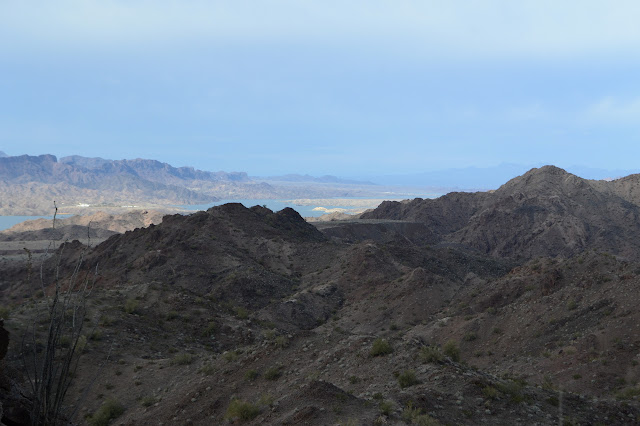
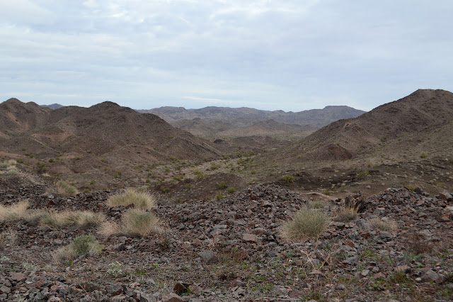
The trail swings around to start down the side of another, larger, wash. I have gotten high enough for views of the river now. It seems unlikely I want to go along with it downhill and the map seems to agree with me. I turn back to the high point to find that I should have been looking back once in a while, too, and there is another bit of trail turning upward along the ridge line there.


The dammed river becomes more expansive as I climb and eventually parts of the dam are visible. The trail I am on now is a little easier to follow than the previous ones and I wonder who might have made it. It is too narrow for burros and horses. People tend to drop a cairn or two along the way, especially at junctions and although I entertain the idea that a trail came up from the other wash for a moment, people tend to make a wider trail too. A single use of a motorcycle could be all it would need, but eventually one of the steeper slopes would throw that rider. There is very occasional evidence of deer or goats in a few prints and piles of leavings. They do not come up often, but they are certainly using this trail. It is a bit wide for them, but given enough time in an unforgiving and generally unchanging environment and their trails would widen.

The country gets particularly rough and my trails start to vanish again as I get closer to the jewel, as it were, of the ridge I am following. Well, the first of three particularly pointy bits on the map. Navigating them is taking a lot of picking paths for each few feet gained as I get over the edge to spot the wash I was directed to move along. It is wide and flat and open and, above all, easy. I continue to pick my way along broken rocks on a slope as that easy path I was saving for later becomes more apparent with its easy road right up to a very distinctive rock.


Picking my way along the ridge itself if getting to me, especially with an obvious easy route spread out below. I got halfway there along the ridges, but the easier route picking is down off them, not along them. I head down. It offers brief challenges instead of constant difficulties. I could follow the wash down to the road, but it would be much shorter to navigate a wide wash area. I'm not yet looking for that much easy, so I wander over the low hills that offer almost no challenges at all for foot placement.


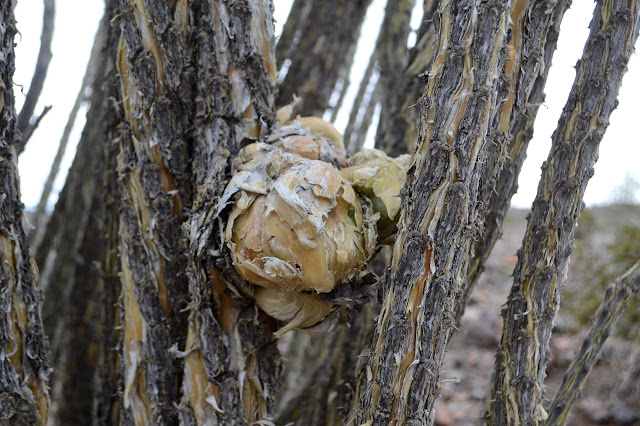
Of course my views from down in the wash are somewhat less dramatic than they were above. There is no river/lake or distant mountains or distinctively different flats off to the southeast or anything like that. But there is that rather attention grabbing rock. Walking the wash is not quite as easy as I'd thought because the sands have been turned up and softened by vehicle traffic where they haven't been hard packed instead. The wash splits and I debate which way, eventually going right in compliance with directions. The route follows the wash until it suddenly launches up onto the ridge line to wind toward that rock. For a moment I think someone has splashed a bit of stark white paint over part of it before realizing it is a small keyhole right through and the white is from the clouds that cover most the sky today.

I needn't have been too worried about which road to pick before. Apparently all roads lead to the rock. No fewer than three arrive at the top of a knoll just to the north of it and they join forces to continue on south to a turn around just short of the rock itself. A definite people trail approaches from the south.


The rock has more secrets than just that keyhole for those who venture to see it up close.


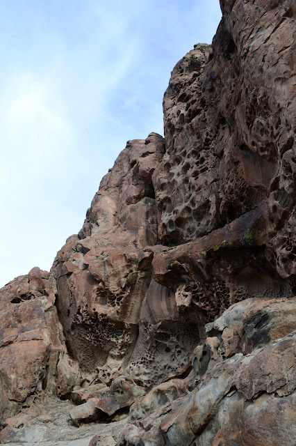
I take quite a bit of time to check out the rock before finally going to locate and sign the geocache beside it. It certainly is a rock worth showing off to others. Somehow I do not even ponder climbing it, though. After some lunch, it is off to more searching. The first section corner is not far at all. I take the road to the east, then cut north to find first a wooden stake. Disappointing. I keep looking and there is a cairn beside the monument. Better.


Up on the next hill are a series of large cairns, so I go up to investigate them. By the wire and nearly decayed wood, the surveyors left a post here to sight off of. As I finish, I glance up the ridge to see the most curious thing. Parallel sets of tracks follow along it from the road above. Could it all have been here since 1915? Would they even have had a truck to use back then? The vehicles of the time have always given me the impression of a narrower wheel separation than is on display here. It could just be that some surveyors have been around since then or that someone was curious about the cairns and drove their way down then backed out again in their heavy 1950s Suburban.

Then it is off to the next one and see what I can discover in between. Since corners are typically a mile from each other, it will be a longer walk. It is across the fingers of land formed by the washes and one short pass. I have spotted a possible for the pass, but it is never what it looks like. It's always something behind it. Still, something to aim at for now. I could follow the washes down and back up or just trot my merry way up and down and up and down and up and down again in the more direct route. Of course it's going to be the more direct route.
The game clearly do not approve of my route choice. I alternate between paths covered in wheel marks down in the washes and thin mystery trails running along the middle of the ridges between. Still, it is not hard to travel between the ridges and the washes, so I like my path. The low pass is the low pass in question, so my aim has been true although I miss the trails to go up it the most efficient way. Down the other side, I only have to follow the wash down and the next corner will be slightly up the side to my left. I scramble up a side wash that seems to have had way too much water in it recently for its size and quickly find the corner. It is slightly newer from 1916 and has a slightly smaller cap.

The third and last corner should be further down the same wash and then up on the left side again. This one is actually at the quarter section, so is only a half mile further along. There are far fewer tracks in this wash. Apparently it is a bit less popular than the others. You can't get out to the needle on it (probably). Still, there are a few tracks.


This last post gives me some trouble. The map puts it right in the middle of a river of stones of indeterminate age. If it is another 100 year old monument, would it have been before or after these ran? Still, accuracy is not quite good enough to arrive at a location and declare it not there. If it was just a tiny bit east, it would certainly be there. I wander higher and higher trying to look left and right as well as best I can.
Suddenly I spot it below me just to the west of the rib of stones. It really is here. It is another from 1916 and only marks the sections it splits, not the township and range. I have found 1.5 of 5 looking for corners before, so three for three feels pretty good. Now all that is left is to follow the wash down and find my way back to the south. The wash joins the more traveled wash as I pass the first and only ATV of the day and just short of the indicated parking spot. There is a junction of road continuing down the wash or north and south over the hills. I have thought about and discarded the notion of going up one of the random bumps marked on Peakbagger, but do follow the road up the flattened hill to the south since I know it will get me where I want to be eventually. It is rough as it climbs and that ATV comes up behind me as I near the top, but it is an interesting view. The ATV stops for it too, well off to my side, before continuing down the other side.

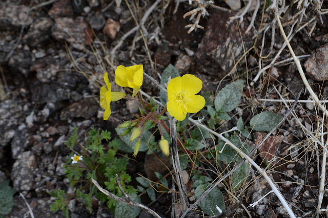
I go down after. There is one spot where the lupin, which is coming up practically everywhere high and low but just starting, is actually already in bloom. It's nice to finally see it.
©2019 Valerie Norton
Written 22 January 2019
Liked this? Interesting? Click the three bars at the top left for the menu to read more or subscribe!


Comments