Black Peak
Lake Havasu BLM
Click for map.
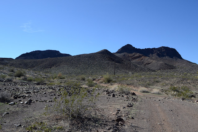
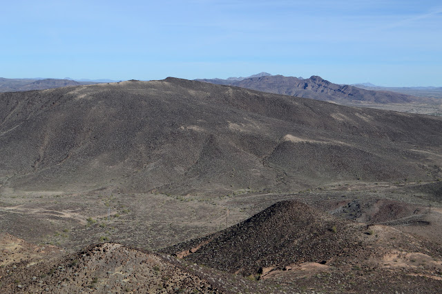
The cluster of three little peaks drew me to the area of Shea Road. I figured they would be quick to hike all together in a most, but not all, of the day sort of way. Antennas stand apparently to the west slightly of the top of the named one, Black Peak, which dampened my spirits a little, but one does come to expect this sort of treatment to peaks. The boundary for the Colorado River Indian Reservation takes a corner up there, so it has potential for an unusual monument at the top. I parked by the one closest to the road in a spot where there weren't so many campers. Practically any place will do along this stretch of road.

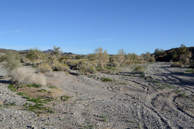
The wash at the far side of my parking area is full of ATV tracks and the buzz of the things, mostly on tracks across the road from where I am, is nonstop. There are quite a few out. The far side of the wash is a steep hill and then nothing of these roads and ATV playgrounds except one track beside a gas pipe running above ground. It is not going my way. My way is up. I select a slope that seems to be continuous rocks dark with their satisfaction of being right where they are for my ascent. The black here is desert varnish and the rocks are actually much lighter where not exposed to weather, but very few of them show it. The route takes me past a claim marker, but that is what developed this road in the first place.

But the rocks it takes me past! Such wonderful bits of volcanic rock. It is all pocked with gas bubbles, but in some they are so numerous that it is almost like a sponge while others only have a very few marring their surface. The ones with only a few seem to have much slicker surfaces which I discover is not a visual trick after a few slips.
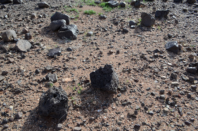

I just start chugging up the slope and the rocks are very cooperative. They are so very very black and not even showing chips from neighbors getting restless. These have been some settled rocks for a while although the slope is quite steep. When I come to slides that are all rock rather than rock embedded in dirt, they tend to be of a size that is very comfortable for the walking generally making nice sized steps.


Eventually the steep hill just sort of levels out. Once at the top, there are even a long used deer trails to choose from although they fade in and out so cannot be relied upon. They are hardly needed for navigation. The way to the top is up.


And then there it is with a bit of PVC tubing sticking up out of a cairn, but nothing else. It does have a register, one of the many set by Gordon MacLeod and Barbara Lilley to advertise the Desert Peaks Section of the Angeles Chapter of the Sierra Club, from 2003. It took 10 years for someone else to sign it and I'm on the first page. The nearby geocache has a different set of signatures, but not more.


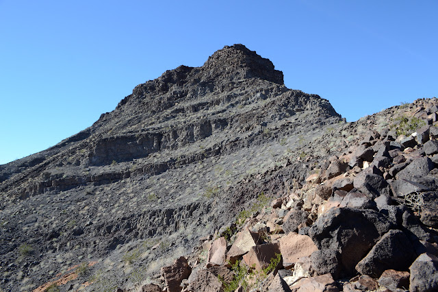
So a celebratory snack and off to the next one. The constant buzzing drone of numerous ATVs vanishes as I drop below the peak. I just sort of flow down the slope trying not to slip on those rocks that are particularly smooth. There is a rather large cleft turning into a deep wash, so I alter from my flow pattern a little in order to miss that, but then it is back to flow. The slope on this side is much easier. Below, there is a road that joins up with a power line road through the valley between the easterly peak and the closer grouping including the high point. This side of both looks like something I wouldn't want to touch, but I expect the same easy slope to exist around the back. I'll just go up what I can then wrap around.
So I follow the road to the power lines and the power lines in their route determined to rise and fall as much as possible, it seems, until at a ridge line I like, at least for a little while. It is a fairly easy climb for a while and even has some deer trails on it.

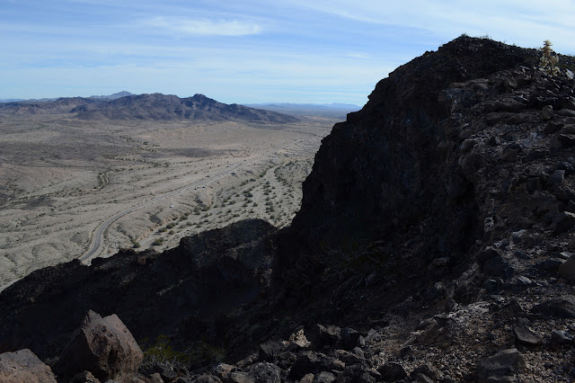
The saddle between Black Mountain and the south peak made it look like they would be really easy to do together on the topo map, but I sure don't think the climb from the saddle to the peak looks very pleasant or safe. As my ridge joins another south of it, I find that the hidden slope is as bad as the worst stuff I am looking across at. I edge up the ridge line instead hoping that those lines look better above, but they don't. The rock crumbles a bit in the spots where I need handholds to continue.
The deer track must actually be a goat track. I can see its lovely little path a little to the side of the ridge edge. It almost looks inviting. Here I am with my poles in one hand and a big camera hanging around my neck. Oh, and my shoes that are so worn I perhaps should have deposited them in the trash already. This is not really the preparation for a crumbling rock class 3 climb. Besides, I'm pretty sure there was something about the ridge top of this mountain that made me not want to travel it from this side. (Just look back at the pictures above. It is long and narrow and does a lot of up and down with no options to go around.)
And so, as utterly uncharacteristic as this is, I stop and turn back. There is a nice sitting rock to eat and enjoy the height I did get to and discover that my water wasn't crying wolf as it usually does at 1 liter left, there really are about three sips left in the bag. That settles any misgivings about leaving the peak unclimbed. That is roughly one sip per mile and out on the slope where the rocks are black and when the wind stops, it is actually a little bit hot today.

So I decide upon the return that will be the least amount of work around the west side, finish eating, and execute. Down the ridge I came up, missing the little bumps this time, and to the road. In spite of the apparent trail, much of the ground is so soft that I leave deep footprints like no one walks here at all. Once at the road, of course, it is very different. Three ATVs passed at one point, so it gets some use. I follow it out northwest until the up and down gets to me, then I wander over to follow a wash instead. The road never gets far from me, but while I just pick my way down a shallow slope, it still climbs and falls over and over. At some point, I need to turn onto another road headed north. One curling over the edge of the mountain looks like it could be it, but I wait for it to get closer. It never does until the other side. It was just a spur and would have been extra work to go and meet. Eventually I follow a fence line with scattered road attempts back north. As it turns west, I turn east across the tops for a rather direct way back to the little nearly empty camping area.
The camp is still nearly empty when I return. I want to hike some stuff further up the road and with plenty of light to find a camp spot, that seems like the place to go. Besides, the road will turn to dirt at the aqueduct and I'd like to know if it is dirt my car can handle or not. The camp is completely empty once I leave.
©2019 Valerie Norton
Written 26 January 2019
Liked this? Interesting? Click the three bars at the top left for the menu to read more or subscribe!


Comments