Looping Rattler and Camp Beale
Cerbat Foothills Recreation Area
Click for map.
The recreation area continues on the far side of the highway (and future I-11 corridor) so I went over to the Camp Beale Trailhead to check that part out. There is a connector under the highway, so all parts of the trail system are available no matter which trailhead is chosen. It is a couple miles between these two via the connector, and they are the closest together of the four available, so it is nice to choose the right one. This trailhead is much smaller and someone has destroyed a large sign that probably once held at least a little good information. At least the trash isn't overflowing.

I head out around the loop to the left this time. That way passes near the actual Camp Beale area which is accessed from a lot a little closer to the highway and requires a free permit from the city to enter. (Get it from the Powerhouse on old route 66 if going there.) As it runs into the connector, there is another sign and this one is in much better shape. It has fire restrictions from 2005 taped up in the corner, so doesn't get a lot of attention and the trails it shows have been added to since it was put up. The map at Coyote Pass is closer to complete. Nice new trail signs do help point the way. They don't happen to point out where Rattler is and my map suggests that maybe I should try going down the unmapped road, so it takes me a moment to find it just a short way further down the loop.

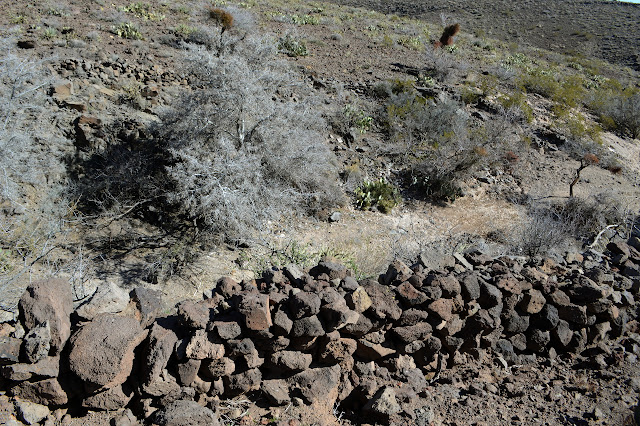
Up and over a hill, there is supposed to be a spring somewhere. I can see the well below it, but not much indication of spring. Climbing up the next hill doesn't help much, but eventually I can get there. I should have just gone up the creek bed between the hills to find it. It isn't much to look at. I wonder at the stacks of rocks along both sides of the canyon above it in long, purposeful looking lines. Perhaps to keep the cows out. It isn't doing it just now.

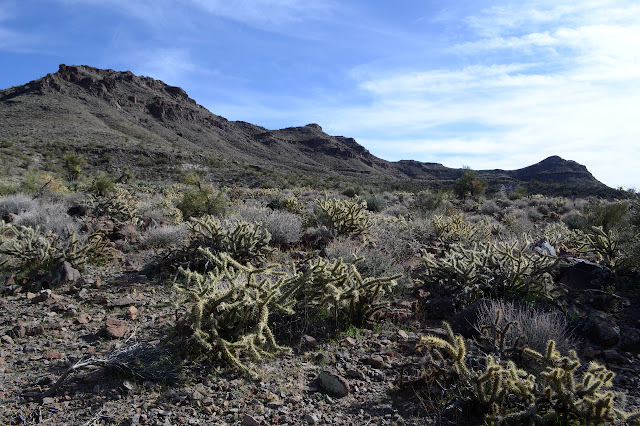
The spring is not quite as rewarding as hoped, so I go on. The trail crosses another canyon before climbing a little more determinedly upward. It must be said that the scenery on this side of the highway is a little more boring than on the other side. In spite of the spring in the area, the plants tell a story of much drier hillsides and are much more sparse with few of the stocky palo verde that grow around here.


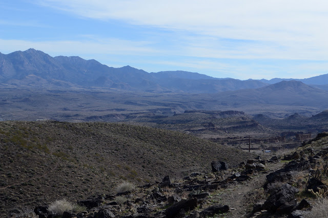
There is a little more excitement in the landscape on display as I reach a saddle and look out over the Badger Trailhead, which is another entry to this system that is only accessible while going northbound on US-93. It also must be said that this side gets up higher, so there is often a little more to see.


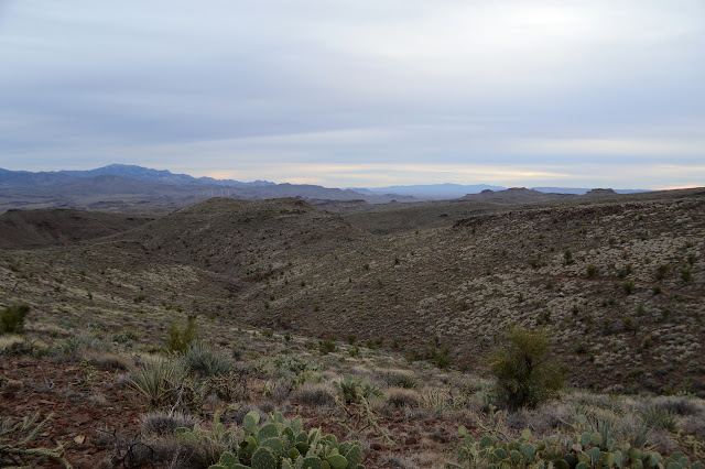
But as I look out across the gentle canyons and see the path of the trail, I am struck by how much it seems to be constructed for length. It lacks the feel of a drunken walk of the trails I was on yesterday only because it takes advantage of the long, low ridges between the canyons to gain length. It climbs as it goes up the canyons and drops toward the ridges, the opposite of normal trail building.


Eventually, I wind my way to a junction. My map says the trail just drops down into the valley below toward (but not all the way to) Badger Trailhead. The map at Coyote Pass says it connects up to another trail above. Not so surprisingly, it does both. I was planning to drop into the valley and then cross county to the trail above in hope for a little more directed route back to the start if there wasn't a trail anyway. The trail signs must be really new because here there are just a couple posts waiting to be placed in the dirt and a sign attached. The trail down seems to get there with a minimum of excess baggage then just sort of fades completely as it comes to an old road.

Gross Spring is somewhere up there. Big or disgusting? I backtrack a little from the road and climb up to it, but it looks like the road may have been going there too. It is piped for the cows, but pooling up anyway. It might have been big once but it is certainly a bit yuck now.

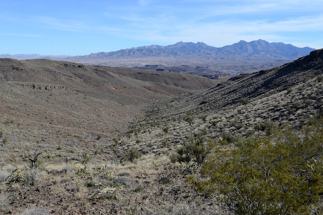
So up I go again. It's only about 400 feet to climb, so it is soon done. The rest of the climb takes a bit longer. It does not follow anything similar to what I would have done for a cross country route. There are still finger canyons to walk all around, so it goes out and back. It even takes a moment to wind upward very very slowly. A pair of cows stand as nearly stationary objects along the way to emphasis how little real distance and elevation I am getting with the winding climb. The first watches me closely as I pass, the second can't be bothered.
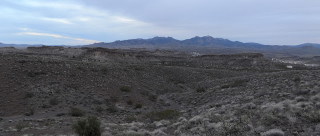
I look out expecting the trail to follow another finger of land out and back, but it turns and climbs a bit more to get to another junction waiting for its sign to be completed. This is Castle Rock, which will connect with the top of Beale Camp Loop to take me back is a more direct manner, or so I hope. It follows right along the top of the ridge and there is a little bit of a gully to it, but it goes. And it gives me some new peaks to look at.


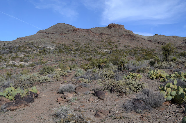
The trail splits. It is another thing not on my map but on the Coyote Pass sign, it is a looping section of Castle Rock. A little further and it ends at the top of the Beale Camp Loop as expected. There is another register and a newer map sign and benches at the junction which is also waiting for the new trail signs to be put up. The wind is picking up, so I do not partake in a bit of rest and take the left to continue around the loop the direction I started. This climbs down off the ridge and travels through the wash below. After a short bit actually in the wash itself, it climbs again to finally get back to the parking lot.
©2019 Valerie Norton
Written 14 February 2019
Liked this? Interesting? Click the three bars at the top left for the menu to read more or subscribe!


Comments