Cargo Muchacho Mountains - attempt
El Centro BLM
Click for map. (Green and blue lines for this one.)
After Stud Mountain, the other peak marked with a "1k" on its dot on the peakbagger map among the Cargo Muchacho Mountains is the unnamed high point. Well, surely I should visit the high point of this little range. For some reason, the surveyors have not seen fit to. They instead have placed a mark called Tumco (for the mine below) on the second highest point of the ridge a bit west of the peak. They placed their azimuth point on a peak even further west. That makes two more peaks I'd like to climb. The peakbaggers who have gone before (and offered any hint to their route) speak highly of popping over a pass with a mine high up it, then over a few more short passes on the far side before taking a wash up to the ridge between the high point and Tumco. The first fellow actually scrambled along the ridge first, possibly hitting the azimuth and traversing around the benchmark peak before climbing to the high point. My plan is to head to the high mine and see what prospector trails present themselves. Then probably over to skip the first few little peaks to try to climb to find the azimuth, on to the station, then to the high point. I have looked at those first few peaks from afar and they look less inviting than the rest. They look sharp and crumbly. I know you can't see crumbly from afar, but they are of a lighter rock that in other spots isn't so solid to climb. My first stop is the Hedges cemetery for a "sensible 2WD parking spot". Or maybe it is the Tumco cemetery as that is what the town was renamed in the latest iteration of mining.

From the cemetery, it is a matter of following easy roads around the hills toward the mine high up one wash. The roads have moved a little here and there, but seem to basically echo what is presented on the local 7.5' USGS map. The tunnels, shafts, and prospects on the way all seem to be there, too, with a few extras thrown in for good measure. There are still small scale mining attempts going on in the area.

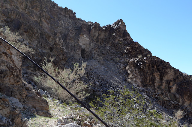
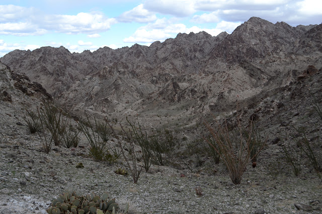
I am passed by an ATV that must just be exploring, because it turns around before the road ends at the mine and heads back out again. My first look at the pass shows no visible trails across it. Disappointing, but closer up there may still be some. Anyway, the slope between the mine and the pass doesn't look too hard to cross.

The ATV hadn't climbed much when it turned around. It looks like none of them have gone all the way up to the mine in a long time although many have gone a bit further than that one. The road becomes hard rock with a deep groove down the middle and there is no place to turn around at the top. Bits of mine buildings lie collapsed at the top. It looks like they may have roofed it with cut and flattened oil barrels. An old trail paces above the road, climbing faster, but also has washed out spots that would make it hard to follow. More trails climb from above the buildings to the shaft and prospect marked on the map. I still don't see anything climbing the pass.


There do seem to be smaller trails continuing upward from the mining area. These would most likely be animal trails, but the animals have a good sense of where to go too. Sitting next to the thought that is my plan to just cross over to the easy saddle is the thought that it doesn't really matter where I hit the ridge since I want to go along so much of it. I follow the trails upward. Steeply upward. Actually, these could be little water courses, but then they seem to cross over a bit of ridge or something that a water course wouldn't do. Although maybe that's just natural lines in the rock. Not all of them actually go anywhere. I keep going up anyway and gradually get that feeling that I'm glad I'm not trying to go down this thing, just like I had on Stud Mountain. This time, there is added worry because a few of my potential hand holds have crumbled at a touch.

My climbing puts me on a shoulder that was part of at least one iteration of a plan. I climb up from it to the ridge only to find it is a ridge I do not want to traverse. I am still too early. I really should have stuck with the plan. At least the climbing here was not so bad as I reverse it back to the little shoulder.

So what to do at the little shoulder? Traverse, I guess. There is something like a traverse where I am although it is rougher. There is another shoulder on the next ridge for my target. Oddly, it is below a steep bit topped by someone's very large cairn.


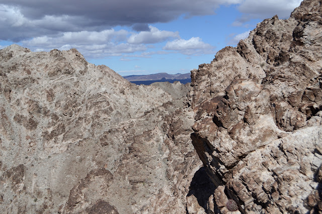
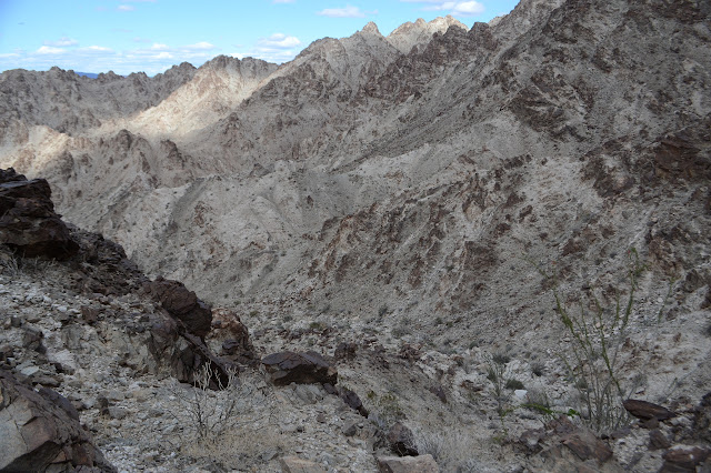
At the next ridge, I glare at my map and the ridge and the peaks above. Where do I want to go up? The washes on this side certainly don't look too bad for climbing, but which should I climb? Maybe the best would be to get to the far side of the azimuth. Well, where I think it might be as it is supposed to be on the "next peak to the west" and "about a quarter of a mile" which seems to indicate that there is actually a smaller bump that was not worth calling a peak in between. If I go up the far side, I will know what the ridge is like as I come down to go up for the benchmark itself. So I traverse again.

I glare at the map. Nothing looks right. Nothing feels right. Nothing is right. I traverse again, then sit and eat. Everything is wrong. And if I'm honest, my legs feel like jelly. They feel like they have 200 feet of climb in them and then they are done. I need to go up 1000 feet. I have gotten nowhere and I've done it the hardest way possible. And I'm starting to feel like the Cargo Muchacho Mountains will be the end of me. At least I'm not so far gone that I feel like they're trying to do me in. Mountains don't go after people. People just do stupid things in mountains. My legs feel no better for the rest. It is time to just quit this thing. It's really early, but if my brain isn't into it (and is making stupid choices) and my body isn't into it (and feels like jelly) then there's not a lot left to enjoy it. I decide to go down the new wash and have a look at what it offers, but then continue down to the lower traverse. There's even a slight promise of a prospector trail down there. I saw some of it over near the original pass.

My legs feel no better for having had a little rest as I start again, it really is time to let it go. Down I go. The prospector trail is real and easy enough to find as it goes up the low ridges where they present low saddles. It is not so easy to follow so I just have to make up some of the bits in between.

The trail can be hard to find on the other side. I pick a route and suddenly start to see that there is trail there after all. It is an easier traverse than the one I picked out higher up.


I climb over one last saddle thinking the pass has to be visible from this one only to find a familiar wash with a road along it on the other side. It is the pass. Of course the prospector trails I was hoping for but hadn't seen from the mine are right there. One goes off to the right and another off to the left. The one to right looks iffy in a few spots I can see and I can see no clues to where to goes past one spot. The one to the left should head over to the mine, so I go that way to find out what I should have done when I got to the mine earlier.

There is a thin fin of rock extending downward and the trail follows this down past the mine. While it is possible to get to the mine, there is no trail visible that does it. Instead, it connects up with a rougher bit of road I had noticed leading off of and then back to the main, washed out road.

Then I just have to follow easy roadway back to my car under ominous clouds.

They break out in a little rain as I get to the vehicle. They break out in a lot of rain as I finish packing up myself and my gear into the vehicle. They get really quite soaking if a bit short on the drive back. I guess I can be happy I'm not attempting to scramble up a rocky mountain while it comes down on top of me. Back at camp, it eventually resolves into a rainbow with gold mines sitting under both ends.
©2019 Valerie Norton
Written 2 March 2019
Liked this? Interesting? Click the three bars at the top left for the menu to read more or subscribe!


Comments