Ibex Benchmark attempt
Yuma BLM
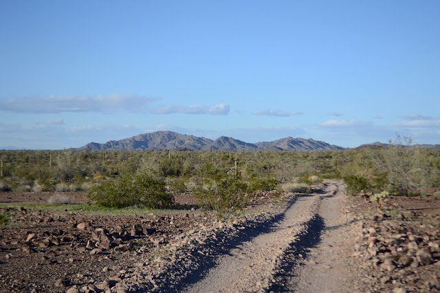
Click for map.
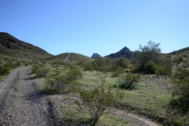
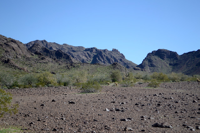
Today I am going after the Ibex benchmark. It is not on that impressive peak I was looking at yesterday, but should give me another look at it to perhaps help plot an approach. To get up that one, I have picked a wash on the west side which is a fair bit of flat stuff south of Plomosa Road. A lot of this flat stuff does not even look to require high clearance, but I'm trying not to take the car places it's really not supposed to go, so I have to walk it. So I better get moving.
There are two roads heading off where I thought I wanted to park and two roads headed off where I did park, but they aren't the same roads, so I am promptly headed off in somewhat the wrong direction. There are just a lot more roads on the land than on my various maps. I seem to be getting closer to a geocache and it is only a quarter mile out of my way and I might as well get it now that I'm "close" to it, so there is even more extra hiking. But what can it matter? It is all flat stuff and I get to check out a spot that seems to get a bit more water than the surrounding area.

It always takes a bit longer than expected, but I am soon striding along a wash, then across it, then actually on my target road and headed south. There are a couple more geocaches to find, but they're all close to the road. And I'm letting the section corners go, even the one that is only 600 feet off.

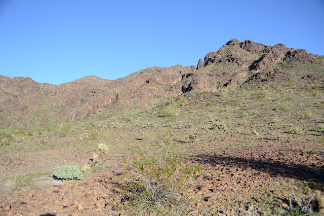
It occurs to me to go ahead and read the reach a little before I get to the thing in case I might be able to go looking for an azimuth. It looks like I am again accidentally following it except that they come from the south for the very good reason that it's about half as far that way. I may be getting a bit too flippant about plotting routes. They turn easterly into a flat bench past a rocky knoll with the azimuth and park a bit further on, then continue up wash and ridges easterly. The knoll is surrounded by flat area. Arriving at the north end of the wide, flat area that goes easterly toward the mountain, I pick out some likely candidates as rocky knolls. There should be a road further on to follow, but I just can't be bothered to wait for it instead of walking across the flat desert.
I've gotten about halfway to the rocky knoll that isn't quite surrounded by flat bits when I glance right to spot a much better candidate.
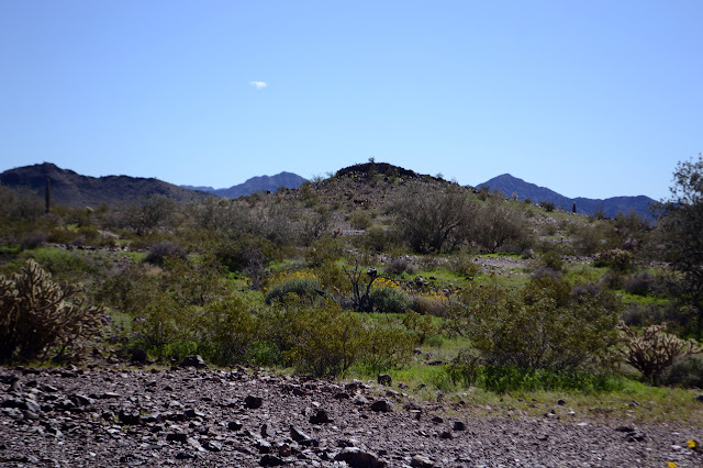
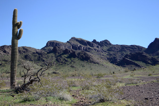
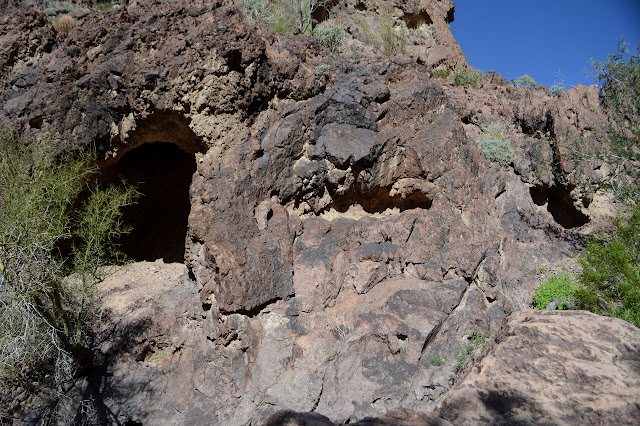
The top of the rocky knoll may give a view of the peak, except I'm not yet sure which one it is. It is supposed to be a rounded one and there are sharper, higher ones east of it. There is a rounded one just visible, but not much of eastern peaks except Ibex itself looking pointy in the distance to the right, nearly hidden away. The benchmark is supposed to be on the northwest side which just happens to look like it has had recent rock fall. Some of the newly exposed rocks are downright grey. I can find no sign of an azimuth, but the grey rocks make that inconclusive. The road passes near the bottom of the knoll, so I follow it over to the other rocky spots I had looked at before, but they are somewhat connected to the side of the canyon, so it is not surprising that they hold nothing either. They also have no view of the possible peak. They do give a view of the rocky knoll that shows it is the only one out there surrounded by flat area. The road ends just past a little mining concern at a turn around beside a rock with a circle of stakes below it. It looks like a fence to protect rock art except the fence itself never got constructed and the rock above is another freshly fallen rock face that now gathers campfire soot. Around the corner is the wash I want to go up. "End of truck travel."
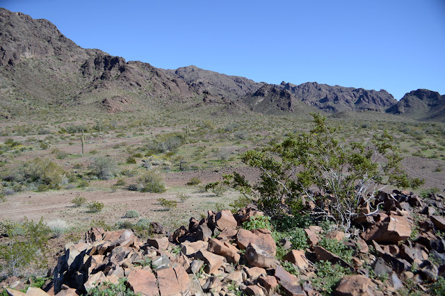
There seems to be a bit of trail off the end of the road and I follow it around the rock and into more wash. It is more big, flat area except cuts come through it some 20-40 feet deep. Three big washes come into the area and the one I want is the middle. It just has this nice, even look to it on the map. So I pick my way toward it only a little worried that they say whatever they did is a "2 hour pack" and it has gotten a little later than I might want.


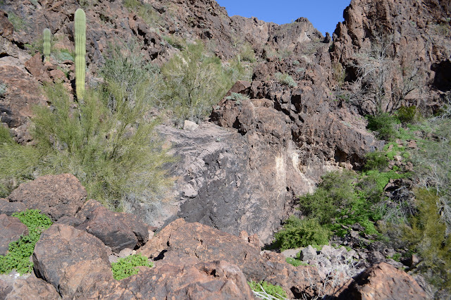
The right wash could be a route up, too, but I stick to my plan and go down the middle. Water must thrash and tumble a bit here when it flows. There is none of that sandy bottom. This is strewn with big boulders and a generally more complicated travel. I find myself on something like a trail high above it and decide to stay there as I enter and climb.

Not that I can stay high for all that long, so soon I am making my way through the boulders. There is a way that is not too bad with plants and steps, mostly, although it winds a lot. Meanwhile, I find my self struck by this thing I keep calling a wash. It really is a canyon with high walls and beauty.

My way is barred by a waterfall. Like a real, vertical rock wall that the water comes down. That is not something I have seen in this area. Only 30 feet or so, but plenty to stop me. I had thought I saw a trail going up the side to the right. I ultimately decide to go up to the left where there seem to be two generally safe ways across to pass it. The far side shows no way through for the right side route, so I am glad of my pick.
It grows steeper in sections and it is becoming apparent that I will never get up this canyon in a reasonable time to get down again. I am just 800 feet from a spring, so maybe that can be my turn around point. It could be fun to see, if it is there. There are puddles from the last rain, but I don't see anything flowing, so it is hard to believe it might be.

Or maybe not even that far. At 200 feet until the spring, there is another chock spot, this one forcing me to get up close to some catsclaw. Somehow, when already deciding to turn around early, it is easy to turn around a little earlier when faced with thorny things. I know that the springs I have seen actually sink back in as quickly as that, but I still don't quite believe in it, so it does push me on very well. Back I will go.

One of the rocks in the bottom looks like a broken piece of concrete brick. This canyon contains mysteries. I stop above the waterfall to eat, realizing I haven't had anything yet and it is well after noon.

Then back, mostly the way I came. Sometimes higher, sometimes lower. I come down through a tunnel in a rock at one point on the way up and spot an arch in the rocks on the way down. So many little wonders. Making my way through the meeting of the washes, I find myself passing navigational cairns. It must be what someone things is the best way through these gullies.

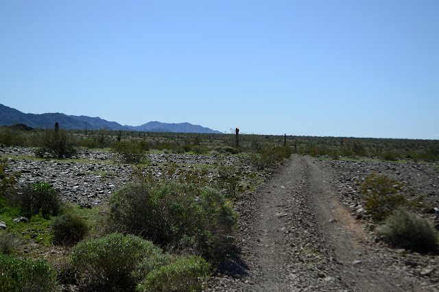
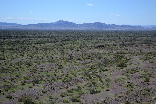
Then I am back out again and nothing to do but the long, flat walk back. Well, I could go after those section corners. It'll be dark by the time I get back, but I'm on road anyway. There is supposed to be a closing corner just over that low ridge. So I go, with some sheep path to help me find the best way.

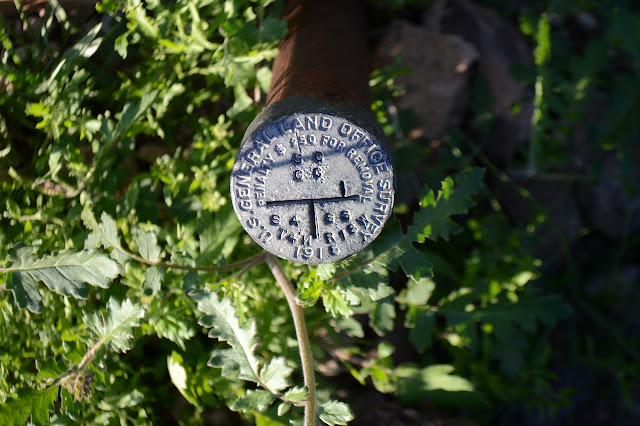
The corner is easy to spot with claim markers poking in next to it. It is an oddity. It is stamped 1915, the "191" part of the mold, but is a larger disk than has been usual for the 1915 era finds I have been making. The other side of the closing corner is also marked, and when I get to it, spiked with a claim marker, it is also stamped 1915, but of the usual size.
And just 1000 feet back to the road. Totally not out of my way. The next is the one 600 feet off and there is even a road to help me get there quickly. Three claim markers serve as witness posts for it. It is a wider disk, but stamped 1952, so I believe it. The third is 1000 feet the other way and once I get there, there's just a lot of wash. There's big trees, so the wash hasn't pulverized everything, but I can't find the corner. I spiral out a few different directions, but nothing comes up. One of the few I have not found.

I spent sunset looking for the last corner, so it is dark by the time I get back. My efforts to walk without a light are thwarted by the wash crossings where there is often a curve with very uneven footing and a scattering of rolling rocks for fun. Out of the washes, the only worry is sand which slows me down and is usually only on one side of the road of the other.
©2019 Valerie Norton
Written 17 February 2019
Liked this? Interesting? Click the three bars at the top left for the menu to read more or subscribe!


Comments