Plomosa Benchmark
Yuma BLM
Click for map.
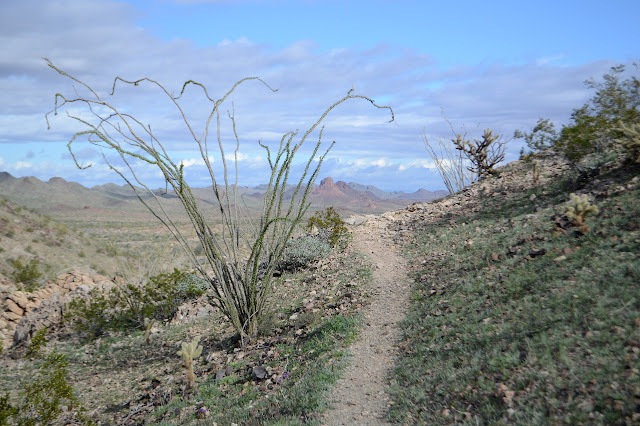
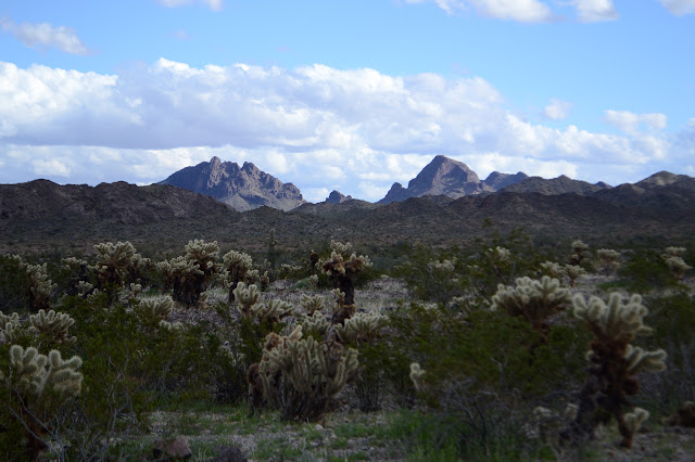
I'm out to get another couple peaks. For today, the plan is to go after the high point of the Plomosa Mountains north of Plomosa Road. It's not a very extensive plan. I'll just go along the paved road to the east side where there are just a few foothills between a lot of flat and the mountain, then find a place to park. Head over the hills to a mine at the base of the mountain, then turn and climb. On the way back, there could be more along the mountains to explore. Turns out, Quinn Pass is an easy place to park and even has a road going my way. I know that's where I am because there is a sign to tell me that Thomas Quinn made his home just north of here and prospected the area and, importantly for those who came after he was forced to move to the city by old age, built a cistern for water.

So I gather up my gear and head north. Distinct trail heads off to the left and I check it out. Maybe it heads off to this cistern that is supposed to have survived long after the cabin was gone. It isn't a promising direction and just goes up the bump and stops. There is a claim marker, but nothing else there. Just over the hill, a very distinct trail crosses the road. I check right, which goes up to a bunch of prospects and then back down the road.

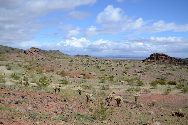
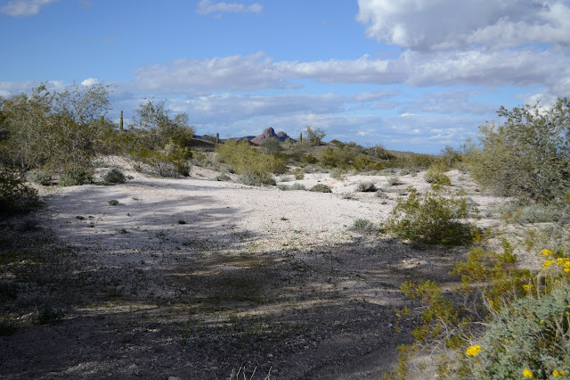
If I keep checking what lies down these trails, I'll never get anywhere. I leave the left side track to its own devices and start down the road. I am quickly suspicious I should have taken the left track which might have been the more gentle walk for the mules that served the prospects once. The road goes steeply and directly down the hill while the trail takes a more leisurely pace, but it never seems to come back. Once down the hill, there is another, small one, but then it is flat desert with occasional washes to cross. It is easy travel. I gradually notice that there are other roads running parallel to the one I am on. It swaps onto a close one when it hits a particularly deep and narrow wash, but otherwise they are just mysterious tracks. Claim markers are frequent as are short ditches made by a bulldozer.


The road I am on turns off to the east and up ahead is a road that goes to the mine. I decide to just cut it cross country. I'm walking and I can do that after all. Travel is a little more difficult without a road to follow, particularly at the washes, but the sheep tend to show a way that is not too bad.


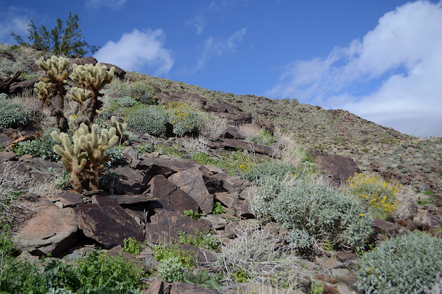
I follow the steep road up into the red rocks by the mine. The area appears to have been scraped with a bulldozer. Below, there are piles of tailings and a few holes visible. There are more holes up in the rocks and a claim marker tucked into the space below a massive balanced boulder. Definitely a mine once.

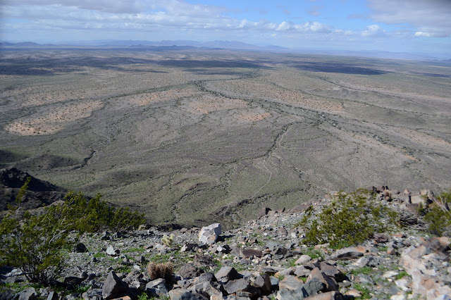
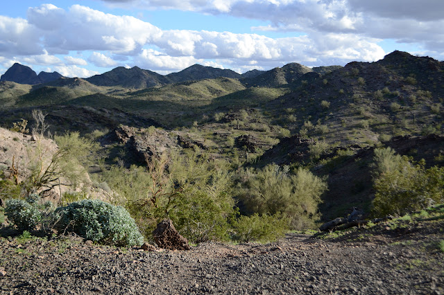
The rise in land gives me a good spot from which to look over the route up to the benchmark at the nearby high point. Washes run off the side all over. It is basically a matter of picking a rib of land, walking over to the bottom of it, then starting upward. I can't help but notice that the hill side looks really quite green. I pick a wash a couple to the north and start down a faint old road that once took a more sensible route up to the mine than the current one, then pick my way over the rocks up and down and up again. Then on to the easy and steady climb. The hill side is green because of the multitude of tiny flowers growing on it.


I picked a rib of land that had fewer cholla and not much in the way of rock outcrops so it is a simple walk up to the top. Oddly, there are no trails on it. I have started to expect trails on anything easy to walk. Hitting the ridge at the top, there is still a little way north to go before the high point and benchmark.
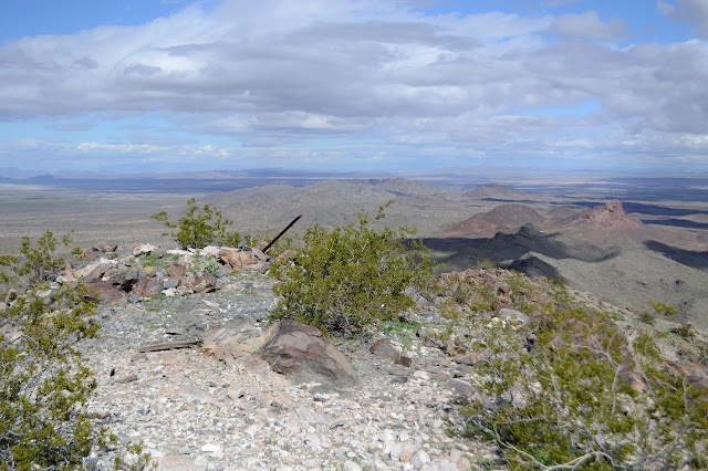
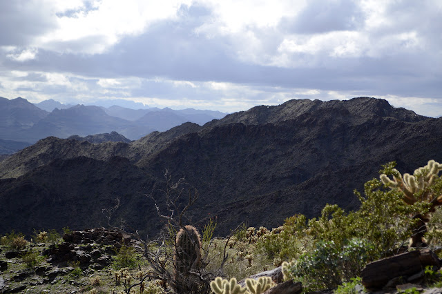
And of course its a good spot to be, full of mighty vistas. The distant clouds form and vanish and roll past. So do the close ones. They are quite unsettled.

I have thoughts of wandering the ridge southward, but take a moment to read through the reach a little curious where the azimuth might be. It's a rather confusing thing that goes north and west to get to a peak northeast of the starting point, but a second entry seems to indicate I have followed it just about exactly and the azimuth is somewhere down by the mine on a small rock or a small knoll 100 feet south of a bladed road. I really should remember to read these things before. Now I'll have to go back the way I came to find it. I head south along the ridge for a little bit anyway.

The going quickly gets less attractive, so I turn toward the closest of those ribs of the mountain. I'm pretty sure I'd rather go back to the one I came up on, but of course this one is here now, so I start down it. The sheep like it. Their droppings are everywhere and I didn't see any on the way up. The teddy bears are everywhere too. Cholla is just too close for comfort at multiple moments. At least the sheep have generally managed to keep a corridor open so there is a way that doesn't involve barbed spikes. Barely.

I make my way toward the biggest outcrop of red rock I can see, although there actually are a few candidates out across the plain. This is still the reddest. I come around the back of it to find a bunch of shallow caves, some quite large, that I had missed before. I stop by them to look in, then up the back to the top.
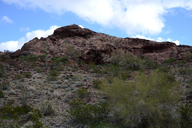
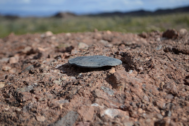
Not up there. The birds sure like the two highest points and they are white with droppings. Okay, so there are clues that it is not the highest. Come up to the mine on a bladed road to the end of truck travel, but driving up the ridge a little north will get you closer before the end, exactly like I hiked. I try to flip the reach around. The azimuth comes before the parking spot. There seems to be nothing there. I go down to the reddest area where the rocks are so broken up that anything placed there would have been destroyed. Maybe I should give up. I work back along the road to places that should be before the end of truck travel. There is a red, well, bump really, north of the road. A sort of composite rock that seems to have a piece of slate, maybe, balanced up on some rock edges. A little twisted and battered, it is the azimuth. It may be north of the current road, but it is about 100 feet south of that faint old road with the more sensible view of how roads should climb hills.
So what is next to strike my fancy? Well, off to the south fairly directly is another section corner. I go for it although they are starting to feel like a gimmie out here. Along the way, I fall into a track that looks at first like more sheep trail, but there is something wrong with it. The choices it makes are a little odd and there seems to be a second trail just like the first running parallel. Parallel tracks are 4 wheeled vehicles, but this one is much wider than any I have ever encountered. One guy said you can still find General Patton's tank tracks out here. The treads would have to be rather thin, but maybe. I give up the trail as it swings off in a random direction that does seem rather tanklike it its disregard. Maybe.

I pass another road climbing up into the hills to prospects, then cross a deep wash that would not have been nearly so deep had I let the sheep lead me across a ledge. There are all manner of claim markers on the way with one more marking the corner like a witness post as I close in on it. This one was set in 1953, so not nearly so old as the ones I have been finding.
So what next to strike my fancy? A bit to the east it says "mine" with a bit of road to it out in the middle of the flats. At first I find myself following some claims that were marked with green posts. They usually come in sets of two, but then there is a bundle of four. Corners for claims run up against each other. Sometimes 300 feet by 1500 feet just isn't enough. It is next to a "bladed road" so unused it has massive cholla growing down the middle. Then I follow a wash on to the mine.
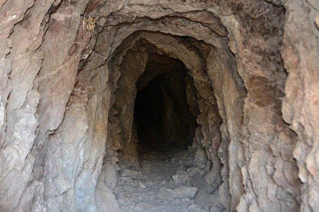
Claim markers identify it as Paymaster and a number for each segment. There are at least 28 segments. Paymaster sure sounds hopeful. It's not quite what I was hoping for, so I push on in the same direction into the hills toward a couple tunnels marked "adits". These are much more like it. I come over the hill to see a big hole in the side and tailings all around it. Near it are more holes, some going in funny directions, and all quite deep.

One layer of the rocks they weren't interested in glitters in the sun. A layer of lime above their interest shows interesting crystals. And of course, there is the big hole to go exploring. There is little rock litter on the floor, but I can't quite bring myself to go wandering. I wouldn't want to be the one to bring it down. I wouldn't want to be looking up and step into a shaft, either.

A bit of road passes by the mine. It seems to get rougher as it goes south. Maybe it once served this mine, maybe it just happens to be on easier ground. It is probably time to turn back, so I follow it south toward the road. There are more mines along the way. Ever more claims. Just so many claims. Everyone seems to want to rocks to make them rich.

After some gentle ups and downs, I can spot the road by the Smart Car zipping past. The road gradually turns away toward the east as it approaches and eventually I just leave it to cross a wash and to back west. It is a half mile back up to the pass and my car.
©2019 Valerie Norton
Written 16 February 2019
Liked this? Interesting? Click the three bars at the top left for the menu to read more or subscribe!


Comments