Tumco and the Cargo Muchacho Mountains high point
El Centro BLM
Click for map. (Purple and orange lines.)
I am back for another try at the Tumco benchmark and the high point of the Cargo Muchacho Mountains. This time, there will be no wishy-washy moments where I think one bit of plan is as good as another and just go for the one that involves the climbing right in front of me. There will be self discipline and I will stick to the plan. Also, I have stacked the deck and chosen a route that I think will not include any temptation to leave the plan. I am going to follow the reach published for the Tumco benchmark, or at least my best interpretation of it, and then follow the ridge on up to the high point. The azimuth can happen in between if I am feeling it at the moment. The way down can be either back the way I came or over the top, again depending on how I feel. Okay, so there are choices in there, but they come when I have solid information about what will be the one I'll like best. This time I am starting at the parking for the self guided tour for the Tumco town site. The area has been blocked off to motor vehicle traffic, so this is the parking for everyone.

The brochures are long gone, so interpreting the numbers on the iron signs is difficult. Maybe there is something that can be downloaded if one has signal. The first number comes up quickly. Near it, there seems to be a prospect, a well, and a trash heap of rusting metal. Further on, rocks mark out rectangle foundations of long gone buildings. A few stone walls stand that were once part of the mining development. A concrete foundation can be seen. The map marks some tanks up on the hillside, and sure enough they are there. Through the middle of it runs a fine sand that looks like it came off some process. A number looks to be ready to tell me about it, if only I had the brochure. There are also a few signs, one vandalized beyond readability, that allow learning even without.


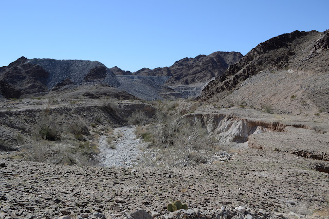
As I get to the open pit shown on the map, I have gone too far. I turn back and up a wash that says "Tumco mine" on it on the map. I am assuming that the location USGS surveyors call the mine is the spot marked on the USGS map. Not always a good assumption, but in this case the rest of the reach, that is route, they use makes sense. From here, they go over a low saddle to the next wash east, then up that northerly to the peak. It actually has a few lines of wash up toward the peak on the small scale, but I have picked out the one I like best. I will see what it looks like in reality, but I am not too worried that there will be no route up.

There is nothing along the way to suggest there was a headquarters of the mine or something to make this the location for it. If there had been such a thing, it would as likely as not have been wood and be long gone. I follow a road up the side of the wash, but this just makes getting to the saddle harder. There are wash outs and eventually I only have a prospector trail that hasn't aged well to follow. Meanwhile, the road through the bottom of the wash now goes up and over the saddle anyway. It does not get very much further. It looks like the other wash has had attempts at roads put in, but none have held well. There are some prospector trails up on the right side of the wash which are easier to travel than the bottom of it. They keep seeming to run out, but each time as I am about to yield and drop into the wash, I see a bit more and go for that instead.
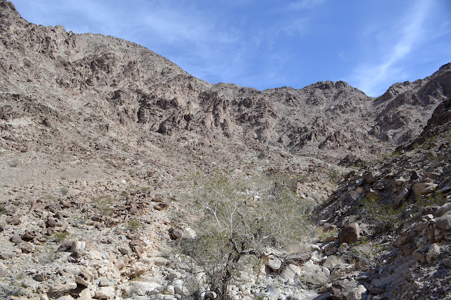


I pick out one of the washes coming down off the mountain based on what I can see and make my way toward the base. It is the same one I picked out on the map. Perfect. No conflicts today between plan and desire. I can even imagine there is a cairn indicating this one, but it is likely not a built thing.

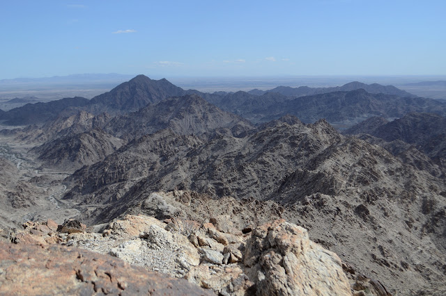
And so I go up. It is a solid climb, but never feels like too much. I look back from time to time and am higher and higher, but never does it bring on the slightest bit of a dizzy feeling. Today looks right and feels right. It is so much better than two days ago.

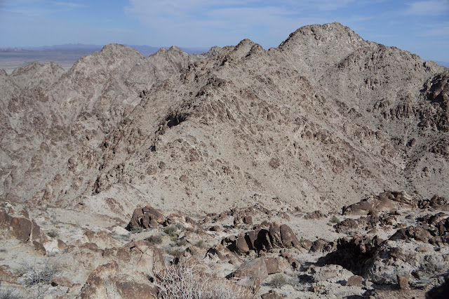
The going is not entirely straightforward, but there is always a quick route around the various little challenges it throws up. I pass a can on the way. It could indicate humans passing this way before or just that they were above once. One bit of rock almost looks like it has a glob of gold in it. These are supposed to have gold, but probably not quite like that. Sparkling bits of gold glitter are everywhere, but that's just fools gold. Eventually the slope becomes easier and I run out of a defined wash. The ocotillo have started up and I find my way up the hillside to the ridge.

Working upward to my left, toward the peak, I eventually climb fast enough to reach the ridge itself. There is not much up and down left on it between me and the peak with the benchmark and there is practically a trail along it. Sheep or human? Maybe both and more besides. A fair bit of cold wind is blowing across it so that I am no longer warm from the climb.
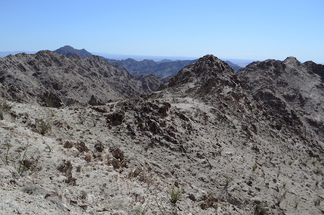


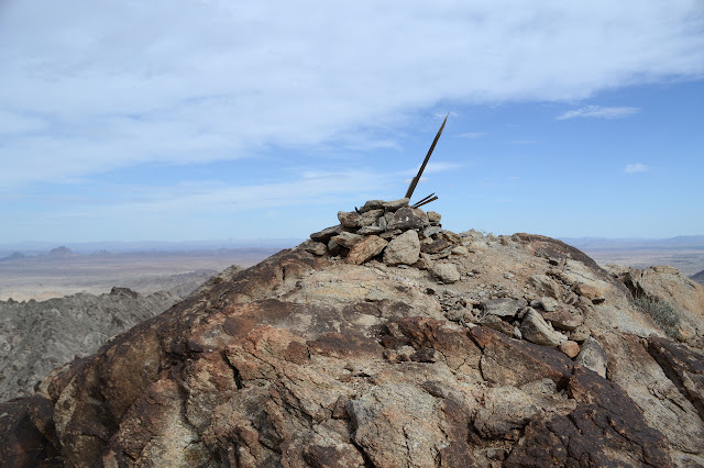
And then there is the peak. I can't seem to find the benchmark or any of its references at first, but I can find an abused register. It is another by MacLeod and Lilley to advertise the Desert Peaks Section in 1983. Someone since then decided to protect the glass jar with a cut beer can and someone along the way placed it all open end up. It was last signed, at least in pencil, in 2012. The spiral binding dissolves in my hand as I handle the thing and the lid is near to dissolving, but the curved pages are not yet cemented or too brittle. I put it back all back with the can open side down so it does not collect water, then return to my benchmark search. There seems to be trail down toward the azimuth, too, and a lesser trail up to the high point. There is plenty to see. Eventually, I do find the benchmark, half caked in dirt, near the local high point. One reference is way down low and the other was just out of sight over a rock as I passed within feet of it on the way up.


So, that azimuth mark. One of the survey teams that has gone after it goes into a bit more detail about the route. There are pinnacles along the way and it is on the westernmost of several bumps that make the peak. They then call it a "30 minute pack". Along easy terrain, these folks would generally call a quarter mile a "5 minute pack". I decide to just skip it.

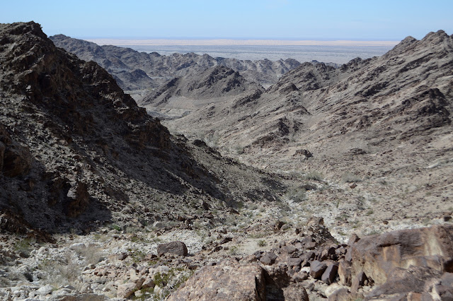
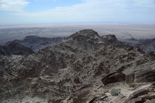
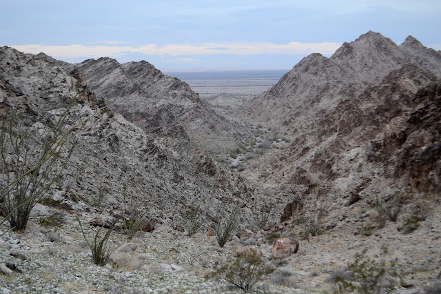
So I face that ridge line with all those bumps and plot to go around at least a few of them. I wiggle a bit to my right now and then as I go down the make the going easier. There is nothing hard getting down to the low point between benchmark and high point. From there, I think I can see a trail heading around the edge of the first peak, again to the right, and follow it. It might just be a line. Still, it's not bad. It seems to go a bit longer than expected and I really haven't been climbing any. As it hits a more major bit of wash and the winds turn stiff again, I start to climb to reach a nice ridge between two washes coming down off the high point, and then on up to the narrow peak. I can't help but notice that these washes look even nicer for travel. The trouble is they pour out to the east instead of joining those to the west.
Surveyors have actually been here, too, and left a rod of some sort with a little triangle and USGS stamped on it. There is a register here, too, set on the same day by the same people, but since it hasn't been abused it is showing no particular wear.

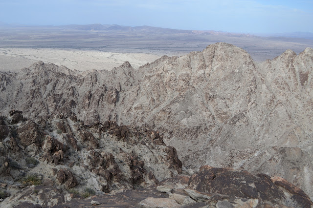
The others have used a route back down the ridge to the saddle between the benchmark and peak, then down a wash. The trouble is, I just don't feel like bothering with the ridge at all. All the washes I was looking at before looked nice enough, so I just start down the north side. It does give me a little hesitation. The top looks especially easy and the bottom quite nice, but the space in between seems a little short along the horizontal for such a large distance in the vertical. I am particularly given pause as the wash I am following suddenly develops into a ridge. Still, give it a chance, see what comes. The shorter way would be to my left, but it looks steeper on the map. I look over the edge and just see something I can navigate. Good enough. Down I go.

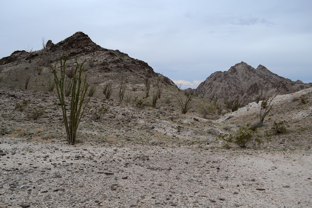
And then the clouds turn thick and dark. Is it going to do what it did before? Pour down, brief and soaking? I guess I will just get wet if it does. I don't let it get to me. The wash tries to throw a few waterfalls at me. I look them over. Short and full of hand holds. Nothing is going to take away my feeling that today is in tune and in sync! The wash starts to level off and walking beside it becomes better than walking in it. As expected, I get far enough down, and there's a perfectly nice prospector trail, a little hard to follow, to take me back over the saddle to the main mining area. There is even a nice, fat cairn to help me find it. Well, nearly.


I pass by some claim markers that actually have their paperwork. I saw one with a paper nearby the other day, but it had been washed to the point that the signature was all that was left and even that wasn't much. This one has stayed dry with the same scribble of a signature as the other. It is a "load claim" rather than the "quartz claim" I found before on Hackberry Peak, and only dates back to last December. I return it to its stick and follow the trail expecting it to turn familiar after a ridge or two.
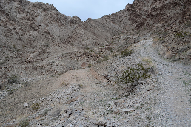
The trail does offer an option to drop into the wash rather than climb over a couple of the low saddles just as it is getting familiar. Small navigational cairns mark both routes. Although some of the saddle climbing was a little harder here than might be needed to be, I go with it. My legs haven't felt anywhere near as tired and overdone as they did those couple days ago or on Stud Mountain. The reward of a better chosen route.

I try to follow the left trail through the last valley where I used the right trail before. After a little flailing, I end up on the same trail anyway. Both had looked good as I passed before. At the top of the pass, I think about trying the right side trail, but the clues seem just a little too strong that it vanishes quickly. I try to get down to the mine instead. The route along the rock fin is better.
Since I am not headed back to the cemetery this time, I decide to take a prospector trail I noticed shortcutting over to a spot thick with marks for prospects and shafts and tunnels. Sure enough, there is plenty of disturbed rocks all over the place.

Road leads over a short pass where I again see the top of an iron structure I was wondering about before. I go ahead and walk a little extra to find out that it is topping the biggest shaft I have ever seen shooting down into the earth at a slight angle further than the light reaches. Then I head back for the car taking a moment to find one of the few section corners marked in the area. It was placed the same year as the benchmark.

Suddenly my gloomy late afternoon lights up golden. The last light of the day has dropped below the clouds. This was definitely the day I needed after the last couple hikes. What a fine day indeed.

©2019 Valerie Norton
Written 3 March 2019
Liked this? Interesting? Click the three bars at the top left for the menu to read more or subscribe!


Comments