Ladybug Peak
Coronado National Forest
Click for map.
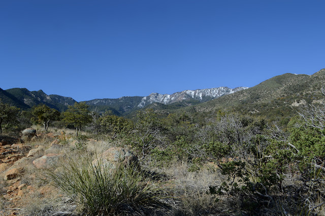
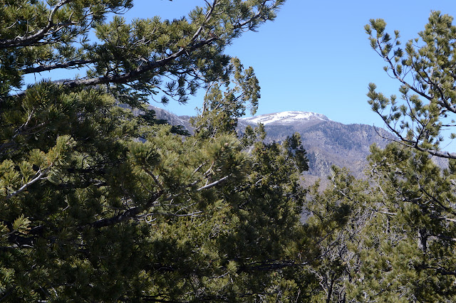
Well, I said quite some time back that I was going to Coronado National Forest and now I finally got to a little bit of it. I saw it for all its high prominence peaks. It is a forest made of many separate pieces centered on "sky islands", mountains that stick up significantly from the surrounding terrain such that the tops have vastly different (and often unique, like islands) flora and fauna. It's a more poetic way of saying the same thing. This particular sky island is the Pinaleno Mountains and the high point, Mount Graham, stands over 10k feet on a desert floor of about 4k feet. I figure a good get-to-know-the-place hike will be the Ladybug Trail. It runs through a bit of elevation without getting into too much snow, will let me get a better look at the higher elevations, and there is even a peak to grab at the end. Also, unlike a few other trails in the area, most of it didn't just burn in the 2017 Frye Fire.


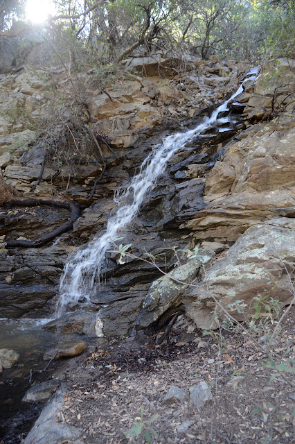
The trail starts up a fuel break, then a sign points down the hill. It goes steeply down, over the orchard water supply, and across Jacobson Creek, which is running pretty well. A waterfall flowing into it catches my eye, then there is a general wondering where the trail is going. Someone put a big cairn below it a little before it reaches the creek and there is a general flattening of the dirt going upstream. On the other side, there is not a lot of room for anyone to be until a little downstream, where, ah yes, the trail does continue right across the bottom of the waterfall. That explains the big cairn, which is directly across from it. The only dry foot crossing looks to be on a log which is wide and flat enough to feel safe on this side, but gets a bit narrow by the end. Being already on top, it is easy enough, but getting up onto it in a balanced way for the return looks like it will be difficult. Not something to worry about yet, as I jump down and start climbing.

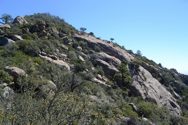
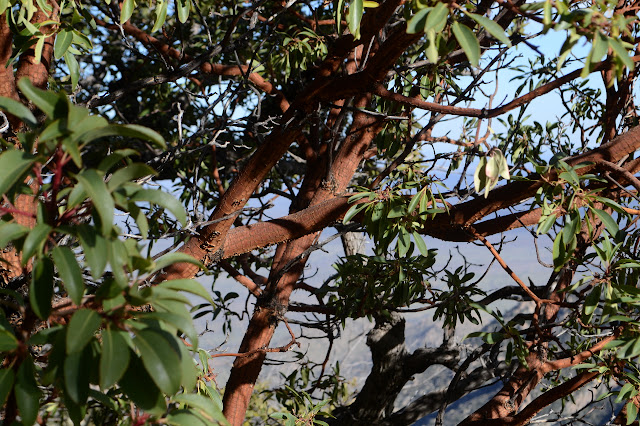
The trail winds upward gaining views. First is out over the orchard. I'm not sure what an Angle is, but it seems to have purple blossoms right now. The flora seems to be all on a similar theme to that back in Santa Barbara, but distinctly different. The manzanita is only a little different, the oak looks like it might be some sort of tan oak. (It's a silver oak and they are currently losing their leaves while budding out for spring.) Even the juniper, which we don't have much of, looks different. Come to think of it, as far ranging as juniper is, there better be a lot of different sorts or something odd is happening. Out on well drained rocky areas, the desert still grabs some room and cactus grow. I thought I was out of the cholla, but there are some very occasional ones that are rather purple with short spines and yellow fruiting bodies along the road to the orchard. Oh, and there are some nice rock outcrops along the way.

The top of the ridge seems to be where people get to, then take a break involving leaving toilet paper about. Ewwww. Why? There's a little bit more view, too, but it is still a bit of the toe of the mountain.

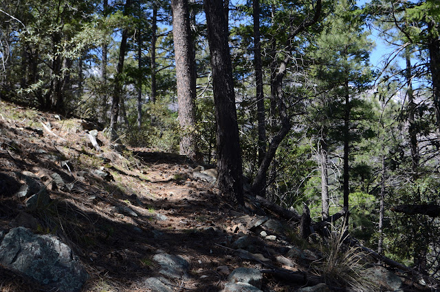
Not that the climb is done. There is still a long, steady up along the ridge to walk. It seems a little on the unmaintained side with brush sticking into it, but there isn't all that much brush in the area, so it's not that bad.


And some of those spots I took to be going up on the map are actually going down, I just didn't look closely enough to notice. I thought it was going to be an easy 600 feet a mile, but of course it isn't a steady up. The current ridge meets up with the named Veach Ridge and then there's a new drainage area to look out over.

In spite of the low amount of maintenance, there are no trees down on the trail until a saddle quite far along. There is one and then a couple and then one more and then a forest, but most of them are standing. Someone has decided folks might get lost in the forest and there are some cairns set. They seem unnecessary to me, but as seasons change, so can the trail. When I can see ahead, there is a particularly pointed peak that I am fixating on as a finish, but I know that it must be the one after, because that is where another ridge comes up to. Trail comes up that ridge, too, and I can see the snow covered trail as it crosses a particularly vertical section. It looks a little scary. I wander through it all until there is quite unexpectedly a trail junction. It says it goes down to Turkey Flat and seems just as official as the one I am on (and I will find is just as well marked at the other end) but is not on the Forest Service quad.


Just past the junction, there is the first bit of nearby snow. Soon after, I am excited by the first bit of snow on trail. My excitement drops again by finding snow on trail. Ah, reality. It is a little worrisome that there seem to be no footprints across the snow, but snow is good at melting those away. It does not look unsafe to cross, but I have no idea what will come ahead.
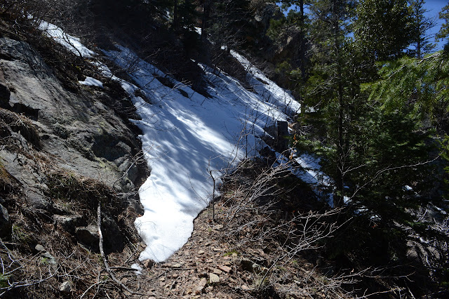
The snow gets more frequent, but the patches do not seem all that much bigger as I climb higher. There is no place I feel particularly in danger from it. I kick in steps and it pretty much holds me. There is some trouble near where trees are down because there is often an empty space near the tree. There are more trees down as I climb, too. The cairns still do not seem needed even when the snow is on a switchback, which it often is. It takes a lot of energy to climb in the snow and my socks are getting moist.

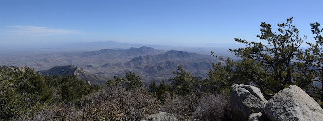
Then there is the expected junction with Bear Canyon Trail. It is snowed over, but the signs are there to make it obvious and I can see trail heading out the the edges. There is not much left to finding the peak now. Just have to go upward. I have some expectations for finding a use trail just a little further after turning right, but when there is yet another patch of snow, I just start upward instead. There is soon quite a lot of use trail and even a small campsite. People seem to go up the last bit of the peak every which way. The top itself is a bit rocky with a view and a benchmark.


After a while, it is time to head down again, this time via the clearest of the use trails. It gets a little obscured as it travels through the camp site below, but then starts up stronger than ever to drop down to the trail on the far side of the snow patch I did not bother to cross. It is so distinct that there are probably a few people who accidentally take it and find themselves at the campsite, at least, when trying to travel the trail. Lots of footsteps show in the snow in that direction while there are none in my direction. Everyone on the trail recently was heading up the peak the short way. Traveling through the snow is much less energy intensive heading downhill.


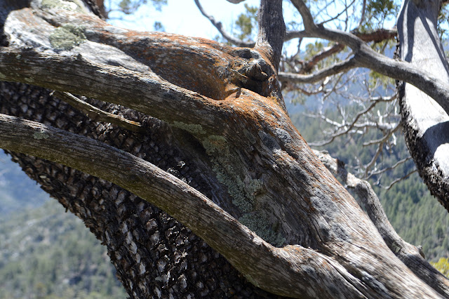
The snow patches feel smaller coming back unless they give me trouble by hiding downed logs or being on a tight switchback over a drop, then they seem at least as large. I keep seeing these spots under freshly melted snow that look to be strung with mold hyphae, or maybe cobwebs. The first seems more likely. A glimpse of life under the snow. I notice some things I did not notice coming up, too, like the dwarf madrone. When almost down to the point the trail leaves the ridge, there is a trail pushing through the brush to a rocky outcrop that looks like a good destination for those wishing to go a shorter distance.


Good spots are all around. After a while, I head down the rest of the way and back to camp.
©2019 Valerie Norton
Written 12 April 2019
Written 12 April 2019
Liked this? Interesting? Click the three bars at the top left for the menu to read more or subscribe!


Comments