The Flatiron and above via Treasure Loop and Siphon Draw
Tonto National Forest
Click for map.
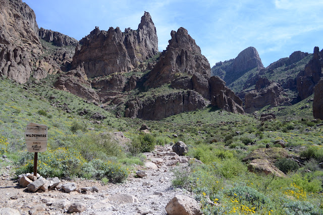
Ah, the Superstition Mountains. They really are a jewel of the state and right now they seem quite green. Of course, I'm out to get up into them and around here, they actually have trails. The one I am after is a non-system, unmaintained trail, but it will still be a nice change to be on even that much trail. Entries exist north and south of the Lost Dutchman State Park as well as within, but it seems silly to pay $7 to go in and then walk right back out again. I'm starting at the north end at the first lot on the road to First Water although the closest is at the south end. It's only 6 miles up and down, according to the information for the geocache at the top, so this gives me a little more area to explore. On trail! Cholla can still be a problem when on trail, but not all that often. Oh, the delight of being on trail.


This area does get enough foot traffic that the trails grow side trails and secondary trails and the like, but the way to go seems pretty clear. Even this trail from the parking lot is an extra spurring off Jacob's Crosscut. Arriving at the crosscut, there is only a sign pointing out where it goes and none for the trail I have just come along. Not much further is a similarly partially signed trail climbing up into the mountains. Shortly after that is a bit of the Treasure Loop. It all looks flat to me and the reported trail length to the top isn't so much, so I figure I'll have a little bit of route that is not the same trail coming and going. The trail is as wide as a road and, in a word, crowded.

The trail actually does get to some little bit of climbing. I skip a spur that continues on just a little bit more before starting down the more southerly of the other two roads.

I'm thinking it might be nice to not lose all the elevation I climbed up already when a very distinct cutoff trail presents itself. The way it crosses the few gullies make it clear it is a use trail and I am not sure I have saved any effort for taking it by the time I get to Siphon Draw. This one is also crowded with people.
The trail gets to having multiple routes even before the maintenance ends. I can only guess at the official end as there is no indication along the way. The rocks rise around me in interesting shapes and with numerous shallow caves. Up ahead, I can make out numerous figures walking up and down steep bare rock with water flowing along a channel in the middle. It is a pretty good guess that the official trail ends somewhere before that. Good thing there are so many people to use as sign posts to know that is the route.

No actual cairns seem to mark the rocks. People who have been here already know to basically follow the bottom of the draw the whole way up, skipping the waterfalls. People who haven't, well, they figure it out or they don't. The water is coming over a waterfall which does not look like an easy climb but the rock channel is. At the top, many have tried to continue up and have made a very distinct start of a trail that has me fooled until a group of three pop up from the direction of the water channel.


So I go down instead of up as soon as the particularly steep dirt scramble is clear of those already coming off the top. Paths go high and low past a wall of wet rock, then up up up.

I am getting a little too absent minded in following the trail as I start following a pair of backpackers up what is increasingly obvious to be a small land slide. Plenty of others have come up this way before, but they must have corrected at various spots as there are thin trails back into the main water channel. I try one, but find it a bit too steep right at the end. Overall navigation isn't too hard, so I may as well stay on the current route. The backpackers above are becoming increasingly uncomfortable, though, so I try another side trail and follow it all the way to the main track. I'm not sure if much was gained. There are increasing opportunities to turn this thing to class 3 climbing as the draw climbs higher. Then the slope mellows out and there is a sudden web of use trails going everywhere.


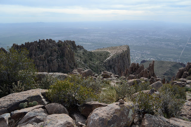
Most people break off to the right to stand at the top of the Flatiron. I'll get there, but for now I am headed for the local high point. I no longer have any human sign posts as I make my way to a saddle and then along one of a few trails marked in cairns. It is clear that some folks like a few other spots to look out on the world below. I do a pretty good job guessing which I actually want to take, but there are more moments requiring a bit of upper arm strength to get up and over some large boulders.


But then it just becomes winding through the rocks to the spot that is highest to take in the views. They are quite extensive.


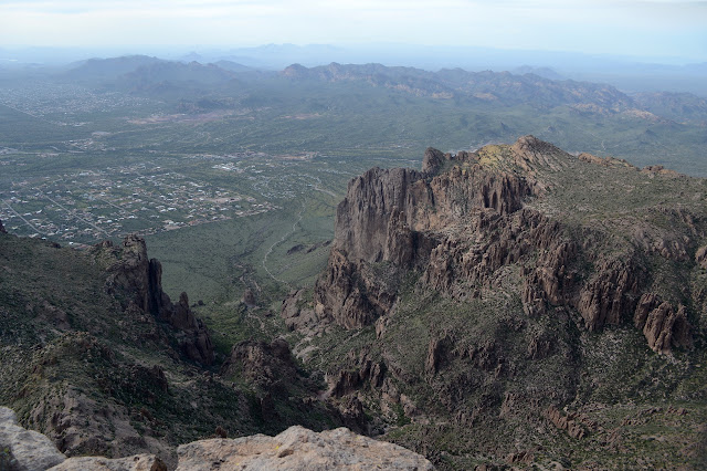
It looks like I should be able to find an easier trail without so much bouldering out that way, so I try it. I am not the first one, but it certainly isn't popular. There is a steep but serviceable walking route on down to the ridge trail by following the left side of the valley down and around. The trail there is thin but serviceable to follow. Water crossing it is also thin but serviceable so soon after a brief lived snow. A trail tries to cut along high over to the top of the Flatiron, but it eventually gives up and joins the highway that most are using to get there. Out at the tip, there is evidence of some monument glued to a rock, but nothing of it is left. There are good views here, too, but a little lower and different.

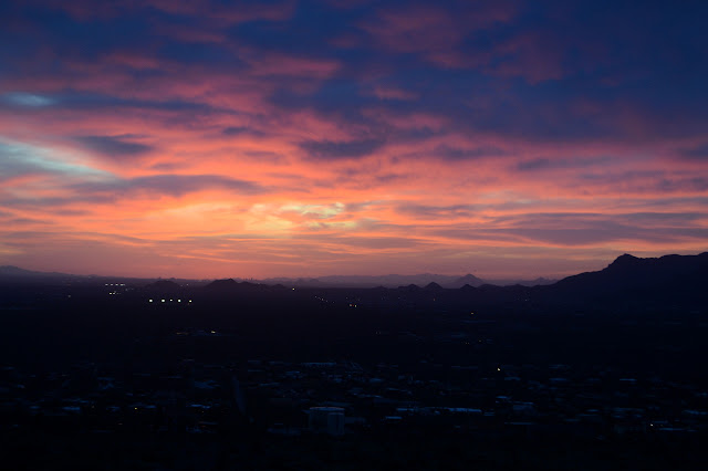
Then I have to somehow reverse the process. There are a few spots I am not looking forward to and my knees were feeling it just on the climb. Just got to do it. Slow and steady and carefully. Somehow the little cliffs along the way just aren't so bad. The bit I skipped while going up the landslide is only a slight challenge after not seeing it going up. The sunset has some points of interest and I am back to official trail system by the time it gets dark.

Then it is maintained trails all the way back except that last bit of shortcut to parking. There is a ruin along the section of Siphon Draw Trail that I missed on the way up. Steps lead down to a sunken floor, but nothing nearby says anything about what it might have been. As it gets dark, I can see many lights moving up and down and along the hills. Mostly down. There are still quite a few people out. It's a nice night to finish late.
©2019 Valerie Norton
Written 26 March 2019
Written 26 March 2019
Liked this? Interesting? Click the three bars at the top left for the menu to read more or subscribe!


Comments