Yellow Medicine Butte
Gila Bend Mountains, BLM
Click for map.
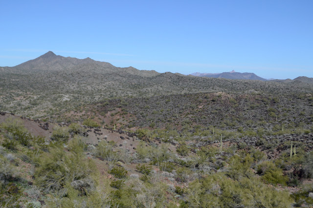
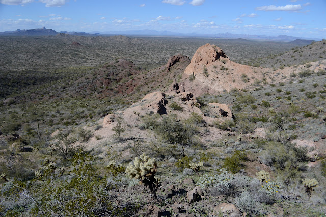
Yellow Mesa Butte isn't much, but it catches the eye a bit in the afternoon and evening light. I decided to go up it, it's little pointed peak to the east, and then off to Saddle benchmark further to the east. There is a bit of cliff on the north end and around the sides, all of it guarded by cholla, but I figure I can wander up a big wash along the west side to the south and take what looks like a bit of a ramp on up to the top. That's the general plan anyway. Oh, and I got some higher resolution mapping for the area.

There are a couple washes along the way to starting around the mountain and there will be a couple on it. They tend not to be quite so deep on the mountain, but the ones cutting through the desert here often have nice walls on them. When they also have hard rock bottoms, they can hold small pools of water and one small one has just that. Little things are swimming in it. It must hold for a little while. It is just a brief diversion before getting moving up the mountain.

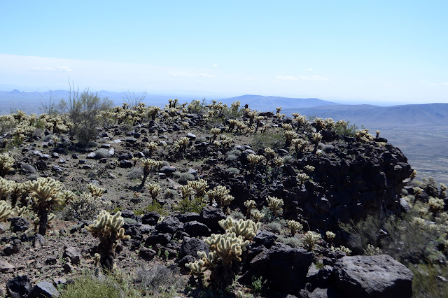
Again it is a hill whose existence was driving by volcanic forces and there are plenty of forms of basalt to look over. There seem to be constant oddities.


I get up to the ramp up and have a look around the side of the mountain only to find there is a lot more mountain between me and it with a lot of big washes cutting directly down in between. Surely I looked at the map once I got the better resolution and checked to see what my route looked like on it? Evidently not as I check it now. It's all shown right there. If I had wanted to go up that ramp, the most obvious thing to do would be get out on the mining road and head south. It has looked like it might be possible to go directly up here, as long as the cholla cooperate. They look very thick toward the top. The most sensible thing to do from my start would be go up to the saddle and up from there. Even from here, that might be the best route. But that will be down, so I want to try something else.
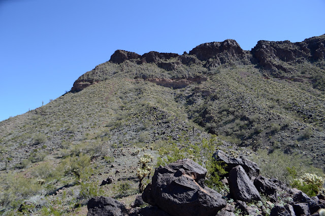

The ramp gets steep quickly. At first I can go along some big rocks that hold their position, but as it gets steeper, the rocks start sliding under me. It is not as bad as hiking up cinder has been, but certainly in that category.

There is just too much cholla to deal with on such a slope. I went for the better toe protection from cholla stabs instead of grip and it is looking to be the wrong choice. The slope of loose rock away from cholla ends in a deer path along the first of a more stable soil, but there is more cholla to evade, too. I check the path to see where it goes. It comes from one wash and drops into the next, although if I am brave enough it might do what I want. I am not brave enough. Not even with other shoes. Above, the cholla are starting to look solid. Back to plan A, but first, shed a lot of elevation just gained and shed a bit more for easier traversal of the washes coming off the mountain.
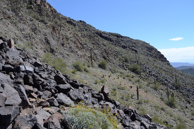
The traversal is not so bad, low down. The land actually encourages a gentle climb as well, and I seem to need little encouragement to climb a little if I want to ultimately be up high. Then, there ahead of me, there seems to be a line. There are little cliffs to avoid and plenty of cholla to avoid, but I think they might actually be avoidable. So I go for it. Sometimes avoiding the cholla means taking a short scramble up the rocks at a nice crack and sometimes the best hand holds area full of dried out cholla discards, so I have to take something else, but there really is a way.
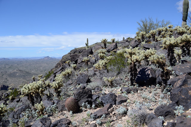
And then I am at the top and it is mostly flat and there is quite a lot of cholla. Picking out a route with space for me takes a little planning. There is a way and a route and yet somehow I get myself stabbed a few times. Add it to a discard that was in the skeleton of a coreopsis and landed in the back of my leg and a few bits into fingers poorly placed and a few other random stabs, I am getting tired of getting stabbed. I am getting really tired of having to stop and carefully pull away whatever conglomeration has attached itself to me, barbs and all, and then look for if anything was left behind. I can feel the dread of cholla starting to fill me and leave little room for anything else like enjoying being in a high place.


I finally wind my way through the barbed spines to a peak that seems like it could be a high point. One more peak along, someone has built a tall cairn and there is a smaller one on a rock that looks to be the highest thing around. I head over, visit the rock for a short dance, then the big cairn to finally turn around and see there was also a cairn right behind me on the peak I was on. Tucked deep in the big one is a register. Off down the north end, it looks very like a path although the register hasn't been signed in a few years.


I go back to the other peak again because I kind of think it seems more like the top, but there is no register on it. I was thinking reverse my route. I keep thinking that with all those path choices, I can stay out of the cholla although the clear evidence is that I will get stabbed a few times. My original plan was to head down to the saddle and up the other side. I am feeling no desire to continue up the other side, but the appearance of a trail, including a cairn a little way down, gives me confidence in going that way instead. I yield to the evidence and try for the shorter route as a better chance to come away without more stabs. I really wanting there to be no more stabs. I am feeling a lot of inward cringing at the thought of getting stabbed again at the moment.

Heading down, I quickly lose the trail. Well, that wasn't so handy at all. There seems to be no second cairn for in anywhere. Still, the chute it is sitting at the top of seems quite usable for travel downward with plenty of spots that aren't cliffs. And there is a very fresh trail of broken green stuff. It could be some animal, but the size of the crushed and broken areas make me think it was a human. Plenty of people don't sign registers, after all.


There are steep spots, but the climb down is not bad. Oh, and there are no more cholla stabs. I am dropping down south of the saddle, so as it gets flatter, I angle along to the north as well. I still end up climbing a little to get to it. Looking up, the pointy secondary peak seems to be trying to show me routes without so much cholla on them, but I am having none of it. No no no. I am not even trying it. Enough cholla. From the saddle, I pick out a rather clear hill top with some palo verde on it and work my way there to go have a long sit and definitely not go up anything else covered in cholla. It is a little more difficult than it would be to just go down the wash, but I don't care. Hill, sit, stay.

Then I head down the wash in front of me to the road below. It is a fairly easy to travel wash, although my shoes try to slip me off a few things. I definitely should have risked another foot stab rather than wear these worn ones. The wash crosses the road at a ford, so that puts me easily on it.

It is a mile along the road back to my start, but it goes quickly, especially compared to the miles that went before it.
©2019 Valerie Norton
Written 14 March 2019
Liked this? Interesting? Click the three bars at the top left for the menu to read more or subscribe!


Comments