Basin and Snowshed Loop
Coronado National Forest
Click for map.
Even though I know the "parks" around here are just saddles, I have this urge to go up and see Pine Park. It's just 3 miles along, just past a junction at the ridge. For a little extra incentive, there's a Fossil Saddle and Fossil Seep a half mile the other way. It's the way I would have gone up had I done Chiricahua as a day hike instead of a backpack. And I might could just make a loop out of it and maybe get some different viewpoints of Cave Creek Canyon. Maybe. I'll get to the top and decide. I would have waited another day to let my poor legs rest a little more after the 32 mile overnight backpack, but the storm that started as I was finishing put down a bit of snow all over the higher elevations and I wouldn't mind getting up there while it still is. Starting at Herb Martyr just like for the loop past Ash Spring, I head directly across the campground to the large sign across the creek skipping that early section of confusion altogether and getting to follow a well used trail instead.

This time, at the second sign, I stay straight. The trail quickly crosses Cave Creek and starts up the other side. The signs say Little Dam is this way and indeed, there it is. Rising only about a foot high, I almost miss it. It is indeed a little dam. Past it, the trail enters the fenced wilderness with a mystery trail coming down the fence line. I may have to check out where it goes when I get back.

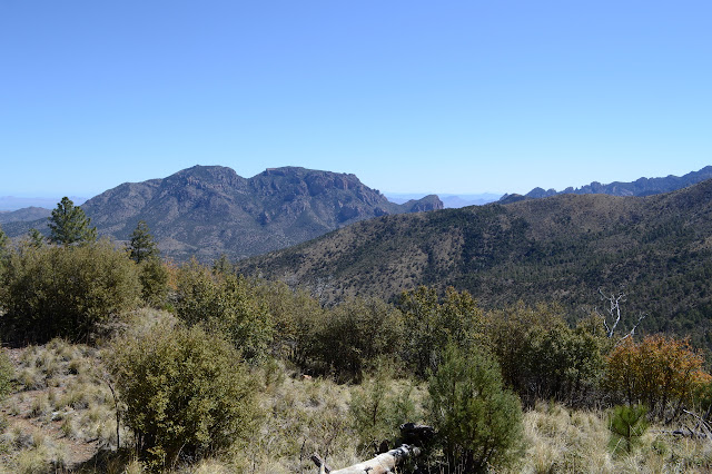
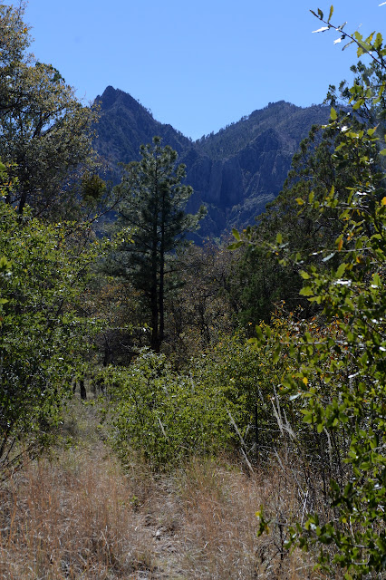
Once in the wilderness, I am surrounded by scrub regrowth after a burn. Snapped, blackened pine trunks suggest it was a little more forest like before. The trail is showing some signs of water wear, but seems to be putting up a good fight against becoming a wash. It seems a little easy on the climb for something that has to rise 2000 feet in 3 miles, but it eventually gets going. Cave Creek looks like it could be a difficult thing to up cross country, but it could be worthy. Besides all the great rocks, it also has a waterfall, but it keeps its much more hidden away from people than Winn Falls on Cima Creek but more exposed to the sun.


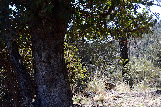
Pines return in the higher elevations, still showing where the fire bit into them. It would be miserable to get to Pine Park and find no pines. Coming around one corner on a shoulder of ridge, there is the fattest madrone I have ever encountered. I had read that Santa Barbara was the southern end of their range, but maybe that is just the coastal ones. They certainly grow tall and thin in the wetter northern climates. Maybe it's not a madrone, but look at the bark and the leaves, it has to be! Someone has been up here with a McLeod working on the trail in the last couple of years, too, and it is nice to have no difficulties finding the trail and walking on it.
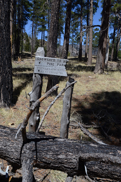
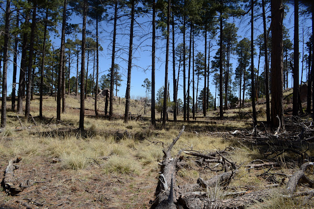
In a very protected spot in a small depression in the dirt, there is a little bit of hail rather than snow. The little ice chunks can look quite the same at a distance when they cover over the land and stick a little while. It certainly was hail down below, so I guess it was reasonable to expect hail rather than snow up here. At the top, a sign points out my way. Right for 1/8 mile to Pine Park and left for 1/2 mile for Fossil Saddle. Just 5 miles to the road below. Right for now. A moment of steep is followed by a bit of flat and something like a big bowl with fewer pines than it once had. I have arrived at Pine Park.
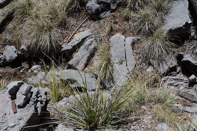
Next up, Fossil Saddle. The sign there has not fared so well. Many around here are constructed with a metal ring around the edge and this one is now a burned bit of wood with a too large ring. A larger piece of wood sits against a pine, but I am not certain it was a sign once. I'm not sure what else it might have been either.


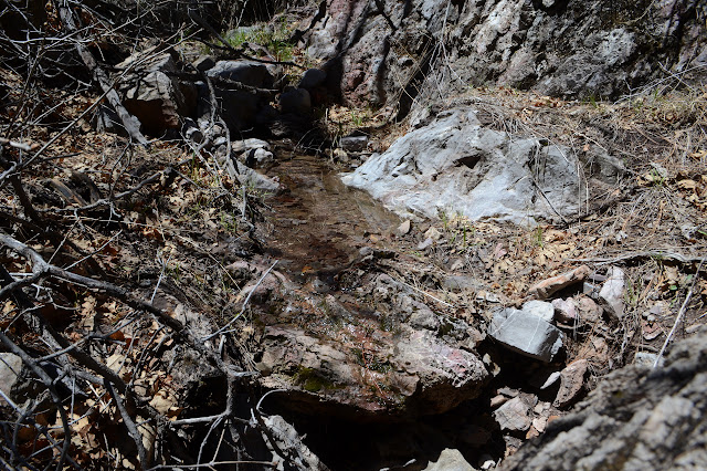
Today seems like a good day for the seep, so I head down. It is a succession of following a trail, deciding it is definitely not the one, then trying something lower. Eventually, I am pretty sure I have the trail, but if seems to vanish before the actual seep. There is water in the bottom, so there could be a seep. Following it back up, I simply missed the trail again because I was going to where it is marked on the map instead of to the actual thing. It has a piece of sign next to it and everything.

USGS says this trail goes all the way down to South Fork below, but it was faint enough where others acknowledge it. I head up again managing to follow the trail about halfway to the top, then deciding a fallen tree is hiding a switchback. Maybe. There's trail I think I walked above anyway. I have got it in my mind that Fossil Saddle itself is a lower spot on the ridge and head down. Very silly and a poor excuse to neglect to look through the nearby rocks for the namesake. So now I have half a mile down a ridge that is 5 miles to the road, but I don't have to go that far. I can take a trail about a mile short of that back up to Herb Martyr. It should be 11 miles total? I may as well. But I'll stop in a saddle for lunch first.

The trail is nice enough as I head down, but doesn't seem to have been worked as recently and has some areas that were really hard hit by the fire. The next destination on the sign is Cypress Saddle where the trail switches over from being above Cave Creek to being above a small drainage between the two forks. I'm looking forward to seeing what is being called a cypress since the closest thing I've seen is juniper. The saddle was devastated in the fire. Nothing of any height remains.


But with the trail transition, there is a bit of the more elaborate canyon to see. The unfortunate trees, standing dead, block the view for a short way, but soon the area is a grassy hillside with quite a lot of view.


The trail swings to the other side of the ridge again and starts down. The transition comes with some welcome shade as it is starting to feel quite hot this afternoon. The land seems to change over to an oak savanna as it flattens out toward the bottom of the valley. The junction I am looking for is marked by decaying, but not burned, signs. The trees don't look particularly harmed either.

So I turn and start a very gentle climb back to the campground. There are cabins along the road, and the trail takes to a fence line on the far side of the creek from them. Guess they really don't want us to wander over to the cabins. There are signs for the access to the road at the end of the cabins and at John Hands Campground. The fence continues on. I'm not entirely keen on a fence walk. It has a few minor moments of interest. There is a view of Winn Falls, of course, and a long rock staircase on one side of a gully crossing. I'm sure I followed this trail down along the creek a little way one day, so I am expecting to get down off the hill eventually. Passing Herb Martyr, I am sure I have missed something and lost the trail as it gets steeper along the fence line. There are water bars right there edging the fence. It is embarrassingly late that I finally realize I won't have to check out that mysterious trail along the wilderness fence. I'm on it. That trail I followed must have been just some random use trail.
Sure enough, I finally get to the Basin Trail where it enters the wilderness and can finally turn back to get back to the campground. It is a little bit out of the way, but I finish up at 10.5 miles, a half mile shorter than I estimated. It might be time to move on. I was feeling a little bit like I was repeating myself even though this is almost entirely new trail.
©2019 Valerie Norton
Written 3 May 2019
Liked this? Interesting? Click the three bars at the top left for the menu to read more or subscribe!


Comments