Cave Creek: Showshed, Chiricahua, and Flys Peaks
Coronado National Forest
Click for map.
Start with the FIRST DAY <<
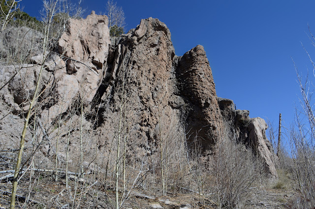
(Day 2 of 2) I have pudding with chia seeds and pecans requiring no cooking to eat, but I want some hot cider so I have to pack up camp first. There just isn't a single bit of flat area not already occupied. The rock wall I am below is interesting. At first it looks like a bit of old river bed, but it is actually volcanic with minerals leeching through. I'm not sure what the structures I took for rounded river stones at first are. The "impact crater" is where the water lands as it rushes over the top of the rocks in the rain. The spout is dark from water stains. Back along the crest are many patches of snow including some in among the bigger tuft of trees near where I first thought about stopping for the night.

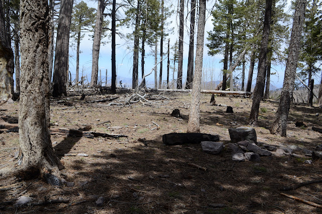
My first goal for the day is Snowshed Peak, so I head right back to the saddle and start up the peak. The saddle is grassy, but the peak quickly becomes a mess of regrowing aspen as I climb. I struggle a bit through it all until suddenly finding myself on a built trail. Big rocks have been moved to the side and everything. It is a little easier to follow up, but I must be doing a bad job of it because I am having the sense that there are actually two of them that I keep switching between. Thickets of aspen and fallen trees make it difficult to stay exactly on the trail and for a bit I find myself actually using the berm of large rocks beside it. Toward the top, someone has made a few token cuts at clearing the trail. The top itself is full of fallen logs that simply must be navigated to the high point.


I do a better job of following the trail back down. Whoever had done the work at the top did a lot of work a the bottom before I found the trail. They probably ran out of energy or time and popped up to the peak, then did a few more things after a rest at the top.

And then back to my tiny camp and the trickle of a spring and to finding one more trail that leaves from it. First a little more water from the spring because it turned out to be quite nice water and I have no idea what Eagle Spring, just a short way along the trail, holds.
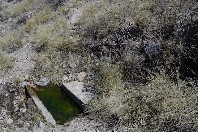
Trying to find the other side of the Crest Trail as it meets at the spring is the same exercise as last night. Follow what looks like a bit of trail out onto the ridge in a way that none of the trails go, then circle back. Up above, there is trail and it can be followed back to the sign nailed to a tree. Of course. From the map, it looks like the spring is at the junction, but it is really a few feet off to the side. It wraps around again to the southwestern side of the peak and to views I only partly saw in the night under the moon as I made my way toward the spring. Halfway along, Eagle Spring is visible with a little trail (and even a sign) down to it. A similar concrete trough is unbroken and full of water making it a much easier source for the important stuff.


The trail sort of makes a triangle around Chiricahua Peak and at the next junction, everything is Crest Trail. Well, one bit is #270 and the other two are #270C, but the sign just says Crest Trail everywhere. I take the right, which brings me quickly to a sign for Ojo Agua Trail. As near as I can tell, this takes me to the source of Cave Creek. It's only 300 feet down battling who knows what in tree fall on tired legs that did 16 miles yesterday. The source... I will go and I will see. Trail is fine down to a sign pointing out Headquarters Spring is off to the left. This one is much closer, so no wonder that the trail seems better used that way. Never mind, I am going to the source.


It is a lovely little spring coming out of the canyon a few feet above the dry creek bed. The flow could be likened to a garden hose, and a somewhat weak one at that, but it seems like a really nice bit of water for being so high up. Now I have to climb back up. Ugh. The trees, the downed trees. I briefly think about checking out Headquarters Spring too, but it has plenty of trees down too and I already found a nice one. Back at the Crest Trail, there was another reason I was looking for this junction. There should be an old trail up to the top from here. One peakbagger says it is entirely gone, and he does seem to be correct near the junction. As I scan a little further on, I can see a bit of trail. As I follow it, logs have been cut apart for me and cairns set. It is not quite so far gone as stated. Further up as the peak flattens out, it is more of a shallow water course, but there are still a few cuts to give me the nod that I am on track. Then I am at a cube of rock with a benchmark in the top of it.
There is not too much view in among the trees. The north side is a little more clear, at least until the aspen extravaganza gets going. There should be another benchmark a little way down the mountain, but I can't find it.

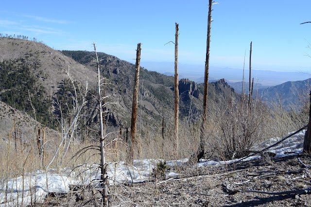
I still have that one more peak to go, so I head down the regular trail, which has a bit of snow on it. This one seems to have been maintained recently and is very easy to follow down to the Crest Trail once more. The Crest Trail is not quite so nice as I make my way through another section of 100% dead trees. So many are still standing that it is going to get a lot worse. A pair carrying long metal somethings come up the other way, the first footprints I've seen being made. They are just day hiking as there are easier ways to get up here. There is a sign for Anita Park and pass without going up to see its spring. The trail is somewhat visible. It looks like they are counting people at the top of Greenhouse Trail. There is a nice bit of green trees to travel under as the day starts to get a little warm, but plenty of them are falling over too.

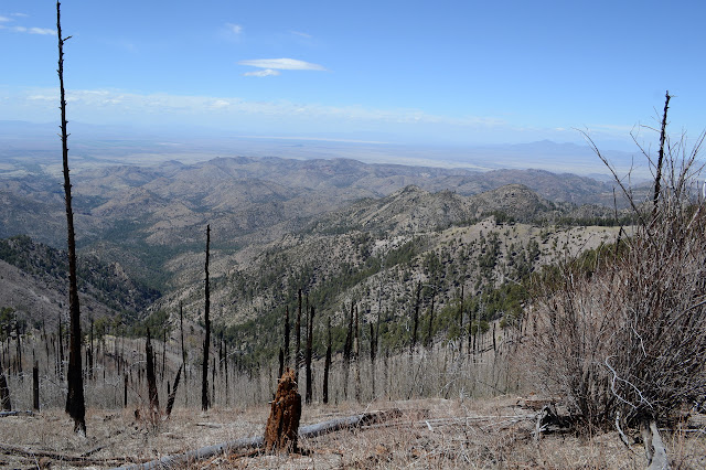

As I approach Flys Peak, there should be trails around both sides, one going up, and one down to a spring. I can only see one well worn trail around to the left and a sign pointing out the one going up. Another exercise in following what is probably trail gets me to tree cuts and definitely trail for the rest of the climb. A big cairn topped with half an insulator marks where trail from the other side also climbs up. I keep going up and up and stop at a bit of concrete that probably once had something to do with another fire lookout that once sat at the top of the peak.


So now to find the benchmark. It is not shown at the top of the peak, so I wander over to where it is supposed to be nearly tripping over a reference mark. Well, there really is a benchmark. Following the arrow gets me a long way down without seeing anything. Well, that was reference 2, so there ought to be a 1 around. It takes a little searching, but it is there. The triangulation point is just a bunch of small, loose rocks. No station. So it goes. And so I go, on back to Greenhouse Trail and start down missing Booger Spring and the spring marked high along Cima Creek. Greenhouse trail quickly gets into nice forest, or so it looks, but again there are a lot of green topped trees down. Just past the spring is a ranger station, so I am suspicious that any spring would be plumbed for it and inaccessible.

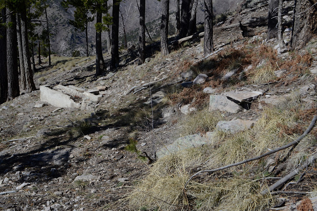
The Cima Park Ranger Station looks to be in quite nice repair. The sign says for use of trail and fire crew only. My little bit of spring water is about up, so I head past it down to the creek, stepping over a slightly exposed bit of ceramic pipe heading down to the creek. Um. I think I'll go a little upstream. The outhouse is also rather close to the water, but it has a patented fly proof cover on it! One of the forgotten wonders of a bygone era. The creek has good flow, especially for being so high up the mountain. Below the ranger station is a ruin. The green house?

The trail stays high on the side of the steep dirt canyon for a while, which gives me one kind of worry traveling it. Then it drops down to the creek and starts crossing constantly in a way I would not expect of a trail that serves a ranger station, even if it is no longer such. Then it gets into some spots that aren't high up from the creek, but could easily land one in it. A rocky bit 10 feet up has missing sections almost too long to step across. I am glad when it finally leaves the creek to climb into the next canyon.


There is a viewpoint up at the top of the ridge. As I drop down, my view narrows down to mostly that of Silver Peak. Halfway down, there is a good look at why the trail had to leave Cima Creek: Winn Falls. Much of the long cliff it tumbles down is lost even at the official viewpoint. There is trail out further and even something very scrappy going up a little peak. I am not certain it would actually give a better view, but I go out a little way and there is improvement. I am not feeling quite ready for the little peak and leave it.


Besides the waterfall, this canyon is a little bit plain. Not entirely plain, but certainly not a match for what I went up. Also, it seems to be clouding up in a determined way with a foreboding of storm to come.

I am getting hit by raindrops before I leave the wilderness. The 10% chance of rain isn't supposed to happen until tomorrow. I can pull out the water resistant windbreaker that isn't particularly, so I do. It is mostly big, lonely drops that are coming down.
The end of the road has a turn around, but no parking for anyone who might actually try driving it. Just short of that, it seems slightly undercut by the stream running beside it, but then none of that matters because there is a tree across the road, so no vehicles are getting that far. The tree limbs hang down so far, it looks like no one has tried getting even as far as the downed tree in a long time. I keep looking for camp sites, but any disturbance by the side of the road, and there are very few, looks like some hasty turn around point. There is a sign for the Basin Trail as it continues north, although I'm not sure everything is pointed correctly. The trail looks like an even lesser used road to me. As it gets darker, it gets wetter and the thunder rolls more frequently. I am glad to get to the smooth road where I can stop carefully placing my feet around the rocks and start swinging them quickly. This stuff is going to break and I would rather it didn't do it on top of me.

It holds off breaking until I have more protection, but it does break and pour down something fierce. I guess that chance of rain probably got updated and upgraded sometime after Sunday. As the thunder thrashes and the rain pours, I am really glad I did not decide to be out in it. Oh, and my kitty is reported to have been well behaved. That seems unlikely.
Although this trip was done "point to point", there are trails to connect most of the route between the trailheads in about 3 miles.
©2019 Valerie Norton
Written 1 May 2019
Liked this? Interesting? Click the three bars at the top left for the menu to read more or subscribe!


Comments