Crystal Cave route
Coronado National Forest

Click for map.
If you want to go into a cave, then stop right here because you can't get into Crystal Cave without at least a chat with a ranger way down in Douglas. It is locked up and left a bit obscure although the trail to it is the only thing on the map. Across from it is parking for the Snowshed Basin Trail that connects Snowshed and Basin Trails. Or maybe it's the Herb Martyr Trail. They sign actually says "Snowshed Basin Trail / Snowshed Trail / Basin Trail / Herb Martyr Campground / Road 42" which is a lot of things to be, but none of it has arrows. Oh, and there's a warning about entering a burned area because this part of the forest burned not too many years ago too. It would be nice to get away from burn, but it's getting harder and harder to do. I turn around and there is a clear, narrow trail. It passes a blank sign board on its way to places unknown.
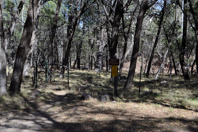


It is flat for a bit, then crosses a dry creek and scampers steeply up the other side to go high and avoid a short drop off. Some just climb the drop, I suspect. Or maybe they try going up the creek just to be stopped by it and come back. I go up and down the other side and cross the dry creek again to a sign that makes it clear, finally, where I am and that the cave is closed. "Obtain permit information at Ranger Stations - Portal - Douglas - Tuscon." It sits on a clearly constructed trail while up to this point was not so much so.

I actually have a different objective in coming that is better done if I stay high and don't do the last crossing, but I am now wondering if there might be some clue by the gate why it is called Crystal Cave. Onward and upward. There are some good views around the canyon from the trail.


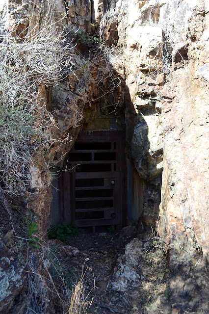
The cave really is locked up tight. It even has two different locks of the sort where the blanks are specially made for the organization. I peek in to see what might be visible, but there is nothing much of interest. I wave for the camera, but it doesn't get my picture until after I've stopped moving. The trail continues on, but without quite so much enthusiasm as it had getting to the cave. I don't really feel like following that.
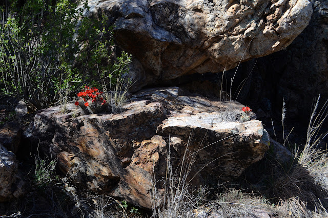
So I head back down to poke around on the small ridge across the way, but a bit of red causes me to pause. Hey, it even has a convenient trail up to it.


This trail is a curious thing. I notice that someone has actually been cutting branches along it as I travel back to the main trail. I'm not going to see where it goes either, though. Could well just be some hunter's trail. The real reason I am poking around is to get a geocache, so I cross back over the creek and poke my way up the hill to find it. I'm glad I went on the other trail too. The geocache advertises a view of Crystal Cave and indeed you can look across to the outside of it, there just isn't any view of anything else there or along the way.

And with that, I am done, so back to the car and back to camp.
©2019 Valerie Norton
Written 21 April 2019
Liked this? Interesting? Click the three bars at the top left for the menu to read more or subscribe!


Comments