Ben Lilly memorial
Gila National Forest
Click for map.
The stop is one I wouldn't know about except that there is a geocache to mention "the little trail" and OpenStreetMap marks the memorial. It looks like there may have one been a little parking beside a sign to alert drivers to the presence of something along this hairpin turn. Now there is a sign post and if you drive off the road beside it, even a high clearance may not do well. It is possible to park inside the hairpin, even with a low vehicle. After parking, I head to find the first of three geocaches in the area, utterly fail to find a second even after a lot of looking, then decide not to even go after a third because there's a whole lot more terrain between me and it than indicated on the crude elevation information also contained on my OpenStreetMap. My goodness, but there is a lot of terrain hidden from the road behind a few trees. Of course, none of these are on any sort of trail. Priorities.

But once I've decided not to go after the last, there is still the subject of the little trail. Where is it? I head back to the start and the sign post. It really does look like there was a graveled area to drive on here and then they decided to forget about it and bank the turn. So I follow the little blue-grey rocks that seem not to belong until they fade. There are a lot of footprints here and they have beaten a few paths. The close geocache is just far enough off to be away from these paths. However, one of them has concrete water bars. Nothing says someone official built this trail like concrete water bars, so I follow them like cairns to a little concrete stairway, and up that to a metal memorial. That wasn't so hard to find after all. And it was really little.


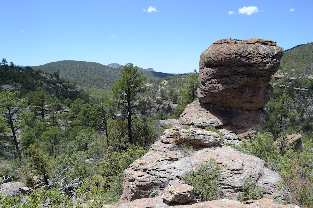
Ben Lilly seems to be a less colorful Davy Brown, but then Davy would probably be a less colorful Davy Brown presented in bronze like this. Ben also has his own campground named for him on the other side of the wilderness by Willow Creek. A few steps from the memorial is the view again.


Back at the steps, trails pound further along. I start down them then decide against and turn back. That wasn't so hard to find after all.


©2019 Valerie Norton
Written 13 Jun 2019
Liked this? Interesting? Click the three bars at the top left for the menu to read more or subscribe!


Comments