The Military Road
Gila National Forest
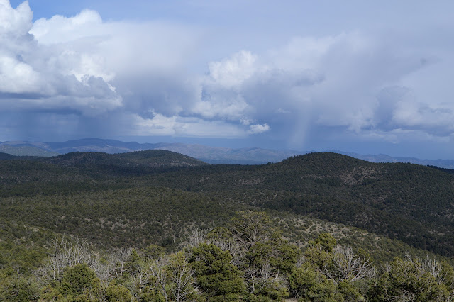
Click for map.
I'm getting antsy about getting in my long hike. The weather yesterday threatened terribly, but it looked like the folks who took horses out in it had nothing particularly long or hard to deal with. Today only has the slightest bits of threat here and there, so should be better. I'm taking my rain gear anyway: the old non-breathable coat and a cheap rain skirt I picked up and my tall gaiters. The breathable coat leaks, so it's out, but my legs are most sensitive to feeling clammy anyway. The skirt technically doesn't breath either, but it circulates instead. My shoes are just going to get wet if it rains. Extra wet with everything getting pushed down to them. Ah, misery. Maybe it'll stay a nice, blue sky.

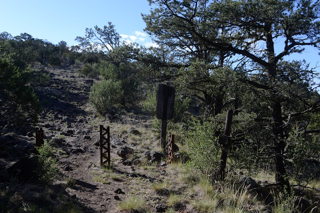
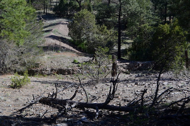
I start off at the kiosk, which doesn't seem to say anything about the trail. The road is not too rough as it executes a loop that seems to have about four campsites along it. The corral at the other end has a sign that, after some effort to read, indicates that you should ask the Wilderness Ranger District for permission before using it. Past that, the road is narrow and lumpy and prone to steep moments with a couple big car camping sites along the side. Just past Jordan Tank (a muddy few feet of water just below one of the sites) is a "no motor vehicles" sign. The tracks show it is generally being honored of recent, but it does get used up to another little loop just before the wilderness boundary. They're a little more forceful about the "no motor vehicles" there.

So off I go to see what this trail holds. I'm really not sure except there are a few tanks, a couple benchmarks, and I might wander up a nearby peak at some point. I just want to go out and turn around sometime 2-3PM.


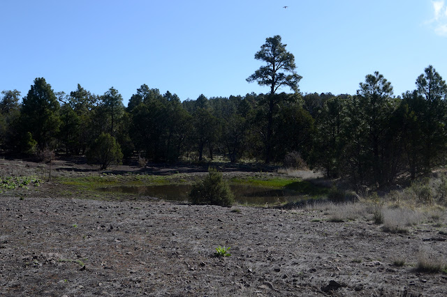
The travel along here is so gentle, I'm a little worried I'll accidentally get into the sort of mileage that hurts a bit. Sore feet and ground down feeling legs can really put a damper on a day. I'm not there yet, of course. I glance left along a track of hoof prints to spot the first tank of the day. It is a mud puddle with a few feet of water. Not much to delight, but then it is meant to preserve not delight.
A little further along, there is a broken up sign but not a lot of call for an intersection. Looking at the map, this is where the trail stops flirting with the edge of the wilderness and finally plunges into the expanse. It was probably an old wilderness sign. Maybe the fence that has been along the left, sometimes far sometimes close, sometimes visible sometimes hiding, will finally go away. There really are a lot of fences in this forest. The area around the sign looks like good camping, but with so much flat anything can be.
A bit of mystery artifact pops up at the side in the form of some corrugated sheet metal connected to bits of wood. I have no explanation. Gila Flat Tank is not much past #2, but much further down the hill. It is quite a bit bigger and some details about it attract me down for a closer look. More engineering went into the dam on this one and there seems to be a cabin. Indeed, there is. It is even marked on the map although I failed to notice it before. Water runs down through the meadow below the tank. I expect this simply seeps through. It does look a much nicer water source.

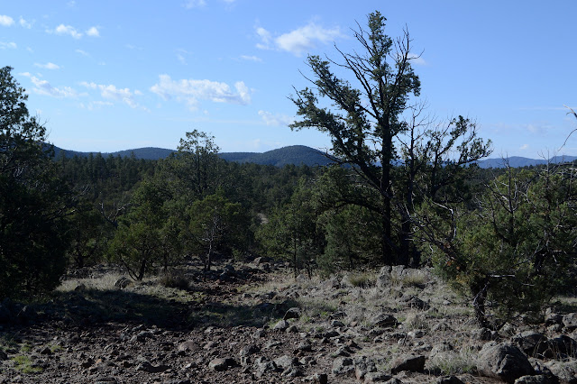
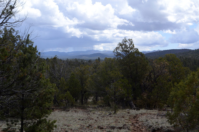
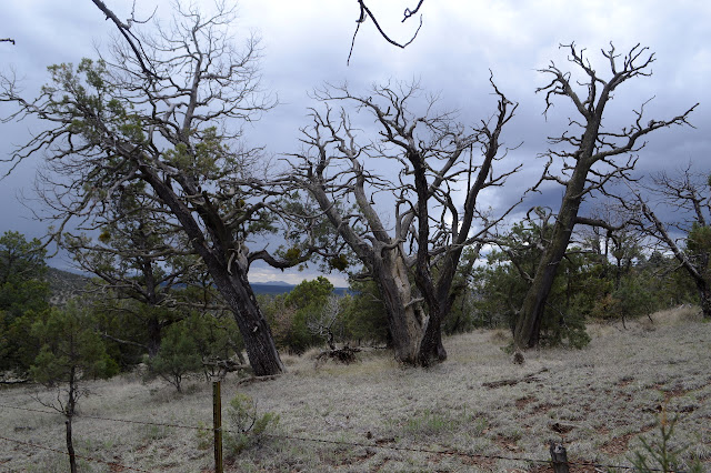
I am starting to think that I should not have worried about clouds coming in to take away my views. The area is so flat that the only thing to really look at are the wild old alligator juniper trees once in a while. There are some very tortured and exposed ones that cause awe at the tenacity of life.


I manage to notice that I am getting close to the benchmark noted on the map. I am not certain what I might find after my searches for various marks in the old Fort Bayard lands. "The Military Road" sounds like it might be related. As I am getting a little past the location marked, there finally is a distinctly old but human made pile of rocks. Well, that could have been felt to be sufficient marking to make it a recoverable location, I suppose. I am so much expecting something that wouldn't be considered sufficient today that I almost miss noticing the actual disk behind the rock pile.

A trail splits off to my left and as I wonder who might have decided they needed a trail there and where it might go, I notice that the fence once had a gate there with a wire strung high above it. The fence has continued to pace the trail long after it left the wilderness boundary. It is in particularly poor repair here by the gate, which is thrown open and one side fallen along with quite a length behind it. No sign marks it though. My exploration today is of a less deep kind, so I keep on to notice that flagging for trail work has started up and then there is some actual recent trail work. As if to illustrate the importance of the fence, there is one tree that they could not bother to remove from on top of it even as they removed it from the trail right next to it. There are views now, just a little bit, and some of them show a bit of raining. The valley to my right seems to be having a long bout of it.

The road is shown to take a big turn at Thirtytwo Tank on the Forest Service map, but OpenStreetMap shows another trail coming up from the north. I think I might take a third option and continue off to the east to go up Middle Mountain. The tank itself is almost completely dry but still easy to notice by there being still more fencing surrounding it and going in all directions. To my surprise, there is a rather new looking sign to mark the junction facing those coming up from the north. It says I've come 4 3/4 from 15 and have 5 3/4 to get to 35 if I should like. Well, 10.5 miles total one way then. Huge rock cairns mark it as it goes south. As I start to plot my way to the east, I can't help but notice that about 5 feet north, there is another trail for me. It is thin but shows some use by more than wildlife.

I may as well take it. It heads up a hill that appears to have once had something built on it, but about 12 feet of stacked log fence is all that is left now. The route does not seem all that promising at first, tending a bit far to the south. It wiggles toward a saddle I think I should pass along and then swings south again before getting there. Suspicious it just knows something I don't, like that the hill side gets a bit steep with minor rock climbs that way, I leave it for the more direct cross country route to encounter yet another fence. Since I want to tend a little north, I cross over it at a near downed spot, but it isn't following any directional lines. I am stuck on the north as the trail comes around to follow it on the south side. By the time I get to the open ranch gate in the fence at the saddle, I figure I will just try the trail as it is. I now expect it to cross between Middle Mountain and a peak nearly as tall to the south. From there, if I follow the tanks as bread crumbs which seems rather dubious, it might drop down to Big Rock Canyon near Slick Rock Canyon. That sounds interesting.


Faithfully followed, the trail curves around the edge of Middle Mountain in a very easy climb to exactly where I think it is going. The wide saddle at the top looks like something that could rightly be called a park. It is a little hard to see as it crosses, but has a very definite direction east. This is where I get off, so I let it do whatever it does and turn north to just generally figure out what way is up and go that way.


The tree covered top is wide and flat and has that fence wandering up it, taking a corner, then down again. There are a few spots to look out over a little of the land, but not that much. The clouds are putting up a few rumbles that seem distant and non-threatening, but with only about 5 seconds between flash and sound. After a snack at one lookout, I figure I should go down again. There's not much to the peak anyway. The fence probably follows the ridge line that was my original plan to get here, so I'll follow it down to the saddle, then take the trail back.

It is an easy slope down, but the footing needs more watching since I'm now off trail. Even this bit of fence has a mystery gate. The one at the saddle made sense even if there is no trail, that would be a typical cross country crossing. This one, with tall posts on either side and a wire across the top to help mark it from afar, seems less so. The land looks a little as though it was once scraped and just a little way along this scrape there is a spot where rocks have obviously been pushed to the side. Old road and now not even a trail. I go onward, stopping for a moment to put on my rain gear at the first few drops. They seem inevitable now and I still have some time to turn around. I am a little unhappy that continuing on will mean walking into the raining area.

Once at the trail, it is doing a better job of raining. It is getting a lot colder, too. I hadn't been wearing my fleece, but now I wish I had pulled it on before the rain coat. What I don't want to do is stop and let the rain in while I get it on now. Just walk faster to get warm, some say. That never seems to work for me unless it is a solid uphill. All I have seen so far is are gentle slopes and this one is mostly down. At least the water is beading on my coat.

Ten minutes later, the water is not beading on my coat and I think there might be a little going down the back of my neck. This trail seems harder to follow, or maybe it is just that I spend more time looking down now that my footing is getting soggy. I'll just get to the second benchmark, I think. It was exciting to find one so old and would be fun to find two. It is a little way past one more tank.

The mud just gets worse and worse on the trail and my misery just increases. My arms feel wet, my head is wet, there is a slow stream down my back. The only thing that will be still dry shortly is the bit from hips to above knees that is covered by the new rain skirt, which works well except for a tendency to get kicked upward by my knees. It is made to wrap with the slit to the front, but that tended to leave it riding upward and letting water in at the center, so I quickly turned it backward. And why am I enduring? So that I don't feel like I got back too soon? That seems a rather poor reason. The rain seems to be settling in ad the thunder has stopped. The mud threatens to overtop my shoes or throw me into it as I get close to the tank. Since I am practically there, I'll see if there's any water, but then if the benchmark is really that important, I can just hike up to it from the other side another time.

So I walk right back up through the treacherous mud and stream gullies that might be trail or the walk around might be trail. For now, I'm going walk around. A little spot where I lost the trail coming is easy to follow going and includes a predated fox that is now a head and part of a spine. It is an odd thing to see. The rain that seemed so settled actually gets bored and fizzles. I am almost back to the junction as it gets light enough that I am willing to pull off my coat to put on my fleece. It is silly considering how soggy I am. My right hand doesn't even want to grip well enough to pull the zipper, but my weak hand proves it is not so weak. I really should have just done it. That was too long to wait. I probably only spared myself a few minutes of rain by turning around. It was just a half mile more... but really, if it is so important, there are ways to get here again. I continue my march back and at least the feeling of misery is fading.

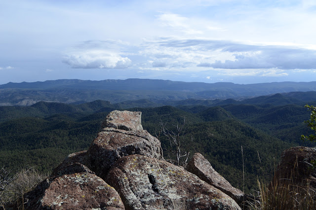
It gets sunny, but it still takes me a long time to want to get out of my fleece again. Back at the Gila Flat Tanks, I am thinking again about Buck Hannen Mountain. It is sunny now and I do have the time. Getting there is the same as before. Take a left turn and try to figure out which way is uphill. The second part is actually a bit of a challenge at first. I preserve on and it starts to slope a little more before coming to a rock outcrop and what I have to admit is a surprisingly good peak. Not just in the direction of the drop off, but for all directions it is a rather good view point.


I head down the north slope, which is also nice and easy. It flattens out and then suddenly I am at the trail again. It only took about a half mile extra to go up the mountain and it was very much worth it. I hike on back, registering a bit of surprise that the oversized looking camper that was down on the loop in the morning has now made it up to the spot above Jordan Tank. Nice spot if you can get there.
©2019 Valerie Norton
Written 26 May 2019
Liked this? Interesting? Click the three bars at the top left for the menu to read more or subscribe!


Comments