High and Low on the Gila River: Middle Fork and Little Bear Canyon
Gila National Forest
DAY 1 | DAY 2 | DAY 3
Click for map.
There is not the slightest hint of frost in the morning. It is much warmer down here than it was in the park. My shoes and socks aren't quite dry from yesterday and chilly to put on, but they'll get even wetter soon enough. I devour my breakfast a little easier than usual and pack it all up. With a quick look over to make sure the place is clean and nothing left, I turn to see exactly how soon. The sun is not even thinking of peeking over the top of the cliffs (besides, the sky seems a little overcast) at 7:11AM as a cliff ahead forces the trail across and I plunge into the water with almost no hesitation. The water is not bad, really. It's the evaporative cooling that starts as I step out that is annoying.

It is 3/4 of a mile before I get to a better camp site and just across the river is a particularly nice one. I could have got there before sunset, had I known. It's just impossible to know without having been here before.

The first pair of hikers coming the other way includes one that is finally happy about carrying dry socks all the way from the Mexico border. The water isn't that bad, but his glee now will be nothing compared to his glee when he hits all the snow melt in Colorado. I need to stop thinking of my neoprene socks as "for Colorado" so I can remember to grab them for likely cold water dealings in other states too. Mine are in the car.


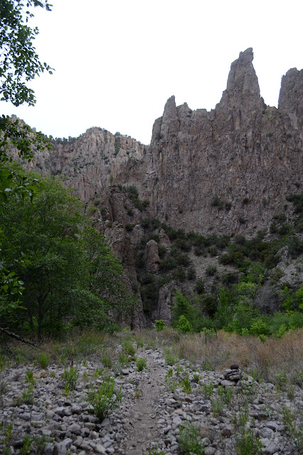
A particularly wide grassy area, big enough to be getting some sun, not only has quite a lot of camp sites, but most of them even seem occupied. Some tents are moving, many show no signs of life. I cross the river to a pretty little pouring of water down the mountain. A pretty little pouring of hot water. It feels nice to soak my toes, just starting to hurt from the cold, in the hot water. The trail splits here, but the large portion goes up. It climbs steeply to a pair of large pools occupied by three of the residents of the "lifeless" tents. I have found Jordan Hot Springs. I don't quite feel ready to join them, so try the other trail instead.


There is the unmistakable smell of unattended campfire up ahead, which makes me grumpy. I'm not sure how an unattended fire smells differently, but as I round the corner, all signs of camping have vanished except for the burning logs. Someone seems to have thought tossing the rocks from the fire ring onto the fire would put it out. I have seen a lot of fire rings with the rocks pushed inward, maybe this is a regional practice. You'd think that someone might notice it only serves to weaken the fire ring and does nothing to the fire. Signs at the West Fork indicate that the area is drier than usual and been seeing more campfires turn into forest fires than usual. I guess I have to play Smokey the Bear again. Same deal as last time: If you don't think I ought to be pouring gallons of water over a fire ring, put out your own fire. Properly.


There is just one more river crossing to Little Bear Canyon and I am a few minutes past the time I wanted to be there to take the extra miles along the river toward the visitor center instead of climbing up. While a little sleep made me able to face some more crossings, I think I might have been crying "enough" before the end like I was last night. I will take the secret passage instead! This one doesn't even look like a secret passage from afar the way so many others have. I stop to wash the wet sand from my shoes and socks since simple shaking is not enough. It is too late for one sock with a couple holes along the side. I rather liked this pair. It was sold as dress socks, but mostly wool and have a nice bottom cushion and thin on the top and a fun pattern too. I should have been wearing the Darn Tough socks. I'm less keen on them and if I managed to rip one up, they say they'll replace it.
There is a very distinct trail at first, but then there is only the flat canyon bottom between tall rock sides. Although my shoes are wet, I hope for them to dry out as quickly as possible, so try to stay out of the thin stream of water winding through the sand. It really is a secret passage.


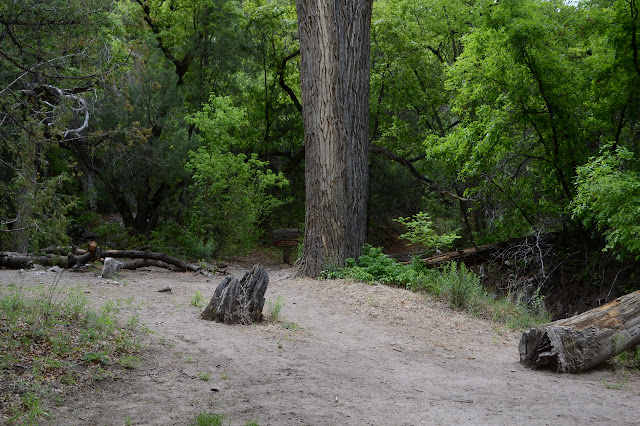
Gradually, the sides soften to hill sides and there are more trees and more trail along the sides instead of in the bottom. The higher it gets, the drier it gets. I'm passing a few backpackers heading the other way and wonder at their choice of big, waterproof boots as footwear. Hopefully there is something else hidden away. They could be thinking the same thing about my soggy and ripped up trail runners.
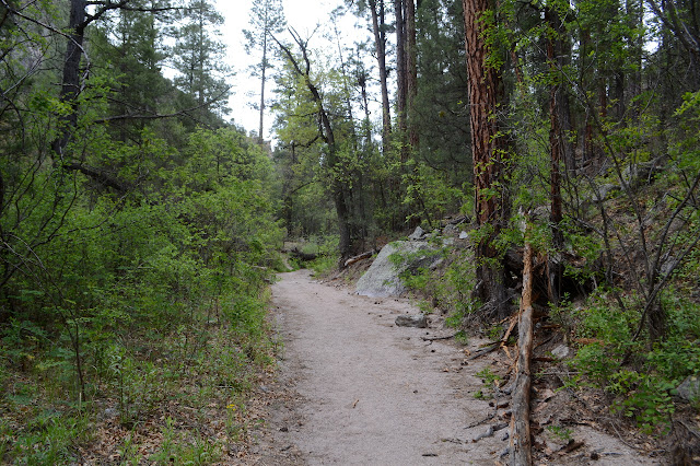


It's grassy by the top and stays grassy with junipers on the gentle downhill down the other side. Now canyons are part of the view instead of the path. This trail even gets a nice, big, wooden wilderness sign.

Finished up, I have clocked 45 miles (some likely fictitious) for the loop and come in with an hour to spare for my deadline to collect Timmy and got to see a bit more than I could in a day hike. It was nice to see the river up close and personal and nice to get out of it and get a little more high stuff at the end. And I'm a little closer to backpacking in every state. That makes 8!
©2019 Valerie Norton
Written 8 Jun 2019
Liked this? Interesting? Click the three bars at the top left for the menu to read more or subscribe!


Comments