High and Low on the Gila River: West Fork to Woodland Park
Gila National Forest
DAY 1 | DAY 2 | DAY 3
Click for map.
My cat sitter reappeared from nowhere! Well, from Woody's Corral after some half completed communication. She said I can have another backpacking trip, but there is a deadline of 3PM on Sunday to complete it. If the communication had finished earlier, I might have had a week to play with, but so it goes. The weather seems to be changing and the predictions seem unbelievable. (The highs and lows are too close together to be real.) Last night was a lot warmer (56°F) than things have been, so I expect I don't need any puffy pants. I got packed and moved and my backpack packed and things charged and a plan sorted by 1PM, just an hour later than hoped, so now I am ready to head out of PJ Corral (about a quarter mile from Woody's) intending to finish some 40-45 miles in the next 50 hours. First up is the slightest taste of the West Fork, then climbing up to Grave Tank.

The trail behind the kiosk is well used and easy to follow. The junction with Little Bear Canyon comes quickly and syphons off the hikers of the "CDTGR", which are most of who would be so close to a trailhead at such a late hour. I get to follow the trail paralleling the road except with a much longer path instead. At least I'm not on the road? Anyway, this gives a nice perspective of the canyon and the side canyons. Getting up close and personal with the side canyons is why it is so much longer.

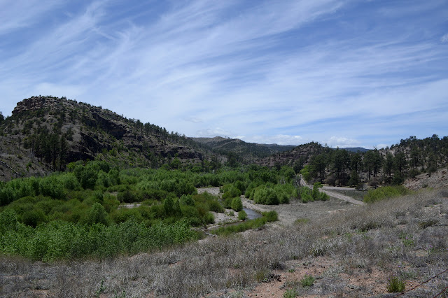
Once past the end of the road, it meets a connector from the Gila Cliff Dwellings National Monument and then the river. Splish-splash time! Actually, today is a very conservative day for cavorting with the river and there are actually only two crossings. I've been wading through too much of it, socks and all, in the past few days to bother with trying to keep anything dry now. It does look almost hopable via rocks, but not quite. I plunge in the ford just like the horses. Their shoes do seem to take up less water, though. Then wander the grasses and trees on the far side taking a moment to look for the Grudging cabin ruin one map says should be there. Not that I see.

As I continue along through the low hills, the trail swings back toward the river which seems to have developed quite a high sided canyon while I wasn't looking. The details I spot through the trees are a little misleading. One bit of rock looks like a big waterfall at first, but is actually a burst of white rock. It is well eroded and probably supports a nice waterfall when it is raining, but it is quite dry now. Slowly, better views emerge and then the trail figures out how to get down into it since there is that second crossing to do still.


This crossing doesn't look like it could be hopped on rocks, but I plunge on in anyway. I know I should grab some water, but golly that stuff is heavy. I'll make do with tank water. It's already up high for me. The junction I am looking for is just past the crossing. Time to climb.


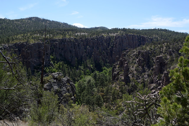
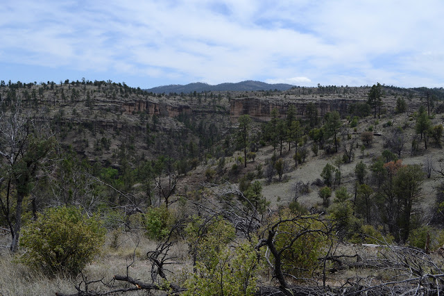
The canyon slips away into its camouflage of the hills at the top as I climb up into those same hills. The Forest Service topo indicates no trail past Grave Tank, but I have another source to say there is. The trail is not signed, but it is there with rocks across it and a cairn on the other to help folks stay on the slightly better defined official trail. It looks like it gets fairly regular use although not much in the past week or two. It is somewhat brushy and has been a long time since someone sawed out the trees, but nothing about it is particularly difficult to find or travel.


Grave Tank was a large tank once, but no longer. It suffered a breach at some point years ago and now the earthen dam and the ground below it is cut through by the occasional creek that has reasserted itself. There is no water here. Well, it is still early, so I can continue on. Big Bear Tank is up ahead a few miles. It doesn't look very big, but maybe it has something.


It looks like Big Bear Tank is intact, but fire has left it a little more exposed to the sun than it may have once been. The little tank might have some softer mud in the bottom, but no water without a lot of work. I should be able to get to Woodland Park Tank, another large one, before too late in the night. Maybe it will really be as nearby as the signs keep saying, but I doubt it. I wonder what route they might be measuring.

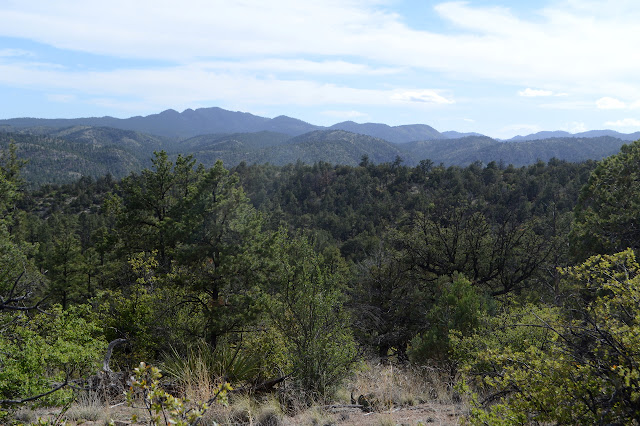
Maybe they are really measuring to Woodland Park, which seems to be vast and just far enough from flat for me to walk comfortably along it. The character here is a lot like along the Military Road. Much of what there is to look at are the old, twisted alligator juniper. That gives way to a long downhill among tall ponderosa pines. I can't help but notice that at least 10% of them have long scorched grooves from top to bottom. Lightning strikes basically anywhere it feels like around here. The signs still point off to the tank on Woodland Park, so they must not just mean the large area. The distance is more realistic now.


The gentle dip the trail seems to be following gradually gains a gentle green. It offers hope, but I do not quite dare to hope. Another big tank could have had another insufficient dam to hold it. The glistening thing through the trees seems like it offers hope too, but maybe that is just a mirage. It is a little late for a mirage. I must have put on a bit of speed for me because just before sunset, Woodland Park Tank really is there and it really is a great big beautiful splash of water. Surrounded by a lot of mud.

There is a camp nearby. It looks surprisingly unused. What do they know that I don't know? But it is 3 minutes to sunset and time to find a place so this is mine for the night. I walk around the tank for an approach that won't leave me caked with mud to find what seems to be the obligatory horse skeleton nearby. Down by the dam is a spot I can get to the water without getting into the mud. A sheen on the water makes it look like someone washed their dishes directly in the water here. Thanks. (Do unto those after you as you would have done unto you before you!) The shallow water is warm and yellow, but it is a little less yellow after the filter and it actually tastes good. I settle in for some supper, sleep, and the yipping of coyotes. Actually, they sound a little lower than the coyotes I have been hearing. Maybe they're the wolves?
ON TO THE NEXT DAY
©2019 Valerie Norton
Written 2 Jun 2019
Liked this? Interesting? Click the three bars at the top left for the menu to read more or subscribe!


Comments