Iron Creek and Clayton Mesa
Gila National Forest
Click for map.
I actually found the mystery geocache hidden "on" Whitewater Baldy. It was about 40 feet down the hill from where my information said it should be and full of black crumbling paper, charred trade items, and a very corroded geocoin that hopefully some vinegar will clean up sufficiently for logging. (I quite like Geocoins and other trackable items. They get moved around and the travels are recorded. The people who pick them up can write a little something or post pictures. They have a unique code that is used for logging them when they get picked up, but this one will be difficult.) There is another mystery geocache "by" Snow Lake with points to visit up on Clayton Mesa. This one was actually found once they year after the fire. The expected hike for it is about 14 miles from the lake down Middle Fork Gila River and up on the mesa. I have my own idea to visit 5 out of 6 locations by traveling a loop over Clayton Mesa and Iron Creek Mesa connected by a short bit of the Middle Fork with a spur out to see what "ruins" are marked on one map. It is more like 20 miles, but I don't have to cross the river even once. I do have a wet foot crossing of Willow Creek almost immediately and there are at least a couple crossings of Iron Creek. One wouldn't want to be totally away from water, surely? There is also a warning sign for entering a burned area followed by an older one at the wilderness boundary. One could be quite happy to be away from burned areas.


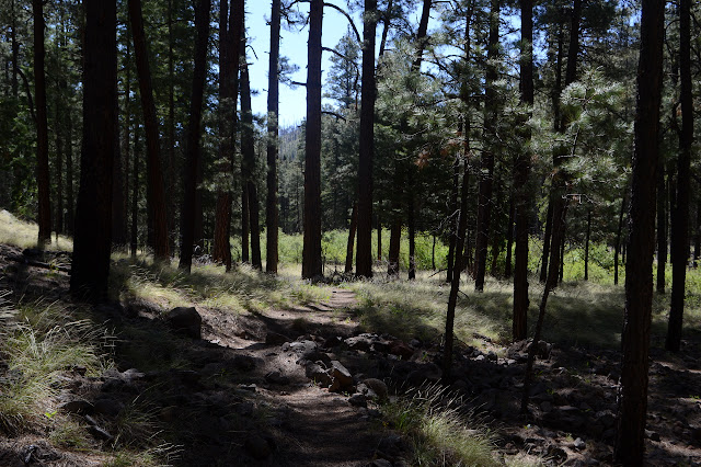
There are irises growing in the meadow. They are sparse, but they make me happy. How can you go wrong on a day when there are irises? The trail soon crosses Little Turkey Creek, but this one is so shallow and wide the water doesn't even get into my shoes. Further up, there is a gate of sorts. The trail shows clear signs of being a road once, but it would have been hard to squeeze a vehicle between the sides of the gate. It goes on to climb up to Iron Creek Mesa via a small, dry tributary that includes many crossings, most with culverts.


At the top, there is an unexpected junction with no sign. It is a bit earlier than expected, but is probably the Whitewater Baldy Trail, or the Iron Creek Trail as it was signed at the other end. It looks to be getting used well enough here, but it has quite a few miles in between. There are more irises in the meadows and then Iron Creek Lake. While it does have an earthen dam like the tanks, that seems to just be to raise the level which does not currently reach the foot of the dam. It could actually be a natural lake.

My plan is to go first to Clayton Mesa, which requires dropping down to Iron Creek for a couple miles, then climbing back up the other side. I am a bit worried as the trail starts to descend before a junction, but then there is an old sign with its bolts sunk in deeply because it was attached to a living tree that still pushes the wood outward while the bolts remain in place. Behind it is a little clear trail. That bodes well for getting back that way. The way I am going is still clearly old road.


The trail abandons the road bed for a bit where it looks like it may have vanished into the creek it stayed too close to. About halfway down, there are clear signs of a debris flow that came down a side canyon and scoured the bottom of this one. Much of the debris landed at the bottom, where it hit the much larger canyon of Iron Creek, and the trail had to be recreated. A little water at one point in the scrubbed bottom suggests there might be a spring, but it vanishes again quickly.

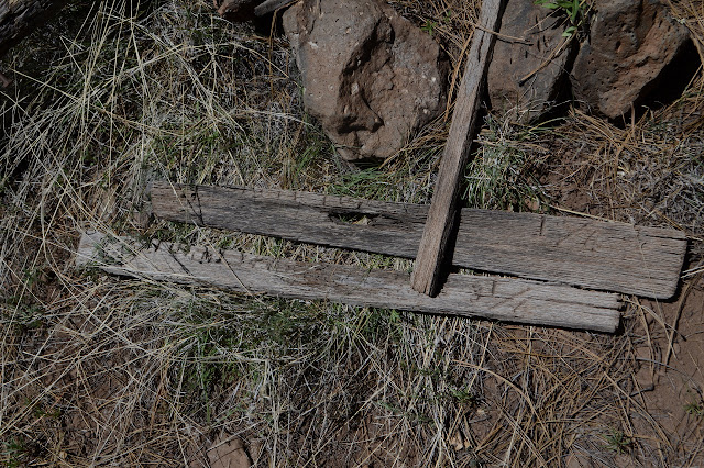
There is a suggestion of a trail heading up Iron Creek, but nothing on the map. I'm sure some go that way sometimes and travel would be easy enough. The creek is running beautifully and the fire was not savage here though it was nearby. I follow the trail signs over the deposited debris and past a new fallen tree heading down along it. There are still some signs that this was once road including a culvert washed from a small tributary crossing, but they get hard to notice in the wide, flat canyon. The trail sticks stubbornly to the left side of the creek although there are a few spots the horses cross. The road probably did too, or maybe it got where it was going.


The trail finally consents to crossing the creek near Cooper Canyon. There should be a junction here, but I see no sign of it and certainly no sign. The area burned very completely, especially Cooper Canyon. My trail crosses that creek, too, and then it is time for the climb up to Clayton Mesa. A very steep climb up the mesa. The trail should climb somewhere around here, but this one was made by use rather than engineers.
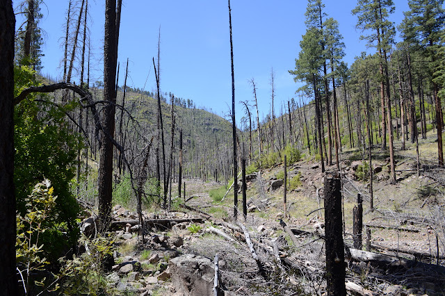
High up there is a very clear junction where there shouldn't be anything. No sign would have survived the savage burn around it. Maybe people still want a route along Cooper Canyon, but definitely not in the bottom? My trail levels off and there are blazes, so this track is on route again. It is surprisingly clear and obvious, all things considered. It isn't doing good things to my shoes, which have gotten thin in spots in the desert and are now ripping in the burn.


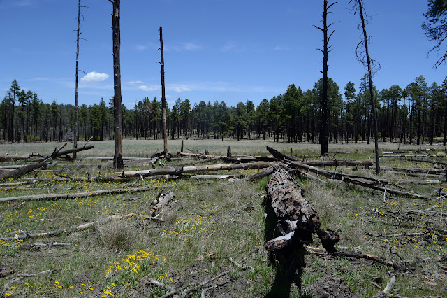
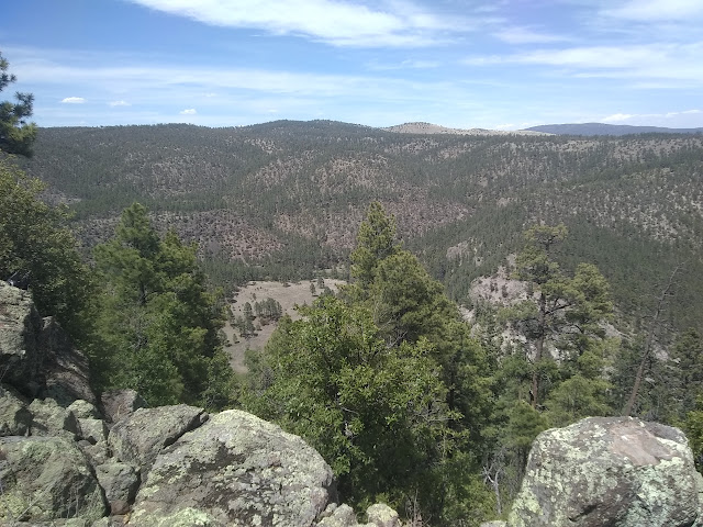
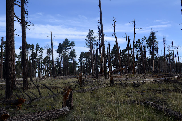
The mesa burned, but I seem to be traveling through parts where the fire wasn't all that destructive. It may have thinned the trees a little and the low branches are gone, but there is a forest. The trail fades a little as it gets out on flat. The trail fades a lot as it starts across a section of very destructive burn that is now a collection of fallen logs. As I lose the trail entirely, I figure I may as well enjoy the irises instead. The meadows up here are even more full of them than they were at the start.


There is another meadow and even more irises and somehow at the far end of it I seem to be on trail again. I follow the thin line noting the blazes that keep happily confirming the route. You'll get there, just follow this! Except I don't quite want to follow it entirely. I have waypoints 3-5 to check for the mystery geocache and two more for myself. I want to go up a high point and look for the RIM benchmark. Waypoint 4 is just off trail to my right, so I cross country up a little hill only to find it is on trail. There is a multiple choice "what do you see here?" question, but my answer is "none of the above". Not a good start. I try playing "what was here before the fire?" but now I have two possible answers, neither good. I make some notes in the hopes it will make better sense later, but hopes are not high. Following the trail back, there is a pile of wood that formerly pointed out the junction where the trail that I have been following ends at Clayton Mesa Trail.

Waypoint 3 is a little way off to the left. There shouldn't be trail there, so I go cross country again only to find there is trail. In among the burned logs, there might even have been some trail work. The question for this one is as answerable as the last. Not a good continuation. At least next up is the high point. That can't have gone wandering with the fire.

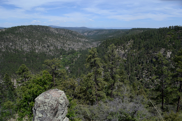
Waypoint 5 is a little further out onto the rim and it has better views than the high point. Iron Creek developed cliffs in its canyon shortly after I left it, and now I can really see them. Also, I'm standing on one. And I think I can even answer the question. The RIM benchmark is a little bit further along the rim, or should be. I can't find it. I can find a rusty can. I can find a slump in the rim where it should be, but that doesn't seem to be newer than a benchmark might be. The spot also has good views. Capturing them is made difficult because I seem to have been carrying around an uncharged battery as an extra for my camera.


Now to find the trail again to get down. Since the trail seems to have curved this way, it might not even be far. It shouldn't be that far anyway. Quickly there is something looking distinct, so I follow it until it starts climbing over the edge of the rim long before it should and in very steep, short switchbacks. This is not the trail I am looking for. I head off to find trail again, but nothing else presents itself. At the point of the mesa where there should be trail, there is only a fire ring and a very uninviting cliff. Maybe a little more to the Clayton Creek side...
Nothing nothing nothing. There just isn't any trail I can see. I decide to take another look at the one off the north side of the mesa, but at this point there's probably not enough time to finish the loop anyway. I need to go back out the way I came in.

Well, now returning should be easy. I go back to waypoint 3 and I'm on trail. So I do and follow that trail back only to find that it actually came off the main trail. I follow it along enough to see it really is the main trail. Blazes and everything. Maybe if I'd stuck on this. Maybe if I hadn't had the false clues of finding trail going my way at every turn. Too late now. I'm going back. I kick the tree off the proper trail at a junction where I had gone wrong on the way in before correcting cross country, then continue on. Everything should be easy to follow now. Shortly after a distinct "Y" in the trail, everything is distinctly different from expected. Hum. Maybe it's going to the even higher point. Maybe I don't have to follow exactly the same thing back. I go for it. It keeps getting faint and hard to find, but I keep accidentally finding it again. After about 5 iterations of refinding the trail, it vanishes altogether. Guess I can't always think like the trail. I just make my own way upward.


There are patches of burn that are now thigh high oaks growing up from roots. They grow close to each other and can be a problem to get through, but they are not bad here. I climb steeply up to the plateau above and then it is just a long walk to where it is highest. After a while, there is even a trail going my way. Halfway along, there are a pair of cairns that seem to mark a junction with a trail perpendicular. The trail is not quite going to the high point, but where that is exactly is uncertain. The map marks it a bit too far south. Things are certainly going downhill by then. Still, at some point I am in the vicinity of the highest point that can be called a part of Clayton Mesa. The mesa seems to have a series of high points followed by anther after a little dip. Even this high point follows on to the Jerky Mountains after a little dip. Oh, those Jerky Mountains! What jerks! I don't have time to continue on to that one. Actually, this was probably pushing it.

Then I turn to meet my trail again. I figure I'll follow a finger of mesa that sticks out in the right direction as it passes over the second highest of the points. Is there a trail going my way? It takes a while, but eventually I am walking parallel to one of the better trails of the day. I may as well use it, especially as I have a suspicion as to where it goes. Exactly.


As the trail drops over the side of this plateau, there are more trees to jump and it starts to braid, but the braids never seem to wander off. It feels a little bit like a ridge edge dropping away. It swings off that to a soft dirt hillside for some switchbacks, and then swings back to meet the trail at the junction I had noticed before. This is almost definitely a part of a new route people are using from Iron Creek to Turkeyfeather Pass. Three trails finish in the vicinity and one goes over it to collect them all, so it might be a major crossing point for travel around here. Then again, one of those trails is that one over Turkeyfeather Mountain of which I could see no obvious sign while traveling the Crest Trail to Mogollon Baldy.

Once at the junction, it's all just a reverse play of getting up there. Down the steep trail trying not to slip. Across the creek, which can be done leaving the feet dry. Along the flat beside Iron Creek, except where the trail gets scampery, without too much impetus to go wrong. Up the little scrapped gully to Iron Creek Mesa. I could grab its high point without too much trouble. It smoothly flows on to more high points after little dips until its at the top of Whitewater Baldy, and I've already been there.

Across the mesa and down on the old road is especially easy while enjoying the very bright pinks of the sunset. Little Turkey Creek doesn't make my feet wet, but Willow Creek sure does. I would only have to wear wet shoes for about 20 feet except that I didn't bother to drive the 0.7 miles from Ben Lilly (hunter of bear and jaguar) Campground, so I get to walk those road miles with soggy feet in the dark. The road sure feels a lot harder under my feet now than it did in the morning.
©2019 Valerie Norton
Written 21 Jun 2019
Liked this? Interesting? Click the three bars at the top left for the menu to read more or subscribe!


Comments