Snow Lake, Middle Fork Gila River, Aeroplane Mesa, and Loco Mountain
Gila National Forest
Click for map.
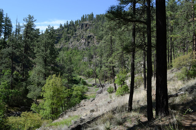
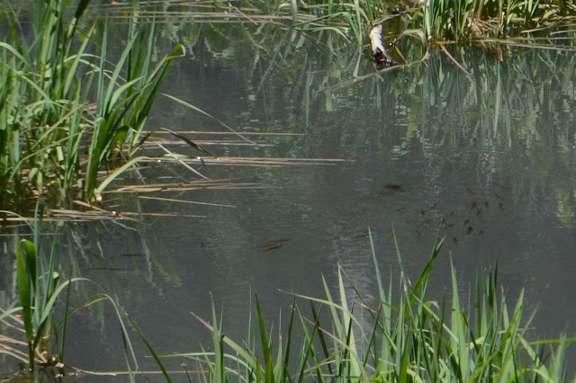
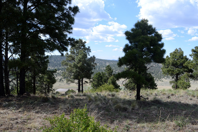
I feel... incomplete after the hike up and around and not down the other side of Clayton Mesa, so I came over to Snow Lake to hike down the river and see the ruins I didn't get to see and maybe even sort out this impossible mystery geocache. That last is really unlikely, but I suspect that if I'd got all but one of the clues on the previous hike, I still wouldn't have got close enough to the cache itself to bother trying to find it. I might have a better chance now that I'm taking the "correct" approach. More importantly, I bumped into the second fire lookout of Mogollon Baldy and she indicates the Middle Fork of the Gila River up here is quite beautiful, but you do have to get down around the dam first. Snow Lake is just a really big tank with a great earthen dam at the end of it. The trail starts at the far side below Dipping Vat Campground and skirts around the edge competing with some fishermen trails. There are a couple dads teaching a couple daughters the art of fishing at the side and one canoe paddling around the middle. The campground has a few others scattered around it, but certainly is not full. Any way you try, it is a long bumpy haul to get here.

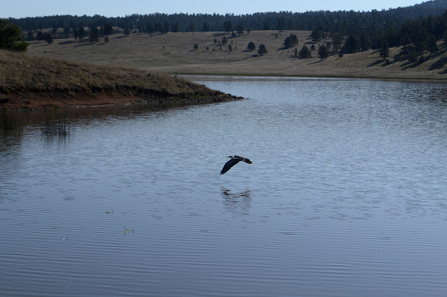
My way around the lake is made a little harder by confusing a fisherman trail for the official one, but the mistake is easily corrected. Something in the water right next to the dam makes a big splash different from a fish, but I can't see anything as I watch for it to come back up. Are there beaver? A little climb puts me up on the dam for a walk across and much further down the other side. The water below is generally stagnant. When the trail crosses back over the river, it is on stiff mud. These crossings might not be so bad.
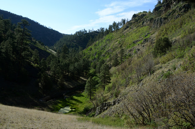
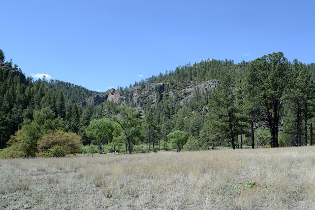
The stagnant pools and stiff mud for a river doesn't last long. Gilita Creek pours in plenty of water to get it all moving and now crossings are of the wet foot variety. It is already warm enough not to mind so much. On the far side, I am trashing through willows to find my way. This won't be fun if the trail is like this. It is a long time of ducking through a very well established trail before I finally break out to find the real trail has been going along happily just above the willows. The trail probably won't be like that. I keep going and get into willows one side of a crossing or the other some, but never quite like that first run below Gilita.


As the river makes some very long windings, I am below waypoint 6 for the mystery geocache. Way below. The other waypoints were by trails, so maybe this one is too. It is up one of the few easy slopes of the canyon, but I don't see a route marked in any way that goes up it as I go past.

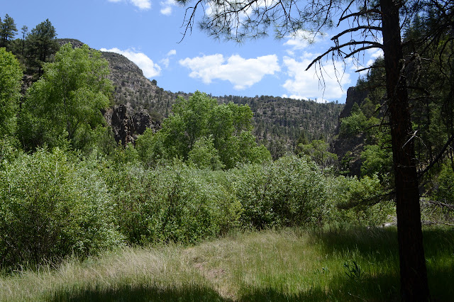
The canyon opens up and there are wide flats as I get closer to the ruins marked on one map. Trail sometimes splits to follow both sides of the meadow. I rather suspect that if I choose wrong, there will be more thrashing through willows, but there is nothing to indicate which is right. I choose, and there is more thrashing through willows and a big step into the river. Maybe I chose wrong. Maybe I'll find out on the way back.
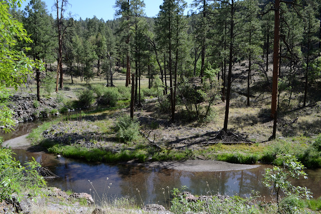

Waypoint 1 comes up and I feel fairly certain of the answer, but then I already was. The marked ruin is a little way back, so I backtrack to find it. There is nothing there. Except there do seem to be some rocks in a very straight line. As I look more closely, I can pick out the base of the old walls. Among the trees, there is a hole. A toilet? Or a well? There was a bit of effort put into it, so probably a well. Sure the river is right over there, but this would have made hauling water a lot easier and seepage from the river would have filled it.

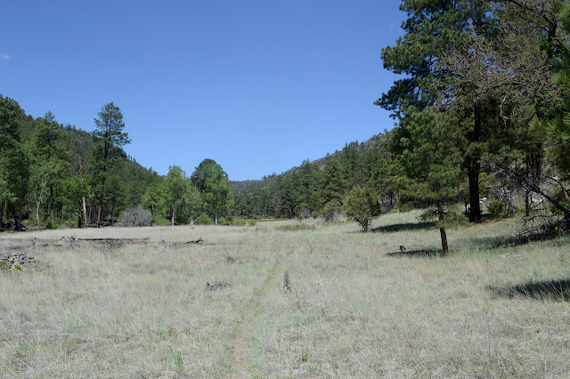
So that is the first ruin. I turn back to the trail to watch four elk crossing the large meadow. They all have their heads down in the long grass which is not nearly long enough to hide them. Where the ground becomes slanted, the growth is much shorter. They all pause one by one, then sprint across this to the trees.


The second marked ruin is almost to Iron Creek. It sits a bit higher on a hill, so I might get to see more. I hope so, but there only seems to be a stacked rock wall. The junction with Iron Creek Mesa Trail is just a little further along and is very obvious. If I had got this far, I'd have made it back easily. I expect. There is no sign to be certain of the junction. Waypoint 2 is supposed to be a sign but it is across the creek and further along the trail.
There is no sign when I get to the waypoint 2, which is a bit off trail. There is a small cairn braced up against a tree. There is no junction to indicate the need for a sign. There is a large camp on the other side of the trail and I wouldn't be surprised if trail once cut from here to join Iron Creek Trail. Many junctions are actually triangles of trail and the way the other junction split as though all traffic to it comes from upstream made me suspect this would be one. If so, not many are keeping this leg of it. A little further down should be Clayton Mesa Trail. Two little cairns mark either side of Clayton Creek, where there should be a junction, but they are the only indication of trail I can see. Nothing seems to be going up the hill side on the right like it should be.

I think that rather than just go down as far as I can, then return, I will take one of the trails up to Aeroplane Mesa and climb Loco Mountain, then take the much shorter road back. The second trail looks like the better one. Someone must have come off one of the mesas. I have had nothing but a few stale footprints on trail since the dam and now there are a couple pairs of fresh ones on the trail. I see no water splash at the far side of the crossings, so probably not so fresh that I'll meet whoever it is.

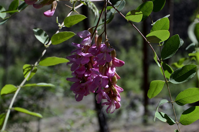
Some places the trail is getting hard to follow. There is a high spot or two that people seem to be missing, leaving them wading in sand. The first trail up escapes my notice. Just short of Swinging Cross Canyon and the trail (distinct, but no sign) that goes up it to Papineau grave, then off to destinations I saw on signs while I backpacked from the other side of the wilderness, are a couple of backpackers. They are wearing sandals! That's cheating! Although the shoes drying on a log in the sun do indicate they might not have been hiking in these. They tell me that a fellow crashed a cross continental flight up there before going on to lead something in WWII. I had expected it got the name from a crash, but good to know it was one that could be walked away from. He might have been English, which would explain the spelling.

Aeroplane Mesa Trail is so easy to find that it is the river trail I almost miss. I probably need another liter of water to finish my hike, so when the trail starts climbing, I double back then spot a shorter way back to the river. I am actually getting my water before noticing that there is a little trail out the other side. Some folks have tried to leave other clues there is a junction here, too. Now I see them. I'm not the only one. Where the trail takes its first switchback, there is a thin, steep trail back down to the river. It is not a trail I would want to take.


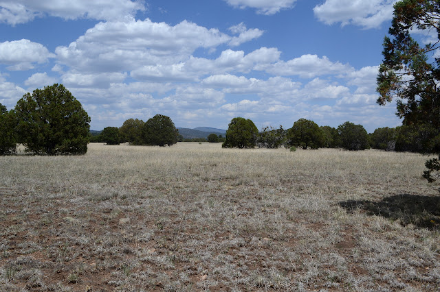
This trail clearly gets a lot of use with horses, so I am not worried about finding anything difficult all the way to the road. There are some spots on the climb that braid, but it mostly hangs together. An obvious spur near the top leads to an old truck just taking in the view since... the 1940s? It is a good view. Once everything flattens out, there are 4 or 5 parallel trails to choose from across the grass.

There is a high point that might be called the high point of Aeroplane Mesa, except that after a shallow dip there's a bit more of the mesa that is higher and just continues on up until Loco Mountain. What does one call the top of a mesa? I skip it and go looking for a pair of closing corners instead. Maybe I should have gone for the highish point. It would actually be there. Ish. The corners aren't unless they are cairns crushed down into the surface.


Onward and upward. It rained yesterday, so I have been expecting it to recycle up and rain again today, at least a little bit. There is a bit of energy in the sky, but it doesn't quite look like it will after all.

I was thinking get to the saddle on trail and walk the ridge, but Loco Mountain isn't all that steep and I take off from the trail a little earlier. There is still a little bit of ridge walking. An arrow along the way looks like it might be from a hunt. The tip looks like a vicious metal thing with multiple blades and hinges so that if it gets stuck in, it is unlikely to come out again. It didn't hit its mark. I am expecting a benchmark and there is a reference, a station, and another reference, all marked Jerky. It's not where I expect, besides Jerky is way out there. It should be a bit more west. It does look a little higher over there, so I keep going. There is the older Loco Mtn mark and the top.
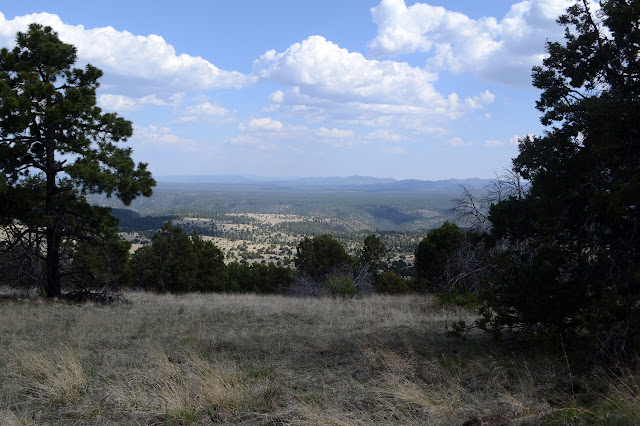
I head back along the ridge to the trail, just missing a hiker who seems to be filming the scenery as she walks over the top. She's probably more popular on Instagram than I am. The edge of the wilderness is only marked by a sign to say it is 2.5 miles back to Aeroplane Mesa and 3.5 miles to the river. It's probably a quarter mile down to the trailhead and campground. Aeroplane Mesa Campground looks nice and some of the sites even have smokers as well as grills.

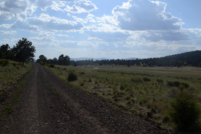
And now I just need to walk 4 miles or less of good gravel road. I expect it is less than 4 because the sign where it turns off just north of Snow Lake said maintenance ends after 4 miles and this is narrow, but maintained. A sign and witness post at the side of the road directs me to the Jerky azimuth mark. Hey, I found the whole set of the Jerky interlopers! The trail I didn't notice has a rough road to it and is marked at both ends. I can't tell if the trail itself is there because it starts way up at the top of the ridge.
And then there's that pesky waypoint 6. It's actually very close to the road through a little saddle. Instead of walking road, I could go for it and use the way down to walk the river instead. I could see if my guesses are correct and try to find the geocache anyway. Only the least significant digits of each coordinate are lost without having the sign. That's... actually significant enough, especially if trying to find a decon container. There's a clue. It might be doable. Although the road swings up around the north end of the lake, it is probably a little bit shorter and definitely a whole lot flatter. I'll lose 600 feet dropping back to the river and have to recover a lot of it. I turn off the road and start making a way across country, then making a way along an old road with bumps plowed into it to discourage vehicles. There haven't been any vehicles in a very long time, so it seems to be working. About the wilderness boundary, I can't tell where it goes, so cross country again.

I am no more certain of the answer than I was before I visited the waypoint, but my guesses do put me in an area that could hold the cache. Not far from the waypoint is a good trail leading down. Elk trail. It has no cuts on branches, no cairns, but a whole lot of elk prints. They lead me well down the steepest part, but the trail vanishes in a flatter section in the middle. It is easy enough to make my own way down as it gets steeper again. I probably should have stayed a little more to the left for an easier time of it. I don't even have to drop the last bit to the river because the trail comes up a little to meet me.

Of course I could have stayed out of the river on the road, too. Now I have to splash through a few crossings. I see why I missed the trail after Gilita Creek. I took it for the one that follows the creek. There is a flag for folks if they want to follow that one. It seems to go through the willows, but a different way than I did coming down. I make a bit of scrambling around the rocky hill side where I think the geocache is hidden, but nothing in my zone seems to match the clue. When the GPS suddenly seems to move the grid by 50 feet in the sunset, I decide I'm done looking. There was a traditional by the dam I forgot to look for in my thoughts of the mystery. It takes a few minutes, but the ammo can is there for my to sign. So are benchmarks of concrete that were part of the dam construction.
The beaver is still in the lake. I can't really tell for sure that's what it is as it swims towards me, then back and forth a little off shore. It is watching me as I watch it. I start walking again and it follows. In the dimming light, most of what I see is the wake of its travel. A much more forward beaver than is usual among their kind. It does not swim as fast as I walk, so I leave it behind long before getting back to the car.
©2019 Valerie Norton
Written 23 Jun 2019
Liked this? Interesting? Click the three bars at the top left for the menu to read more or subscribe!


Comments